close
-
Layers w
- Weather Layers
- Pro
- Pro
- Pro
- Pro
- Pro
- Pro
- More Layers
- Pro
- Pro
- Pro
- Pro
-
Upgrade to

3D
Trail Conditions
- Unknown
- Snow Groomed
- Snow Packed
- Snow Covered
- Snow Cover Partial
- Freeze/thaw Cycle
- Icy
- Prevalent Mud
- Wet
- Variable
- Ideal
- Dry
- Very Dry
Trail Flow (Ridden Direction)
Trailforks scans users ridelogs to determine the most popular direction each trail is ridden. A good flowing trail network will have most trails flowing in a single direction according to their intension.
The colour categories are based on what percentage of riders are riding a trail in its intended direction.
The colour categories are based on what percentage of riders are riding a trail in its intended direction.
- > 96%
- > 90%
- > 80%
- > 70%
- > 50%
- < 50%
- bi-directional trail
- no data
Trail Last Ridden
Trailforks scans ridelogs to determine the last time a trail was ridden.
- < 2 days
- < 1 week
- < 2 weeks
- < 1 month
- < 6 months
- > 6 months
Trail Ridden Direction
The intended direction a trail should be ridden.
- Downhill Only
- Downhill Primary
- Both Directions
- Uphill Primary
- Uphill Only
- One Direction
Contribute Details
Colors indicate trail is missing specified detail.
- Description
- Photos
- Description & Photos
- Videos
Trail Popularity ?
Trailforks scans ridelogs to determine which trails are ridden the most in the last 9 months.
Trails are compared with nearby trails in the same city region with a possible 25 colour shades.
Think of this as a heatmap, more rides = more kinetic energy = warmer colors.
- most popular
- popular
- less popular
- not popular
ATV/ORV/OHV Filter
Max Vehicle Width
inches
US Cell Coverage
Legend

Radar Time
Activity Recordings
Trailforks uses anonymized public activity data.
?
Activity Recordings
Trailforks uses anonymized public activity data.
?
Personal Heatmap
▶
Activity Types
all
/
none
▶
Options
2
Date range
month
–
Winter Trails
Warning
A routing network for winter maps does not exist. Selecting trails using the winter trails layer has been disabled.
Missing Trails
Most Popular
Least Popular
Trails are colored based on popularity. The more popular a trail is, the more red. Less popular trails trend towards green.
Jump Magnitude Heatmap
Heatmap of where riders jump on trails. Zoom in to see individual jumps, click circles to view jump details.
BC Backroad Status
![map legend]()
Service Road Atlas is a free to use, community-driven service for viewing and creating reports on the numerous back-country service roads around B.C. and Alberta.

Slope Aspect
Direction the slope faces
Trails Deemphasized
Trails are shown in grey.
Only show trails with no bike usage.
Suggested Layers
Based on selected activity type
Save the current map location and zoom level as your default home location whenever this page is loaded.
Save
No description for Norrköping has been added yet!
Login or register to submit one.
This region uses the Uk/Euro style trail grading system.
Activities Click to view
- Mountain Bike
539 trails
- E-Bike
24 trails
- Gravel Bike
0 trails
- Adaptive Bike
0 trails
- Winter Fat Bike
0 trails
- Horse
29 trails
- Hike
526 trails
- Trail Running
532 trails
- ATV/ORV/OHV
2 trails
- Downhill Ski
9 trails
- Backcountry Ski
8 trails
- Nordic Ski
21 trails
Region Details
- 99
- 66
- 252
- 97
- 24
Region Status
Open as of Jun 17, 2026Stats
- Avg Trail Rating
- Trails (view details)
- 542
- Trails Mountain Bike
- 539
- Trails E-Bike
- 24
- Trails Horse
- 29
- Trails Hike
- 526
- Trails Trail Running
- 532
- Trails Dirtbike/Moto
- 1
- Trails ATV/ORV/OHV
- 2
- Trails Snowshoe
- 1
- Trails Downhill Ski
- 10
- Trails Backcountry Ski
- 8
- Trails Nordic Ski
- 21
- Total Distance
- 277 miles
- Total Descent
- 32,181 ft
- Total Vertical
- 560 ft
- Highest Trailhead
- 568 ft
- Reports
- 1,389
- Photos
- 87
- Ridden Counter
- 14,390
Sub Regions
-
Abborreberg
- 2
- 4
-
Kättsätter
- 7
- 8
-
Kimstad
- 8
- 2
-
Klockaretorpet
- 2
- 15
- 1
-
Kolmården Bergscykling
- 30
- 152
- 77
- 16
-
Norrköping Södra
- 1
- 4
- 2
-
Skärblacka
- 7
- 10
- 6
- 1
-
Svärtinge / Bergkulla
- 8
- 42
- 5
- 4
-
Vånga
- 2
-
Vrinnevi
- 6
- 1
-
Yxbacken
-
Yxbacken cykelpark
- 2
- 3
- 3
Popular Norrköping Mountain Biking Trails
• 100 ★ 0.0 • 2,871 ft • 46 ft • 139 •
Popular blue difficulty singletrack. This multi-use trail can be used both directions and has a moderate overall physical rating with a 46 ft blue climb. On average it takes 3 minutes to complete this trail.
• 100 ★ 0.0 • 4,865 ft • 114 ft • 129 •
Popular blue difficulty singletrack. This multi-use trail can be used downhill primary and has a moderate overall physical rating with a 114 ft blue climb. It features bridge. On average it takes 10 minutes to complete this trail.
• 85 ★ 5.0 • 4,216 ft • 98 ft • 122 •
Popular blue difficulty singletrack. This multi-use trail can be used downhill primary. On average it takes 6 minutes to complete this trail.
• 100 ★ 2.0 • 4,213 ft • 162 ft • 121 •
Popular blue difficulty singletrack. This multi-use trail can be used both directions. It features bridge. On average it takes 8 minutes to complete this trail.
• 75 ★ 4.0 • 1,545 ft • 157 ft • 119 •
Popular blue difficulty singletrack. This multi-use trail can be used uphill primary and has a hard overall physical rating with a 157 ft blue climb. On average it takes 3 minutes to complete this trail.
• 100 ★ 0.0 • 3,799 ft • 61 ft • 119 •
Popular red difficulty singletrack. This multi-use trail can be used downhill primary and has a hard overall physical rating with a 61 ft blue climb. On average it takes 6 minutes to complete this trail.
• 100 ★ 0.0 • 4,797 ft • 60 ft • 114 •
Popular blue difficulty singletrack. This multi-use trail can be used downhill primary and has a hard overall physical rating with a 60 ft blue climb. It features bridge. On average it takes 7 minutes to complete this trail.
Norrköping Mountain Bike Routes
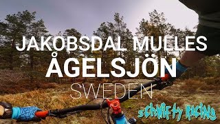
Kättsätter MTB 7km Featured
4 miles • 232 ft • 6 • Loop •
Officiella 7km MTB leden i Kättsätter. Följ markeringarna med vit cirkel och svart cykel i mitten.
★ 4.0 • 5 miles • 327 ft • 5 • Loop •
Jäterolig, bra, lite av varje. Följ svart cykel i vit cirkel markering.
★ 4.0 • 10 miles • 1,032 ft • 10 • Loop •
Bitvis mycket lätt bitvis mycket svår, både uppför och nerför.
★ 5.0 • 13 miles • 1,286 ft • 12 • Loop •
Beautiful and technical enduro bike route around the lake Ågelsjön. No hiking inCykelpark
★ 5.0 • 4 miles • 285 ft • 10 • Loop •
Följ blå markering som är väl markerad och enkel att följa.
★ 5.0 • 36 miles • 3,230 ft • 44 • Loop •
Ska vara 12km men fick det till 13km. Följ röd markering som är bra uppmärkt. Samma spår i början...
Photos of Norrköping Mountain Bike
Videos of Norrköping Mountain Bike
trail: Rotmos
2:01 |
237 |
May 10, 2016
trail: Jakobsdal Västra Sidan
2:51 |
359 |
Jul 4, 2015
trail: Röda Träd
2:59 |
294 |
May 10, 2009
trail: Röda Träd
2:58 |
651 |
May 10, 2009
trail: OMG
3:22 |
632 |
May 26, 2008
trail: Mulles DH
666 |
Oct 16, 2017 , Norrköping
trail: Nedre Kattbäcken
1136 |
Jul 26, 2015 , Norrköping

trail: Mulles DH
762 |
Jul 26, 2015 , Norrköping
Recent Trail Reports
| status | trail | date | condition | info | user |
|---|---|---|---|---|---|
| Gamla Strandstigen | Jun 17, 2026 @ 2:49pm (Europe/Stockholm) Jun 17, 2026 | Dry | mountain-viking KS | ||
| Lilla Bengölen | Jun 17, 2026 @ 2:49pm (Europe/Stockholm) Jun 17, 2026 | Dry | mountain-viking KS | ||
| Vallbacken | Jun 17, 2026 @ 2:49pm (Europe/Stockholm) Jun 17, 2026 | Ideal | mountain-viking KS | ||
| Östgötaleden Lomgölen | May 31, 2026 @ 10:25am (Europe/Stockholm) May 31, 2026 | Dry | mountain-viking KS | ||
| Östgötaleden Korpklint | May 31, 2026 @ 10:25am (Europe/Stockholm) May 31, 2026 | Dry | mountain-viking KS | ||
| Korpklint Downhill | May 31, 2026 @ 10:25am (Europe/Stockholm) May 31, 2026 | Dry | mountain-viking KS | ||
| Jako Stig 2 | May 31, 2026 @ 10:25am (Europe/Stockholm) May 31, 2026 | Variable | mountain-viking KS | ||
| Östgötaleden Korpen | May 31, 2026 @ 10:25am (Europe/Stockholm) May 31, 2026 | Ideal | mountain-viking KS | ||
| Lilla Skrik | May 11, 2026 @ 5:20pm (Europe/Stockholm) May 11, 2026 | Dry | crash-override | ||
| Jakobsdalsvängen | Apr 5, 2026 @ 4:15pm (Europe/Stockholm) Apr 5, 2026 | Wet | Bjorn74 |
Activity Feed
| username | action | type | title | date |
|---|---|---|---|---|
| mountain-viking | add | report | activity #97186779 and 2 more | Jun 17, 2026 @ 8:43am Jun 17, 2026 |
| mountain-viking | comment | trail | activity #96717319 | Jun 10, 2026 @ 9:12pm Jun 10, 2026 |
| mountain-viking | vote | trail | activity #96717273 | Jun 10, 2026 @ 9:10pm Jun 10, 2026 |
| mountain-viking | add | photo | activity #96717237 and 2 more | Jun 10, 2026 @ 9:08pm Jun 10, 2026 |
| mountain-viking | add | photo | activity #95973686 and 1 more | May 31, 2026 @ 1:30pm May 31, 2026 |
Recent Comments
| username | type | title | comment | date |
|---|---|---|---|---|
| trail | Omgrävd. Skogsmaskiner använt stigen men som... | Jun 10, 2026 @ 9:12pm Jun 10, 2026 | ||
| trail | not possible to ride | Jul 16, 2024 @ 10:03am Jul 16, 2024 | ||
| trail | Gör gärna en stigrapport (Trail Report)... | Mar 30, 2024 @ 12:34am Mar 30, 2024 | ||
| trail | Finns tyvärr inte längre, helt sönderkört... | Mar 29, 2024 @ 1:13pm Mar 29, 2024 | ||
| trail | Fixar | Oct 26, 2023 @ 8:18am Oct 26, 2023 |
Local Badges
-

Epic Ride Climb 2k34 awarded -

Climbing 10k Badge47 awarded -

Climbing 100k Badge7 awarded -

Epic Ride Descent 2k34 awarded -

Descent 10k Badge47 awarded -

Descent 100k Badge7 awarded
Bike & Skill Parks
| name | type | city | rating |
|---|---|---|---|
| Yxbacken cykelpark | bike park | Norrköping |
Activity Type Stats
| activitytype | trails | distance | descent | descent distance | total vertical | rating | global rank | state rank | photos | reports | routes | ridelogs |
|---|---|---|---|---|---|---|---|---|---|---|---|---|
| Mountain Bike | 539 | 276 miles | 31,654 ft | 132 miles | 561 ft | #337 | #29 | 85 | 1,389 | 28 | 18,576 | |
| E-Bike | 24 | 10 miles | 3,002 ft | 6 miles | 407 ft | #1,668 | #44 | 1,257 | 284 | |||
| Horse | 29 | 11 miles | 1,542 ft | 6 miles | 335 ft | #385 | #33 | 419 | ||||
| Hike | 526 | 273 miles | 29,206 ft | 129 miles | 561 ft | #304 | #24 | 2 | 1,364 | 7 | 454 | |
| Trail Running | 532 | 273 miles | 29,688 ft | 129 miles | 561 ft | #232 | #24 | 1,361 | 10 | 2,564 | ||
| Dirtbike/Moto | 1 | 1,434 ft | 33 ft | 538 ft | 33 ft | 417 | ||||||
| ATV/ORV/OHV | 2 | 2,854 ft | 56 ft | 1,844 ft | 59 ft | #297 | #7 | 418 | ||||
| Snowshoe | 1 | 2,126 ft | 102 ft | 1,512 ft | 85 ft | 1 | ||||||
| Downhill Ski | 9 | 2 miles | 712 ft | 1 mile | 423 ft | #329 | #2 | 1 | 100 | |||
| Backcountry Ski | 8 | 4 miles | 633 ft | 2 miles | 371 ft | #77 | #5 | 11 | 9 | |||
| Nordic Ski | 21 | 10 miles | 942 ft | 4 miles | 440 ft | #226 | #28 | 1 | 453 |
Frequently Asked Questions About Norrköping
▼
What are the best places to ride in Norrköping?
Norrköping has 12 areas to explore for mountain biking. The top rated areas are:
▼
What are the highest rated mountain biking trails in Norrköping?
The highest rated mountain biking trails in Norrköping are:
- Mulles DH (4.4/5)
- Jakobsdal Västra Sidan (4.4/5)
- Vrinnevi MTB 2 (4.3/5)
- Rotmos (4.3/5)
- Scoutstugorna (4.3/5)
▼
What is the best time of the year to ride in Norrköping?
Based on ride log data, the most popular months to ride in Norrköping are:
- July (132 activities)
- August (88 activities)
- May (76 activities)
▼
Where can I park to ride in Norrköping?
There are 22 parking locations listed in Norrköping. The most popular parking spots are: View all parking and trailhead locations on the map to plan your visit.
Activities
Trails
- By mountain-viking
 KS & contributors
 - Admins: ollesvenskonthetrail, JALLE, OrjanX, martinlindstr, KS, mountain-viking
- #5402 - 14,719 views
- norrköping activity log | embed map of Norrköping mountain bike trails | norrköping mountain biking points of interest
Downloading of trail gps tracks in kml & gpx formats is enabled for Norrköping.
You must login to download files.