close
-
Layers w
- Weather Layers
- Pro
- Pro
- Pro
- Pro
- Pro
- Pro
- More Layers
- Pro
- Pro
- Pro
- Pro
-
Upgrade to

3D
Trail Conditions
- Unknown
- Snow Groomed
- Snow Packed
- Snow Covered
- Snow Cover Partial
- Freeze/thaw Cycle
- Icy
- Prevalent Mud
- Wet
- Variable
- Ideal
- Dry
- Very Dry
Trail Flow (Ridden Direction)
Trailforks scans users ridelogs to determine the most popular direction each trail is ridden. A good flowing trail network will have most trails flowing in a single direction according to their intension.
The colour categories are based on what percentage of riders are riding a trail in its intended direction.
The colour categories are based on what percentage of riders are riding a trail in its intended direction.
- > 96%
- > 90%
- > 80%
- > 70%
- > 50%
- < 50%
- bi-directional trail
- no data
Trail Last Ridden
Trailforks scans ridelogs to determine the last time a trail was ridden.
- < 2 days
- < 1 week
- < 2 weeks
- < 1 month
- < 6 months
- > 6 months
Trail Ridden Direction
The intended direction a trail should be ridden.
- Downhill Only
- Downhill Primary
- Both Directions
- Uphill Primary
- Uphill Only
- One Direction
Contribute Details
Colors indicate trail is missing specified detail.
- Description
- Photos
- Description & Photos
- Videos
Trail Popularity ?
Trailforks scans ridelogs to determine which trails are ridden the most in the last 9 months.
Trails are compared with nearby trails in the same city region with a possible 25 colour shades.
Think of this as a heatmap, more rides = more kinetic energy = warmer colors.
- most popular
- popular
- less popular
- not popular
ATV/ORV/OHV Filter
Max Vehicle Width
inches
US Cell Coverage
Legend

Radar Time
Activity Recordings
Trailforks uses anonymized public activity data.
?
Activity Recordings
Trailforks uses anonymized public activity data.
?
Personal Heatmap
▶
Activity Types
all
/
none
▶
Options
2
Date range
month
–
Winter Trails
Warning
A routing network for winter maps does not exist. Selecting trails using the winter trails layer has been disabled.
Missing Trails
Most Popular
Least Popular
Trails are colored based on popularity. The more popular a trail is, the more red. Less popular trails trend towards green.
Jump Magnitude Heatmap
Heatmap of where riders jump on trails. Zoom in to see individual jumps, click circles to view jump details.
BC Backroad Status
![map legend]()
Service Road Atlas is a free to use, community-driven service for viewing and creating reports on the numerous back-country service roads around B.C. and Alberta.

Slope Aspect
Direction the slope faces
Trails Deemphasized
Trails are shown in grey.
Only show trails with no bike usage.
Suggested Layers
Based on selected activity type
Save the current map location and zoom level as your default home location whenever this page is loaded.
SaveTaiwoo
Region Details
- 5
- 7
- 15
- 6
- 1
Stats
- Avg Trail Rating
- Trails (view details)
- 34
- Trails Mountain Bike
- 34
- Trails E-Bike
- 24
- Trails Hike
- 24
- Trails Trail Running
- 16
- Trails Dirtbike/Moto
- 1
- Total Distance
- 31 miles
- Total Descent
- 13,313 ft
- Total Vertical
- 1,730 ft
- Highest Trailhead
- 1,815 ft
- Reports
- 4
- Photos
- 51
- Ridden Counter
- 28
Sub Regions
- Beijing (7)
- Fragrant Hills (3)
- Jizhou City Northeast (27)
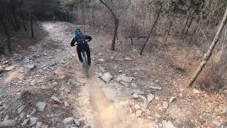
Popular North Mountain Biking Trails
• 75 ★ 3.7 • 2 miles • 1,134 ft • 8 •
Popular blue difficulty singletrack. This mountain bike primary trail can be used uphill primary and has a moderate overall physical rating with a 1,134 ft blue climb. On average it takes 49 minutes to complete this trail.
• 5 ★ 5.0 • 4,196 ft • 5 ft • 4 •
金色传说是一条位于防火道上的路线,全线视野清晰开阔,路线主要特征为乱石,土路,小碎石和松散的破面。Golden Legend is a singletrack trail with clear and wide view on a fire road.The trails...
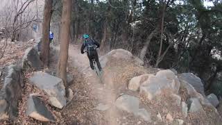
• 5 ★ 5.0 • 4,290 ft • 6 ft • 3 •
Less popular blue difficulty singletrack. This mountain bike primary trail can be used both directions. It features rock face and rock garden. On average it takes 8 minutes to complete this trail.
• 90 ★ 0.0 • 2 miles • 27 ft • 3 •
Skinny badly paved concrete tiles between the road and the river . Quite technical since each tile is probably only the width of a big laptop . But really great fun . This is only a segment , can find more if you keep going north along...
• 5 ★ 4.5 • 1 mile • 62 ft • 3 •
Back Hill trail is a almost winter only trial, in summer the bushes and brunches will extend to the trail, make you very difficult to ride.
• 100 ★ 0.0 • 502 ft • 3 ft • 2 •
Really really REALLY small skills park originally built for a kids ' bmx club . There are really only two main lines but there ' s everything a beginner needs . Careful of dog poop . It ' s everywhere .
Photos of North Mountain Bike
Videos of North Mountain Bike

trail: Back Hill Trail
5:08 |
1771 |
Mar 23, 2019 , Beijing
3:30 |
1273 |
Mar 21, 2019 , Beijing
trail: Orchard Climb
9:35 |
1638 |
Mar 21, 2019 , Beijing
Recent Trail Reports
| status | trail | date | condition | info | user |
|---|---|---|---|---|---|
| Almost Mountain Biking Beijing | Jun 17, 2022 @ 7:54pm Jun 17, 2022 | Dry | rMuf9d | ||
| Sweep Leaves Jizhou City Northeast | Feb 4, 2022 @ 2:12am Feb 4, 2022 | Dry | LiuKerman | ||
| Rocky Twins(East) Jizhou City Northeast | Jan 30, 2022 @ 4:19am Jan 30, 2022 | Very Dry | LiuKerman | ||
| Over Fence Jizhou City Northeast | Jan 27, 2022 @ 5:07am Jan 27, 2022 | Ideal | LiuKerman |
Activity Feed
| username | action | type | title | date |
|---|---|---|---|---|
| kvUcMH | add | photo | activity #79329118 | Aug 31, 2025 @ 7:19am Aug 31, 2025 |
| Rosie103 | wishlist | region | activity #74940520 | Jul 1, 2025 @ 2:05am Jul 1, 2025 |
| miQPSX9a | ridden | trail | activity #57204176 | Aug 14, 2024 @ 3:54am Aug 14, 2024 |
| atomicskate | wishlist | region | activity #53699849 | Jun 5, 2024 @ 9:34pm Jun 5, 2024 |
| feiYwyBWM | rsvp | event | activity #50928857 | Apr 8, 2024 @ 12:43am Apr 8, 2024 |
Local Badges
-

Completionist0 awarded
Local Mountain Biking Directory
-
52BIKEBike Shop
![52BIKE]()
Activity Type Stats
| activitytype | trails | distance | descent | descent distance | total vertical | rating | global rank | state rank | photos | reports | routes | ridelogs |
|---|---|---|---|---|---|---|---|---|---|---|---|---|
| Mountain Bike | 34 | 31 miles | 13,314 ft | 21 miles | 1,729 ft | 51 | 4 | 5,459 | ||||
| E-Bike | 24 | 21 miles | 10,387 ft | 16 miles | 1,686 ft | 3 | 12 | |||||
| Hike | 24 | 21 miles | 9,072 ft | 14 miles | 1,703 ft | 2 | 357 | |||||
| Trail Running | 16 | 14 miles | 4,892 ft | 8 miles | 1,499 ft | 1 | 23 | |||||
| Dirtbike/Moto | 1 | 1 mile | 955 ft | 1 mile | 958 ft |
Activities
Trails
Points of Interest
- By moogmoog
 & contributors
 - Admins: grippygravel
- #23781 - 925 views
- north activity log | embed map of North mountain bike trails | north mountain biking points of interest
Downloading of trail gps tracks in kml & gpx formats is enabled for North.
You must login to download files.