close
-
Layers w
- Weather Layers
- Pro
- Pro
- Pro
- Pro
- Pro
- Pro
- More Layers
- Pro
- Pro
- Pro
- Pro
-
Upgrade to

3D
Trail Conditions
- Unknown
- Snow Groomed
- Snow Packed
- Snow Covered
- Snow Cover Partial
- Freeze/thaw Cycle
- Icy
- Prevalent Mud
- Wet
- Variable
- Ideal
- Dry
- Very Dry
Trail Flow (Ridden Direction)
Trailforks scans users ridelogs to determine the most popular direction each trail is ridden. A good flowing trail network will have most trails flowing in a single direction according to their intension.
The colour categories are based on what percentage of riders are riding a trail in its intended direction.
The colour categories are based on what percentage of riders are riding a trail in its intended direction.
- > 96%
- > 90%
- > 80%
- > 70%
- > 50%
- < 50%
- bi-directional trail
- no data
Trail Last Ridden
Trailforks scans ridelogs to determine the last time a trail was ridden.
- < 2 days
- < 1 week
- < 2 weeks
- < 1 month
- < 6 months
- > 6 months
Trail Ridden Direction
The intended direction a trail should be ridden.
- Downhill Only
- Downhill Primary
- Both Directions
- Uphill Primary
- Uphill Only
- One Direction
Contribute Details
Colors indicate trail is missing specified detail.
- Description
- Photos
- Description & Photos
- Videos
Trail Popularity ?
Trailforks scans ridelogs to determine which trails are ridden the most in the last 9 months.
Trails are compared with nearby trails in the same city region with a possible 25 colour shades.
Think of this as a heatmap, more rides = more kinetic energy = warmer colors.
- most popular
- popular
- less popular
- not popular
ATV/ORV/OHV Filter
Max Vehicle Width
inches
US Cell Coverage
Legend

Radar Time
Activity Recordings
Trailforks uses anonymized public activity data.
?
Activity Recordings
Trailforks uses anonymized public activity data.
?
Personal Heatmap
▶
Activity Types
all
/
none
▶
Options
2
Date range
month
–
Winter Trails
Warning
A routing network for winter maps does not exist. Selecting trails using the winter trails layer has been disabled.
Missing Trails
Most Popular
Least Popular
Trails are colored based on popularity. The more popular a trail is, the more red. Less popular trails trend towards green.
Jump Magnitude Heatmap
Heatmap of where riders jump on trails. Zoom in to see individual jumps, click circles to view jump details.
BC Backroad Status
![map legend]()
Service Road Atlas is a free to use, community-driven service for viewing and creating reports on the numerous back-country service roads around B.C. and Alberta.

Slope Aspect
Direction the slope faces
Trails Deemphasized
Trails are shown in grey.
Only show trails with no bike usage.
Suggested Layers
Based on selected activity type
Save the current map location and zoom level as your default home location whenever this page is loaded.
SaveWe may be biased, but our trails are the best in Ontario We have loads of elevation and tons of variance in the trail networks through our escarpment. Our primary networks are all either right in town (What? You can bike to the trails???!) or only a 10 minute drive. We love our trails, and hope you will too. Plus, cool off by hopping into a lake after your ride at one of dozens of beaches within the city limits.
Activities Click to view
- Mountain Bike
319 trails
- E-Bike
156 trails
- Adaptive Bike
0 trails
- Winter Fat Bike
2 trails
- Horse
5 trails
- Hike
303 trails
- Trail Running
305 trails
- Dirtbike/Moto
6 trails
- ATV/ORV/OHV
6 trails
- Snowmobile
6 trails
- Snowshoe
119 trails
- Downhill Ski
8 trails
- Backcountry Ski
7 trails
- Nordic Ski
37 trails
Region Details
- 13
- 4
- 132
- 75
- 23
- 1
- 2
Region Status
Open as of 2 daysStats
- Avg Trail Rating
- Trails (view details)
- 278
- Trails Mountain Bike
- 319
- Trails E-Bike
- 156
- Trails Gravel Bike
- 1
- Trails Winter Fat Bike
- 2
- Trails Horse
- 5
- Trails Hike
- 303
- Trails Trail Running
- 305
- Trails Dirtbike/Moto
- 6
- Trails ATV/ORV/OHV
- 6
- Trails Snowmobile
- 6
- Trails Snowshoe
- 119
- Trails Downhill Ski
- 8
- Trails Backcountry Ski
- 7
- Trails Nordic Ski
- 37
- Total Distance
- 149 miles
- Total Descent
- 17,262 ft
- Total Vertical
- 673 ft
- Highest Trailhead
- 1,317 ft
- Reports
- 989
- Photos
- 641
- Ridden Counter
- 21,543
Sub Regions
-
Boulter Township
- 5
-
Duchesnay Falls
- 10
- 6
- 2
-
Horse Trails (The Monastery Trails)
- 10
- 6
-
Laurentian Escarpment Community Trails
- 1
- 55
- 14
- 5
- 1
-
Laurier Woods
- 12
-
Northshore
- 11
- 28
- 10
- 2
- 1
-
Peninsula Road
-
Sage Trails
- 2
-
The Ridge
- 3
- 3
- 3
-
Three Towers Trails
- 14
- 10
- 3
-
Tupper Trails
- 2
- 2
Popular North Bay Mountain Biking Trails
• 100 ★ 4.0 • 1,942 ft • 116 ft • 266 •
Popular green difficulty singletrack. This mountain bike primary trail and has a moderate overall physical rating with a 116 ft blue climb. On average it takes 4 minutes to complete this trail.
• 100 ★ 4.0 • 833 ft • 3 ft • 258 •
Popular green difficulty singletrack. This mountain bike primary trail and has a easy overall physical rating with a 3 ft green climb. On average it takes 1 minutes to complete this trail.
• 100 ★ 4.9 • 2,444 ft • 0 ft • 249 •
Highly rated popular black diamond difficulty singletrack. This mountain bike primary trail can be used downhill primary. It features berm, bridge, drop, jump, gap jump, ladder bridge and roller coaster. On average it takes 2 minutes to complete this trail.
• 100 ★ 4.0 • 1,562 ft • 38 ft • 236 •
Popular green difficulty singletrack. This mountain bike primary trail can be used both directions and has a easy overall physical rating with a 38 ft green climb. On average it takes 2 minutes to complete this trail.
• 100 ★ 5.0 • 755 ft • 3 ft • 229 •
Popular green difficulty singletrack. This mountain bike primary trail. On average it takes minutes to complete this trail.
• 100 ★ 4.2 • 1,870 ft • 0 ft • 214 •
Popular green difficulty singletrack. This mountain bike primary trail can be used both directions and has a easy overall physical rating with a 0 ft green climb. On average it takes 2 minutes to complete this trail.
• 95 ★ 4.0 • 1,004 ft • 12 ft • 208 •
Popular green difficulty singletrack. This mountain bike primary trail can be used both directions and has a easy overall physical rating with a 12 ft green climb. On average it takes 1 minutes to complete this trail.
• 95 ★ 4.0 • 1,670 ft • 22 ft • 202 •
Popular green difficulty singletrack. This mountain bike primary trail can be used both directions and has a easy overall physical rating with a 22 ft green climb. On average it takes 2 minutes to complete this trail.
North Bay Mountain Bike Routes
★ 5.0 • 4 miles • 312 ft • 18 • Loop •
This loop is part of the 'primary' grooming trails and users can reasonably be assured that it will be...
1 mile • 158 ft • 4 •
Flowy with a mix of features such as wood bridges, jumps and rocks. Finish of the loop is a doubletrack...
4 miles • 399 ft • 8 • Loop •
This is a test route for an Adaptive Bike Trail route at . Not vetted by AMTB rider yet.
2,697 ft • 36 ft • 3 •
Flowy, easy single track with minimal obstacles and minimal climbing. Easy loops for kids to do 1, 2, 3 or...
4 •
Trail Order: Connector, Butterball, Discovery, Dogg, Doubletrack, Shortcut to Dragon Tail, Dragon Tail,...
★ 4.0 • 3 miles • 582 ft • 4 • Loop •
This is one quick way out to the at North Shore! More route options are available, this is just one way -...
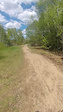
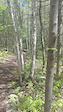
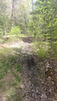
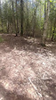
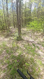
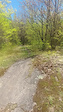
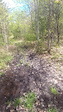
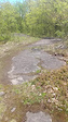
Photos of North Bay Mountain Bike
Videos of North Bay Mountain Bike
trail: Main Trail
0:19 |
12 |
May 26, 2025
trail: Main Trail
0:15 |
5 |
May 26, 2025
trail: Main Trail
0:09 |
4 |
May 26, 2025
trail: Main Trail
0:33 |
10 |
May 26, 2025
trail: Main Trail
0:12 |
68 |
May 26, 2025
trail: Main Trail
0:24 |
2 |
May 26, 2025
trail: Main Trail
0:24 |
17 |
May 26, 2025
trail: Main Trail
0:15 |
22 |
May 26, 2025
Current Trail Warnings
| status | trail | date | condition | user | info |
|---|---|---|---|---|---|
| RUSH | Jun 25, 2026 @ 6:21pm (America/Toronto) 2 days | Wet | C1etienne | Trailwork and rerouting is ongoing | |
| Old Dam | Jun 7, 2026 @ 12:43pm (America/Toronto) Jun 7, 2026 | Unknown | zapramian | ||
| Flowy Detour | Jun 6, 2026 @ 8:27am (America/Toronto) Jun 6, 2026 | Unknown | zapramian |
Recent Trail Reports
| status | trail | date | condition | info | user |
|---|---|---|---|---|---|
| Rockabilly | Jun 25, 2026 @ 6:31pm (America/Toronto) 2 days | Ideal | C1etienne | ||
| Horsetrail Climb | Jun 2, 2026 @ 9:07pm (America/Toronto) Jun 2, 2026 | Ideal | Laykem2dlf2 | ||
| Main Trail | Jun 2, 2026 @ 4:35pm (America/Toronto) Jun 2, 2026 | Ideal | Laykem2dlf2 | ||
| Precambrian Pavement | Jun 2, 2026 @ 4:35pm (America/Toronto) Jun 2, 2026 | Ideal | Laykem2dlf2 | ||
| Hillside Lake Trail | May 21, 2026 @ 5:22pm (America/Toronto) May 21, 2026 | Variable | andyh1 | ||
| Pioneer | May 21, 2026 @ 2:47pm (America/Toronto) May 21, 2026 | Variable | andyh1 | ||
| Sidewinder | Apr 23, 2026 @ 6:04pm (America/Toronto) Apr 23, 2026 | Wet | flyindutchman | ||
| Berms | Apr 23, 2026 @ 6:04pm (America/Toronto) Apr 23, 2026 | Wet | flyindutchman | ||
| Rodeo Ride | Apr 23, 2026 @ 6:04pm (America/Toronto) Apr 23, 2026 | Wet | flyindutchman | ||
| Connector | Apr 23, 2026 @ 6:04pm (America/Toronto) Apr 23, 2026 | Wet | flyindutchman |
Activity Feed
| username | action | type | title | date |
|---|---|---|---|---|
| Laykem2dlf2 | add | video | activity #97952699 | Jun 27, 2026 @ 6:19pm 45 mins |
| Bullski67 | comment | trail | activity #97871469 | Jun 26, 2026 @ 7:04pm 24 hours |
| C1etienne | add | report | activity #97796401 and 1 more | Jun 25, 2026 @ 3:22pm 2 days |
| Alain78 | wishlist | trail | activity #97638374 | Jun 23, 2026 @ 10:51am Jun 23, 2026 |
| C1etienne | vote | trail | activity #97570799 | Jun 22, 2026 @ 10:25am Jun 22, 2026 |
Recent Comments
| username | type | title | comment | date |
|---|---|---|---|---|
| trail | Trail has been closed | Jun 26, 2026 @ 7:04pm 24 hours | ||
| trail | To be closed | Jun 14, 2026 @ 6:25pm Jun 14, 2026 | ||
| report | I made the report about pines a year ago. I... | Jun 10, 2026 @ 5:41pm Jun 10, 2026 | ||
| trail | Not a NBMBA trail access has been cut off due... | Jun 5, 2026 @ 5:46am Jun 5, 2026 | ||
| report | update: consider the exit intersection of... | Apr 14, 2026 @ 5:00pm Apr 14, 2026 |
Local Badges
-

Completionist0 awarded -

Big Ride 30k1,511 awarded -

Epic Ride 50k463 awarded -

Top 10 Trails2 awarded -
Completionist0 awarded -
Completionist0 awarded
Bike & Skill Parks
| name | type | city | rating |
|---|---|---|---|
| Velosolutions Pump Track | skill park | North Bay |
Local Mountain Biking Directory
-
North Bay Mountain Bike Association
-
Wheelhouse
-
BikeMattawa
-
Cheap SkatesBike Shop
-
Cycle WorksBike Shop
Local Trail Supporters
- Bill
- BULL FAMILY
- Built by Andrew but maintained by Dave and Cathy
Activity Type Stats
| activitytype | trails | distance | descent | descent distance | total vertical | rating | global rank | state rank | photos | reports | routes | ridelogs |
|---|---|---|---|---|---|---|---|---|---|---|---|---|
| Mountain Bike | 319 | 124 miles | 14,022 ft | 48 miles | 673 ft | #413 | #16 | 614 | 983 | 24 | 17,948 | |
| E-Bike | 156 | 41 miles | 3,491 ft | 14 miles | 610 ft | #1,971 | #46 | 3 | 814 | 9 | 588 | |
| Gravel Bike | 1 | #617 | #24 | 4 | 91 | |||||||
| Winter Fat Bike | 2 | #111 | #61 | 2 | 6 | 3 | 93 | |||||
| Horse | 5 | 25 miles | 1,512 ft | 9 miles | 308 ft | #1,319 | #22 | 95 | 2 | |||
| Hike | 303 | 128 miles | 13,967 ft | 48 miles | 673 ft | #718 | #18 | 24 | 970 | 4 | 2,304 | |
| Trail Running | 305 | 128 miles | 13,967 ft | 48 miles | 673 ft | #666 | #12 | 969 | 4 | 2,283 | ||
| Dirtbike/Moto | 6 | 25 miles | 1,512 ft | 9 miles | 308 ft | #677 | #11 | 95 | 51 | |||
| ATV/ORV/OHV | 6 | 25 miles | 1,512 ft | 9 miles | 308 ft | #513 | #10 | 95 | 12 | |||
| Snowmobile | 6 | 25 miles | 1,526 ft | 9 miles | 308 ft | #182 | #10 | 6 | 2 | |||
| Snowshoe | 119 | 59 miles | 5,016 ft | 21 miles | 630 ft | #174 | #19 | 50 | 3 | 255 | ||
| Downhill Ski | 8 | 1 mile | 886 ft | 1 mile | 295 ft | #164 | #5 | 6 | 58 | |||
| Backcountry Ski | 7 | 26 miles | 2,005 ft | 10 miles | 446 ft | #397 | #4 | 10 | 76 | |||
| Nordic Ski | 37 | 55 miles | 4,777 ft | 21 miles | 630 ft | #234 | #12 | 10 | 1,932 |
Frequently Asked Questions About North Bay
▼
What are the best places to ride in North Bay?
North Bay has 13 areas to explore for mountain biking. The top rated areas are:
▼
What are the highest rated mountain biking trails in North Bay?
The highest rated mountain biking trails in North Bay are:
- Berms (4.5/5)
- Slalomander (4.4/5)
- Eastbound and Down (4.4/5)
- No B Line (4.3/5)
- Hillbilly (4.3/5)
▼
What is the best time of the year to ride in North Bay?
Based on ride log data, the most popular months to ride in North Bay are:
- July (337 activities)
- August (323 activities)
- June (294 activities)
▼
Where can I park to ride in North Bay?
There are 10 parking locations listed in North Bay. The most popular parking spots are: View all parking and trailhead locations on the map to plan your visit.
Activities
- North Bay Mountain Biking Trails
- North Bay E-Biking Trails
- North Bay Horseback Trails
- North Bay Hiking Trails
- North Bay Trail Running Trails
- North Bay Dirtbiking Trails
- North Bay ATVing/Offroading Trails
- North Bay Snowmobiling Trails
- North Bay Snowshoeing Trails
- North Bay Skiing Trails
- North Bay Backcountry Skiing Trails
- North Bay Nordic Skiing Trails
Trails
- By markholloway
 Trailforks Map Team & contributors
 - Admins: NBMBA
- #9790 - 32,276 views
- north bay activity log | embed map of North Bay mountain bike trails | north bay mountain biking points of interest
Downloading of trail gps tracks in kml & gpx formats is enabled for North Bay.
You must login to download files.