close
-
Layers w
- Weather Layers
- Pro
- Pro
- Pro
- Pro
- Pro
- Pro
- More Layers
- Pro
- Pro
- Pro
- Pro
-
Upgrade to

3D
Trail Conditions
- Unknown
- Snow Groomed
- Snow Packed
- Snow Covered
- Snow Cover Partial
- Freeze/thaw Cycle
- Icy
- Prevalent Mud
- Wet
- Variable
- Ideal
- Dry
- Very Dry
Trail Flow (Ridden Direction)
Trailforks scans users ridelogs to determine the most popular direction each trail is ridden. A good flowing trail network will have most trails flowing in a single direction according to their intension.
The colour categories are based on what percentage of riders are riding a trail in its intended direction.
The colour categories are based on what percentage of riders are riding a trail in its intended direction.
- > 96%
- > 90%
- > 80%
- > 70%
- > 50%
- < 50%
- bi-directional trail
- no data
Trail Last Ridden
Trailforks scans ridelogs to determine the last time a trail was ridden.
- < 2 days
- < 1 week
- < 2 weeks
- < 1 month
- < 6 months
- > 6 months
Trail Ridden Direction
The intended direction a trail should be ridden.
- Downhill Only
- Downhill Primary
- Both Directions
- Uphill Primary
- Uphill Only
- One Direction
Contribute Details
Colors indicate trail is missing specified detail.
- Description
- Photos
- Description & Photos
- Videos
Trail Popularity ?
Trailforks scans ridelogs to determine which trails are ridden the most in the last 9 months.
Trails are compared with nearby trails in the same city region with a possible 25 colour shades.
Think of this as a heatmap, more rides = more kinetic energy = warmer colors.
- most popular
- popular
- less popular
- not popular
ATV/ORV/OHV Filter
Max Vehicle Width
inches
US Cell Coverage
Legend

Radar Time
Activity Recordings
Trailforks uses anonymized public activity data.
?
Activity Recordings
Trailforks uses anonymized public activity data.
?
Personal Heatmap
▶
Activity Types
all
/
none
▶
Options
2
Date range
month
–
Winter Trails
Warning
A routing network for winter maps does not exist. Selecting trails using the winter trails layer has been disabled.
Missing Trails
Most Popular
Least Popular
Trails are colored based on popularity. The more popular a trail is, the more red. Less popular trails trend towards green.
Jump Magnitude Heatmap
Heatmap of where riders jump on trails. Zoom in to see individual jumps, click circles to view jump details.
BC Backroad Status
![map legend]()
Service Road Atlas is a free to use, community-driven service for viewing and creating reports on the numerous back-country service roads around B.C. and Alberta.

Slope Aspect
Direction the slope faces
Trails Deemphasized
Trails are shown in grey.
Only show trails with no bike usage.
Suggested Layers
Based on selected activity type
Save the current map location and zoom level as your default home location whenever this page is loaded.
Save
No description for North Brabant has been added yet!
Login or register to submit one.
Region Details
- 16
- 3
- 40
- 31
- 1
Stats
- Avg Trail Rating
- Trails (view details)
- 93
- Trails Mountain Bike
- 107
- Trails E-Bike
- 42
- Trails Horse
- 2
- Trails Hike
- 47
- Trails Trail Running
- 47
- Total Distance
- 155 miles
- Total Descent
- 7,989 ft
- Total Vertical
- 1,032 ft
- Highest Trailhead
- 1,037 ft
- Reports
- 573
- Photos
- 506
- Ridden Counter
- 9,605
Sub Regions
- Asten (3)
- Bergen op Zoom (7)
- Best (3)
- Bladel (7)
- Boekel (1)
- Boxmeer (2)
- Breda (3)
- Drunen (2)
- Eersel (4)
- Heeze-Leende (4)
- Helmond (9)
- Hoogerheide (8)
- Mierlo (10)
- Nuenen (10)
- oosterhout (7)
- Oss (1)
- Maashorst (0)
- Sint-Oedenrode (1)
- Tilburg (6)
- Valkenswaard (55)
- Waalre (8)
Popular North Brabant Mountain Biking Trails
• 100 ★ 3.7 • 15 miles • 340 ft • 546 •
IMPORTANT: It's illegal to ride on this trail without a license. License fees are € 5.00/day, € 7.50/weekend or € 12.00/year (updated to 2018 fees). Riding on this trail without a license is on your own risk. Licenses can be...
• 70 ★ 4.2 • 5 miles • 61 ft • 502 •
Highly rated popular green difficulty family friendly singletrack. This mountain bike primary trail can be used one direction and has a moderate overall physical rating with a 61 ft blue climb. It features jump. Trail visibility is always easy to follow. On average it takes 19 minutes to complete this trail.
• 50 ★ 3.4 • 5 miles • 75 ft • 355 •
Moderately popular green difficulty family friendly singletrack. This mountain bike primary trail can be used one direction and has a easy overall physical rating with a 75 ft blue climb. Trail visibility is always easy to follow. On average it takes 14 minutes to complete this trail.
• 50 ★ 4.7 • 10 miles • 157 ft • 311 •
IMPORTANT: It's illegal to ride on this trail without a license (vignet). Licenses can be bought at Café De Klinkert, Café De Roestelberg in Kaatsheuvel, Café De Rustende Jager in Biezenmortel and Café De Drie Linden in Giersbergen...
• 100 ★ 4.9 • 3 miles • 82 ft • 271 •
Great trail. Nice flow, lots of corners. Well maintained. Length is about 5 km, and can be combined with the trail to the north of it: , which is 10 km long. Has multiple optional features like drops, a log jump, a skinny and a jump.
• 35 ★ 4.0 • 7 miles • 241 ft • 255 •
Less popular blue difficulty singletrack. This mountain bike primary trail can be used one direction. On average it takes 31 minutes to complete this trail.
• 50 ★ 4.4 • 4 miles • 173 ft • 207 •
Moderately popular green difficulty singletrack. This mountain bike primary trail can be used one direction. On average it takes 21 minutes to complete this trail.
• 25 ★ 4.0 • 4 miles • 111 ft • 206 •
Less popular blue difficulty singletrack. This mountain bike primary trail can be used one direction and has a moderate overall physical rating with a 111 ft green climb. Trail visibility is always easy to follow. On average it takes 15 minutes to complete this trail.
North Brabant Mountain Bike Routes
★ 4.5 • 50 miles • 886 ft • 1 • Loop •
Marathon route from The National Park Hoge Kempen. For trained riders. Approx. 81km and 815hm
★ 4.0 • 8 miles • 279 ft • 1 • Loop •
Trailcrew Mountainbike Route Waalre & Friends is doing the maintenance. Oude Spoorbaanroute Deze 13...
★ 4.0 • 6 miles • 241 ft • 2 • Loop •
Trailcrew Mountainbike Route Waalre & Friends is doing De Aalsterhutroute is een mooi en uitdagend...
★ 5.0 • 11 miles • 378 ft • 0 •
Tilburg krijgt een eigen mountainbikeroute! De route komt in het weinig bekende Stadsbos013. Het bos is...
14 miles • 638 ft • 5 •
combination of the Aalsterhut trail and Oude Spoorbaan trail.
★ 3.0 • 26 miles • 800 ft • 7 • Out & Back •
nice and flowy trails, not to technical
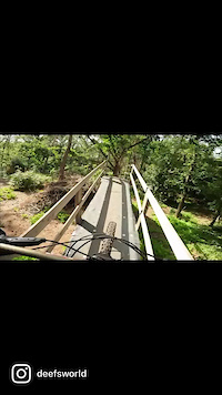
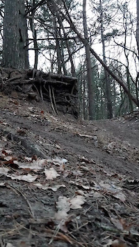
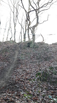
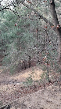
Photos of North Brabant Mountain Bike
Videos of North Brabant Mountain Bike
0:37 |
135 |
Jun 19, 2022
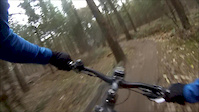
trail: The big drop
0:06 |
42 |
Feb 17, 2022
trail: Duitse duin singletrack
0:07 |
53 |
Jan 4, 2021
trail: Dropdown
0:07 |
141 |
Jan 4, 2021
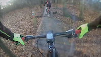
trail: Cadettenkamp
13:15 |
199 |
Dec 27, 2016
trail: Cadettenkamp
2:56 |
88 |
Sep 18, 2015
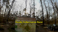
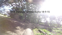
trail: Dorst
4:16 |
197 |
Mar 11, 2015
trail: Dorst
5:58 |
279 |
Dec 6, 2014
Recent Trail Reports
Activity Feed
| username | action | type | title | date |
|---|---|---|---|---|
| lvburik | vote | trail | activity #97555310 | Jun 22, 2026 @ 5:37am 1 day |
| pim78 | ridden | trail | activity #97367908 | Jun 19, 2026 @ 11:09pm Jun 19, 2026 |
| Jxroussel | comment | trail | activity #97185947 | Jun 17, 2026 @ 8:30am Jun 17, 2026 |
| Jxroussel | add | report | activity #97184801 | Jun 17, 2026 @ 8:12am Jun 17, 2026 |
| Jxroussel | add | report | activity #97161579 | Jun 16, 2026 @ 9:23pm Jun 16, 2026 |
Recent Comments
| username | type | title | comment | date |
|---|---|---|---|---|
| trail | the sign posted route is significantly... | Jun 17, 2026 @ 8:30am Jun 17, 2026 | ||
| trail | Onmogelijk te berijden, volledig overgroeid en... | Apr 5, 2026 @ 2:42pm Apr 5, 2026 | ||
| trail | Echte crosscountry track | Jul 8, 2024 @ 8:29am Jul 8, 2024 | ||
| trail | Na het maaiwerk begin oktober zijn nagenoeg... | Nov 10, 2023 @ 11:50am Nov 10, 2023 | ||
| trail | I got excited seeing the height difference so... | Jan 8, 2023 @ 8:23am Jan 8, 2023 |
Local Badges
-

10 Green Trails2 awarded -

Epic Mountain Bike Climb 2k0 awarded -

Climbing 10k Badge0 awarded -

Mountain Biking 100k Badge0 awarded -

Epic Ride Descent 2k0 awarded -

Descent 10k Badge0 awarded
Bike & Skill Parks
| name | type | city | rating |
|---|---|---|---|
| Eersel MX | skill park | Bladel | |
| Boxmeer MX | skill park | Boxmeer | |
| Berghem MX | skill park | Oss | |
| Reusel MX "Wielewaal" | skill park | Bladel | |
| Budel MX | skill park | Heeze-Leende |
Activity Type Stats
| activitytype | trails | distance | descent | descent distance | total vertical | rating | global rank | state rank | photos | reports | routes | ridelogs |
|---|---|---|---|---|---|---|---|---|---|---|---|---|
| Mountain Bike | 107 | 155 miles | 7,989 ft | 51 miles | 1,033 ft | 499 | 573 | 44 | 115,821 | |||
| E-Bike | 42 | 34 miles | 1,837 ft | 13 miles | 1,027 ft | 4 | 520 | 9 | 5,720 | |||
| Horse | 2 | 42 | ||||||||||
| Hike | 47 | 61 miles | 4,665 ft | 19 miles | 1,020 ft | 539 | 1,983 | |||||
| Trail Running | 47 | 61 miles | 4,665 ft | 19 miles | 1,020 ft | 539 | 941 |
Activities
Trails
Points of Interest
- By brenthillier
 NSMBA TRAILFORKS & contributors
 - Admins: apply
- #10818 - 2,831 views
- north brabant activity log | embed map of North Brabant mountain bike trails | north brabant mountain biking points of interest
Downloading of trail gps tracks in kml & gpx formats is enabled for North Brabant.
You must login to download files.