close
-
Layers w
- Weather Layers
- Pro
- Pro
- Pro
- Pro
- Pro
- Pro
- More Layers
- Pro
- Pro
- Pro
- Pro
-
Upgrade to

3D
Trail Conditions
- Unknown
- Snow Groomed
- Snow Packed
- Snow Covered
- Snow Cover Partial
- Freeze/thaw Cycle
- Icy
- Prevalent Mud
- Wet
- Variable
- Ideal
- Dry
- Very Dry
Trail Flow (Ridden Direction)
Trailforks scans users ridelogs to determine the most popular direction each trail is ridden. A good flowing trail network will have most trails flowing in a single direction according to their intension.
The colour categories are based on what percentage of riders are riding a trail in its intended direction.
The colour categories are based on what percentage of riders are riding a trail in its intended direction.
- > 96%
- > 90%
- > 80%
- > 70%
- > 50%
- < 50%
- bi-directional trail
- no data
Trail Last Ridden
Trailforks scans ridelogs to determine the last time a trail was ridden.
- < 2 days
- < 1 week
- < 2 weeks
- < 1 month
- < 6 months
- > 6 months
Trail Ridden Direction
The intended direction a trail should be ridden.
- Downhill Only
- Downhill Primary
- Both Directions
- Uphill Primary
- Uphill Only
- One Direction
Contribute Details
Colors indicate trail is missing specified detail.
- Description
- Photos
- Description & Photos
- Videos
Trail Popularity ?
Trailforks scans ridelogs to determine which trails are ridden the most in the last 9 months.
Trails are compared with nearby trails in the same city region with a possible 25 colour shades.
Think of this as a heatmap, more rides = more kinetic energy = warmer colors.
- most popular
- popular
- less popular
- not popular
ATV/ORV/OHV Filter
Max Vehicle Width
inches
US Cell Coverage
Legend

Radar Time
Activity Recordings
Trailforks uses anonymized public activity data.
?
Activity Recordings
Trailforks uses anonymized public activity data.
?
Personal Heatmap
▶
Activity Types
all
/
none
▶
Options
2
Date range
month
–
Winter Trails
Warning
A routing network for winter maps does not exist. Selecting trails using the winter trails layer has been disabled.
Missing Trails
Most Popular
Least Popular
Trails are colored based on popularity. The more popular a trail is, the more red. Less popular trails trend towards green.
Jump Magnitude Heatmap
Heatmap of where riders jump on trails. Zoom in to see individual jumps, click circles to view jump details.
BC Backroad Status
![map legend]()
Service Road Atlas is a free to use, community-driven service for viewing and creating reports on the numerous back-country service roads around B.C. and Alberta.

Slope Aspect
Direction the slope faces
Trails Deemphasized
Trails are shown in grey.
Only show trails with no bike usage.
Suggested Layers
Based on selected activity type
Save the current map location and zoom level as your default home location whenever this page is loaded.
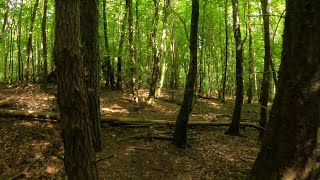
SaveMaybe the best riding the South East? The North Downs / Surrey Hills are proper beefy hills with an established scene. Stuff is always being built and there aren't many who know all the trails there. Rides start from Westcott or from Peaslake with good trails both up and down, across 6 areas. Coldharbour, Ranmore, Leith, Holmbury, Pitch and Winterfold.
The local soil is mainly sand so it drains well. You can do everyhting from hardcore XC to hardcore DH.
The local soil is mainly sand so it drains well. You can do everyhting from hardcore XC to hardcore DH.
source: Essex Herts MTB
Primary Trail Type: Cross-Country
AKA: Surrey Hills
Land Status: City Managed
 google parking directions
This region uses the Uk/Euro style trail grading system.
Activities Click to view
- Mountain Bike
15 trails
- E-Bike
5 trails
- Hike
23 trails
- Trail Running
23 trails
Region Details
- 5
- 4
- 4
Region Status
Open as of Jun 19, 2026Stats
- Avg Trail Rating
- Trails (view details)
- 14
- Trails Mountain Bike
- 15
- Trails E-Bike
- 5
- Trails Horse
- 1
- Trails Hike
- 23
- Trails Trail Running
- 23
- Total Distance
- 8 miles
- Total Descent
- 1,579 ft
- Total Vertical
- 569 ft
- Highest Trailhead
- 809 ft
- Reports
- 313
- Photos
- 18
- Ridden Counter
- 3,066
Popular North Downs Mountain Biking Trails
• 35 ★ 0.0 • 5,013 ft • 341 ft • 159 •
Track to top of North Downs. Moderately steep climb. Mostly unpaved apart from small section at the top. Roots can be tricky for inexperienced cyclists, but nothing hazardous at all.
• 60 ★ 4.0 • 3,770 ft • 5 ft • 113 •
Lovely twisty single track, sometimes peddly with some jumps for those that want to. Joins the timber yard trail at the bottom but not quite shown on here.
• 20 ★ 0.0 • 1,498 ft • 3 ft • 88 •
Straight, simple, quick descent with lots of roots to watch out for. Much much quicker in summer.
• 10 ★ 3.0 • 2,706 ft • 0 ft • 51 •
Fast and smooth downhill. Fun, fast and not too challenging. It's a bridleway, but there are dog walkers too.
• 50 ★ 0.0 • 2,923 ft • 196 ft • 47 •
Moderately popular blue difficulty mixed. This multi-use trail can be used both directions.
• 10 ★ 0.0 • 2,034 ft • 39 ft • 23 •
Less popular green difficulty singletrack. This mountain bike primary trail can be used both directions. On average it takes 2 minutes to complete this trail.
• 5 ★ 0.0 • 1,073 ft • 30 ft • 2 •
Splits from popular Flicks trail about 20m in. Downhill at first, some parts difficult to follow. Bottom of the trail and obvious track back to top. A short quick loop
• 5 ★ 0.0 • 1,305 ft • 77 ft • 1 •
Less popular blue difficulty singletrack. This mountain bike primary trail can be used downhill primary. On average it takes 7 minutes to complete this trail.
North Downs Mountain Bike Routes
★ 3.3 • 18 miles • 2,279 ft • 13 •
A 19 Mile ride around Surrey Hills taking in some of the best bits... including 2 visits to Peaslake...
Photos of North Downs Mountain Bike
Videos of North Downs Mountain Bike
trail: Sawmill
3:27 |
359 |
Aug 31, 2022 , Dorking
Recent Trail Reports
| status | trail | date | condition | info | user |
|---|---|---|---|---|---|
| Trail | Jun 19, 2026 @ 6:21pm (Europe/London) Jun 19, 2026 | Dry | fartymarty | ||
| Sawmill | May 10, 2026 @ 11:47am (Europe/London) May 10, 2026 | Very Dry | fartymarty | ||
| North Downs Way - Hollister Farm | Apr 30, 2026 @ 11:44am (Europe/London) Apr 30, 2026 | Very Dry | fartymarty | ||
| The tube | Sep 7, 2025 @ 10:27am Sep 7, 2025 | Dry | baldysellshisstuff | ||
| BW 136 | Sep 7, 2025 @ 10:27am Sep 7, 2025 | Dry | baldysellshisstuff | ||
| Timber Yard Track | Nov 10, 2024 @ 8:21am Nov 10, 2024 | Variable | Dukeinlondon | ||
| Flacks Loop | Jun 23, 2024 @ 6:23am Jun 23, 2024 | Dry | rhys1999 | ||
| Fullers Farm Rd Climb | Apr 28, 2023 @ 5:05pm Apr 28, 2023 | Ideal | Dukeinlondon | ||
| Down to Honeysuckle Bottom | Nov 13, 2021 @ 1:06am Nov 13, 2021 | Variable | marklat | ||
| Down to the Horses | Nov 7, 2021 @ 6:14am Nov 7, 2021 | Ideal | InternationalBiscuit |
Activity Feed
| username | action | type | title | date |
|---|---|---|---|---|
| fartymarty | add | report | activity #97551508 | Jun 22, 2026 @ 3:41am 17 hours |
| NavMTB | wishlist | route | activity #96402340 | Jun 6, 2026 @ 1:31pm Jun 6, 2026 |
| Wendyt0W30b | wishlist | trail | activity #95023824 | May 18, 2026 @ 11:55pm May 18, 2026 |
| funkydanger | wishlist | route | activity #94914221 | May 17, 2026 @ 9:43am May 17, 2026 |
| fartymarty | add | report | activity #94483584 | May 11, 2026 @ 2:03am May 11, 2026 |
Recent Comments
| username | type | title | comment | date |
|---|---|---|---|---|
| trail | This loop no longer exists. The area is... | Mar 29, 2025 @ 9:41am Mar 29, 2025 | ||
| trail | Really trailforks? 24 mins to cover 620 yards!!! | Apr 11, 2022 @ 11:21am Apr 11, 2022 | ||
| trail | Could someone add a GPX to this trail please?... | Feb 6, 2022 @ 12:19pm Feb 6, 2022 | ||
| trail | and a steep climb if you are going up it. | Jan 19, 2020 @ 11:40am Jan 19, 2020 | ||
| trail | Tree down across path near bottom. | Sep 8, 2018 @ 6:28am Sep 8, 2018 |
Nearby Areas
| name | distance | ||||
|---|---|---|---|---|---|
| The Hurtwood | 1.2 km | ||||
| Surrey Hills | 76 | 56 | 4 | 1.5 km | |
| Redlands Woods | 3.4 km | ||||
| St Leonards Forest | 9 | 10 | 10.1 km | ||
| Buchan Country Park | 1 | 3 | 10.2 km |
Local Mountain Biking Directory
-
Friends of the Hurtwood
![Friends of the Hurtwood]()
-
Nirvana CyclesBike Shop
-
Bikes Direct WarehouseBike Shop
Activity Type Stats
| activitytype | trails | distance | descent | descent distance | total vertical | rating | global rank | state rank | photos | reports | routes | ridelogs |
|---|---|---|---|---|---|---|---|---|---|---|---|---|
| Mountain Bike | 15 | 8 miles | 1,578 ft | 4 miles | 568 ft | #10,832 | #383 | 1 | 313 | 1 | 2,760 | |
| E-Bike | 5 | 3 miles | 331 ft | 1 mile | 502 ft | #5,060 | #220 | 311 | 218 | |||
| Horse | 1 | 5,013 ft | 3 ft | 121 ft | 338 ft | 17 | ||||||
| Hike | 23 | 8 miles | 1,545 ft | 4 miles | 568 ft | #3,094 | #47 | 17 | 312 | 130 | ||
| Trail Running | 23 | 8 miles | 1,545 ft | 4 miles | 568 ft | #6,508 | #158 | 312 | 155 |
Frequently Asked Questions About North Downs
▼
What are the highest rated mountain biking trails in North Downs?
The highest rated mountain biking trails in North Downs are:
- Sawmill (4/5)
- Down to the Horses (3.8/5)
- Fullers Farm Rd Climb (0/5)
- BW 136 (0/5)
- Down to Honeysuckle Bottom (0/5)
▼
What is the best time of the year to ride in North Downs?
Based on ride log data, the most popular months to ride in North Downs are:
- July (13 activities)
- August (9 activities)
- November (9 activities)
▼
Where can I park to ride in North Downs?
There are 1 parking locations listed in North Downs. The most popular parking spots are:
▼
What is the longest trail in North Downs?
The longest trail in North Downs is Fullers Farm Rd Climb at 1.5 km. View all trails sorted by distance.
- By mat-g
 & contributors
 - Admins: FOTH
- #6909 - 22,587 views
- north downs activity log | embed map of North Downs mountain bike trails | north downs mountain biking points of interest
Downloading of trail gps tracks in kml & gpx formats is enabled for North Downs.
You must login to download files.