close
-
Layers w
- Weather Layers
- Pro
- Pro
- Pro
- Pro
- Pro
- Pro
- More Layers
- Pro
- Pro
- Pro
- Pro
-
Upgrade to

3D
Trail Conditions
- Unknown
- Snow Groomed
- Snow Packed
- Snow Covered
- Snow Cover Partial
- Freeze/thaw Cycle
- Icy
- Prevalent Mud
- Wet
- Variable
- Ideal
- Dry
- Very Dry
Trail Flow (Ridden Direction)
Trailforks scans users ridelogs to determine the most popular direction each trail is ridden. A good flowing trail network will have most trails flowing in a single direction according to their intension.
The colour categories are based on what percentage of riders are riding a trail in its intended direction.
The colour categories are based on what percentage of riders are riding a trail in its intended direction.
- > 96%
- > 90%
- > 80%
- > 70%
- > 50%
- < 50%
- bi-directional trail
- no data
Trail Last Ridden
Trailforks scans ridelogs to determine the last time a trail was ridden.
- < 2 days
- < 1 week
- < 2 weeks
- < 1 month
- < 6 months
- > 6 months
Trail Ridden Direction
The intended direction a trail should be ridden.
- Downhill Only
- Downhill Primary
- Both Directions
- Uphill Primary
- Uphill Only
- One Direction
Contribute Details
Colors indicate trail is missing specified detail.
- Description
- Photos
- Description & Photos
- Videos
Trail Popularity ?
Trailforks scans ridelogs to determine which trails are ridden the most in the last 9 months.
Trails are compared with nearby trails in the same city region with a possible 25 colour shades.
Think of this as a heatmap, more rides = more kinetic energy = warmer colors.
- most popular
- popular
- less popular
- not popular
ATV/ORV/OHV Filter
Max Vehicle Width
inches
US Cell Coverage
Legend

Radar Time
Activity Recordings
Trailforks uses anonymized public activity data.
?
Activity Recordings
Trailforks uses anonymized public activity data.
?
Personal Heatmap
▶
Activity Types
all
/
none
▶
Options
2
Date range
month
–
Winter Trails
Warning
A routing network for winter maps does not exist. Selecting trails using the winter trails layer has been disabled.
Missing Trails
Most Popular
Least Popular
Trails are colored based on popularity. The more popular a trail is, the more red. Less popular trails trend towards green.
Jump Magnitude Heatmap
Heatmap of where riders jump on trails. Zoom in to see individual jumps, click circles to view jump details.
BC Backroad Status
![map legend]()
Service Road Atlas is a free to use, community-driven service for viewing and creating reports on the numerous back-country service roads around B.C. and Alberta.

Slope Aspect
Direction the slope faces
Trails Deemphasized
Trails are shown in grey.
Only show trails with no bike usage.
Suggested Layers
Based on selected activity type
Save the current map location and zoom level as your default home location whenever this page is loaded.
SavePopular Trail Networks
view all areas »
No description for North Jersey has been added yet!
Login or register to submit one.
Stats
- Avg Trail Rating
- Trails (view details)
- 2,850
- Trails Mountain Bike
- 1,772
- Trails E-Bike
- 207
- Trails Gravel Bike
- 144
- Trails Adaptive Bike
- 168
- Trails Winter Fat Bike
- 120
- Trails Horse
- 342
- Trails Hike
- 2,707
- Trails Trail Running
- 2,516
- Trails Dirtbike/Moto
- 2
- Trails Observed Trials
- 4
- Trails ATV/ORV/OHV
- 2
- Trails Snowmobile
- 17
- Trails Snowshoe
- 293
- Trails Downhill Ski
- 73
- Trails Backcountry Ski
- 46
- Trails Nordic Ski
- 226
- Total Distance
- 1,849 miles
- Total Descent
- 227,478 ft
- Total Vertical
- 9,106 ft
- Highest Trailhead
- 9,106 ft
- Reports
- 35,541
- Photos
- 5,602
- Ridden Counter
- 352,616
Articles
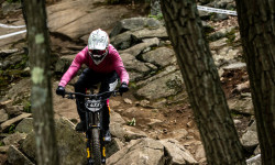
Video & Race Report: Eastern States Cup DH #2 - Mountain Creek, NJ
Jun 9, 2026 from pinkbike.com
Battle lines harden at Mountain Creek as Lucas DeDora goes 1/1 in seeding and finals, while Mary Jane Kissinger commands all three splits to...
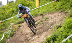
Video & Race Report: Eastern States Cup Intense DH #2 - Mountain Creek, NJ
Jun 19, 2025 from pinkbike.com
Round two of the Intense DH Series brought together the Northeast's fastest, all hungry to lay down the speed and battle it out at one of the...
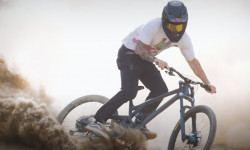
Video: George Ryan Tears Up Mountain Creek Bike Park in 'Park Rat'
Feb 20, 2025 from pinkbike.com
As the trail builder for Mountain Creek Bike Park in New Jersey, George Ryan sees some lines that others might miss.
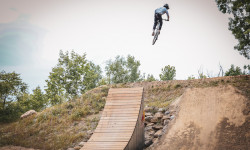
Video: 'Minor Threat' ft. Jack McKinney & Evan Menditto
Jul 16, 2023 from pinkbike.com
The riders swapped out the 20" bikes for some long travel ones, ditching the concrete for the trails of Mountain Creek Bike Park.
Sub Regions
- Bergen County (106)
- Alpine (91)
- Bergen Alpine (2)
- Camp Alpine (35)
- Palisades Interstate Park (57)
- PIPC Alpine (0)
- Emerson (4)
- Franklin Lakes (4)
- Parsons Pond (4)
- Ridgewood (3)
- Alpine (91)
- Essex County (67)
- Belleville (0)
- Cedar Grove (64)
- Livingston (2)
- Prospect Park (2)
- Montclair (0)
- Brookdale Park (0)
- West Caldwell (0)
- West Essex Park (0)
- West Orange (1)
- Belleville (0)
- Hudson County (19)
- Morris County (618)
- Boonton (3)
- Chester (41)
- Denville (64)
- Jonathan's Woods (13)
- Tourne County Park (37)
- Jefferson (103)
- Kinnelon (71)
- Kinnelon (11)
- Mendham (11)
- Morris Plains (1)
- Morristown (105)
- Mount Olive (39)
- Mountain Lakes (6)
- Randolph (21)
- Rockaway Township (38)
- Wildcat Ridge WMA (38)
- Roxbury (15)
- Berkshire Valley WMA (10)
- Black River Park (2)
- Stanhope (95)
- Wharton Borough (0)
- Dickerson Mine Preserve (16)
- Muriel Hepner Nature Park (2)
- Boonton (3)
- Passaic County (611)
- Hewitt (88)
- Ringwood (214)
- Ramapo Mountain State Forest (105)
- Ringwood State Park (109)
- Vernon (179)
- Wayne (81)
- High Mountain (81)
- West Milford (153)
- Woodland Park (2)
- Rifle Camp Park (2)
- Hewitt (88)
- Sussex County (397)
- Andover (51)
- Byram Township (113)
- Hopatcong (1)
- Newton (11)
- Sparta Township (0)
- Sussex (74)
- Stokes State Forest (93)
- Union County (2)
- Westfield (2)
- Tamaques Park (2)
- Westfield (2)
- Warren County (39)
- Allamuchy Township (19)
- Hackettstown (12)
- Pequest WMA (8)
- Hardwick Township (3)
- Hope (16)
- Phillipsburg (0)
- Washington (0)
- Worthington State Forest (1)
- Branchville (96)
- Jersey City (13)
- Liberty State Park (13)
- Long Valley (2)
- Mine Hill (16)
- Paulinskill Valley Trail (1)
Popular North Jersey Mountain Biking Trails
• 100 ★ 3.9 • 3,031 ft • 7 ft • 2,065 •
This is the infamous that is loaded with tight berms.
• 100 ★ 4.0 • 722 ft • 0 ft • 2,009 •
Starts off with a small step down into 3 tables. Leads into 2 doubles with an optional gap jump & one last table. After the last table it leaves you at a fork with on the left and on the right.
• 100 ★ 4.2 • 4,334 ft • 0 ft • 1,975 •
Easiest trail at the park, great for beginners but super fun to blaze down.
• 95 ★ 4.2 • 1,900 ft • 14 ft • 1,969 •
Jump trail at the bottom of dominion with large table tops, an on off drop, and a U-kicker. Leads to the top of
• 95 ★ 4.5 • 833 ft • 0 ft • 1,964 •
Highly rated popular green difficulty machine groomed. This mountain bike primary trail. It features berm and jump. On average it takes minutes to complete this trail.
• 85 ★ 2.7 • 1 mile • 3 ft • 1,916 •
Popular green difficulty singletrack. This mountain bike primary trail. On average it takes 3 minutes to complete this trail.
North Jersey Mountain Bike Routes
Clawson Challenge Featured
★ 4.0 • 16 miles • 1,217 ft • 10 • Loop •
The route is a medley of the best trails Jim Clawson created - known by his friends as Ort or Mr. Nature....
Best of Ramapo Featured
★ 4.0 • 11 miles • 1,394 ft • 16 • Loop •
These trails are what many intermediate and experienced ride enjoy most - a mix of moderate and...
★ 5.0 • 7 miles • 1,033 ft • 10 • Loop •
This is the full mildcat loop from the beach parking lot. If you're new to the Wildcat trails and not sure...
★ 5.0 • 5 miles • 653 ft • 1 • Loop •
Following the yellow trail almost all the way around with some of the red trail for a 5-mile lap. Good for...
12 miles • 920 ft • 8 • Loop •
If you're looking to explore the best of Kittatinny Valley give this route a try, it covers all the best...
★ 4.4 • 10 miles • 703 ft • 10 • Loop •
This is a route RGMTB used for a Meetup ride. Wanted to document it and use it again.
Photos of North Jersey Mountain Bike
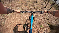
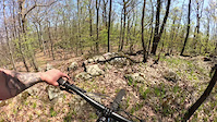
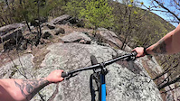
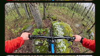
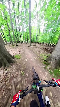
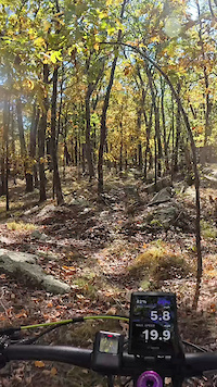
Videos of North Jersey Mountain Bike
featured
![Black River Trails]()

trail: Black River Trail
4:54 |
2925 |
Nov 18, 2015
trail: Unblazed
0:27 |
8 |
Apr 23, 2026
trail: Lumpy Bumpy
3:00 |
16 |
Apr 22, 2026
trail: Lumpy Bumpy
3:00 |
21 |
Apr 21, 2026
trail: Rollie Pollie
0:05 |
16 |
Apr 19, 2026
trail: Playground Jump Line
0:41 |
61 |
Oct 28, 2025
0:36 |
2 |
Oct 7, 2025

0:14 |
3 |
Sep 14, 2025
Current Trail Warnings
| status | trail | date | condition | user | info |
|---|---|---|---|---|---|
| Switchback Loop (Orange) Allamuchy Mountain State Park | Jun 21, 2026 @ 3:08pm (America/New_York) 3 hours | Unknown | anchotequila | several smaller trees down across the... | |
| Sidewinder Camp Alpine | Jun 21, 2026 @ 9:11am (America/New_York) 9 hours | Ideal | RobJSinger | E-Bike | |
| Skylands Ringwood State Park | Jun 20, 2026 @ 2:08pm (America/New_York) 1 day | Unknown | Americanflyr | E-Bike |
Recent Trail Reports
| status | trail | date | condition | info | user |
|---|---|---|---|---|---|
| Candy Ass Allamuchy Mountain State Park | Jun 21, 2026 @ 3:13pm (America/New_York) 3 hours | Dry | anchotequila | ||
| Orange Camp Alpine | Jun 21, 2026 @ 9:11am (America/New_York) 9 hours | Ideal | RobJSinger | ||
| Stoned Again Camp Alpine | Jun 21, 2026 @ 9:11am (America/New_York) 9 hours | Ideal | RobJSinger | ||
| Alt Red Camp Alpine | Jun 21, 2026 @ 9:11am (America/New_York) 9 hours | Ideal | RobJSinger | ||
| Hudson Trail Camp Alpine | Jun 21, 2026 @ 9:11am (America/New_York) 9 hours | Ideal | RobJSinger | ||
| Blue Camp Alpine | Jun 21, 2026 @ 9:11am (America/New_York) 9 hours | Ideal | RobJSinger | ||
| Yellow-White-Orange DH Camp Alpine | Jun 21, 2026 @ 9:11am (America/New_York) 9 hours | Ideal | RobJSinger | ||
| Red DH Camp Alpine | Jun 21, 2026 @ 9:11am (America/New_York) 9 hours | Ideal | RobJSinger | ||
| White Camp Alpine | Jun 21, 2026 @ 9:11am (America/New_York) 9 hours | Ideal | RobJSinger | ||
| White DH Camp Alpine | Jun 21, 2026 @ 9:11am (America/New_York) 9 hours | Ideal | RobJSinger |
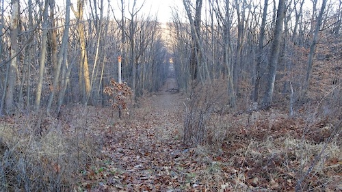
National Scenic Trails & Official Routes
-
Patriots' Path
- Mountain Bike
- Horse
- Hike
- Trail Running
- Snowshoe
- Nordic Ski
Activity Feed
| username | action | type | title | date |
|---|---|---|---|---|
| crosschainbreakers | wishlist | badge | activity #97519221 | Jun 21, 2026 @ 2:06pm 1 hours |
| anchotequila | add | report | activity #97508662 and 1 more | Jun 21, 2026 @ 12:08pm 3 hours |
| RobJSinger | add | report | activity #97498322 and 16 more | Jun 21, 2026 @ 10:21am 5 hours |
| Kyle6BAOML | wishlist | region | activity #97490294 | Jun 21, 2026 @ 8:58am 6 hours |
| rogerk | wishlist | route | activity #97427256 | Jun 20, 2026 @ 1:17pm 1 day |
Recent Comments
| username | type | title | comment | date |
|---|---|---|---|---|
| report | Large roughly 18 to 22 inch diameter blow down... | Jun 20, 2026 @ 11:10am 1 day | ||
| report | Trail cleared as of June 8 | Jun 10, 2026 @ 8:16am Jun 10, 2026 | ||
| report | Tree across trail. Can go over | Jun 10, 2026 @ 7:48am Jun 10, 2026 | ||
| trail | baldageddon dog approves 👍 | Jun 1, 2026 @ 8:29am Jun 1, 2026 | ||
| trail | Great flow trail. Easy level but good to rip. | Jun 1, 2026 @ 7:46am Jun 1, 2026 |
Local Badges
-

The Chimney Rock Rainbow16 awarded -
NJ Mountain Bike Festival Race Trail0 awarded -
NJ Mountain Bike Festival 202127 awarded -
NJ Mountain Bike Festival Warm Puppy Rock26 awarded -

NJ Mountain Bike Festival Crossover from Lot A0 awarded -
NJ Mountain Bike Festival Serpentine0 awarded
Bike & Skill Parks
| name | type | city | rating |
|---|---|---|---|
| Mountain Creek Resort | bike park | Vernon | |
| West Milford Family Pump Track | skill park | West Milford | |
| Joseph F. Tiseo Ramp Park (aka Bloomfield Skatepark) | skill park | Bloomfield | |
| Manhattan Island | skill park | Jersey City |
Upcoming Local Events
-
-
-
Local Products
Local Trail Supporters
- Tom Hennigan
![]()
- Black Bear
- Arthur White
![]()
- David Van Wart
- JORBA
Local Products
Local Trail Supporters
- Tom Hennigan
![]()
- Black Bear
- Arthur White
![]()
- David Van Wart
- JORBA
Activity Type Stats
| activitytype | trails | distance | descent | descent distance | total vertical | rating | global rank | state rank | photos | reports | routes | ridelogs |
|---|---|---|---|---|---|---|---|---|---|---|---|---|
| Mountain Bike | 1,772 | 1,183 miles | 129,491 ft | 449 miles | 1,791 ft | 5,250 | 35,437 | 220 | 238,560 | |||
| E-Bike | 207 | 162 miles | 14,327 ft | 50 miles | 1,250 ft | 11 | 25,430 | 14 | 10,533 | |||
| Gravel Bike | 144 | 157 miles | 11,742 ft | 63 miles | 1,352 ft | 23 | 3,593 | 6 | 1,245 | |||
| Adaptive Bike | 168 | 194 miles | 12,779 ft | 74 miles | 1,457 ft | 2,608 | 4 | 2 | ||||
| Winter Fat Bike | 120 | 96 miles | 8,878 ft | 35 miles | 1,768 ft | 1,440 | 4 | 15 | ||||
| Horse | 342 | 191 miles | 20,400 ft | 77 miles | 1,358 ft | 1 | 15,812 | 5 | 21 | |||
| Hike | 2,707 | 1,792 miles | 200,581 ft | 691 miles | 9,104 ft | 308 | 35,457 | 63 | 16,424 | |||
| Trail Running | 2,516 | 1,710 miles | 192,749 ft | 661 miles | 9,104 ft | 2 | 35,448 | 63 | 9,725 | |||
| Dirtbike/Moto | 2 | 2 miles | 79 ft | 2,503 ft | 446 ft | 2,407 | 124 | |||||
| Observed Trials | 4 | 3 miles | 236 ft | 2 miles | 1,060 ft | 379 | 76 | |||||
| ATV/ORV/OHV | 2 | 2 miles | 36 ft | 2,940 ft | 256 ft | 2,417 | 82 | |||||
| Snowmobile | 17 | 23 miles | 1,680 ft | 11 miles | 869 ft | 36 | 1 | 2 | ||||
| Snowshoe | 293 | 173 miles | 16,283 ft | 67 miles | 1,611 ft | 10,800 | 4 | 321 | ||||
| Downhill Ski | 73 | 16 miles | 12,618 ft | 16 miles | 1,450 ft | 3 | 13 | 887 | ||||
| Backcountry Ski | 46 | 32 miles | 4,278 ft | 14 miles | 1,129 ft | 33 | 1 | 190 | ||||
| Nordic Ski | 226 | 129 miles | 12,254 ft | 54 miles | 1,788 ft | 8,532 | 1 | 457 |
Activities
- North Jersey Mountain Biking Trails
- North Jersey E-Biking Trails
- North Jersey Gravel Biking Trails
- North Jersey Adaptive Biking Trails
- North Jersey Winter Fat Biking Trails
- North Jersey Horseback Trails
- North Jersey Hiking Trails
- North Jersey Trail Running Trails
- North Jersey Snowmobiling Trails
- North Jersey Snowshoeing Trails
- North Jersey Skiing Trails
- North Jersey Backcountry Skiing Trails
- North Jersey Nordic Skiing Trails
Trails
- By iridefatbikes
 & contributors
 - Admins: JORBA, NYNJTC, josowski, Tkeyworth
- #7644 - 24,618 views
- north jersey activity log | embed map of North Jersey mountain bike trails | north jersey mountain biking points of interest polygons
Downloading of trail gps tracks in kml & gpx formats is enabled for North Jersey.
You must login to download files.