close
-
Layers w
- Weather Layers
- Pro
- Pro
- Pro
- Pro
- Pro
- Pro
- More Layers
- Pro
- Pro
- Pro
- Pro
-
Upgrade to

3D
Trail Conditions
- Unknown
- Snow Groomed
- Snow Packed
- Snow Covered
- Snow Cover Partial
- Freeze/thaw Cycle
- Icy
- Prevalent Mud
- Wet
- Variable
- Ideal
- Dry
- Very Dry
Trail Flow (Ridden Direction)
Trailforks scans users ridelogs to determine the most popular direction each trail is ridden. A good flowing trail network will have most trails flowing in a single direction according to their intension.
The colour categories are based on what percentage of riders are riding a trail in its intended direction.
The colour categories are based on what percentage of riders are riding a trail in its intended direction.
- > 96%
- > 90%
- > 80%
- > 70%
- > 50%
- < 50%
- bi-directional trail
- no data
Trail Last Ridden
Trailforks scans ridelogs to determine the last time a trail was ridden.
- < 2 days
- < 1 week
- < 2 weeks
- < 1 month
- < 6 months
- > 6 months
Trail Ridden Direction
The intended direction a trail should be ridden.
- Downhill Only
- Downhill Primary
- Both Directions
- Uphill Primary
- Uphill Only
- One Direction
Contribute Details
Colors indicate trail is missing specified detail.
- Description
- Photos
- Description & Photos
- Videos
Trail Popularity ?
Trailforks scans ridelogs to determine which trails are ridden the most in the last 9 months.
Trails are compared with nearby trails in the same city region with a possible 25 colour shades.
Think of this as a heatmap, more rides = more kinetic energy = warmer colors.
- most popular
- popular
- less popular
- not popular
ATV/ORV/OHV Filter
Max Vehicle Width
inches
US Cell Coverage
Legend

Radar Time
Activity Recordings
Trailforks uses anonymized public activity data.
?
Activity Recordings
Trailforks uses anonymized public activity data.
?
Personal Heatmap
▶
Activity Types
all
/
none
▶
Options
2
Date range
month
–
Winter Trails
Warning
A routing network for winter maps does not exist. Selecting trails using the winter trails layer has been disabled.
Missing Trails
Most Popular
Least Popular
Trails are colored based on popularity. The more popular a trail is, the more red. Less popular trails trend towards green.
Jump Magnitude Heatmap
Heatmap of where riders jump on trails. Zoom in to see individual jumps, click circles to view jump details.
BC Backroad Status
![map legend]()
Service Road Atlas is a free to use, community-driven service for viewing and creating reports on the numerous back-country service roads around B.C. and Alberta.

Slope Aspect
Direction the slope faces
Trails Deemphasized
Trails are shown in grey.
Only show trails with no bike usage.
Suggested Layers
Based on selected activity type
Save the current map location and zoom level as your default home location whenever this page is loaded.
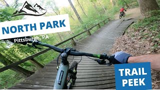
SaveAt over 3,000 acres, North Park is Allegheny County Parks' largest park. The park includes a wide range of recreational amenities, including a 75 acre fishing lake, saking rink, pool, nature center, off-leash dog park, 18 hole golf course and the Latodami Environmental Education Center. North Park was established in 1927. Its development via the Civilian Conservation Corps (CCC) was an important source of local employment during the Great Depression. Visitors today would be surprised to know that buffalo were kept on the site during the early 1930s. Today, North Park is home to a variety of wildlife, including the Southern Flying Squirrel, Coyote, Mink and Gray Fox.
North Park has an abundance of trails, although they are not always easy to link up. There are over 40 miles of single-track, multi-use trails. Popular trails include:
-Pool Loop and Devils Elbow (white blazed trails, park by Pool)
-Kotobuki (purple with black dot blazed trails, park by Pool
-Golf Course Front and Back Nine and V8 (green blazed trails, park at JC Stone Field)
-North Ridge Rainbow and Pfundstein Trail (red with blue dot blazed trails, park by Boathouse)
Primary Trail Type: Cross-Country
Land Status: County Park
Land Manager: Allegheny County Parks
 google parking directions
 Access Info:
Trails can be found along most tree lines. They will be clearly marked.
Activities Click to view
- Mountain Bike
93 trails
- Hike
97 trails
- Trail Running
97 trails
Region Details
- 5
- 1
- 31
- 53
- 3
Region Status
Open as of Jun 20, 2026Stats
- Avg Trail Rating
- Trails (view details)
- 99
- Trails Mountain Bike
- 93
- Trails E-Bike
- 4
- Trails Gravel Bike
- 1
- Trails Adaptive Bike
- 1
- Trails Horse
- 1
- Trails Hike
- 97
- Trails Trail Running
- 97
- Total Distance
- 39 miles
- Total Descent
- 5,590 ft
- Total Vertical
- 407 ft
- Highest Trailhead
- 1,306 ft
- Reports
- 1,530
- Photos
- 185
- Ridden Counter
- 23,841
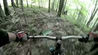
Popular North Park Mountain Biking Trails
• 95 ★ 3.0 • 3 miles • 517 ft • 566 •
Long technical trail mixed with some smooth easy sections. A combination of uphill and downhill. This trail meets up with the the .
• 100 ★ 4.4 • 1 mile • 129 ft • 547 •
is blazed purple with black dot. It is named after a Japanese restaurant that used to exist near the start of the trail. In 2016 there was a major reroute coordinated by Trail Pittsburgh. Rockwater Trail Services was hired in to machine...
• 100 ★ 4.0 • 2,369 ft • 13 ft • 536 •
Popular green difficulty singletrack. This multi-use trail can be used both directions. On average it takes 2 minutes to complete this trail.
• 95 ★ 4.4 • 3 miles • 189 ft • 473 •
The red dot trail runs from Road near the Ice Skating Rink to Irwin Run where Babcock Blvd intersects Pierce Mill Rd. This trail is an extension of N Ridge Trail. is a faster flowy downhill section. The trail climbs and descends with...
• 100 ★ 4.5 • 1 mile • 120 ft • 458 •
Popular blue difficulty singletrack. This multi-use trail can be used both directions and has a moderate overall physical rating. It features rock face. On average it takes 10 minutes to complete this trail.
• 100 ★ 0.0 • 3,071 ft • 26 ft • 457 •
Popular green difficulty singletrack. This multi-use trail can be used both directions. On average it takes 4 minutes to complete this trail.
• 100 ★ 0.0 • 1,100 ft • 11 ft • 427 •
Popular green difficulty singletrack. This multi-use trail can be used both directions and has a easy overall physical rating with a 11 ft green climb. On average it takes 1 minutes to complete this trail.
• 95 ★ 3.5 • 2,346 ft • 0 ft • 416 •
Popular blue difficulty singletrack. This multi-use trail can be used both directions. On average it takes 2 minutes to complete this trail.
North Park Mountain Bike Routes
★ 5.0 • 16 miles • 1,898 ft • 23 • Loop •
Park at Probike&Run or at . Get in right before #9 tee box. Nice Ride but watch out for hikers and...
9 miles • 1,031 ft • 6 • Loop •
North Park nine-mile loop. Start at the Olympica shelter and take the counter clock-wise, the this route...
★ 1.5 • 18 miles • 1,981 ft • 15 • Loop •
Best trails of North Park. Park at spillway, road climb, white loop up by the pool, down to Pro Bike Run,...
14 miles • 1,302 ft • 10 • Loop •
Dope North Park loop. Hit north and south ridges.
• 13 miles • 1,088 ft • 8 •
• 23 miles • 2,448 ft • 14 •
Photos of North Park Mountain Bike
Videos of North Park Mountain Bike

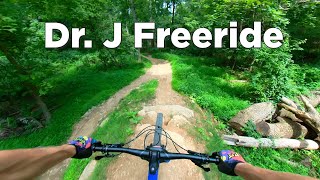
trail: Dr J Freeride
0:57 |
621 |
Apr 24, 2017
trail: Trail
3:00 |
322 |
Oct 31, 2013
trail: Alternate
3:26 |
266 |
Jul 22, 2012
13:58 |
284 |
Sep 6, 2023
trail: Dr J Freeride
0:32 |
740 |
Nov 29, 2021 , Allison Park
youtuber
![Beers, pizza, and the love of riding bikes:...]()

trail: Dr J Freeride
10:17 |
726 |
Jan 30, 2020 , Allison Park
youtuber
![North Park: The Mtb Skills Park of Our Dreams...]()

12:29 |
891 |
Jan 12, 2020
youtuber
![North Park: The Mtb Skills Park of Our Dreams...]()

trail: Dr J Freeride
12:29 |
1995 |
Jan 12, 2020 , Allison Park
Recent Trail Reports
| status | trail | date | condition | info | user |
|---|---|---|---|---|---|
| The Drop to 4 Corners | Jun 20, 2026 @ 1:49pm (America/New_York) Jun 20, 2026 | Unknown | ddiaz312 | ||
| MTB Trail | Jun 20, 2026 @ 11:40am (America/New_York) Jun 20, 2026 | Unknown | ddiaz312 | ||
| Connector | Jun 14, 2026 @ 3:19pm (America/Detroit) Jun 14, 2026 | Ideal | brampz24 | ||
| Connector | Jun 14, 2026 @ 3:19pm (America/Detroit) Jun 14, 2026 | Ideal | brampz24 | ||
| Old Babcock Blvd View | Jun 14, 2026 @ 3:19pm (America/Detroit) Jun 14, 2026 | Variable | brampz24 | ||
| White Blaze | Jun 14, 2026 @ 3:19pm (America/Detroit) Jun 14, 2026 | Ideal | brampz24 | ||
| Giddy up | Jun 14, 2026 @ 3:19pm (America/Detroit) Jun 14, 2026 | Ideal | brampz24 | ||
| Sarah's Lollipop Loop | Jun 14, 2026 @ 3:19pm (America/Detroit) Jun 14, 2026 | Ideal | brampz24 | ||
| MTB Trail | Jun 14, 2026 @ 3:19pm (America/Detroit) Jun 14, 2026 | Ideal | brampz24 | ||
| MTB Trail | Jun 14, 2026 @ 3:19pm (America/Detroit) Jun 14, 2026 | Ideal | brampz24 |
Activity Feed
| username | action | type | title | date |
|---|---|---|---|---|
| Bikedoc640 | vote | route | activity #97855974 | Jun 26, 2026 @ 2:03pm 12 mins |
| brampz24 | add | photo | activity #97508865 | Jun 21, 2026 @ 12:10pm Jun 21, 2026 |
| LukeGXCUpE | wishlist | region | activity #97406834 | Jun 20, 2026 @ 9:50am Jun 20, 2026 |
| ddiaz312 | add | report | activity #97399701 and 1 more | Jun 20, 2026 @ 8:40am Jun 20, 2026 |
| LukeGXCUpE | wishlist | region | activity #97384528 | Jun 20, 2026 @ 5:30am Jun 20, 2026 |
Recent Comments
| username | type | title | comment | date |
|---|---|---|---|---|
| trail | Tree down after the big angled log roll. No... | Jun 14, 2026 @ 9:33am Jun 14, 2026 | ||
| report | Cleared | Nov 13, 2025 @ 11:04am Nov 13, 2025 | ||
| report | Cleared | Sep 20, 2025 @ 11:18am Sep 20, 2025 | ||
| trail | Tree down toward trail end | Sep 5, 2025 @ 12:38pm Sep 5, 2025 | ||
| trail | Agreed about the need for berms. A number of... | Aug 11, 2025 @ 10:07am Aug 11, 2025 |
Nearby Areas
| name | distance | ||||
|---|---|---|---|---|---|
| Hartwood Acres | 10 | 34 | 1 | 5.5 km | |
| Sewickley Heights Borough Park | 7.5 km | ||||
| Riverview Park | 6 | 15 | 8.1 km | ||
| Highland Park | 1 | 9.3 km | |||
| Deer Lakes Park | 15 | 10 km |
Local Badges
-

Completionist0 awarded
Bike & Skill Parks
| name | type | city | rating |
|---|---|---|---|
| Freeride Skills Park | skill park | Allison Park |
Activity Type Stats
| activitytype | trails | distance | descent | descent distance | total vertical | rating | global rank | state rank | photos | reports | routes | ridelogs |
|---|---|---|---|---|---|---|---|---|---|---|---|---|
| Mountain Bike | 93 | 37 miles | 5,361 ft | 16 miles | 364 ft | #595 | #215 | 187 | 1,526 | 3 | 18,701 | |
| E-Bike | 4 | 4 miles | 630 ft | 2 miles | 262 ft | 1,178 | 3 | 738 | ||||
| Gravel Bike | 1 | #439 | #219 | 1 | 48 | |||||||
| Adaptive Bike | 1 | #442 | #221 | 1 | 1 | |||||||
| Horse | 1 | 1 mile | 315 ft | 3,232 ft | 213 ft | 104 | 2 | |||||
| Hike | 97 | 39 miles | 5,358 ft | 17 miles | 407 ft | #3,686 | #1,289 | 4 | 1,505 | 1 | 399 | |
| Trail Running | 97 | 39 miles | 5,358 ft | 17 miles | 407 ft | #2,870 | #735 | 1,505 | 1 | 848 |
Frequently Asked Questions About North Park
▼
What are the highest rated mountain biking trails in North Park?
The highest rated mountain biking trails in North Park are:
- Dr J Freeride (4.4/5)
- Kotobuki (4.3/5)
- Pfundstein Trail (4.2/5)
- MTB Trail (4.1/5)
- Purple Blaze (4.1/5)
▼
What is the best time of the year to ride in North Park?
Based on ride log data, the most popular months to ride in North Park are:
- July (254 activities)
- June (209 activities)
- May (202 activities)
▼
Where can I park to ride in North Park?
There are 8 parking locations listed in North Park. The most popular parking spots are: View all parking and trailhead locations on the map to plan your visit.
▼
What is the longest trail in North Park?
The longest trail in North Park is North Park Lake Shore Loop Trail at 5.0 miles. View all trails sorted by distance.
Activities
Trails
Points of Interest
- By eastsideride & contributors
- Admins: Trail PGH
- #4678 - 36,636 views
- north park activity log | embed map of North Park mountain bike trails | north park mountain biking points of interest
Downloading of trail gps tracks in kml & gpx formats is enabled for North Park.
You must login to download files.