close
-
Layers w
- Weather Layers
- Pro
- Pro
- Pro
- Pro
- Pro
- Pro
- More Layers
- Pro
- Pro
- Pro
- Pro
-
Upgrade to

3D
Trail Conditions
- Unknown
- Snow Groomed
- Snow Packed
- Snow Covered
- Snow Cover Partial
- Freeze/thaw Cycle
- Icy
- Prevalent Mud
- Wet
- Variable
- Ideal
- Dry
- Very Dry
Trail Flow (Ridden Direction)
Trailforks scans users ridelogs to determine the most popular direction each trail is ridden. A good flowing trail network will have most trails flowing in a single direction according to their intension.
The colour categories are based on what percentage of riders are riding a trail in its intended direction.
The colour categories are based on what percentage of riders are riding a trail in its intended direction.
- > 96%
- > 90%
- > 80%
- > 70%
- > 50%
- < 50%
- bi-directional trail
- no data
Trail Last Ridden
Trailforks scans ridelogs to determine the last time a trail was ridden.
- < 2 days
- < 1 week
- < 2 weeks
- < 1 month
- < 6 months
- > 6 months
Trail Ridden Direction
The intended direction a trail should be ridden.
- Downhill Only
- Downhill Primary
- Both Directions
- Uphill Primary
- Uphill Only
- One Direction
Contribute Details
Colors indicate trail is missing specified detail.
- Description
- Photos
- Description & Photos
- Videos
Trail Popularity ?
Trailforks scans ridelogs to determine which trails are ridden the most in the last 9 months.
Trails are compared with nearby trails in the same city region with a possible 25 colour shades.
Think of this as a heatmap, more rides = more kinetic energy = warmer colors.
- most popular
- popular
- less popular
- not popular
ATV/ORV/OHV Filter
Max Vehicle Width
inches
US Cell Coverage
Legend

Radar Time
Activity Recordings
Trailforks uses anonymized public activity data.
?
Activity Recordings
Trailforks uses anonymized public activity data.
?
Personal Heatmap
▶
Activity Types
all
/
none
▶
Options
2
Date range
month
–
Winter Trails
Warning
A routing network for winter maps does not exist. Selecting trails using the winter trails layer has been disabled.
Missing Trails
Most Popular
Least Popular
Trails are colored based on popularity. The more popular a trail is, the more red. Less popular trails trend towards green.
Jump Magnitude Heatmap
Heatmap of where riders jump on trails. Zoom in to see individual jumps, click circles to view jump details.
BC Backroad Status
![map legend]()
Service Road Atlas is a free to use, community-driven service for viewing and creating reports on the numerous back-country service roads around B.C. and Alberta.

Slope Aspect
Direction the slope faces
Trails Deemphasized
Trails are shown in grey.
Only show trails with no bike usage.
Suggested Layers
Based on selected activity type
Save the current map location and zoom level as your default home location whenever this page is loaded.
SaveThe North Third riding area is a short distance from Stirling and can be accessed from various locations, it gets its name from the reservoir that was built in 1911. It is known locally as N3. It covers a much wider area than the proximity to the water. There is Lewis Hill with unrivalled views to the Trossachs and the multi use trail along the top of Sauchie Craig's which is a fantastic black graded ride. Off the top of Sauchie Craig's there are steep and technical trails have been built, you'd be forgiven when looking down the cliffs to the water for thinking it's impossible to get there by bike. Popeye and Achilles defy this. The Windy Yet Glen and Middle Third Wood Split the Craigs and amongst them both there is a variety of trails to suit all riders and abilities. Wild Boar, Flojo, Timber, Veggie, Route 77, Candy Crush, Psilocybin, Jump Line, Homicide, Killers Secret, Killers Side Door, Homicide Central, Marley & Me can all be ridden in a variety of loops adding up the distance and descent.
Primary Trail Type: Cross-Country
 google parking directions
 Access Info:
Various starting points possible to access the riding at North third.
This region uses the Uk/Euro style trail grading system.
Region Supporters & Maintainers
- Roots CyclesSponsor
Activities Click to view
- Mountain Bike
50 trails
- E-Bike
50 trails
- Hike
32 trails
- Trail Running
32 trails
Region Details
- 12
- 3
- 9
- 12
- 13
Region Status
Caution as of May 1, 2026Stats
- Avg Trail Rating
- Trails (view details)
- 49
- Trails Mountain Bike
- 50
- Trails E-Bike
- 50
- Trails Hike
- 32
- Trails Trail Running
- 32
- Total Distance
- 21 miles
- Total Descent Distance
- 10 miles
- Total Descent
- 3,713 ft
- Total Vertical
- 634 ft
- Highest Trailhead
- 847 ft
- Reports
- 541
- Photos
- 160
- Ridden Counter
- 5,938
Popular North Third Mountain Biking Trails
• 80 ★ 4.4 • 1 mile • 132 ft • 340 • • hike
Popular black difficulty singletrack. This hike primary trail can be used one direction and has a moderate overall physical rating with a 132 ft blue climb. It features drop and jump. On average it takes 15 minutes to complete this trail.
• 85 ★ 4.6 • 5,223 ft • 25 ft • 301 • • hike
Following the cliff edge, this trail has lots to keep you on your toes. Rooty descents and climbs, cliff edge turns and rock drops are guarenteed to test your abilities. The fast flowing final descent is tight and twisty with some...
• 65 ★ 3.9 • 4,111 ft • 10 ft • 264 •
A fast single track, cross country style trail with flowing features.
• 100 ★ 4.7 • 1,001 ft • 0 ft • 250 •
After , and nearby, we have completed an additional trail. .
• 65 ★ 3.4 • 1,430 ft • 7 ft • 204 •
Natural trail on varying surfaces. Rocks, roots and mud.
• 55 ★ 2.5 • 2,441 ft • 45 ft • 204 • • hike
Moderately popular blue difficulty singletrack. This hike primary trail can be used both directions and has a easy overall physical rating with a 45 ft green climb. On average it takes 3 minutes to complete this trail.
• 65 ★ 1.0 • 1 mile • 67 ft • 200 • • hike
Moderately popular green difficulty singletrack. This hike primary trail can be used both directions and has a easy overall physical rating with a 67 ft green climb. It features bridge. Trail visibility is always easy to follow. On average it takes 12 minutes to complete this trail.
North Third Mountain Bike Routes
14 miles • 2,415 ft • 21 • Loop •
Starting at the Battle of Bannockburn Heritage centre and taking in a loop of 9 trails.
Photos of North Third Mountain Bike
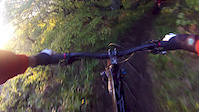
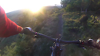
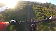
Videos of North Third Mountain Bike

trail: North Third
5:50 |
624 |
May 17, 2017
trail: North Third
0:41 |
136 |
May 17, 2017
trail: North Third
0:22 |
102 |
May 17, 2017

trail: North Third
0:34 |
77 |
May 17, 2017
trail: North Third
2:08 |
102 |
May 17, 2017

trail: Sauchie Craig
3:05 |
771 |
Jan 22, 2017
trail: North Third
2:34 |
224 |
Aug 17, 2015
trail: North Third
5:09 |
180 |
Aug 17, 2015
Recent Trail Reports
| status | trail | date | condition | info | user |
|---|---|---|---|---|---|
| Micro Dose | May 1, 2026 @ 11:03pm (Europe/London) May 1, 2026 | Ideal | JWG OTA | ||
| Psilocybin | May 1, 2026 @ 10:12pm (Europe/London) May 1, 2026 | Unknown | JWG OTA | ||
| Mycelium | May 1, 2026 @ 10:08pm (Europe/London) May 1, 2026 | Unknown | JWG OTA | ||
| Craigs Wood | Feb 21, 2026 @ 9:41am (Europe/London) Feb 21, 2026 | Variable | ShoodNoBetter BCDC | ||
| Craigs Wood Path | Feb 21, 2026 @ 9:41am (Europe/London) Feb 21, 2026 | Variable | ShoodNoBetter BCDC | ||
| Access Road | Feb 21, 2026 @ 9:41am (Europe/London) Feb 21, 2026 | Variable | ShoodNoBetter BCDC | ||
| Achilles | Jan 17, 2026 @ 9:49pm (Europe/London) Jan 17, 2026 | Prevalent Mud | stuartw OTA | ||
| Homicide | Nov 1, 2025 @ 12:55pm (Europe/London) Nov 1, 2025 | Wet | Keeferoo | ||
| Food Of The Gods (FOTG) | Oct 21, 2025 @ 3:26pm (Europe/London) Oct 21, 2025 | Unknown | JWG OTA | ||
| Sauchie Craig | Oct 12, 2025 @ 1:46pm (Europe/London) Oct 12, 2025 | Variable | trueborndjross |
Activity Feed
| username | action | type | title | date |
|---|---|---|---|---|
| alantomkins | wishlist | trail | activity #95094608 | May 20, 2026 @ 2:13am May 20, 2026 |
| JWG | add | photo | activity #93814933 and 5 more | May 1, 2026 @ 3:35pm May 1, 2026 |
| JWG | add | trail | activity #93810971 | May 1, 2026 @ 2:35pm May 1, 2026 |
| JWG | add | report | activity #93809400 and 2 more | May 1, 2026 @ 2:09pm May 1, 2026 |
| JWG | update | trail | activity #93809280 | May 1, 2026 @ 2:07pm May 1, 2026 |
Recent Comments
| username | type | title | comment | date |
|---|---|---|---|---|
| trail | A few small trees down near the start. | Oct 4, 2025 @ 12:18pm Oct 4, 2025 | ||
| trail | Can confirm trail is still closed in Sep 25... | Sep 20, 2025 @ 2:33pm Sep 20, 2025 | ||
| trail | Tree down blocking the trail half way along... | Jul 23, 2025 @ 1:04pm Jul 23, 2025 | ||
| trail | 2 big trees down blocking the trail. 1st... | Jul 23, 2025 @ 1:00pm Jul 23, 2025 | ||
| trail | Lots of fallen trees and very wet. Definitely... | May 26, 2025 @ 8:23am May 26, 2025 |
Nearby Areas
| name | distance | ||||
|---|---|---|---|---|---|
| Cambusbarron | 29 | 5 | 1.5 km | ||
| Plean Country Park | 15 | 1 | 4.4 km | ||
| Carron Valley | 10 | 16 | 5.1 km | ||
| Torwood | 6 | 5 | 5.2 km | ||
| Uni Wood | 1 | 5 | 5.3 km |
Local Badges
-

Completionist0 awarded
Activity Type Stats
| activitytype | trails | distance | descent | descent distance | total vertical | rating | global rank | state rank | photos | reports | routes | ridelogs |
|---|---|---|---|---|---|---|---|---|---|---|---|---|
| Mountain Bike | 50 | 21 miles | 3,714 ft | 10 miles | 633 ft | #2,310 | #73 | 158 | 541 | 1 | 2,711 | |
| E-Bike | 50 | 21 miles | 3,714 ft | 10 miles | 633 ft | #2,591 | #90 | 2 | 533 | 1 | 735 | |
| Hike | 32 | 18 miles | 2,001 ft | 7 miles | 633 ft | #6,695 | #154 | 373 | 109 | |||
| Trail Running | 32 | 18 miles | 2,001 ft | 7 miles | 633 ft | #6,857 | #169 | 373 | 115 |
Frequently Asked Questions About North Third
▼
What are the highest rated mountain biking trails in North Third?
The highest rated mountain biking trails in North Third are:
- Sauchie Craig (4.4/5)
- Homicide (4.4/5)
- Jump line (4.3/5)
- Achilles (4.3/5)
- Popeye (4.3/5)
▼
What is the best time of the year to ride in North Third?
Based on ride log data, the most popular months to ride in North Third are:
- April (10 activities)
- August (9 activities)
- September (4 activities)
▼
Where can I park to ride in North Third?
There are 1 parking locations listed in North Third. The most popular parking spots are:
▼
What is the longest trail in North Third?
The longest trail in North Third is Reservior Path at 1.3 miles. View all trails sorted by distance.
Activities
Trails
- By JWG
 OTA & contributors
 - Admins: OTA, OTA
- #44848 - 6,538 views
- north third activity log | embed map of North Third mountain bike trails | north third mountain biking points of interest polygons
Downloading of trail gps tracks in kml & gpx formats is enabled for North Third.
You must login to download files.