close
-
Layers w
- Weather Layers
- Pro
- Pro
- Pro
- Pro
- Pro
- Pro
- More Layers
- Pro
- Pro
- Pro
- Pro
-
Upgrade to

3D
Trail Conditions
- Unknown
- Snow Groomed
- Snow Packed
- Snow Covered
- Snow Cover Partial
- Freeze/thaw Cycle
- Icy
- Prevalent Mud
- Wet
- Variable
- Ideal
- Dry
- Very Dry
Trail Flow (Ridden Direction)
Trailforks scans users ridelogs to determine the most popular direction each trail is ridden. A good flowing trail network will have most trails flowing in a single direction according to their intension.
The colour categories are based on what percentage of riders are riding a trail in its intended direction.
The colour categories are based on what percentage of riders are riding a trail in its intended direction.
- > 96%
- > 90%
- > 80%
- > 70%
- > 50%
- < 50%
- bi-directional trail
- no data
Trail Last Ridden
Trailforks scans ridelogs to determine the last time a trail was ridden.
- < 2 days
- < 1 week
- < 2 weeks
- < 1 month
- < 6 months
- > 6 months
Trail Ridden Direction
The intended direction a trail should be ridden.
- Downhill Only
- Downhill Primary
- Both Directions
- Uphill Primary
- Uphill Only
- One Direction
Contribute Details
Colors indicate trail is missing specified detail.
- Description
- Photos
- Description & Photos
- Videos
Trail Popularity ?
Trailforks scans ridelogs to determine which trails are ridden the most in the last 9 months.
Trails are compared with nearby trails in the same city region with a possible 25 colour shades.
Think of this as a heatmap, more rides = more kinetic energy = warmer colors.
- most popular
- popular
- less popular
- not popular
ATV/ORV/OHV Filter
Max Vehicle Width
inches
US Cell Coverage
Legend

Radar Time
Activity Recordings
Trailforks uses anonymized public activity data.
?
Activity Recordings
Trailforks uses anonymized public activity data.
?
Personal Heatmap
▶
Activity Types
all
/
none
▶
Options
2
Date range
month
–
Winter Trails
Warning
A routing network for winter maps does not exist. Selecting trails using the winter trails layer has been disabled.
Missing Trails
Most Popular
Least Popular
Trails are colored based on popularity. The more popular a trail is, the more red. Less popular trails trend towards green.
Jump Magnitude Heatmap
Heatmap of where riders jump on trails. Zoom in to see individual jumps, click circles to view jump details.
BC Backroad Status
![map legend]()
Service Road Atlas is a free to use, community-driven service for viewing and creating reports on the numerous back-country service roads around B.C. and Alberta.

Slope Aspect
Direction the slope faces
Trails Deemphasized
Trails are shown in grey.
Only show trails with no bike usage.
Suggested Layers
Based on selected activity type
Save the current map location and zoom level as your default home location whenever this page is loaded.
SaveThese trails are mainly on USFS land with a few of the trailheads within the Town of Vail. Almost all have seasonal wildlife closures from April 15 - June 20 so plan accordingly and please respect these closures
Primary Trail Type: Cross-Country
Shuttleable: YES
Land Status: National Forest
 google parking directions
Links
IMBA Ride Center

Vail Valley
Activities Click to view
- Mountain Bike
16 trails
- E-Bike
3 trails
- Hike
17 trails
- Trail Running
17 trails
Region Details
- 5
- 1
- 7
- 2
Region Status
Caution as of 18 hoursStats
- Avg Trail Rating
- Trails (view details)
- 15
- Trails Mountain Bike
- 17
- Trails E-Bike
- 3
- Trails Horse
- 2
- Trails Hike
- 17
- Trails Trail Running
- 17
- Total Distance
- 42 miles
- Total Descent
- 6,882 ft
- Total Vertical
- 2,598 ft
- Highest Trailhead
- 10,508 ft
- Reports
- 421
- Photos
- 131
- Ridden Counter
- 2,078
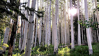
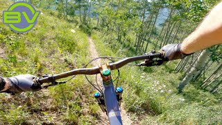
Popular North Vail Mountain Biking Trails
• 85 ★ 4.2 • 4 miles • 363 ft • 273 •
Fast and flowy single track. Pine, aspen, and grasslands sections with nice viewpoints of the Vail Valley. Recommend riding up the road and down this trail.
• 90 ★ 3.0 • 2 miles • 856 ft • 226 •
Popular blue difficulty singletrack. This multi-use trail can be used both directions and has a moderate overall physical rating with a 856 ft blue climb. On average it takes 28 minutes to complete this trail.
• 60 ★ 4.2 • 3 miles • 86 ft • 167 •
Highly rated moderately popular black diamond difficulty singletrack. This mountain bike primary trail can be used both directions. On average it takes 10 minutes to complete this trail.
• 70 ★ 4.0 • 4,120 ft • 43 ft • 161 •
Popular blue difficulty singletrack. This mountain bike primary trail can be used both directions. On average it takes 3 minutes to complete this trail.
• 80 ★ 3.0 • 3,474 ft • 0 ft • 132 •
After hitting Rd from the , climb up for about 0.5 miles and the trailhead through a fence will be on your left. Short, fun, and flowy. Better option than riding the road down from the head.
• 80 ★ 0.0 • 2,319 ft • 79 ft • 104 •
Popular green difficulty singletrack. This mountain bike primary trail can be used both directions and has a easy overall physical rating with a 79 ft blue climb. On average it takes 3 minutes to complete this trail.
• 70 ★ 3.6 • 7 miles • 1,635 ft • 99 •
Popular hiking and biking trail in Vail. Best ridden from East to West as a full ride. Used as a connector from to create a loop. Climbs up from the Red Sandstone Rd trailhead, followed by a washed out down, cross the creek, and then...
North Vail Mountain Bike Routes
★ 2.0 • 9 miles • 1,646 ft • 1 • Loop •
Great lunch ride. Red Sandstone Rd can get a bit busy with cars heading to Piney Lake, especially on the...
19 miles • 3,036 ft • 5 • Loop •
Looking for a bigger ride than just ? Add in to make this an even sweeter ride!
★ 3.0 • 13 miles • 2,188 ft • 6 • Loop •
Park at the North Trail parking lot trailhead on Red Sandstone Rd. Head up the paved road out of the...
Photos of North Vail Mountain Bike
Videos of North Vail Mountain Bike
trail: Lost Lake
3:16 |
113 |
Aug 27, 2020
youtuber
![My favorite ride in the Vail valley! | Vail...]()
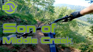
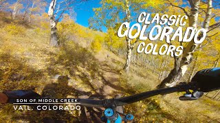
trail: Son Of Middle Creek (2136)
7:33 |
331 |
Nov 30, 2021 , Vail
youtuber
![Where I ride before the lifts start | Vail,...]()
trail: Son Of Middle Creek (2136)
14:52 |
210 |
Aug 2, 2021 , Vail
youtuber
![Alpine mountain biking away from the bike park...]()
trail: Son Of Middle Creek (2136)
14:52 |
307 |
Jul 29, 2021 , Vail
trail: Son Of Middle Creek (2136)
6:58 |
381 |
Oct 26, 2020 , Vail
Recent Trail Reports
| status | trail | date | condition | info | user |
|---|---|---|---|---|---|
| Son Of Middle Creek (2136) | Jun 21, 2026 @ 12:03am (America/Los_Angeles) 18 hours | Unknown | trailforks Trailforks | ||
| North Trail Connector | Jun 21, 2026 @ 12:03am (America/Los_Angeles) 18 hours | Unknown | trailforks Trailforks | ||
| North Trail | Jun 21, 2026 @ 12:03am (America/Los_Angeles) 18 hours | Unknown | trailforks Trailforks | ||
| North Trail | Jun 21, 2026 @ 12:03am (America/Los_Angeles) 18 hours | Unknown | trailforks Trailforks | ||
| Buffehr Creek | Jun 21, 2026 @ 12:03am (America/Los_Angeles) 18 hours | Unknown | trailforks Trailforks | ||
| Davos Trail | Jun 14, 2026 @ 7:56am (America/Denver) Jun 14, 2026 | Dry | jmac125 | ||
| North Trail (Davos) | Apr 27, 2026 @ 3:40pm (America/Denver) Apr 27, 2026 | Unknown | sammyc151 VVMTA | ||
| North Trail Connector | Sep 22, 2025 @ 4:38pm (America/Denver) Sep 22, 2025 | Wet | huhmanj | ||
| Lost Lake | Aug 31, 2025 @ 7:09pm Aug 31, 2025 | Unknown | jakesigal | ||
| Road to Lost Lake Trail | Jul 2, 2024 @ 10:11am Jul 2, 2024 | Dry | sammyc151 VVMTA |
Activity Feed
| username | action | type | title | date |
|---|---|---|---|---|
| trailforks | add | report | activity #97458316 and 4 more | Jun 21, 2026 @ 12:03am 18 hours |
| jmac125 | add | report | activity #96979323 | Jun 14, 2026 @ 9:42am Jun 14, 2026 |
| sammyc151 | add | report | activity #93541343 | Apr 27, 2026 @ 2:41pm Apr 27, 2026 |
| sammyc151 | add | report | activity #93185687 and 5 more | Apr 22, 2026 @ 6:00pm Apr 22, 2026 |
| murter | ridden | trail | activity #91108806 | Mar 22, 2026 @ 2:09pm Mar 22, 2026 |
Recent Comments
| username | type | title | comment | date |
|---|---|---|---|---|
| trail | Interesting adventure ride going east to west.... | Aug 31, 2025 @ 7:15pm Aug 31, 2025 | ||
| trail | Very nice with good flow. Not a black.... | Aug 31, 2025 @ 4:21pm Aug 31, 2025 | ||
| report | From north trail down | Jun 26, 2025 @ 3:07am Jun 26, 2025 | ||
| trail | Mellow decent from the lake with a few tech... | Jul 22, 2023 @ 1:17pm Jul 22, 2023 | ||
| trail | Don’t waste your time on this trail! Really... | Jun 18, 2023 @ 4:06pm Jun 18, 2023 |
Nearby Areas
| name | distance | ||||
|---|---|---|---|---|---|
| Vail Nordic Center | 10 | 1 | 3.2 km | ||
| Vail Mountain | 4 | 17 | 10 | 2 | 3.7 km |
| Minturn Bike Park | 3 | 3 | 2 | 6.2 km | |
| Vail Pass | 2 | 4 | 6.2 km | ||
| West Avon Preserve | 2 | 7 | 1 | 7.7 km |
Activity Type Stats
| activitytype | trails | distance | descent | descent distance | total vertical | rating | global rank | state rank | photos | reports | routes | ridelogs |
|---|---|---|---|---|---|---|---|---|---|---|---|---|
| Mountain Bike | 16 | 42 miles | 6,883 ft | 16 miles | 2,598 ft | #6,352 | #2,392 | 39 | 433 | 2 | 2,077 | |
| E-Bike | 3 | 11 miles | 525 ft | 2 miles | 1,788 ft | #7,080 | #2,050 | 307 | 83 | |||
| Horse | 2 | 2 miles | 30 ft | 751 ft | 646 ft | 157 | 1 | |||||
| Hike | 17 | 42 miles | 6,883 ft | 16 miles | 2,598 ft | #2,840 | #972 | 94 | 418 | 314 | ||
| Trail Running | 17 | 42 miles | 6,883 ft | 16 miles | 2,598 ft | #4,839 | #1,422 | 418 | 181 |
Frequently Asked Questions About North Vail
▼
What are the highest rated mountain biking trails in North Vail?
The highest rated mountain biking trails in North Vail are:
- Son Of Middle Creek (2136) (4.1/5)
- Buffehr Creek (4.1/5)
- Lost Lake (4/5)
- North Trail Connector (4/5)
- North Trail (3.8/5)
▼
What is the best time of the year to ride in North Vail?
Based on ride log data, the most popular months to ride in North Vail are:
- July (35 activities)
- June (21 activities)
- August (17 activities)
▼
Where can I park to ride in North Vail?
There are 2 parking locations listed in North Vail. The most popular parking spots are:
▼
What is the longest trail in North Vail?
The longest trail in North Vail is North Trail at 6.6 miles. View all trails sorted by distance.
- By esaeger1
 VVMTA & contributors
 - Admins: VVMTA, VVMTA, VVMTA
- #25989 - 2,860 views
- north vail activity log | embed map of North Vail mountain bike trails | north vail mountain biking points of interest
Downloading of trail gps tracks in kml & gpx formats is enabled for North Vail.
You must login to download files.