close
-
Layers w
- Weather Layers
- Pro
- Pro
- Pro
- Pro
- Pro
- Pro
- More Layers
- Pro
- Pro
- Pro
- Pro
-
Upgrade to

3D
Trail Conditions
- Unknown
- Snow Groomed
- Snow Packed
- Snow Covered
- Snow Cover Partial
- Freeze/thaw Cycle
- Icy
- Prevalent Mud
- Wet
- Variable
- Ideal
- Dry
- Very Dry
Trail Flow (Ridden Direction)
Trailforks scans users ridelogs to determine the most popular direction each trail is ridden. A good flowing trail network will have most trails flowing in a single direction according to their intension.
The colour categories are based on what percentage of riders are riding a trail in its intended direction.
The colour categories are based on what percentage of riders are riding a trail in its intended direction.
- > 96%
- > 90%
- > 80%
- > 70%
- > 50%
- < 50%
- bi-directional trail
- no data
Trail Last Ridden
Trailforks scans ridelogs to determine the last time a trail was ridden.
- < 2 days
- < 1 week
- < 2 weeks
- < 1 month
- < 6 months
- > 6 months
Trail Ridden Direction
The intended direction a trail should be ridden.
- Downhill Only
- Downhill Primary
- Both Directions
- Uphill Primary
- Uphill Only
- One Direction
Contribute Details
Colors indicate trail is missing specified detail.
- Description
- Photos
- Description & Photos
- Videos
Trail Popularity ?
Trailforks scans ridelogs to determine which trails are ridden the most in the last 9 months.
Trails are compared with nearby trails in the same city region with a possible 25 colour shades.
Think of this as a heatmap, more rides = more kinetic energy = warmer colors.
- most popular
- popular
- less popular
- not popular
ATV/ORV/OHV Filter
Max Vehicle Width
inches
US Cell Coverage
Legend

Radar Time
Activity Recordings
Trailforks uses anonymized public activity data.
?
Activity Recordings
Trailforks uses anonymized public activity data.
?
Personal Heatmap
▶
Activity Types
all
/
none
▶
Options
2
Date range
month
–
Winter Trails
Warning
A routing network for winter maps does not exist. Selecting trails using the winter trails layer has been disabled.
Missing Trails
Most Popular
Least Popular
Trails are colored based on popularity. The more popular a trail is, the more red. Less popular trails trend towards green.
Jump Magnitude Heatmap
Heatmap of where riders jump on trails. Zoom in to see individual jumps, click circles to view jump details.
BC Backroad Status
![map legend]()
Service Road Atlas is a free to use, community-driven service for viewing and creating reports on the numerous back-country service roads around B.C. and Alberta.

Slope Aspect
Direction the slope faces
Trails Deemphasized
Trails are shown in grey.
Only show trails with no bike usage.
Suggested Layers
Based on selected activity type
Save the current map location and zoom level as your default home location whenever this page is loaded.
Save
No description for North York has been added yet!
Login or register to submit one.
Activities Click to view
- Mountain Bike
63 trails
- E-Bike
52 trails
- Gravel Bike
2 trails
- Adaptive Bike
1 trails
- Winter Fat Bike
1 trails
- Hike
62 trails
- Trail Running
61 trails
- Snowshoe
27 trails
- Nordic Ski
22 trails
Region Details
- 33
- 4
- 14
- 7
- 1
Region Status
Caution as of Jun 23, 2026Stats
- Avg Trail Rating
- Trails (view details)
- 59
- Trails Mountain Bike
- 63
- Trails E-Bike
- 52
- Trails Gravel Bike
- 2
- Trails Adaptive Bike
- 1
- Trails Winter Fat Bike
- 1
- Trails Hike
- 62
- Trails Trail Running
- 61
- Trails Dirtbike/Moto
- 1
- Trails Snowshoe
- 27
- Trails Nordic Ski
- 22
- Total Distance
- 35 miles
- Total Descent Distance
- 11 miles
- Total Descent
- 1,489 ft
- Total Vertical
- 339 ft
- Highest Trailhead
- 734 ft
- Reports
- 152
- Photos
- 53
- Ridden Counter
- 2,287
Sub Regions
-
East Don Parklands
- 1
Popular North York Mountain Biking Trails
• 100 ★ 0.0 • 397 ft • 3 ft • 124 • • hike
Popular green difficulty singletrack. This hike primary trail can be used both directions. On average it takes minutes to complete this trail.
• 90 ★ 5.0 • 3,537 ft • 70 ft • 97 •
Popular green difficulty singletrack. This mountain bike primary trail can be used both directions with a 70 ft blue climb. Trail visibility is always easy to follow. On average it takes 4 minutes to complete this trail.
• 25 ★ 2.8 • 3,340 ft • 68 ft • 50 •
Less popular blue difficulty singletrack. This mountain bike primary trail can be used both directions and has a moderate overall physical rating with a 68 ft blue climb. It features berm, bridge, drop and jump. On average it takes 16 minutes to complete this trail.
• 95 ★ 0.0 • 1,138 ft • 10 ft • 30 •
Popular green difficulty singletrack. This multi-use trail can be used both directions and has a easy overall physical rating with a 10 ft green climb. Trail visibility is always easy to follow. On average it takes minutes to complete this trail.
• 60 ★ 0.0 • 1,634 ft • 23 ft • 28 •
Moderately popular green difficulty family friendly singletrack. This multi-use trail can be used both directions. Adaptive MTB rating: amtb blue. On average it takes 2 minutes to complete this trail.
• 25 ★ 0.0 • 958 ft • 0 ft • 21 •
Less popular green difficulty singletrack. This multi-use trail can be used both directions. Adaptive MTB rating: amtb green. On average it takes 4 minutes to complete this trail.
North York Mountain Bike Routes
Photos of North York Mountain Bike
Videos of North York Mountain Bike

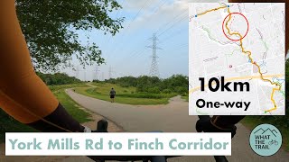
trail: Finch Corridor
13:02 |
469 |
Jul 13, 2021 , North York

trail: East Don Parkland Trail
13:02 |
295 |
Jul 13, 2021 , North York
trail: Betty Sutherland Trail
13:02 |
302 |
Jul 13, 2021 , North York
Current Trail Warnings
| status | trail | date | condition | user | info |
|---|---|---|---|---|---|
| Betty Sutherland Trail | Jun 23, 2026 @ 8:46pm (America/Toronto) Jun 23, 2026 | Variable | norman-landry | Gravel Bike trail still closed under 401 due to... |
Recent Trail Reports
| status | trail | date | condition | info | user |
|---|---|---|---|---|---|
| Hobart's Godstone | Jun 20, 2026 @ 3:06pm (America/Toronto) Jun 20, 2026 | Ideal | EderCard | ||
| Cherry Hills | May 10, 2026 @ 1:20pm (America/Toronto) May 10, 2026 | Ideal | CDNWalker | ||
| Finch Corridor | Apr 26, 2026 @ 10:13pm (America/Toronto) Apr 26, 2026 | Ideal | arfletcher | ||
| Sheppard East Park | Apr 26, 2026 @ 10:12pm (America/Toronto) Apr 26, 2026 | Dry | arfletcher | ||
| Clarinda Park Connector | Mar 16, 2026 @ 10:53pm (America/Toronto) Mar 16, 2026 | Snow Packed | arfletcher | ||
| Leslie Access | Mar 16, 2026 @ 10:53pm (America/Toronto) Mar 16, 2026 | Snow Covered | arfletcher | ||
| Dallington Trail | Mar 16, 2026 @ 10:52pm (America/Toronto) Mar 16, 2026 | Snow Covered | arfletcher | ||
| Denver Crescent Access | Mar 16, 2026 @ 10:51pm (America/Toronto) Mar 16, 2026 | Snow Packed | arfletcher | ||
| Cummer River | Jan 7, 2026 @ 2:50pm (America/Toronto) Jan 7, 2026 | Snow Cover Partial | nicovlogg89 | ||
| East Don - Green Trail Court | Oct 22, 2025 @ 11:13pm (America/Toronto) Oct 22, 2025 | Ideal | arfletcher |
Activity Feed
| username | action | type | title | date |
|---|---|---|---|---|
| norman-landry | add | report | activity #97664311 | Jun 23, 2026 @ 5:49pm Jun 23, 2026 |
| user__name | wishlist | trail | activity #97438196 | Jun 20, 2026 @ 3:36pm Jun 20, 2026 |
| EderCard | add | report | activity #97435968 | Jun 20, 2026 @ 3:02pm Jun 20, 2026 |
| MaverickSNrM9g | wishlist | trail | activity #95600498 | May 26, 2026 @ 5:06pm May 26, 2026 |
| CDNWalker | add | report | activity #94449890 | May 10, 2026 @ 12:18pm May 10, 2026 |
Recent Comments
| username | type | title | comment | date |
|---|---|---|---|---|
| trail | Overgrown | Aug 7, 2025 @ 11:56am Aug 7, 2025 | ||
| trail | Impassable about 2/3 of the way through. Overgrown | Jun 1, 2024 @ 12:57pm Jun 1, 2024 | ||
| trail | It is accessible from Maxome Ave, just you... | Jun 7, 2022 @ 4:25pm Jun 7, 2022 | ||
| report | Yep ...fully paved and beautiful ...thanks! | Aug 30, 2021 @ 12:10pm Aug 30, 2021 | ||
| report | Good man ...I'll pass through this week to... | Aug 28, 2021 @ 7:04pm Aug 28, 2021 |
Local Badges
-

Epic Mountain Bike Climb 2k3 awarded -

Climbing 10k Badge25 awarded -

Mountain Biking 100k Badge1 awarded -

Epic Ride Descent 2k3 awarded -

Descent 10k Badge24 awarded -

Descent 100k Badge1 awarded
Bike & Skill Parks
| name | type | city | rating |
|---|---|---|---|
| Bayview Arena Bike Park | skill park | North York |
Activity Type Stats
| activitytype | trails | distance | descent | descent distance | total vertical | rating | global rank | state rank | photos | reports | routes | ridelogs |
|---|---|---|---|---|---|---|---|---|---|---|---|---|
| Mountain Bike | 63 | 35 miles | 1,490 ft | 11 miles | 338 ft | #2,755 | #55 | 52 | 152 | 1 | 8,342 | |
| E-Bike | 52 | 30 miles | 1,348 ft | 10 miles | 266 ft | #3,580 | #65 | 138 | 69 | |||
| Gravel Bike | 2 | #554 | #57 | 9 | 125 | |||||||
| Adaptive Bike | 1 | #537 | #89 | 5 | ||||||||
| Winter Fat Bike | 1 | #380 | #80 | 1 | ||||||||
| Hike | 62 | 35 miles | 1,391 ft | 11 miles | 338 ft | #4,975 | #95 | 1 | 152 | 373 | ||
| Trail Running | 61 | 34 miles | 1,378 ft | 11 miles | 338 ft | #4,589 | #75 | 152 | 484 | |||
| Dirtbike/Moto | 1 | 15 | 1 | |||||||||
| Snowshoe | 27 | 22 miles | 1,024 ft | 8 miles | 266 ft | #771 | #75 | 28 | 2 | |||
| Nordic Ski | 22 | 21 miles | 889 ft | 7 miles | 266 ft | #869 | #60 | 23 |
Frequently Asked Questions About North York
▼
What are the best places to ride in North York?
North York has 1 areas to explore for mountain biking. The top rated areas are:
▼
What are the highest rated mountain biking trails in North York?
The highest rated mountain biking trails in North York are:
- Shelter Relief (4.2/5)
- Alamosa Loop (4.1/5)
- Blue Ridge Park (4.1/5)
- Blue Ridge Riparian (4.1/5)
- Newtonbrook Creek Pathway (4.1/5)
▼
What is the best time of the year to ride in North York?
Based on ride log data, the most popular months to ride in North York are:
- May (65 activities)
- August (65 activities)
- June (63 activities)
▼
Where can I park to ride in North York?
There are 1 parking locations listed in North York. The most popular parking spots are:
Activities
- By skavenger08
 & contributors
 - Admins: TORONTO
- #42223 - 8,573 views
- north york activity log | embed map of North York mountain bike trails | north york mountain biking points of interest
Downloading of trail gps tracks in kml & gpx formats is enabled for North York.
You must login to download files.