close
-
Layers w
- Weather Layers
- Pro
- Pro
- Pro
- Pro
- Pro
- Pro
- More Layers
- Pro
- Pro
- Pro
- Pro
-
Upgrade to

3D
Trail Conditions
- Unknown
- Snow Groomed
- Snow Packed
- Snow Covered
- Snow Cover Partial
- Freeze/thaw Cycle
- Icy
- Prevalent Mud
- Wet
- Variable
- Ideal
- Dry
- Very Dry
Trail Flow (Ridden Direction)
Trailforks scans users ridelogs to determine the most popular direction each trail is ridden. A good flowing trail network will have most trails flowing in a single direction according to their intension.
The colour categories are based on what percentage of riders are riding a trail in its intended direction.
The colour categories are based on what percentage of riders are riding a trail in its intended direction.
- > 96%
- > 90%
- > 80%
- > 70%
- > 50%
- < 50%
- bi-directional trail
- no data
Trail Last Ridden
Trailforks scans ridelogs to determine the last time a trail was ridden.
- < 2 days
- < 1 week
- < 2 weeks
- < 1 month
- < 6 months
- > 6 months
Trail Ridden Direction
The intended direction a trail should be ridden.
- Downhill Only
- Downhill Primary
- Both Directions
- Uphill Primary
- Uphill Only
- One Direction
Contribute Details
Colors indicate trail is missing specified detail.
- Description
- Photos
- Description & Photos
- Videos
Trail Popularity ?
Trailforks scans ridelogs to determine which trails are ridden the most in the last 9 months.
Trails are compared with nearby trails in the same city region with a possible 25 colour shades.
Think of this as a heatmap, more rides = more kinetic energy = warmer colors.
- most popular
- popular
- less popular
- not popular
ATV/ORV/OHV Filter
Max Vehicle Width
inches
US Cell Coverage
Legend

Radar Time
Activity Recordings
Trailforks uses anonymized public activity data.
?
Activity Recordings
Trailforks uses anonymized public activity data.
?
Personal Heatmap
▶
Activity Types
all
/
none
▶
Options
2
Date range
month
–
Winter Trails
Warning
A routing network for winter maps does not exist. Selecting trails using the winter trails layer has been disabled.
Missing Trails
Most Popular
Least Popular
Trails are colored based on popularity. The more popular a trail is, the more red. Less popular trails trend towards green.
Jump Magnitude Heatmap
Heatmap of where riders jump on trails. Zoom in to see individual jumps, click circles to view jump details.
BC Backroad Status
![map legend]()
Service Road Atlas is a free to use, community-driven service for viewing and creating reports on the numerous back-country service roads around B.C. and Alberta.

Slope Aspect
Direction the slope faces
Trails Deemphasized
Trails are shown in grey.
Only show trails with no bike usage.
Suggested Layers
Based on selected activity type
Save the current map location and zoom level as your default home location whenever this page is loaded.
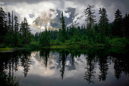
SaveMore than 1 million acres of unspoiled, natural beauty in Northeastern Washington are awaiting your next adventure on the trail. From scenic vistas that seem to go forever; ancient wilderness with old-growth forests; and fantastic geological spectacles, you’ll be able to experience it on one of many hundreds of miles of trails.
Northeast Washington is home to the Colville National Forest, the Salmo-Priest Wilderness, the Little Pend Oreille Wildlife Refuge and portions of the Kaniksu National Forest. A section of the Pacific Northwest National Scenic Trail winds through all three northeast Washington counties.
No matter how you like to see the trail: from horseback, on foot or by bike - there’s a trail for you in either Ferry, Stevens or Pend Oreille counties. Northeast Washington Trails provides a searchable database with trail information and free downloadable maps to help get you where you want to go.
Our area’s greatest asset is the sheer, unspoiled beauty and the almost unlimited outdoor recreation possibilities. You’ll find pristine wilderness, uncrowded lakes and small town hospitality here in the wild side of Washington State.
source: NE Washington Trails
Stats
- Avg Trail Rating
- Trails (view details)
- 933
- Trails Mountain Bike
- 672
- Trails E-Bike
- 328
- Trails Gravel Bike
- 63
- Trails Adaptive Bike
- 68
- Trails Winter Fat Bike
- 131
- Trails Horse
- 155
- Trails Hike
- 689
- Trails Trail Running
- 686
- Trails Dirtbike/Moto
- 20
- Trails Observed Trials
- 6
- Trails ATV/ORV/OHV
- 8
- Trails Snowmobile
- 1
- Trails Snowshoe
- 106
- Trails Downhill Ski
- 138
- Trails Backcountry Ski
- 2
- Trails Nordic Ski
- 49
- Total Distance
- 1,220 miles
- Total Descent
- 221,466 ft
- Total Vertical
- 6,906 ft
- Highest Trailhead
- 7,296 ft
- Reports
- 9,560
- Photos
- 3,688
- Ridden Counter
- 59,464
Popular Trail Networks
view all areas »Sub Regions
- Ferry County (71)
- Lincoln County (1)
- Sprague (1)
- Sprague (1)
- Pend Oreille County (105)
- Metaline Falls (27)
- Abercrombie Mountain (6)
- Hall-Grassy Divide (12)
- Mill Pond (8)
- Newport (29)
- Bead Lake (4)
- Geophysical Trails (6)
- Wolf Trails (19)
- Tiger (49)
- Metaline Falls (27)
- Spokane County (442)
- Cheney (5)
- Liberty Lake (88)
- Mica (5)
- Spokane (322)
- Beacon Hill (125)
- Eagle Ridge (11)
- Little Spokane Natural Area (2)
- Mount Spokane (25)
- Mt. Spokane Cross-Country Ski Park (3)
- Palisades Park (27)
- Riverside State Park (38)
- South Hill Area (4)
- South Hill Bluff (18)
- Waikiki Springs (5)
- Whitworth University Back 40 (41)
- Spokane Valley (34)
- Stevens County (60)
- Chewelah (21)
- Colville (39)
- Colville Mountain (21)
- Gillette Ridge (11)
- Springboard Trail (7)
Popular Northeast Region - WA Mountain Biking Trails
• 100 ★ 2.7 • 746 ft • 10 ft • 1,519 • • mtb
Lots of tight corners and switchbacks making it for a more challenging descent and climb than the route.
• 100 ★ 4.2 • 564 ft • 0 ft • 1,515 • • mtb
Booter Drops into series of dirt jumps ranging from 3-7 ft. tall Gaps ranging from 6-15 ft.
• 100 ★ 4.5 • 2,936 ft • 0 ft • 1,499 • • mtb
A local favorite, begins at the top of the downhill courses and ends at the southeast end of Camp Sekani. was built to be a beginner to intermediate jump trail riders can have fun and build confidence on. is packed with table tops,...
• 100 ★ 4.0 • 2,201 ft • 0 ft • 1,347 • • mtb
Downhill only trail with a rock roll to start known as "the spine" a few rock gardens and berms. This trail has a tendency to be fast and loose.
• 100 ★ 4.0 • 663 ft • 0 ft • 1,169 • • mtb
Roll in off of and into the old wooden roller coaster.
• 95 ★ 4.2 • 4 miles • 791 ft • 1,167 • • mtb
A popular starting place for many Camp Sekani/Beacon Hill rides. is smooth single track that starts right past the red gate out of the Camp Sekani parking area, intersections are marked with signs to keep you going the right way....
Northeast Region - WA Mountain Bike Routes
★ 5.0 • 20 miles • 4,282 ft • 5 • Loop •
A classic Kettle Fest ride, the Jungle Hill descent is the foundation of this route. The route starts from...
★ 5.0 • 12 miles • 2,593 ft • 2 • Point to Point •
Old Stage to the summit, South on the Kettle Crest trail, after climbing/pushing to Copper Butte, the high...
★ 5.0 • 2 miles • 390 ft • 5 • Loop •
This loop allows intermediate riders to progress and inspire confidence in their downhill capability. The...
★ 4.5 • 14 miles • 3,319 ft • 4 • Loop •
Note can be done both directions, but most commonly done clockwise. A great loop climbing from camp to...
★ 5.0 • 13 miles • 2,677 ft • 3 • Point to Point •
A Kettle Crest classic. Climb the Old Stage road to the Crest, and take the Crest south over Copper Butte,...
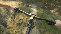
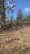
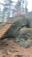
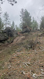
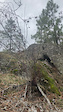
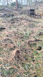
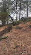
Photos of Northeast Region - WA Mountain Bike
Videos of Northeast Region - WA Mountain Bike
trail: Hair Line
0:25 |
4 |
May 25, 2026

trail: Stalingrab
0:11 |
22 |
May 10, 2026
trail: Mornin Wood
0:08 |
69 |
Dec 22, 2025
trail: Mornin Wood
0:05 |
40 |
Dec 22, 2025
trail: Mornin Wood
0:10 |
35 |
Dec 22, 2025
trail: Mornin Wood
0:09 |
30 |
Dec 22, 2025
trail: Mornin Wood
0:11 |
41 |
Dec 22, 2025
0:12 |
12 |
Dec 5, 2025
Recent Trail Reports
National Scenic Trails & Official Routes
-
Pacific Northwest Trail
- Mountain Bike
- Horse
- Hike
- Trail Running
Activity Feed
| username | action | type | title | date |
|---|---|---|---|---|
| P852Te | ridden | trail | activity #96273088 | Jun 4, 2026 @ 8:01pm 4 hours |
| 8V8VQ7 | ridden | trail | activity #96218790 | Jun 4, 2026 @ 5:12am 19 hours |
| 8V8VQ7 | ridden | trail | activity #96217805 | Jun 4, 2026 @ 4:51am 19 hours |
| EShackleton | wishlist | trail | activity #96188947 | Jun 3, 2026 @ 4:34pm 1 day |
| EShackleton | wishlist | trail | activity #96188911 | Jun 3, 2026 @ 4:34pm 1 day |
Recent Comments
| username | type | title | comment | date |
|---|---|---|---|---|
| trail | Appears to be. | Apr 28, 2026 @ 8:52pm Apr 28, 2026 | ||
| trail | Super fun tech flow section | Apr 28, 2026 @ 1:21pm Apr 28, 2026 | ||
| trail | This trail is a blast. Some chunky steep rolls... | Apr 28, 2026 @ 10:41am Apr 28, 2026 | ||
| trail | Trail is sick! Definitely a must ride while here. | Apr 26, 2026 @ 10:06pm Apr 26, 2026 | ||
| trail | Amazing addition to this system! I love the... | Apr 20, 2026 @ 6:10am Apr 20, 2026 |
Local Badges
-

Epic Ride Descent 2k9 awarded -

Big Ride 30k570 awarded -

Descent 100k Badge1 awarded -

Descent 10k Badge52 awarded -

Climbing 10k Badge52 awarded -

Epic Ride Climb 2k9 awarded
Bike & Skill Parks
| name | type | city | rating |
|---|---|---|---|
| 49 Degrees North Mountain Resort | bike park | Chewelah | |
| Beacon Hill Bike park | skill park | Spokane | |
| Joe Albi BMX Track | skill park | Spokane | |
| Pump Track | skill park | Spokane | |
| Airway Heights MX | skill park | Spokane |
Local Trail Supporters
- Whitworth students and staff
- Whitworth staff and students
![]()
![Washington Trails Association]()
- Whitworth students and sStaff
- Whitworth University, Students, Faculty and Staff
- Whitworth University Students, Faculty and Staff
![]()
![Pacific Northwest]()
Activity Type Stats
| activitytype | trails | distance | descent | descent distance | total vertical | rating | global rank | state rank | photos | reports | routes | ridelogs |
|---|---|---|---|---|---|---|---|---|---|---|---|---|
| Mountain Bike | 672 | 993 miles | 142,936 ft | 430 miles | 6,906 ft | 3,611 | 9,384 | 88 | 125,157 | |||
| E-Bike | 328 | 316 miles | 52,113 ft | 130 miles | 4,390 ft | 1 | 7,819 | 18 | 7,485 | |||
| Gravel Bike | 63 | 251 miles | 12,142 ft | 130 miles | 5,673 ft | 2 | 1,730 | 5 | 903 | |||
| Adaptive Bike | 68 | 254 miles | 11,457 ft | 133 miles | 5,673 ft | 497 | 6 | |||||
| Winter Fat Bike | 131 | 114 miles | 16,542 ft | 45 miles | 3,566 ft | 3,108 | 45 | |||||
| Horse | 155 | 268 miles | 34,918 ft | 106 miles | 5,827 ft | 1,677 | 4 | 12 | ||||
| Hike | 689 | 1,092 miles | 150,230 ft | 458 miles | 6,906 ft | 68 | 8,845 | 9 | 10,343 | |||
| Trail Running | 686 | 1,088 miles | 149,252 ft | 456 miles | 6,906 ft | 5 | 8,829 | 10 | 7,289 | |||
| Dirtbike/Moto | 20 | 54 miles | 9,646 ft | 26 miles | 3,514 ft | 1,264 | 1 | 73 | ||||
| Observed Trials | 6 | 5 miles | 1,391 ft | 2 miles | 2,920 ft | 16 | 19 | |||||
| ATV/ORV/OHV | 8 | 14 miles | 2,054 ft | 4 miles | 3,136 ft | 2 | 1,260 | 23 | ||||
| Snowmobile | 1 | 3 miles | 3 ft | 75 ft | 814 ft | 134 | 6 | |||||
| Snowshoe | 106 | 104 miles | 13,081 ft | 51 miles | 3,622 ft | 224 | 1 | 383 | ||||
| Downhill Ski | 138 | 53 miles | 53,842 ft | 49 miles | 1,906 ft | 135 | 2,058 | |||||
| Backcountry Ski | 2 | 2 miles | 499 ft | 1 mile | 2,566 ft | 132 | 465 | |||||
| Nordic Ski | 49 | 46 miles | 4,806 ft | 20 miles | 3,255 ft | 174 | 1,546 |
Activities
- Northeast Region - WA Mountain Biking Trails
- Northeast Region - WA E-Biking Trails
- Northeast Region - WA Gravel Biking Trails
- Northeast Region - WA Adaptive Biking Trails
- Northeast Region - WA Winter Fat Biking Trails
- Northeast Region - WA Horseback Trails
- Northeast Region - WA Hiking Trails
- Northeast Region - WA Trail Running Trails
- Northeast Region - WA Dirtbiking Trails
- Northeast Region - WA Observed Trials Trails
- Northeast Region - WA ATVing/Offroading Trails
- Northeast Region - WA Snowshoeing Trails
- Northeast Region - WA Skiing Trails
- Northeast Region - WA Nordic Skiing Trails
Trails
- Hard trails in Northeast Region - WA
- Easy trails in Northeast Region - WA
- Favorite trails in Northeast Region - WA
- Most ridden trails in Northeast Region - WA
- Singletrack in Northeast Region - WA
- Viewpoint trails in Northeast Region - WA
- Trails with technical features in Northeast Region - WA
- Race routes in Northeast Region - WA
Points of Interest
- The Black Diamond TTF
- Salmo Cabin
- Other [watercrossing]
- Other [watercrossing]
- Jackson Mountain Summit
- Hall Mountain Summit
- West Sullivan Lake Campground Camping
- East Sullivan Campground Camping
- Noisy Creek Campground Camping
- Gypsy Peak Summit
- Gypsy Peak (7,303 ft)
- Abercrombie Mountain (7,303 ft)
- Hooknose Mountain (7,119 ft)
- By NEWATrails NEWAT & contributors
- Admins: NMA, EMBA-Staff, EMBA-BOD, sanfret, LoriTaylor, EMBA-EC, NEWATrails
- #21718 - 6,726 views
- northeast region - wa activity log | embed map of Northeast Region - WA mountain bike trails | northeast region - wa mountain biking points of interest polygons
Downloading of trail gps tracks in kml & gpx formats is enabled for Northeast Region - WA.
You must login to download files.