close
-
Layers w
- Weather Layers
- Pro
- Pro
- Pro
- Pro
- Pro
- Pro
- More Layers
- Pro
- Pro
- Pro
- Pro
-
Upgrade to

3D
Trail Conditions
- Unknown
- Snow Groomed
- Snow Packed
- Snow Covered
- Snow Cover Partial
- Freeze/thaw Cycle
- Icy
- Prevalent Mud
- Wet
- Variable
- Ideal
- Dry
- Very Dry
Trail Flow (Ridden Direction)
Trailforks scans users ridelogs to determine the most popular direction each trail is ridden. A good flowing trail network will have most trails flowing in a single direction according to their intension.
The colour categories are based on what percentage of riders are riding a trail in its intended direction.
The colour categories are based on what percentage of riders are riding a trail in its intended direction.
- > 96%
- > 90%
- > 80%
- > 70%
- > 50%
- < 50%
- bi-directional trail
- no data
Trail Last Ridden
Trailforks scans ridelogs to determine the last time a trail was ridden.
- < 2 days
- < 1 week
- < 2 weeks
- < 1 month
- < 6 months
- > 6 months
Trail Ridden Direction
The intended direction a trail should be ridden.
- Downhill Only
- Downhill Primary
- Both Directions
- Uphill Primary
- Uphill Only
- One Direction
Contribute Details
Colors indicate trail is missing specified detail.
- Description
- Photos
- Description & Photos
- Videos
Trail Popularity ?
Trailforks scans ridelogs to determine which trails are ridden the most in the last 9 months.
Trails are compared with nearby trails in the same city region with a possible 25 colour shades.
Think of this as a heatmap, more rides = more kinetic energy = warmer colors.
- most popular
- popular
- less popular
- not popular
ATV/ORV/OHV Filter
Max Vehicle Width
inches
US Cell Coverage
Legend

Radar Time
Activity Recordings
Trailforks uses anonymized public activity data.
?
Activity Recordings
Trailforks uses anonymized public activity data.
?
Personal Heatmap
▶
Activity Types
all
/
none
▶
Options
2
Date range
month
–
Winter Trails
Warning
A routing network for winter maps does not exist. Selecting trails using the winter trails layer has been disabled.
Missing Trails
Most Popular
Least Popular
Trails are colored based on popularity. The more popular a trail is, the more red. Less popular trails trend towards green.
Jump Magnitude Heatmap
Heatmap of where riders jump on trails. Zoom in to see individual jumps, click circles to view jump details.
BC Backroad Status
![map legend]()
Service Road Atlas is a free to use, community-driven service for viewing and creating reports on the numerous back-country service roads around B.C. and Alberta.

Slope Aspect
Direction the slope faces
Trails Deemphasized
Trails are shown in grey.
Only show trails with no bike usage.
Suggested Layers
Based on selected activity type
Save the current map location and zoom level as your default home location whenever this page is loaded.
SavePopular Trail Networks
view all areas »
No description for Northern has been added yet!
Login or register to submit one.
Region Details
- 421
- 46
- 579
- 589
- 244
- 46
- 14
Local Trail Association
Stats
- Avg Trail Rating
- Trails (view details)
- 2,652
- Trails Mountain Bike
- 1,960
- Trails E-Bike
- 768
- Trails Gravel Bike
- 106
- Trails Winter Fat Bike
- 4
- Trails Horse
- 44
- Trails Hike
- 2,265
- Trails Trail Running
- 2,240
- Trails Dirtbike/Moto
- 56
- Trails Observed Trials
- 16
- Trails ATV/ORV/OHV
- 105
- Trails Snowmobile
- 89
- Trails Snowshoe
- 1,153
- Trails Downhill Ski
- 99
- Trails Backcountry Ski
- 172
- Trails Nordic Ski
- 532
- Total Distance
- 2,601 miles
- Total Descent
- 230,635 ft
- Total Vertical
- 1,787 ft
- Highest Trailhead
- 2,238 ft
- Reports
- 20,378
- Photos
- 2,735
- Ridden Counter
- 157,704
Sub Regions
- Algoma District (372)
- Elliot Lake (94)
- Sault Ste Marie (188)
- Unorganized North Algoma (138)
- Wawa (1)
- Cochrane District (204)
- Cochrane (9)
- Iroquois Falls (9)
- Kapuskasing (8)
- Moonbeam Township (7)
- Timmins (178)
- Unorganized North Cochrane District (32)
- Cochrane (9)
- District of Parry Sound (109)
- Carling Township (14)
- Machar Township (26)
- McDougall Township (27)
- Georgian Nordic (27)
- Parry Sound (13)
- Timber Ridge (12)
- Ryerson (1)
- Seguin Township (12)
- South River (26)
- The Archipelago Township (3)
- Unorganized Centre Parry Sound District (7)
- Whitestone Township (2)
- Kenora District (198)
- Dryden (18)
- Aaron Provincial Park (4)
- Ghost Lake (14)
- Kenora (53)
- Sioux Lookout (3)
- Sioux Narrows-Nestor Falls (51)
- Unorganized Kenora District (69)
- Dryden (18)
- Manitoulin Island (16)
- Burpee And Mills Township (0)
- M'Chigeeng (0)
- McLean's Park (16)
- Burpee And Mills Township (0)
- Nipissing District (399)
- East Ferris Township (8)
- Stepping Stones (37)
- Mattawa (2)
- Mattawan (15)
- North Bay (318)
- Boulter Township (5)
- Duchesnay Falls (18)
- Horse Trails (The Monastery Trails) (26)
- Laurentian Escarpment Community Trails (123)
- Laurier Woods (12)
- Northshore (55)
- Peninsula Road (0)
- Sage Trails (2)
- The Ridge (9)
- Three Towers Trails (46)
- Tupper Trails (4)
- South Algonquin Township (2)
- Temagami (14)
- Unorganized South Nipissing (18)
- East Ferris Township (8)
- Rainy River District (27)
- Sudbury District (428)
- Chapleau Township (2)
- Espanola (8)
- Boogie Mountain (8)
- Killarney (7)
- Sables-Spanish Rivers Township (5)
- Sudbury (395)
- Azilda - Kona (21)
- Big Top (0)
- Bioski Cross-Country Ski & Snowshoe (0)
- Fairbank Provincial Park (5)
- Fielding Park (4)
- French River Provincial Park (2)
- Hanmer (0)
- Kivi Park (30)
- Lake Laurentian Conservation Area (81)
- Laurentian Nordic (8)
- Little Britain (4)
- Lonsdale (7)
- Mikkola (15)
- Minnow Lake (14)
- New Sudbury (12)
- Nickeldale (23)
- Parc Voyageur Park (4)
- Princess Anne (4)
- Robinson Lake (17)
- Skead (8)
- Walden Trails (110)
- Wavy Lake (2)
- Unorganized Sudbury District (10)
- Chapleau Township (2)
- Thunder Bay District (229)
- Armstrong Station (32)
- Dorion Township (2)
- Manitouwadge Township (3)
- Perry Lake (3)
- Marathon (6)
- Neebing Township (3)
- Mink Mountain (3)
- Nipigon (4)
- Oliver Paipoonge Township (3)
- Red Rock Township (3)
- Thunder Bay (134)
- Unorganized Thunder Bay District (46)
- Timiskaming District (26)
Popular Northern Mountain Biking Trails
• 100 ★ 4.5 • 932 ft • 0 ft • 746 •
This green flow trail has some bermed turns on it. This is a great trail for all skill levels.
• 100 ★ 3.0 • 2,185 ft • 66 ft • 651 •
Starting on the double track trail at the bottom of the sandy hill descent, cross the metal bridge and take first right. Make sure you have enough speed to set yourself into the short punchy climb along the ridge. Once at the top you'll...
• 95 ★ 4.6 • 1 mile • 146 ft • 625 •
This beginner (green) level access trail provides all riders with an accessible trail into the heart of the trail system. Riders of all skill levels will enjoy the fast, flowing design of the machine built tread. From the Northside of...
• 100 ★ 3.4 • 2,359 ft • 0 ft • 615 •
Smooth and Flowy trail that is great for riders of all levels. This is one of the most popular trails as most of the coloured loops start off with it.
• 100 ★ 0.0 • 820 ft • 12 ft • 572 •
Popular green difficulty singletrack. This mountain bike primary trail can be used uphill primary and has a moderate overall physical rating with a 12 ft green climb. Winter use: Groomed Smooth snow grooming. On average it takes 2 minutes to complete this trail.
• 100 ★ 4.0 • 938 ft • 0 ft • 568 •
Popular blue difficulty singletrack. This mountain bike primary trail can be used downhill primary and has a moderate overall physical rating. It features berm and drop. Winter use: Groomed Smooth snow grooming. On average it takes 1 minutes to complete this trail.
• 100 ★ 5.0 • 738 ft • 3 ft • 547 •
Popular green difficulty singletrack. This mountain bike primary trail can be used both directions and has a moderate overall physical rating with a 3 ft blue climb. Winter use: Groomed Smooth snow grooming. On average it takes minutes to complete this trail.
• 100 ★ 4.2 • 1,178 ft • 17 ft • 526 •
This is another popular smooth and flowing trail that is great for all skill levels.
Northern Mountain Bike Routes
WMBC Sept Social Ride - Advanced Featured
7 miles • 566 ft • 8 • Loop •
This is the Advanced Route for the social ride on Tuesday Sep 17, starting at 6:00 pm at Buzzy Brown's...
WMBC Sept Social Ride - Intermediate Featured
7 miles • 491 ft • 9 • Loop •
This is the Beginner Route for the social ride on Tuesday Sep 17, starting at 6:00 pm at Buzzy Brown's...
WMBC Sept Social Ride - Beginner Featured
9 miles • 297 ft • 2 • Loop •
This is the Beginner Route for the social ride on Tuesday Sep 17, starting at 6:00 pm at Buzzy Brown's...
★ 4.0 • 7 miles • 543 ft • 39 • Loop •
Red Arrows - Extremely Difficult - 12 km & 163 m of elevation climb Pack a second pair of lungs and...
★ 4.0 • 8 miles • 532 ft • 23 • Loop •
Creek Trails white beacon loop beginning from the trailhead parking lot at the blue ski building....
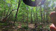
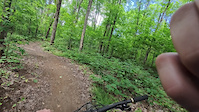
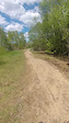
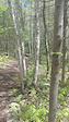
Photos of Northern Mountain Bike
Videos of Northern Mountain Bike
trail: Yellow Brick Road
0:48 |
19 |
Aug 16, 2025
trail: The Altar
2:47 |
11 |
Aug 16, 2025
trail: Yoda
0:16 |
10 |
Aug 16, 2025
trail: Da Big Kahuna
2:11 |
64 |
Aug 15, 2025
trail: Soonami
2:14 |
85 |
Aug 15, 2025
trail: Sublime
3:53 |
17 |
Aug 15, 2025
trail: Main Trail
0:19 |
12 |
May 26, 2025
trail: Main Trail
0:15 |
5 |
May 26, 2025
Current Trail Warnings
| status | trail | date | condition | user | info |
|---|---|---|---|---|---|
| Brutal Bruin Hersey Lake Conservation Area | Jun 14, 2026 @ 9:05am (America/Toronto) Jun 14, 2026 | Unknown | ExploreTheBackcountry | Trail is flooded north of Sandstorm | |
| Old Dam Laurentian Escarpment Community Trails | Jun 7, 2026 @ 12:43pm (America/Toronto) Jun 7, 2026 | Unknown | zapramian | ||
| Flowy Detour Laurentian Escarpment Community Trails | Jun 6, 2026 @ 8:27am (America/Toronto) Jun 6, 2026 | Unknown | zapramian |
Recent Trail Reports
Activity Feed
| username | action | type | title | date |
|---|---|---|---|---|
| Jaymilly | wishlist | region | activity #97307869 | Jun 19, 2026 @ 4:38am 3 hours |
| ErinBjjPFg | wishlist | route | activity #97273827 | Jun 18, 2026 @ 1:40pm 18 hours |
| Noahsnider | vote | trail | activity #97202646 | Jun 17, 2026 @ 12:23pm 2 days |
| C1etienne | add | photo | activity #97158892 | Jun 16, 2026 @ 8:05pm 2 days |
| C1etienne | ridden | trail | activity #97157402 | Jun 16, 2026 @ 7:36pm 2 days |
Recent Comments
| username | type | title | comment | date |
|---|---|---|---|---|
| trail | To be closed | Jun 14, 2026 @ 6:25pm Jun 14, 2026 | ||
| report | I made the report about pines a year ago. I... | Jun 10, 2026 @ 5:41pm Jun 10, 2026 | ||
| trail | Not a NBMBA trail access has been cut off due... | Jun 5, 2026 @ 5:46am Jun 5, 2026 | ||
| trail | Pretty roomy and rocky. No flow. Good for... | May 13, 2026 @ 10:16am May 13, 2026 | ||
| report | update: consider the exit intersection of... | Apr 14, 2026 @ 5:00pm Apr 14, 2026 |
Local Badges
-

The Miner0 awarded -

The Prospector271 awarded -

10 Green Trails295 awarded -

Climbing 10k Badge32 awarded -

Epic Ride Climb 2k5 awarded -

Top 10 Trails1 awarded
Bike & Skill Parks
| name | type | city | rating |
|---|---|---|---|
| Shuniah Mines Skills Area | skill park | Thunder Bay | |
| Kinsmen Bike Park | skill park | Thunder Bay | |
| Esposito Park Pumptrack | skill park | Sault Ste Marie | |
| Minnow Lake Outdoor Skate Park (Carmichael Arena) | skill park | Sudbury | |
| Kinsmen Junior Pump Track | skill park | Sault Ste Marie |
Local Trail Supporters
- Bill
![]()
- OneUp Components
![]()
![]()
- Built by Andrew but maintained by Dave and Cathy
![]()
![Thunder Bay Community Economic Development Commission (CEDC)]()
- BULL FAMILY
![Tbaytel]()
![]()
![]()
![]()
- Holocene Trail Co.
![Innergex]()
![]()
![]()
Activity Type Stats
| activitytype | trails | distance | descent | descent distance | total vertical | rating | global rank | state rank | photos | reports | routes | ridelogs |
|---|---|---|---|---|---|---|---|---|---|---|---|---|
| Mountain Bike | 1,960 | 1,643 miles | 118,868 ft | 615 miles | 1,604 ft | 2,274 | 19,807 | 199 | 118,956 | |||
| E-Bike | 768 | 765 miles | 51,660 ft | 287 miles | 1,624 ft | 7 | 12,474 | 38 | 1,738 | |||
| Gravel Bike | 106 | 163 miles | 8,406 ft | 63 miles | 1,083 ft | 1 | 1,612 | 12 | 580 | |||
| Winter Fat Bike | 4 | 9 | 385 | 21 | 338 | |||||||
| Horse | 44 | 206 miles | 8,445 ft | 80 miles | 1,719 ft | 2,866 | 16 | |||||
| Hike | 2,265 | 2,370 miles | 191,982 ft | 896 miles | 1,788 ft | 382 | 19,588 | 21 | 18,684 | |||
| Trail Running | 2,240 | 2,351 miles | 190,200 ft | 887 miles | 1,788 ft | 13 | 19,578 | 61 | 15,668 | |||
| Dirtbike/Moto | 56 | 290 miles | 10,545 ft | 109 miles | 810 ft | 1 | 2,866 | 133 | ||||
| Observed Trials | 16 | 62 miles | 2,008 ft | 23 miles | 682 ft | 273 | 9 | |||||
| ATV/ORV/OHV | 105 | 353 miles | 13,881 ft | 135 miles | 830 ft | 2 | 3,713 | 1 | 131 | |||
| Snowmobile | 89 | 281 miles | 11,407 ft | 112 miles | 804 ft | 1,907 | 1 | 45 | ||||
| Snowshoe | 1,153 | 1,314 miles | 107,290 ft | 501 miles | 1,650 ft | 13 | 10,912 | 22 | 2,153 | |||
| Downhill Ski | 99 | 28 miles | 17,182 ft | 22 miles | 823 ft | 521 | 1,278 | |||||
| Backcountry Ski | 172 | 153 miles | 11,765 ft | 56 miles | 1,066 ft | 15 | 1,953 | 14 | 368 | |||
| Nordic Ski | 530 | 587 miles | 36,096 ft | 233 miles | 1,263 ft | 16 | 10,673 | 15 | 10,516 |
Activities
- Northern Mountain Biking Trails
- Northern E-Biking Trails
- Northern Gravel Biking Trails
- Northern Horseback Trails
- Northern Hiking Trails
- Northern Trail Running Trails
- Northern Dirtbiking Trails
- Northern Observed Trials Trails
- Northern ATVing/Offroading Trails
- Northern Snowmobiling Trails
- Northern Snowshoeing Trails
- Northern Skiing Trails
- Northern Backcountry Skiing Trails
- Northern Nordic Skiing Trails
Trails
Points of Interest
- By markholloway
 Trailforks Map Team & contributors
 - Admins: Canadmos
- #9948 - 6,179 views
- northern activity log | embed map of Northern mountain bike trails | northern mountain biking points of interest polygons
Downloading of trail gps tracks in kml & gpx formats is enabled for Northern.
You must login to download files.