close
-
Layers w
- Weather Layers
- Pro
- Pro
- Pro
- Pro
- Pro
- Pro
- More Layers
- Pro
- Pro
- Pro
- Pro
-
Upgrade to

3D
Trail Conditions
- Unknown
- Snow Groomed
- Snow Packed
- Snow Covered
- Snow Cover Partial
- Freeze/thaw Cycle
- Icy
- Prevalent Mud
- Wet
- Variable
- Ideal
- Dry
- Very Dry
Trail Flow (Ridden Direction)
Trailforks scans users ridelogs to determine the most popular direction each trail is ridden. A good flowing trail network will have most trails flowing in a single direction according to their intension.
The colour categories are based on what percentage of riders are riding a trail in its intended direction.
The colour categories are based on what percentage of riders are riding a trail in its intended direction.
- > 96%
- > 90%
- > 80%
- > 70%
- > 50%
- < 50%
- bi-directional trail
- no data
Trail Last Ridden
Trailforks scans ridelogs to determine the last time a trail was ridden.
- < 2 days
- < 1 week
- < 2 weeks
- < 1 month
- < 6 months
- > 6 months
Trail Ridden Direction
The intended direction a trail should be ridden.
- Downhill Only
- Downhill Primary
- Both Directions
- Uphill Primary
- Uphill Only
- One Direction
Contribute Details
Colors indicate trail is missing specified detail.
- Description
- Photos
- Description & Photos
- Videos
Trail Popularity ?
Trailforks scans ridelogs to determine which trails are ridden the most in the last 9 months.
Trails are compared with nearby trails in the same city region with a possible 25 colour shades.
Think of this as a heatmap, more rides = more kinetic energy = warmer colors.
- most popular
- popular
- less popular
- not popular
ATV/ORV/OHV Filter
Max Vehicle Width
inches
US Cell Coverage
Legend

Radar Time
Activity Recordings
Trailforks uses anonymized public activity data.
?
Activity Recordings
Trailforks uses anonymized public activity data.
?
Personal Heatmap
▶
Activity Types
all
/
none
▶
Options
2
Date range
month
–
Winter Trails
Warning
A routing network for winter maps does not exist. Selecting trails using the winter trails layer has been disabled.
Missing Trails
Most Popular
Least Popular
Trails are colored based on popularity. The more popular a trail is, the more red. Less popular trails trend towards green.
Jump Magnitude Heatmap
Heatmap of where riders jump on trails. Zoom in to see individual jumps, click circles to view jump details.
BC Backroad Status
![map legend]()
Service Road Atlas is a free to use, community-driven service for viewing and creating reports on the numerous back-country service roads around B.C. and Alberta.

Slope Aspect
Direction the slope faces
Trails Deemphasized
Trails are shown in grey.
Only show trails with no bike usage.
Suggested Layers
Based on selected activity type
Save the current map location and zoom level as your default home location whenever this page is loaded.
SavePopular Trail Networks
view all areas »
No description for Northern BC has been added yet!
Login or register to submit one.
Region Details
- 166
- 23
- 298
- 391
- 184
- 22
- 2
Local Trail Association
Stats
- Avg Trail Rating
- Trails (view details)
- 1,836
- Trails Mountain Bike
- 1,112
- Trails E-Bike
- 443
- Trails Gravel Bike
- 1
- Trails Adaptive Bike
- 1
- Trails Horse
- 60
- Trails Hike
- 1,339
- Trails Trail Running
- 1,306
- Trails Dirtbike/Moto
- 53
- Trails Observed Trials
- 8
- Trails ATV/ORV/OHV
- 30
- Trails Snowmobile
- 13
- Trails Snowshoe
- 347
- Trails Downhill Ski
- 160
- Trails Backcountry Ski
- 117
- Trails Nordic Ski
- 311
- Total Distance
- 2,283 miles
- Total Descent
- 413,684 ft
- Total Vertical
- 9,964 ft
- Highest Trailhead
- 9,977 ft
- Reports
- 16,055
- Photos
- 4,478
- Ridden Counter
- 151,597
Articles
Profile
May 4, 2024 from pinkbike.com
http://www.pinkbike.com/u/tirefunk/blog/something-new-in-northern-bc.html
Video & Race Report: Canadian Enduro League Round 6 in Valemount, BC
Jul 21, 2023 from pinkbike.com
The host town of Valemount has been rapidly climbing the list of must-ride mountain bike destinations.
Tabor Mountain, BC's Newest Bike Park - Video
Aug 10, 2016 from pinkbike.com
Here's a little preview of Tabor Mountain Bike Park, BC's newest bike park, just 20 minutes from Prince George and with trails for everyone, Tabor...
Video: Building a Bike Park from Scratch in Valemount, BC
Sep 11, 2020 from pinkbike.com
From a couple trails to a full on bike park.
Sub Regions
- Atlin (17)
- Bear Lake (0)
- Burns Lake (60)
- Chetwynd (26)
- Mt Wabi (16)
- Dawson Creek (48)
- Field (2)
- Fort Nelson (6)
- Fort St. James (33)
- Fort St. John (33)
- Beatton Provincial Park (12)
- Beatton River (6)
- Big Bam (10)
- Charlie Lake Provincial Park (3)
- Fraser Lake (37)
- Gitwinksihlkw (12)
- Hazelton (22)
- Glen Mountain (17)
- Houston (26)
- Morice Mountain (10)
- Mount Harry Davis (14)
- Hudson's Hope (3)
- Dinosaur Lake (1)
- Kitimat (23)
- Haisla Hill (7)
- Popper (1)
- Skeletor (10)
- Mackenzie (43)
- McBride (18)
- McLeod Lake (1)
- Prince George (331)
- A.M.H.T Recreation Area (0)
- Buckhorn (2)
- Cranbrook Hill (15)
- Greenway/Forests for the World (93)
- Otway (39)
- Pidherny Recreation Site (102)
- Tabor Mountain Recreation Trails (22)
- The Swedes (1)
- University Hill (30)
- Prince Rupert (1)
- Salmon Valley (2)
- Smithers (67)
- Terrace (72)
- Copper Mountain (32)
- Maroon Mountain (1)
- Oliver Creek (0)
- Seven Sisters (2)
- Terrace Mountain (30)
- Tumbler Ridge (28)
- Wolverine Trails (18)
- Valemount (164)
- Vanderhoof (33)
- Jump Park (0)
- Rip'n The North Bike Park (26)
- Riverside Park (7)
- Waterlily Lake (0)
- Dome Mountain (0)
Popular Northern BC Mountain Biking Trails
• 100 ★ 4.5 • 1 mile • 3 ft • 1,966 •
Berms and flow with a few little table tops and fast fun lines top to bottom. There is an optional expert jump/gap line at the midpoint of the descent with a well signed easy ride around on the left. This trail is great for all day laps...
• 100 ★ 4.7 • 4,206 ft • 0 ft • 1,963 •
Fun and flowy with a number of optional technical trail features including drops, jumps, gaps, and a wall ride.
• 100 ★ 4.7 • 2,339 ft • 0 ft • 1,686 •
Another flowy downhill option that can be taken from the mid point of Tinfoil Hat or where terminates. The trail is filled with staggered hits and huge berms. This trail ends on the just below the trailheads for and Bacon. The...
• 100 ★ 4.5 • 1 mile • 39 ft • 1,651 •
Beginning at the end of , this downhill alignment is a feature-rich 2.5km adrenaline rush. More advanced than the Tin Foil Hat, this trail offers a more challenging descent to those looking to get a bit more technical. Tree lines,...
• 95 ★ 4.7 • 4 miles • 1,314 ft • 1,446 •
Funded by the Columbia Basin Trust this machine built uptrack is intended for uphill traffic only and connects the staging area with the trail head for Tinfoil / Andreas', with a connector to Bacon at the midpoint. Named after the...
• 90 ★ 4.7 • 3,930 ft • 15 ft • 1,182 •
Likely one of the nicest jump lines in BC outside of a commercial facility. Beginning at an elevation of over 1500m, this feature-rich line is close to 1km long boasting some unique options and over 20 jumps to get the arms pumping.
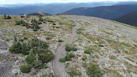
Northern BC Mountain Bike Routes
Check Out the New Digs Featured
★ 5.0 • 3 miles • 516 ft • 6 • Loop •
Discover the new trails located on Tabor Mountain with this short and sweet loop. Better yet, see how fast...
Advanced All-In Pedal Loop Featured
7 miles • 1,801 ft • 6 • Loop •
A steep and challenging 6 km climb brings you just below the lookout to 4 km of pump and flow. Go All-In.
5 miles • 916 ft • 4 •
This is the go-to quick after work pedal loop. Usually takes most people an hour or less.
★ 4.0 • 4 miles • 870 ft • 4 • Loop •
Popular route to session Shangri-La, good times all-round. Begins with a demanding climb up Steinhoe...
★ 4.0 • 4 miles • 1,064 ft • 4 • Point to Point •
Climb up then, at the @4.25kms mark, enter the rideable, but incomplete trail, Griff's line. You will...
3 miles • 532 ft • 4 •
This is the route that we'll be using for the Sprockids B.I.K.E. ride at the round up BBQ. It's rider and...
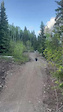
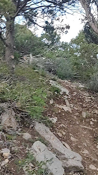
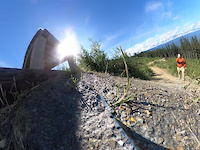
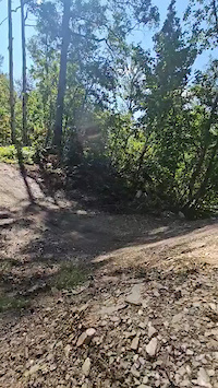
Photos of Northern BC Mountain Bike
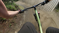
Videos of Northern BC Mountain Bike
trail: Padawan - Lower
0:10 |
6 |
May 20, 2026
trail: Padawan - Lower
0:06 |
4 |
May 20, 2026
trail: Son of a Trickster
0:17 |
8 |
May 1, 2026
trail: Turducken
0:17 |
7 |
Dec 30, 2025
trail: Moby Dick
0:24 |
32 |
Sep 27, 2025
trail: Klinkhammer
0:04 |
61 |
Jul 28, 2025
trail: High Roller
4:00 |
|
Sep 3, 2024
trail: Royal Coachman
0:03 |
|
Aug 31, 2024
Current Trail Warnings
| status | trail | date | condition | user | info |
|---|---|---|---|---|---|
| Shining The Bluff Recreation Area | Jun 7, 2026 @ 4:50pm (America/Vancouver) Jun 7, 2026 | Dry | richied | Large tree across trail | |
| Rigamaroll Tabor Mountain Recreation Trails | Jun 6, 2026 @ 11:34am (America/Vancouver) Jun 6, 2026 | Unknown | pivotm6ls ACT | Hike Initial air rake and cleanup | |
| Upper Fold 'em McBride Mountain Trails Network | May 31, 2026 @ 8:23pm (America/Vancouver) May 31, 2026 | Variable | LeonV | Fairly overgrown, plenty of blow down.... |
Recent Trail Reports
Activity Feed
| username | action | type | title | date |
|---|---|---|---|---|
| the-burd | wishlist | trail | activity #97364343 | Jun 19, 2026 @ 8:43pm 1 hours |
| chubby5000 | comment | trail | activity #97362857 and 2 more | Jun 19, 2026 @ 8:00pm 2 hours |
| chubby5000 | vote | trail | activity #97362739 and 2 more | Jun 19, 2026 @ 7:57pm 2 hours |
| Krankwar | ridden | trail | activity #97325002 | Jun 19, 2026 @ 9:42am 12 hours |
| Shredder126 | wishlist | trail | activity #97287340 | Jun 18, 2026 @ 6:02pm 1 day |
Recent Comments
| username | type | title | comment | date |
|---|---|---|---|---|
| trail | This was SUCH a good trail. Kiiinda reminded... | Jun 19, 2026 @ 8:29pm 1 hours | ||
| trail | Damn this is a fun trail. I met some gals from... | Jun 19, 2026 @ 8:26pm 2 hours | ||
| trail | Such a pretty climb. Rode there in mid June... | Jun 19, 2026 @ 8:00pm 2 hours | ||
| trail | Best ridden West to East West end is loose... | Jun 14, 2026 @ 3:09pm Jun 14, 2026 | ||
| trail | Machine built climbing trail that lacks any... | Jun 14, 2026 @ 7:52am Jun 14, 2026 |
Local Badges
-
Spring Creek Full Pull2 awarded -
2021 TORCA 30 Day Challenge Special - Flathead Flatout27 awarded -

Tabor Champ105 awarded -

2021 TORCA 30 Day Challenge - Day 2344 awarded -
2021 TORCA 30 Day Challenge - Day 1258 awarded -
2021 TORCA 30 Day Challenge - Day 1347 awarded
Bike & Skill Parks
| name | type | city | rating |
|---|---|---|---|
| Valemount Bike Park | bike park | Valemount | |
| Duchess Park Pump Track | skill park | Prince George | |
| The HuB Pump Track | skill park | Terrace | |
| Pidherny Skill Park | skill park | Prince George | |
| Pidherny pump track | skill park | Prince George |
Local Products
Local Trail Supporters
- Matt Preston
![]()
- Noble 5 Creek Ltd
![Dr. Kira Lewis N.D.]()
![Devon Budd Realtor]()
![Tourism Prince George]()
![Stretch & Fetch]()
![S.C. Christie & Sons Trucking]()
- Northern Trail Solutions
- Dave Bobb
![Columbia Basin Trust]()
- DIG trail design
- Tony Moore
- Carl Lutz
- the Corks
- Cody Harder
![]()
![]()
- Vic
Activity Type Stats
| activitytype | trails | distance | descent | descent distance | total vertical | rating | global rank | state rank | photos | reports | routes | ridelogs |
|---|---|---|---|---|---|---|---|---|---|---|---|---|
| Mountain Bike | 1,107 | 1,415 miles | 222,743 ft | 586 miles | 8,589 ft | 4,219 | 15,672 | 137 | 128,987 | |||
| E-Bike | 443 | 547 miles | 99,426 ft | 225 miles | 8,556 ft | 3 | 11,314 | 16 | 3,882 | |||
| Gravel Bike | 1 | 1 | 184 | 451 | ||||||||
| Adaptive Bike | 1 | 156 | 40 | |||||||||
| Horse | 60 | 161 miles | 13,402 ft | 48 miles | 5,719 ft | 4,112 | 6 | 64 | ||||
| Hike | 1,339 | 1,938 miles | 253,058 ft | 700 miles | 9,964 ft | 173 | 14,948 | 18 | 16,129 | |||
| Trail Running | 1,306 | 1,865 miles | 243,917 ft | 677 miles | 9,964 ft | 36 | 14,907 | 26 | 18,722 | |||
| Dirtbike/Moto | 53 | 153 miles | 10,413 ft | 39 miles | 7,306 ft | 5 | 3,698 | 3 | 423 | |||
| Observed Trials | 8 | 56 miles | 3,258 ft | 10 miles | 4,137 ft | 26 | 163 | |||||
| ATV/ORV/OHV | 30 | 115 miles | 9,091 ft | 30 miles | 8,084 ft | 8 | 3,700 | 4 | 358 | |||
| Snowmobile | 13 | 59 miles | 4,275 ft | 14 miles | 7,247 ft | 2 | 521 | 2 | 63 | |||
| Snowshoe | 347 | 529 miles | 63,615 ft | 173 miles | 8,173 ft | 21 | 1,631 | 10 | 783 | |||
| Downhill Ski | 160 | 102 miles | 86,995 ft | 84 miles | 3,698 ft | 54 | 2,040 | |||||
| Backcountry Ski | 117 | 263 miles | 41,854 ft | 80 miles | 8,314 ft | 16 | 526 | 1 | 4,710 | |||
| Nordic Ski | 311 | 255 miles | 25,105 ft | 98 miles | 5,377 ft | 16 | 1,547 | 4 | 15,362 |
Activities
- Northern BC Mountain Biking Trails
- Northern BC E-Biking Trails
- Northern BC Horseback Trails
- Northern BC Hiking Trails
- Northern BC Trail Running Trails
- Northern BC Dirtbiking Trails
- Northern BC Observed Trials Trails
- Northern BC ATVing/Offroading Trails
- Northern BC Snowmobiling Trails
- Northern BC Snowshoeing Trails
- Northern BC Skiing Trails
- Northern BC Backcountry Skiing Trails
- Northern BC Nordic Skiing Trails
Trails
Points of Interest
- By skiersteve
 & contributors
 - Admins: BCBR, TrailsBC, BCORMA, DSBC, wheelmaniac3, bcpunk, NBC, PGBRS, aleksa
- #5428 - 14,379 views
- northern bc activity log | embed map of Northern BC mountain bike trails | northern bc mountain biking points of interest polygons
Downloading of trail gps tracks in kml & gpx formats is enabled for Northern BC.
You must login to download files.