close
-
Layers w
- Weather Layers
- Pro
- Pro
- Pro
- Pro
- Pro
- Pro
- More Layers
- Pro
- Pro
- Pro
- Pro
-
Upgrade to

3D
Trail Conditions
- Unknown
- Snow Groomed
- Snow Packed
- Snow Covered
- Snow Cover Partial
- Freeze/thaw Cycle
- Icy
- Prevalent Mud
- Wet
- Variable
- Ideal
- Dry
- Very Dry
Trail Flow (Ridden Direction)
Trailforks scans users ridelogs to determine the most popular direction each trail is ridden. A good flowing trail network will have most trails flowing in a single direction according to their intension.
The colour categories are based on what percentage of riders are riding a trail in its intended direction.
The colour categories are based on what percentage of riders are riding a trail in its intended direction.
- > 96%
- > 90%
- > 80%
- > 70%
- > 50%
- < 50%
- bi-directional trail
- no data
Trail Last Ridden
Trailforks scans ridelogs to determine the last time a trail was ridden.
- < 2 days
- < 1 week
- < 2 weeks
- < 1 month
- < 6 months
- > 6 months
Trail Ridden Direction
The intended direction a trail should be ridden.
- Downhill Only
- Downhill Primary
- Both Directions
- Uphill Primary
- Uphill Only
- One Direction
Contribute Details
Colors indicate trail is missing specified detail.
- Description
- Photos
- Description & Photos
- Videos
Trail Popularity ?
Trailforks scans ridelogs to determine which trails are ridden the most in the last 9 months.
Trails are compared with nearby trails in the same city region with a possible 25 colour shades.
Think of this as a heatmap, more rides = more kinetic energy = warmer colors.
- most popular
- popular
- less popular
- not popular
ATV/ORV/OHV Filter
Max Vehicle Width
inches
US Cell Coverage
Legend

Radar Time
Activity Recordings
Trailforks uses anonymized public activity data.
?
Activity Recordings
Trailforks uses anonymized public activity data.
?
Personal Heatmap
▶
Activity Types
all
/
none
▶
Options
2
Date range
month
–
Winter Trails
Warning
A routing network for winter maps does not exist. Selecting trails using the winter trails layer has been disabled.
Missing Trails
Most Popular
Least Popular
Trails are colored based on popularity. The more popular a trail is, the more red. Less popular trails trend towards green.
Jump Magnitude Heatmap
Heatmap of where riders jump on trails. Zoom in to see individual jumps, click circles to view jump details.
BC Backroad Status
![map legend]()
Service Road Atlas is a free to use, community-driven service for viewing and creating reports on the numerous back-country service roads around B.C. and Alberta.

Slope Aspect
Direction the slope faces
Trails Deemphasized
Trails are shown in grey.
Only show trails with no bike usage.
Suggested Layers
Based on selected activity type
Save the current map location and zoom level as your default home location whenever this page is loaded.
SaveEmergency Info:
Call 9-1-1
The nearest emergency room is Texas Health Presbyterian Hospital, 4400 Long Prairie Rd, Flower Mound 75028
Trail Stewards:
East Loops 1-4: Simon Hodgson
West Loops 5-7: Neil Rosser
E-mail: [email protected] Facebook: https://www.facebook.com/NorthshoreTrail/
Instagram: https://www.instagram.com/northshoretrail/ Twitter: https://twitter.com/TXNSTrail
Trail Conditions: The trail status is posted here AND on Northshore Trail Facebook. TRAIL is CLOSED when MUDDY. More details on issues on the Facebook page. The US Army Corps of Engineers and DORBA Trail Steward Staff keep you updated on any status changes on this website first. E-mails are checked on a regular basis and we appreciate reports of any "trail related issues" we can help with, IE. deadfall, flooding, safety, race planning.
Loops 5-7 are very technical, use caution and know your ability.
Nearest City: Flower Mound, Texas
Directions
There are 5 main trailheads; Murrell Park MADD Shelter, Lakeside, Boy Scout Camping Area, Twin Coves Park, and Rockledge Park. The MADD Shelter, Lakeside and Boy Scout Camping Area Trailheads are FREE to enter, trail map and information in kiosk at MADD shelter trail head.
1. Murrell Park MADD Shelter: From FM 2499, turn west on FM 3040. Take your first left onto McKamy Creek Road. When the road ends at Simmons, turn left, keep going till you enter park. At the stop sign at the park entrance (gatehouse/guardshack), turn right, go down road 1/2 mile and turn right on Green Oaks Drive, this takes you straight to the trailhead. MADD shelter is on Google maps, this is recommended use for directions.
2. Lakeside: Address: Edgmere Road. From FM 2499, take Lakeside Parkway west to traffic circle, stay on Lakeside (left), to next traffic circle turn right on Edgemere Road, bike entrance, Sunset Point boardwalk (Google maps) off Edgemere Road, trail head on the right. Limited parking is on trail side of street.
3. Boy Scout Camping Area: Address: 2908 North Park Drive. From 2499, take Lakeside Parkway west to traffic circle, turn right on Sandy Lane, turn right on Heritage Lane, Heritage turns into McPherson Lane after you cross Canongate Drive, turn right on Elmwood Drive, turn left on North Park Drive and follow the road to the trailhead parking lot. Please do not park in front of either of the swinging gates (they have signs).
4. Twin Coves Park: Fee to enter park by vehicle Address: Twin Coves Park Rd. (Google Maps) RV park managed by The Town of Flower Mound is now open as of 7/7/17. From FM 2499, turn west on FM 3040. Take your first left onto McKamy Creek Road. When the road ends at Simmons, turn right. Turn left on Wichita Trail. The park entrance will be on the left and minimal free parking is almost immediately on the left before officially entering pay station at park just down the road.
5. Rockledge Park: Fee to enter park by bicycle or vehicle. Rockledge park is located at Long Prairie Road, Address: 3600 Pilot Point, Grapevine, TX 76051
Type
Single Track
Distance
22.5 miles broken up into two major loops: East Loops, 1 - 4, which are 12.5 miles and the West Loops, 5 - 7.
Land Manager
U.S. Army Corp of Engineers(USACE)
Phone: (817) 865-2600
Website: www.swf-wc.usace.army.mil/grapevine/
Hours
6AM-10PM
Description
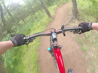
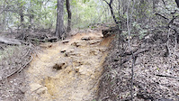
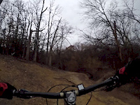
The most well-known and most used trail in the entire metroplex. This is an old motorcross trail that was first used to cycle on by Tom Deans, a long-time DORBA trail steward. The trail is ONE WAY now, going counter clockwise. This trail runs between Rockledge Park and then west, past Twin Coves Park on the north shoreline of Lake Grapevine. Total of 22.5 glorious miles of multi-terrain, multi-skill-level trail. The East side loops 1-4 (east from MADD Shelter) are good for intermediate riders while the West side loops 5-7 (west from MADD Shelter) are considerably more technical. There are several "rock gardens" on this side, very technical to ride through. Watch out for hikers and other bikers speeding around bends. An average of 800 bikers visit per week, so be extra careful!
Trail Rules
The US Army Corps of Engineers have a website with information on the lake and park information.
Bicycles must follow directional signs and navigate the trail counter-clockwise. Runners and Hikers are encouraged to go clockwise to allow more reaction time from bicycles.
ONE EAR BUD TRAIL: Please recognize that this is a high volume trail with many trail users. For your safety and that of all the others on the trail, please use only one earbud as you will need to hear other trail user's requests to pass.
Rocks, roots, trees, and bushes are all part of the trail and what make it challenging. Please DO NOT REMOVE them or alter the trail in any way. Vandalism of US Army Corps Property, The Northshore Trail, is a federal offense. Please notify Trail Stewards (above) regarding any deadfall, rockslides, or changes to the trail, THANK-YOU!
HELMETS ARE REQUIRED
• Stay on Marked Trail
• No Alcoholic Beverages
• No Glass Containers
• Pets on Leash
• No Motorized Vehicles
• No Camping
• No Groundfires
• No Horses on Bike Trails
Facilities
• Restrooms (porta john)
• Pavilions, pinic tables and grills
• Gas/food and bicycle shops are plentiful in Flower Mound
Call 9-1-1
The nearest emergency room is Texas Health Presbyterian Hospital, 4400 Long Prairie Rd, Flower Mound 75028
Trail Stewards:
East Loops 1-4: Simon Hodgson
West Loops 5-7: Neil Rosser
E-mail: [email protected] Facebook: https://www.facebook.com/NorthshoreTrail/
Instagram: https://www.instagram.com/northshoretrail/ Twitter: https://twitter.com/TXNSTrail
Trail Conditions: The trail status is posted here AND on Northshore Trail Facebook. TRAIL is CLOSED when MUDDY. More details on issues on the Facebook page. The US Army Corps of Engineers and DORBA Trail Steward Staff keep you updated on any status changes on this website first. E-mails are checked on a regular basis and we appreciate reports of any "trail related issues" we can help with, IE. deadfall, flooding, safety, race planning.
Loops 5-7 are very technical, use caution and know your ability.
Nearest City: Flower Mound, Texas
Directions
There are 5 main trailheads; Murrell Park MADD Shelter, Lakeside, Boy Scout Camping Area, Twin Coves Park, and Rockledge Park. The MADD Shelter, Lakeside and Boy Scout Camping Area Trailheads are FREE to enter, trail map and information in kiosk at MADD shelter trail head.
1. Murrell Park MADD Shelter: From FM 2499, turn west on FM 3040. Take your first left onto McKamy Creek Road. When the road ends at Simmons, turn left, keep going till you enter park. At the stop sign at the park entrance (gatehouse/guardshack), turn right, go down road 1/2 mile and turn right on Green Oaks Drive, this takes you straight to the trailhead. MADD shelter is on Google maps, this is recommended use for directions.
2. Lakeside: Address: Edgmere Road. From FM 2499, take Lakeside Parkway west to traffic circle, stay on Lakeside (left), to next traffic circle turn right on Edgemere Road, bike entrance, Sunset Point boardwalk (Google maps) off Edgemere Road, trail head on the right. Limited parking is on trail side of street.
3. Boy Scout Camping Area: Address: 2908 North Park Drive. From 2499, take Lakeside Parkway west to traffic circle, turn right on Sandy Lane, turn right on Heritage Lane, Heritage turns into McPherson Lane after you cross Canongate Drive, turn right on Elmwood Drive, turn left on North Park Drive and follow the road to the trailhead parking lot. Please do not park in front of either of the swinging gates (they have signs).
4. Twin Coves Park: Fee to enter park by vehicle Address: Twin Coves Park Rd. (Google Maps) RV park managed by The Town of Flower Mound is now open as of 7/7/17. From FM 2499, turn west on FM 3040. Take your first left onto McKamy Creek Road. When the road ends at Simmons, turn right. Turn left on Wichita Trail. The park entrance will be on the left and minimal free parking is almost immediately on the left before officially entering pay station at park just down the road.
5. Rockledge Park: Fee to enter park by bicycle or vehicle. Rockledge park is located at Long Prairie Road, Address: 3600 Pilot Point, Grapevine, TX 76051
Type
Single Track
Distance
22.5 miles broken up into two major loops: East Loops, 1 - 4, which are 12.5 miles and the West Loops, 5 - 7.
Land Manager
U.S. Army Corp of Engineers(USACE)
Phone: (817) 865-2600
Website: www.swf-wc.usace.army.mil/grapevine/
Hours
6AM-10PM
Description
The most well-known and most used trail in the entire metroplex. This is an old motorcross trail that was first used to cycle on by Tom Deans, a long-time DORBA trail steward. The trail is ONE WAY now, going counter clockwise. This trail runs between Rockledge Park and then west, past Twin Coves Park on the north shoreline of Lake Grapevine. Total of 22.5 glorious miles of multi-terrain, multi-skill-level trail. The East side loops 1-4 (east from MADD Shelter) are good for intermediate riders while the West side loops 5-7 (west from MADD Shelter) are considerably more technical. There are several "rock gardens" on this side, very technical to ride through. Watch out for hikers and other bikers speeding around bends. An average of 800 bikers visit per week, so be extra careful!
Trail Rules
The US Army Corps of Engineers have a website with information on the lake and park information.
Bicycles must follow directional signs and navigate the trail counter-clockwise. Runners and Hikers are encouraged to go clockwise to allow more reaction time from bicycles.
ONE EAR BUD TRAIL: Please recognize that this is a high volume trail with many trail users. For your safety and that of all the others on the trail, please use only one earbud as you will need to hear other trail user's requests to pass.
Rocks, roots, trees, and bushes are all part of the trail and what make it challenging. Please DO NOT REMOVE them or alter the trail in any way. Vandalism of US Army Corps Property, The Northshore Trail, is a federal offense. Please notify Trail Stewards (above) regarding any deadfall, rockslides, or changes to the trail, THANK-YOU!
HELMETS ARE REQUIRED
• Stay on Marked Trail
• No Alcoholic Beverages
• No Glass Containers
• Pets on Leash
• No Motorized Vehicles
• No Camping
• No Groundfires
• No Horses on Bike Trails
Facilities
• Restrooms (porta john)
• Pavilions, pinic tables and grills
• Gas/food and bicycle shops are plentiful in Flower Mound
Primary Trail Type: Cross-Country
AKA: Murrell Park
 google parking directions
 Disclaimer:
Class 1 Pedal Assist Ebikes are allowed, but a permit must be obtained from the Lake Grapevine Army Corps of Engineers Project Office at 110 Fairway Drive, Grapevine. There are some restrictions on who can get one. Please see the link "Ebike Policy and Blank Permit Form" for more information.
Links
Activities Click to view
- Mountain Bike
13 trails
- E-Bike
9 trails
- Hike
13 trails
- Trail Running
13 trails
Stats
- Avg Trail Rating
- Trails (view details)
- 10
- Trails Mountain Bike
- 13
- Trails E-Bike
- 9
- Trails Hike
- 13
- Trails Trail Running
- 13
- Total Distance
- 20 miles
- Total Descent
- 1,514 ft
- Total Vertical
- 69 ft
- Highest Trailhead
- 604 ft
- Reports
- 3,719
- Photos
- 139
- Ridden Counter
- 11,157
Popular Northshore Mountain Biking Trails
• 100 ★ 4.3 • 3 miles • 223 ft • 1,699 •
Highly rated popular blue difficulty singletrack. This multi-use trail can be used one direction and has a moderate overall physical rating with a 223 ft green climb. On average it takes 15 minutes to complete this trail.
• 85 ★ 4.4 • 3 miles • 105 ft • 1,594 •
Highly rated popular blue difficulty singletrack. This multi-use trail can be used one direction and has a moderate overall physical rating with a 105 ft green climb. On average it takes 11 minutes to complete this trail.
• 90 ★ 4.3 • 2 miles • 187 ft • 1,588 •
The east side of is fairly easy but a lot of fun. This is DFW's most popular trail so be prepared for my riders, joggers, and walkers on the weekend. It is very well marked with plenty of parking. Not many climbs and only 2 or 3...
• 95 ★ 4.2 • 3 miles • 254 ft • 1,456 •
Highly rated popular blue difficulty singletrack. This multi-use trail can be used one direction. On average it takes 19 minutes to complete this trail.
• 80 ★ 4.1 • 2 miles • 196 ft • 1,329 •
Highly rated popular blue difficulty singletrack. This multi-use trail can be used one direction and has a moderate overall physical rating with a 196 ft green climb. On average it takes 18 minutes to complete this trail.
• 65 ★ 4.0 • 4 miles • 294 ft • 928 •
This is a super technical trail that has many difficult rocky sections. For more beginner level riders it would be better to start on loops 1-5, and eventually work up to loop 6 and 7. It is still a fun tech trail, and all sections are...
• 70 ★ 3.8 • 2 miles • 227 ft • 617 •
Popular blue difficulty singletrack. This multi-use trail can be used one direction and has a moderate overall physical rating with a 227 ft blue climb. On average it takes 24 minutes to complete this trail.
Northshore Mountain Bike Routes
Loops 1-5 Lakeside Tower Start Featured
13 miles • 1,008 ft • 3 • Loop •
This is loops 1-5 with start at Lakeside tower.
★ 2.5 • 11 miles • 845 ft • 3 • Loop •
Northshore loops 1-4 (blue) from the MADD shelter and back
★ 5.0 • 9 miles • 554 ft • 3 •
1. Combination of 3 "stackable" loops: 5 thru 7. 2. Begin & end at MADD shelter parking lot 3. Trail...
13 miles • 737 ft • 2 • Loop •
This is the route for the 100 mile participants of the 2026 DORBA Judgment Day.
8 miles • 462 ft • 4 • Loop •
Loop from 1-3 and back, skipping the rocky loop 4. Then finish with loop 5 for fun.
6 miles • 479 ft • 1 •
Texas Off Road Series 2025 Race 2 at Northshore looks like this is the loop they will use....
Photos of Northshore Mountain Bike
Videos of Northshore Mountain Bike
trail: Northshore Loop 4
0:59 |
360 |
Jun 1, 2024
trail: Northshore Loop 6
0:17 |
|
Sep 5, 2022
trail: Northshore Loop 4
0:14 |
375 |
Dec 28, 2018
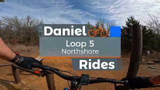
trail: Northshore Loop 5
15:10 |
252 |
Mar 25, 2025 , Flower Mound

5:01 |
442 |
Oct 8, 2023

trail: Northshore Loop 2
21:05 |
443 |
Oct 7, 2023 , Flower Mound
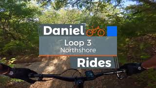
trail: Northshore Loop 3
17:33 |
357 |
Oct 7, 2023 , Flower Mound

trail: Northshore Loop 4
14:12 |
370 |
Oct 7, 2023 , Flower Mound
Recent Trail Reports
| status | trail | date | condition | info | user |
|---|---|---|---|---|---|
| Northshore Loop 7 | Jun 21, 2026 @ 1:01pm (America/Chicago) Jun 21, 2026 | Variable | dorbanorthshore Trail Steward | ||
| Northshore Loop 6 | Jun 21, 2026 @ 1:01pm (America/Chicago) Jun 21, 2026 | Variable | dorbanorthshore Trail Steward | ||
| Northshore Loop 5 | Jun 21, 2026 @ 1:01pm (America/Chicago) Jun 21, 2026 | Variable | dorbanorthshore Trail Steward | ||
| Northshore Loop 4 | Jun 21, 2026 @ 1:01pm (America/Chicago) Jun 21, 2026 | Variable | dorbanorthshore Trail Steward | ||
| Northshore Loop 3 | Jun 21, 2026 @ 1:01pm (America/Chicago) Jun 21, 2026 | Variable | dorbanorthshore Trail Steward | ||
| Northshore Loop 2 | Jun 21, 2026 @ 1:01pm (America/Chicago) Jun 21, 2026 | Variable | dorbanorthshore Trail Steward | ||
| Northshore Loop 1 | Jun 21, 2026 @ 1:01pm (America/Chicago) Jun 21, 2026 | Variable | dorbanorthshore Trail Steward | ||
| Lakeside DFW Access | Jun 21, 2026 @ 1:01pm (America/Chicago) Jun 21, 2026 | Variable | dorbanorthshore Trail Steward | ||
| Connector | Jun 21, 2026 @ 1:01pm (America/Chicago) Jun 21, 2026 | Variable | dorbanorthshore Trail Steward |
Activity Feed
| username | action | type | title | date |
|---|---|---|---|---|
| TxIst | wishlist | region | activity #97581749 | Jun 22, 2026 @ 1:17pm 3 days |
| dorbanorthshore | add | report | activity #97502325 and 9 more | Jun 21, 2026 @ 11:01am Jun 21, 2026 |
| TahaCBTfNG | wishlist | route | activity #97496699 | Jun 21, 2026 @ 10:04am Jun 21, 2026 |
| dorbanorthshore | add | report | activity #97474327 and 9 more | Jun 21, 2026 @ 5:22am Jun 21, 2026 |
| dorbanorthshore | add | report | activity #97312362 and 9 more | Jun 19, 2026 @ 6:25am Jun 19, 2026 |
Recent Comments
| username | type | title | comment | date |
|---|---|---|---|---|
| report | Please refrain from riding the trail when... | Apr 29, 2026 @ 3:31pm Apr 29, 2026 | ||
| trail | Please ride with caution and use all senses | Feb 15, 2026 @ 11:10am Feb 15, 2026 | ||
| trail | Black diamond trail, do not be deceived by the... | Dec 5, 2025 @ 10:38am Dec 5, 2025 | ||
| trail | Black diamond trail, do not be deceived by the... | Dec 5, 2025 @ 10:38am Dec 5, 2025 | ||
| trail | Pretty sketchy and dangerous to the point... | Dec 5, 2025 @ 10:35am Dec 5, 2025 |
Nearby Areas
| name | distance | ||||
|---|---|---|---|---|---|
| Horseshoe | 1 | 1 | 2.9 km | ||
| Knob Hills | 7 | 5.8 km | |||
| Corinth Community Park | 9 | 10.8 km | |||
| Campion Trail | 11.1 km | ||||
| South Lakes Park | 2 | 12.2 km |
Local Products
Activity Type Stats
| activitytype | trails | distance | descent | descent distance | total vertical | rating | global rank | state rank | photos | reports | routes | ridelogs |
|---|---|---|---|---|---|---|---|---|---|---|---|---|
| Mountain Bike | 13 | 20 miles | 1,512 ft | 6 miles | 69 ft | #749 | #286 | 158 | 3,717 | 13 | 35,805 | |
| E-Bike | 9 | #2,859 | #894 | 2 | 665 | 1 | 1,506 | |||||
| Hike | 13 | 20 miles | 1,512 ft | 6 miles | 69 ft | #4,982 | #1,810 | 6 | 3,696 | 440 | ||
| Trail Running | 13 | 20 miles | 1,512 ft | 6 miles | 69 ft | 3,696 | 847 |
Frequently Asked Questions About Northshore
▼
What are the highest rated mountain biking trails in Northshore?
The highest rated mountain biking trails in Northshore are:
- Northshore Loop 3 (4.3/5)
- Northshore Loop 4 (4.2/5)
- Northshore Loop 2 (4.2/5)
- Northshore Loop 1 (4.1/5)
- Northshore Loop 5 (4.1/5)
▼
What is the best time of the year to ride in Northshore?
Based on ride log data, the most popular months to ride in Northshore are:
- July (196 activities)
- September (193 activities)
- August (170 activities)
▼
Where can I park to ride in Northshore?
There are 4 parking locations listed in Northshore. The most popular parking spots are: View all parking and trailhead locations on the map to plan your visit.
▼
What is the longest trail in Northshore?
The longest trail in Northshore is Northshore Loop 6 at 4.0 miles. View all trails sorted by distance.
Activities
- By todd
 Trailforks & contributors
 - Admins: Trail Steward, DORBA MAIN
- #5025 - 275,253 views
- northshore activity log | embed map of Northshore mountain bike trails | northshore mountain biking points of interest
Downloading of trail gps tracks in kml & gpx formats is enabled for Northshore.
You must login to download files.