close
-
Layers w
- Weather Layers
- Pro
- Pro
- Pro
- Pro
- Pro
- Pro
- More Layers
- Pro
- Pro
- Pro
- Pro
-
Upgrade to

3D
Trail Conditions
- Unknown
- Snow Groomed
- Snow Packed
- Snow Covered
- Snow Cover Partial
- Freeze/thaw Cycle
- Icy
- Prevalent Mud
- Wet
- Variable
- Ideal
- Dry
- Very Dry
Trail Flow (Ridden Direction)
Trailforks scans users ridelogs to determine the most popular direction each trail is ridden. A good flowing trail network will have most trails flowing in a single direction according to their intension.
The colour categories are based on what percentage of riders are riding a trail in its intended direction.
The colour categories are based on what percentage of riders are riding a trail in its intended direction.
- > 96%
- > 90%
- > 80%
- > 70%
- > 50%
- < 50%
- bi-directional trail
- no data
Trail Last Ridden
Trailforks scans ridelogs to determine the last time a trail was ridden.
- < 2 days
- < 1 week
- < 2 weeks
- < 1 month
- < 6 months
- > 6 months
Trail Ridden Direction
The intended direction a trail should be ridden.
- Downhill Only
- Downhill Primary
- Both Directions
- Uphill Primary
- Uphill Only
- One Direction
Contribute Details
Colors indicate trail is missing specified detail.
- Description
- Photos
- Description & Photos
- Videos
Trail Popularity ?
Trailforks scans ridelogs to determine which trails are ridden the most in the last 9 months.
Trails are compared with nearby trails in the same city region with a possible 25 colour shades.
Think of this as a heatmap, more rides = more kinetic energy = warmer colors.
- most popular
- popular
- less popular
- not popular
ATV/ORV/OHV Filter
Max Vehicle Width
inches
US Cell Coverage
Legend

Radar Time
Activity Recordings
Trailforks uses anonymized public activity data.
?
Activity Recordings
Trailforks uses anonymized public activity data.
?
Personal Heatmap
▶
Activity Types
all
/
none
▶
Options
2
Date range
month
–
Winter Trails
Warning
A routing network for winter maps does not exist. Selecting trails using the winter trails layer has been disabled.
Missing Trails
Most Popular
Least Popular
Trails are colored based on popularity. The more popular a trail is, the more red. Less popular trails trend towards green.
Jump Magnitude Heatmap
Heatmap of where riders jump on trails. Zoom in to see individual jumps, click circles to view jump details.
BC Backroad Status
![map legend]()
Service Road Atlas is a free to use, community-driven service for viewing and creating reports on the numerous back-country service roads around B.C. and Alberta.

Slope Aspect
Direction the slope faces
Trails Deemphasized
Trails are shown in grey.
Only show trails with no bike usage.
Suggested Layers
Based on selected activity type
Save the current map location and zoom level as your default home location whenever this page is loaded.
SaveNorsk
Merk at hytter med DNT i navnet er låst med DNT-nøkkel.
https://hyttebestilling.dnt.no/
English
Note that cabins with DNT in the name are locked with a DNT key.
https://hyttebestilling.dnt.no/
Trail rules
1. Be considerate and pleasant when meeting hikers.
2. You always have the right of way for pedestrians.
3. Limit your speed so that you are not a danger or inconvenience to others, in particular
along roads and paths that invite high speed, or in unclear sections.
4. Slow down to walking speed well in advance of passing others on a narrow trail.
5. Do not make new tracks, if you do not have the skills to overcome an obstacle, get off the bike.
6. Avoid cycling on particularly vulnerable paths immediately after periods of heavy rainfall.
7. Do not make the path wider by cycling around water ponds or obstacles.
8. Carry the bike through marshy areas so that deep ruts do not form.
9. Do not lock the rear wheel on steep downhill slopes.
10. If two cyclists meet on a hill, the one cycling uphill has the right of way.
Snow Riding
Allemannsretten gives cyclists the right to travel on ski slopes in winter, but we also have a duty to act considerately and not cause damage or inconvenience the interests of skiers when we travel.
On the ski slopes, skiers and pedestrians are the soft ones, and cyclists the hard road users.
NOTS therefore wants to encourage cyclists to follow the rules below to prevent conflict and ensure that everyone who travels in the countryside in winter has good experiences.
1. Be considerate and pleasant when meeting skiers and pedestrians.
2. You always have to give way when meeting skiers, they have longer
braking distance, less control and takes up more space in the width on uphill and downhill slopes
3. Go on the right between the ski tracks, possibly to the far right if possible.
4. Slow down to a controlled speed when skiers are approaching, and pass skiers in the same direction as you with caution on the left side.
5. Be especially observant on downhill slopes, it takes longer to brake on snow than on trails/gravel/asphalt.
6. Avoid crossing the ski track more than necessary.
7. Avoid the most popular departure points during peak times on Saturdays and Sundays and otherwise when traffic is heavy on the ski slopes.
8. Avoid riding on ski slopes when it is clear and you are making deep tracks, or when the slopes are soft and need time to settle after the paver has made tracks.
The trail rules have been developed by NOTS.
We encourage the use of these where appropriate, and then with reference to NOTS.
Emergency Numbers
Police: 112
Ambulance: 113
Fire Dep: 110
If all are needed, call 112.
Links
- Visit Norway
- Norwegian Ministry of Foreign Affairs - Embassies
- Norway International Travel Information By U.S. DEPARTMENT of STATE
- The trail rules in Norwegian
- Norwegian Tourist Association
- English-Norwegian dictionary
- https://mtbmap.no/
- https://trailguide.net/
This region uses the Uk/Euro style trail grading system.
Stats
- Avg Trail Rating
- Trails (view details)
- 10,808
- Trails Mountain Bike
- 8,522
- Trails E-Bike
- 4,520
- Trails Gravel Bike
- 3,332
- Trails Adaptive Bike
- 1,675
- Trails Winter Fat Bike
- 2,511
- Trails Horse
- 521
- Trails Hike
- 8,287
- Trails Trail Running
- 8,247
- Trails Dirtbike/Moto
- 67
- Trails Observed Trials
- 7
- Trails ATV/ORV/OHV
- 112
- Trails Snowmobile
- 104
- Trails Snowshoe
- 452
- Trails Downhill Ski
- 216
- Trails Backcountry Ski
- 757
- Trails Nordic Ski
- 4,134
- Total Distance
- 9,267 miles
- Total Descent
- 1,806,657 ft
- Total Vertical
- 7,005 ft
- Highest Trailhead
- 7,006 ft
- Reports
- 12,504
- Photos
- 9,896
- Ridden Counter
- 114,675
Articles
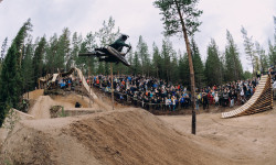
Highlights from Brage Vestavik’s ‘B-RAGE SESH’ Freeride Event in Norway
Nov 6, 2025 from pinkbike.com
A new generation of Norwegian freeriders takes flight on Brage Vestavik’s legendary B-RAGE trail.
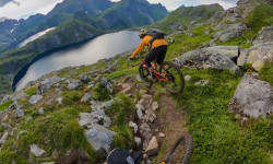
Video: An Epic Ride On A Remote Norwegian Island with Ludo May & Kilian Bron
Sep 30, 2025 from pinkbike.com
Plenty of hike-a-bike, stunning landscapes, and above all, an ultra-technical descent, the two riders’ favourite playground.
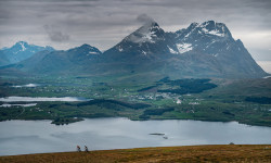
Video: Exploring Norway’s Rugged Atlantic Coastline in 'Chasing Daylight
Sep 25, 2025 from pinkbike.com
In Unstad, better known for surfing than singletrack, e-MTBs unlock brutal climbs and dramatic descents above the Atlantic.
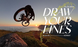
Video: Kilian Bron & Ludo May Explore Norway by Bike in 'Draw Your Lines'
Apr 15, 2025 from pinkbike.com
Some of Norway's most mind-blowing landscapes by bike. Slabs for days!
Sub Regions
- Agder (130)
- Arendal (42)
- Arendal (44)
- Bykle (19)
- Froland (1)
- Kristiansand (7)
- Kristiansand (41)
- Lillesand (1)
- Amli (20)
- Tjørhom (0)
- Vikedal (7)
- Arendal (42)
- Akershus (586)
- ås (3)
- Asker (22)
- Aurskog-Høland (6)
- Enebakk (25)
- Frogn (9)
- Gjerdrum (15)
- Jevnaker (46)
- Jevnaker (27)
- Lunner (34)
- Lørenskog (7)
- Nannestad (42)
- Nes (91)
- Nesodden (17)
- Nordre Follo (71)
- Ullensaker (20)
- Jessheim (15)
- Årnes (16)
- Asker (12)
- Bærum (91)
- Eidsvoll (17)
- Lillestrøm (6)
- Lørenskog (13)
- Nittedal (31)
- Rånåsfoss (74)
- ås (3)
- Buskerud (543)
- Finnmark (1,081)
- Alta (6)
- Kåfjorddalen (4)
- Kautokeino (2)
- Lyngen (26)
- Storslett-Sørkjosen (7)
- Tana (10)
- Tana Bru (9)
- Vadsø (1)
- Vadsø (38)
- Hammerfest (15)
- Kirkenes (12)
- Mestervik (6)
- Tjeldsund (26)
- Alta (6)
- Handnesøya (0)
- hedemark (9)
- Hjerkinn og Folldal (6)
- Innlandet (924)
- Åmot (5)
- Eidskog (1)
- Elverum (49)
- Elverum (71)
- Gausdal (128)
- Gjøvik (16)
- Gran (36)
- Gran (5)
- Hamar (4)
- Hamar (1)
- Lesja (1)
- Lillehammer (32)
- Lillehammer (18)
- Løten (6)
- Nord-Aurdal (27)
- Fagernes (24)
- Nord-Fron (32)
- Nordre Land (2)
- Os (12)
- Ringebu (59)
- Ringsaker (68)
- Brumunddal (9)
- Sel (8)
- Sør-Fron (34)
- Trysil (1)
- Trysil (111)
- Tynset (38)
- Tynset (24)
- Vågå (2)
- Vågåmo (1)
- Vestre Slidre (30)
- Vestre Toten (14)
- Østre Toten (5)
- Skreia (44)
- Øyer (50)
- Hafjell (65)
- Øystre Slidre (12)
- Kongsvinger (14)
- Skeikampen (2)
- Åmot (5)
- Kalnesskogen (0)
- Møre og Romsdal (76)
- Nordland (848)
- Andøy (5)
- Andenes (1)
- Bodø (13)
- Bodø (64)
- Brønnøy (1)
- Fauske (4)
- Hadsel (16)
- Stokmarknes (157)
- Hemnes (1)
- Lødingen (1)
- Moskenes (9)
- Narvik (6)
- Narvik (72)
- Rana (6)
- Mo i Rana (78)
- Sortland (7)
- Sortland (207)
- Steigen (13)
- Vågan (13)
- Vefsn (7)
- Mosjøen (247)
- Vesterålen (438)
- Vestvågøy (6)
- Leknes (36)
- Øksnes (1)
- Myre (3)
- Leirfjord (1)
- Nesna (5)
- Sandnessjøen (1)
- Trofors (12)
- Andøy (5)
- Nordmarka (9)
- Oppland (7)
- Oslo Region (407)
- Oslo (370)
- Oslo (370)
- Rogaland (86)
- Ryfylke (18)
- Salangen (0)
- Telemark (139)
- Troms (180)
- Trøndelag (761)
- Vest-Agder (24)
- Vestfold (63)
- Færder (10)
- Holmestrand (2)
- Horten (51)
- Sandefjord (0)
- Færder (10)
- Vestland (388)
- Østfold (2,543)
- Fet kommune (20)
- Fetsund (20)
- Halden (21)
- Halden (10)
- Hvaler (0)
- Indre Østfold (1,386)
- Marker (13)
- Oppegård (13)
- Råde (1)
- Rakkestad (33)
- Rørfjell (1)
- Skedsmo (1)
- Skiptvet (12)
- Sørum (135)
- Lørenfallet (42)
- Sørumsand (65)
- Aurskog (10)
- Blaker (77)
- Dagali (3)
- Drøbak (90)
- Fredrikstad (72)
- Frogner (39)
- Gjelleråsen (5)
- Moss (15)
- Sarpsborg (164)
- Ski (9)
- Fet kommune (20)
- Hjelledalen (8)
- Lofoten (1)
Popular Norway Mountain Biking Trails
• 95 ★ 4.4 • 3,698 ft • 40 ft • 913 •
Highly rated popular blue difficulty machine groomed. This mountain bike primary trail can be used one direction and has a easy overall physical rating with a 40 ft green climb. It features berm, bridge and roller coaster. On average it takes 4 minutes to complete this trail.
• 95 ★ 3.9 • 5,016 ft • 209 ft • 885 •
Popular blue difficulty singletrack. This mountain bike primary trail and has a moderate overall physical rating with a 209 ft green climb. It features a-frame, berm, bridge and jump. On average it takes 9 minutes to complete this trail.
• 90 ★ 4.8 • 3,974 ft • 56 ft • 847 •
Highly rated popular blue difficulty machine groomed. This mountain bike primary trail can be used downhill primary and has a moderate overall physical rating with a 56 ft green climb. It features berm, bridge, jump and roller coaster. On average it takes 6 minutes to complete this trail.
• 85 ★ 4.4 • 3,049 ft • 97 ft • 780 •
Popular blue difficulty family friendly machine groomed. This mountain bike primary trail can be used one direction and has a moderate overall physical rating with a 97 ft green climb. It features berm and bridge. On average it takes 6 minutes to complete this trail.
• 85 ★ 4.4 • 3,778 ft • 71 ft • 761 •
Popular blue difficulty family friendly machine groomed. This mountain bike primary trail can be used one direction and has a moderate overall physical rating with a 71 ft green climb. It features berm and bridge. On average it takes 4 minutes to complete this trail.
• 85 ★ 4.5 • 1 mile • 111 ft • 760 •
Highly rated popular green difficulty family friendly machine groomed. This mountain bike primary trail can be used one direction and has a easy overall physical rating with a 111 ft green climb. It features berm, bridge, log ride and pump track. On average it takes 11 minutes to complete this trail.
• 80 ★ 4.0 • 2,387 ft • 144 ft • 647 •
Highly rated popular blue difficulty singletrack. This mountain bike primary trail can be used uphill primary and has a moderate overall physical rating with a 144 ft blue climb. On average it takes 4 minutes to complete this trail.
Norway Mountain Bike Routes
★ 5.0 • 2 miles • 27 ft • 1 • Point to Point •
2,5km punkt til punkt, løp som kalles Linnatrimmen, Starter nærbrannstasjonen og ender hvor skiltet til...
★ 5.0 • 1 mile • 58 ft • 4 • Out & Back •
1,9km ski løype,består av grusvei,med noen oppoverbakker,og ned over bakker,etter første krysset kommer...
8 miles • 636 ft • 3 •
Starts from Askim city centre goes trough whole Solbergfosslinna, which is a nice smooth gravel rail...
★ 5.0 • 1 mile • 76 ft • 9 • Out & Back •
2.5 Km long ski out and back route. long straight then left slight climb, and down fast at steep decline,...
21 miles • 499 ft • 2 • Point to Point •
This tour follows the historic railway line between Åmli and Treungen. The railway ran from Arendal to...
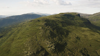
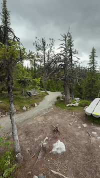
Photos of Norway Mountain Bike
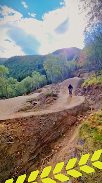
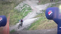
Videos of Norway Mountain Bike
trail: Magic Blue Flow VBP
0:24 |
13 |
Oct 10, 2025
trail: Vorefjellet
2:59 |
14 |
Aug 19, 2025
trail: NM 2020
0:06 |
35 |
Aug 11, 2025
0:11 |
10 |
Jun 30, 2025
trail: Jønsbråten Express
0:22 |
19 |
Oct 18, 2024
trail: Sweet Jane
0:23 |
12 |
Oct 13, 2024
trail: Black 68 Gledalen (Jumpline)
0:28 |
24 |
Oct 4, 2024
trail: Røde Orm
0:22 |
|
Sep 27, 2024
Recent Comments
| username | type | title | comment | date |
|---|---|---|---|---|
| trail | P | Jun 11, 2026 @ 12:05pm Jun 11, 2026 | ||
| trail | Lots of annoying forest | Jun 7, 2026 @ 11:01am Jun 7, 2026 | ||
| trail | The upper two thirds of the trail are one... | May 20, 2026 @ 10:34am May 20, 2026 | ||
| trail | If your on a bike don’t bother, it’s a... | May 11, 2026 @ 11:24am May 11, 2026 | ||
| trail | Kanske ska den vara synlig men med "hike" som... | Apr 16, 2026 @ 4:31am Apr 16, 2026 |
Bike & Skill Parks
| name | type | city | rating |
|---|---|---|---|
| Hafjell Bike Park | bike park | Hafjell | |
| Trysil Bike Arena | bike park | Trysil | |
| Geilo Bike Park | bike park | Geilo | |
| Drammen Skisenter | bike park | Drammen | |
| Traktor Bike Park | bike park | Gjøvik |
Upcoming Local Events
Activity Type Stats
| activitytype | trails | distance | descent | descent distance | total vertical | rating | global rank | state rank | photos | reports | routes | ridelogs |
|---|---|---|---|---|---|---|---|---|---|---|---|---|
| Mountain Bike | 8,522 | 6,039 miles | 1,451,040 ft | 2,962 miles | 4,813 ft | #15 | 9,596 | 12,448 | 169 | 235,711 | ||
| E-Bike | 4,520 | 3,244 miles | 839,613 ft | 1,578 miles | 4,790 ft | #14 | 149 | 11,120 | 74 | 37,307 | ||
| Gravel Bike | 3,332 | 2,595 miles | 320,240 ft | 1,026 miles | 4,790 ft | #11 | 1,666 | 27 | 1,374 | |||
| Adaptive Bike | 1,675 | 1,209 miles | 155,138 ft | 476 miles | 4,787 ft | #12 | 2,808 | 14 | ||||
| Winter Fat Bike | 2,511 | 1,378 miles | 249,885 ft | 635 miles | 4,524 ft | #10 | 3,223 | 1 | 157 | |||
| Horse | 521 | 459 miles | 90,896 ft | 196 miles | 4,127 ft | #14 | 6 | 3,245 | 3 | 5 | ||
| Hike | 8,287 | 5,886 miles | 1,368,698 ft | 2,856 miles | 6,119 ft | #15 | 49 | 12,018 | 42 | 45,171 | ||
| Trail Running | 8,247 | 5,872 miles | 1,363,383 ft | 2,849 miles | 6,119 ft | #15 | 6 | 11,979 | 40 | 14,735 | ||
| Dirtbike/Moto | 67 | 67 miles | 9,908 ft | 25 miles | 2,625 ft | #15 | 3,205 | 1 | 4 | |||
| Observed Trials | 7 | 7 miles | 699 ft | 2 miles | 1,263 ft | #13 | 18 | 6 | ||||
| ATV/ORV/OHV | 112 | 121 miles | 13,501 ft | 42 miles | 2,631 ft | #15 | 2,727 | 4 | ||||
| Snowmobile | 104 | 105 miles | 25,449 ft | 45 miles | 3,379 ft | #12 | 73 | 6 | ||||
| Snowshoe | 452 | 368 miles | 100,328 ft | 178 miles | 4,577 ft | #12 | 103 | 5 | 471 | |||
| Downhill Ski | 216 | 228 miles | 109,547 ft | 139 miles | 4,577 ft | #13 | 2 | 48 | 15,269 | |||
| Backcountry Ski | 757 | 1,135 miles | 175,705 ft | 520 miles | 7,001 ft | #11 | 81 | 5 | 19,339 | |||
| Nordic Ski | 4,134 | 4,727 miles | 499,367 ft | 2,081 miles | 5,240 ft | #7 | 3 | 232 | 6 | 42,160 |
Activities
- Norway Mountain Biking Trails
- Norway E-Biking Trails
- Norway Gravel Biking Trails
- Norway Adaptive Biking Trails
- Norway Winter Fat Biking Trails
- Norway Horseback Trails
- Norway Hiking Trails
- Norway Trail Running Trails
- Norway Dirtbiking Trails
- Norway Observed Trials Trails
- Norway ATVing/Offroading Trails
- Norway Snowmobiling Trails
- Norway Snowshoeing Trails
- Norway Skiing Trails
- Norway Backcountry Skiing Trails
- Norway Nordic Skiing Trails
Trails
Points of Interest
- Small pump track/bmx dirt TTF
- Trykkbassenget Viewpoint
- Varden Viewpoint
- Skihytta Viewpoint
- Golf Pro Shop Information
- Strandbu camping
- Bike rental & lift tickets Information
- Small pump track/bmx dirt TTF
- Emergency room/ Hospital Information
- Train station Information
- Galdhøpiggen (7,943 ft)
- Glittertinden (7,930 ft)
- Galdhøpiggen Sørvest (7,897 ft)
- By canadaka
 Trailforks & contributors
 - Admins: mtbboy1993, Cykeljohan
- #3183 - 69,721 views
- norway activity log | embed map of Norway mountain bike trails | norway mountain biking points of interest polygons
Downloading of trail gps tracks in kml & gpx formats is enabled for Norway.
You must login to download files.