close
-
Layers w
- Weather Layers
- Pro
- Pro
- Pro
- Pro
- Pro
- Pro
- More Layers
- Pro
- Pro
- Pro
- Pro
-
Upgrade to

3D
Trail Conditions
- Unknown
- Snow Groomed
- Snow Packed
- Snow Covered
- Snow Cover Partial
- Freeze/thaw Cycle
- Icy
- Prevalent Mud
- Wet
- Variable
- Ideal
- Dry
- Very Dry
Trail Flow (Ridden Direction)
Trailforks scans users ridelogs to determine the most popular direction each trail is ridden. A good flowing trail network will have most trails flowing in a single direction according to their intension.
The colour categories are based on what percentage of riders are riding a trail in its intended direction.
The colour categories are based on what percentage of riders are riding a trail in its intended direction.
- > 96%
- > 90%
- > 80%
- > 70%
- > 50%
- < 50%
- bi-directional trail
- no data
Trail Last Ridden
Trailforks scans ridelogs to determine the last time a trail was ridden.
- < 2 days
- < 1 week
- < 2 weeks
- < 1 month
- < 6 months
- > 6 months
Trail Ridden Direction
The intended direction a trail should be ridden.
- Downhill Only
- Downhill Primary
- Both Directions
- Uphill Primary
- Uphill Only
- One Direction
Contribute Details
Colors indicate trail is missing specified detail.
- Description
- Photos
- Description & Photos
- Videos
Trail Popularity ?
Trailforks scans ridelogs to determine which trails are ridden the most in the last 9 months.
Trails are compared with nearby trails in the same city region with a possible 25 colour shades.
Think of this as a heatmap, more rides = more kinetic energy = warmer colors.
- most popular
- popular
- less popular
- not popular
ATV/ORV/OHV Filter
Max Vehicle Width
inches
US Cell Coverage
Legend

Radar Time
Activity Recordings
Trailforks uses anonymized public activity data.
?
Activity Recordings
Trailforks uses anonymized public activity data.
?
Personal Heatmap
▶
Activity Types
all
/
none
▶
Options
2
Date range
month
–
Winter Trails
Warning
A routing network for winter maps does not exist. Selecting trails using the winter trails layer has been disabled.
Missing Trails
Most Popular
Least Popular
Trails are colored based on popularity. The more popular a trail is, the more red. Less popular trails trend towards green.
Jump Magnitude Heatmap
Heatmap of where riders jump on trails. Zoom in to see individual jumps, click circles to view jump details.
BC Backroad Status
![map legend]()
Service Road Atlas is a free to use, community-driven service for viewing and creating reports on the numerous back-country service roads around B.C. and Alberta.

Slope Aspect
Direction the slope faces
Trails Deemphasized
Trails are shown in grey.
Only show trails with no bike usage.
Suggested Layers
Based on selected activity type
Save the current map location and zoom level as your default home location whenever this page is loaded.
Save
No description for Novara has been added yet!
Login or register to submit one.
This region uses the Uk/Euro style trail grading system.
Activities Click to view
- Mountain Bike
269 trails
- E-Bike
226 trails
- Horse
36 trails
- Hike
231 trails
- Trail Running
234 trails
Region Details
- 42
- 31
- 89
- 86
Stats
- Avg Trail Rating
- Trails (view details)
- 254
- Trails Mountain Bike
- 269
- Trails E-Bike
- 226
- Trails Gravel Bike
- 2
- Trails Adaptive Bike
- 1
- Trails Winter Fat Bike
- 3
- Trails Horse
- 36
- Trails Hike
- 231
- Trails Trail Running
- 234
- Trails Dirtbike/Moto
- 2
- Trails ATV/ORV/OHV
- 1
- Total Distance
- 228 miles
- Total Descent
- 59,023 ft
- Total Vertical
- 4,184 ft
- Highest Trailhead
- 4,627 ft
- Reports
- 5,080
- Photos
- 785
- Ridden Counter
- 29,368
Sub Regions
- Ameno (8)
- Armeno (36)
- Arona (6)
- Bellinzago Novarese (6)
- Borgo Ticino (9)
- Monte Solivo (7)
- Castelletto Sopra Ticino (1)
- Colazza (78)
- Galliate (16)
- Gattico (1)
- Invorio (25)
- Lesa (2)
- Maggiora (41)
- Fenera Trails Area (34)
- Massino Visconti (5)
- Miasino (1)
- Nebbiuno (4)
- Oleggio (9)
- Pogno (20)
- Sovazza (1)
- Varallo Pombia (1)
Popular Novara Mountain Biking Trails
• 85 ★ 4.6 • 4,049 ft • 0 ft • 488 •
Flow downhill trail with some small jumps
• 80 ★ 4.8 • 3,396 ft • 0 ft • 474 •
Super flow single trail downhill with some small jumps, just 10 mt of rock garden, pay attention. Trail flow senza particolari difficoltà, solo 10 metri di gradoni di roccia su cui fare attenzione
• 95 ★ 4.0 • 1,411 ft • 138 ft • 440 •
Single track per evitare le rampe più ripide della jeeppabile Use this single track to avoid steeper climb on other access road
• 100 ★ 4.2 • 2 miles • 19 ft • 437 •
Highly rated popular blue difficulty singletrack. This mountain bike primary trail with a 19 ft blue climb. On average it takes 21 minutes to complete this trail.
• 85 ★ 4.7 • 3,268 ft • 0 ft • 428 •
Facile e scorrevole con alcuni tratti più ripidi su rocce. Easy trail with flow line and some steeper rocky sections
• 95 ★ 4.6 • 1 mile • 12 ft • 387 •
Highly rated popular blue difficulty singletrack. This mountain bike primary trail can be used downhill primary with a 12 ft blue climb. On average it takes 9 minutes to complete this trail.
• 100 ★ 4.6 • 1,135 ft • 0 ft • 363 •
Single track facile con alcune parti rocciose, molto flow. Dopo una piccola rampa si trova la diramazione sulle 3 varianti. Easy flow trail with few and short rocky sectors.
Novara Mountain Bike Routes
★ 5.0 • 12 miles • 1,857 ft • 32 • Loop •
A loop trail around Altovergante hills, with panoramic view; few steep section, both up hill and downhill....
★ 5.0 • 13 miles • 2,898 ft • 4 •
Cornaggia - First trail minded , not already tested.
★ 4.0 • 17 miles • 914 ft • 0 • Loop •
La Forest Race Trail Mezzomerico è in realtà un tracciato podistico utilizzabile anche come trail x MTB...
21 miles • 3,672 ft • 13 •
Giro impegnativo dal punto di vista fisico e tecnico. Salite con diversi strappi che mettono a dura prova...
13 miles • 2,648 ft • 6 •
Uno dei giri classici nel Parco del Fanera, discesa verso Maggiora dal motto della pelosa e poi il trail...
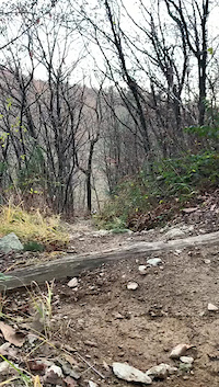
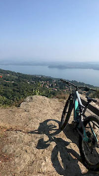
Photos of Novara Mountain Bike
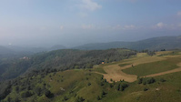
Videos of Novara Mountain Bike
trail: Santa Lucia
0:10 |
44 |
Nov 22, 2020

trail: Cico Trail
3:39 |
249 |
Jul 16, 2020
0:12 |
199 |
Oct 22, 2018
trail: Marambo trail (Monte Falò)
0:10 |
116 |
Sep 22, 2018
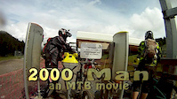
trail: 2000
3:07 |
245 |
Mar 14, 2015
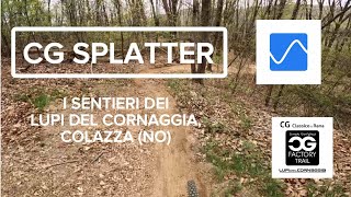
trail: CG Splatter
5:45 |
0 |
Jun 16, 2026 , Colazza
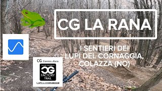
6:58 |
16 |
May 29, 2026 , Colazza
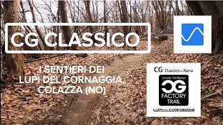
6:24 |
18 |
May 29, 2026 , Colazza
Current Trail Warnings
| status | trail | date | condition | user | info |
|---|---|---|---|---|---|
| Fox trail Armeno | Jun 14, 2026 @ 3:46pm (Europe/Rome) Jun 14, 2026 | Ideal | marambo | Large tree down across trail, blocking trail | |
| dal guado al Termine Armeno | Jun 3, 2026 @ 12:57pm (Europe/Rome) Jun 3, 2026 | Unknown | marambo | E-Bike Chiuso per la presenza di tanti alberi a... | |
| Variante Singletrack Dorsale Armeno | May 30, 2026 @ 6:20pm (Europe/Rome) May 30, 2026 | Dry | marambo | E-Bike Il sentiero è stato “liberato” dalle... |
Recent Trail Reports
Activity Feed
| username | action | type | title | date |
|---|---|---|---|---|
| Reca1965 | vote | trail | activity #97186002 | Jun 17, 2026 @ 8:31am 11 hours |
| Reca1965 | vote | trail | activity #97185994 and 1 more | Jun 17, 2026 @ 8:31am 11 hours |
| alpinemattiyt | add | photo | activity #97164502 | Jun 16, 2026 @ 11:09pm 20 hours |
| alpinemattiyt | add | video | activity #97164481 | Jun 16, 2026 @ 11:09pm 20 hours |
| adessoomaipiu | ridden | trail | activity #97028269 | Jun 15, 2026 @ 1:43am 3 days |
Recent Comments
| username | type | title | comment | date |
|---|---|---|---|---|
| report | Traccia completamente persa….tutto da rifare! | Jun 14, 2026 @ 6:47am Jun 14, 2026 | ||
| trail | partenza facile per i successivi classici di... | May 14, 2026 @ 8:54am May 14, 2026 | ||
| trail | top trail per me!!! | May 14, 2026 @ 8:51am May 14, 2026 | ||
| trail | bellissimo e super curato | May 14, 2026 @ 8:51am May 14, 2026 | ||
| trail | molto dura | May 14, 2026 @ 8:50am May 14, 2026 |
Local Badges
-

Epic Ride 50k129 awarded -

Descent 10k Badge32 awarded -

Descent 100k Badge0 awarded -

Big Ride 30k513 awarded -

Epic Ride Descent 2k67 awarded -

Top 10 Trails0 awarded
Bike & Skill Parks
| name | type | city | rating |
|---|---|---|---|
| MX Armeno | skill park | Sovazza | |
| MX Bellinzago | skill park | Bellinzago Novarese | |
| Pumptrack Ghevio | skill park | Colazza | |
| MX Maggiora | skill park | Maggiora |
Activity Type Stats
| activitytype | trails | distance | descent | descent distance | total vertical | rating | global rank | state rank | photos | reports | routes | ridelogs |
|---|---|---|---|---|---|---|---|---|---|---|---|---|
| Mountain Bike | 269 | 228 miles | 59,022 ft | 110 miles | 4,183 ft | 716 | 5,085 | 22 | 28,167 | |||
| E-Bike | 226 | 181 miles | 42,890 ft | 85 miles | 4,183 ft | 49 | 4,909 | 12 | 8,523 | |||
| Gravel Bike | 2 | 25 | 3 | 85 | ||||||||
| Adaptive Bike | 1 | 4 | ||||||||||
| Winter Fat Bike | 3 | 21 | ||||||||||
| Horse | 36 | 25 miles | 285 ft | 5 miles | 2,474 ft | 366 | ||||||
| Hike | 231 | 200 miles | 50,617 ft | 95 miles | 4,183 ft | 9 | 4,956 | 691 | ||||
| Trail Running | 234 | 202 miles | 51,506 ft | 97 miles | 4,183 ft | 4,979 | 436 | |||||
| Dirtbike/Moto | 2 | 2,772 ft | 20 ft | 364 | 4 | |||||||
| ATV/ORV/OHV | 1 | 2,772 ft | 20 ft | 361 |
Frequently Asked Questions About Novara
▼
What are the best places to ride in Novara?
Novara has 5 areas to explore for mountain biking. The top rated areas are:
▼
What are the highest rated mountain biking trails in Novara?
The highest rated mountain biking trails in Novara are:
- CG Classico - Lupi del Cornaggia (4.6/5)
- Sex-ty - Lupi del Cornaggia (4.5/5)
- Lòzio variante (4.5/5)
- CG Splatter (4.5/5)
- Lòzio 2025 (4.5/5)
▼
What is the best time of the year to ride in Novara?
Based on ride log data, the most popular months to ride in Novara are:
- May (100 activities)
- June (87 activities)
- October (74 activities)
▼
What is the longest trail in Novara?
The longest trail in Novara is Fiume Sesia - Amazon Hub (Canale Cavour) at 13.5 km. View all trails sorted by distance.
Activities
Trails
Points of Interest
- Ponticello Other
- Parco Naturale dei Lagoni di Mercurago Sight
- San Carlone Sight
- Panoramic view Viewpoint
- Ponte pericoloso - Dangerous bridge
- Vista su Alpe Verdina e Mottarone Viewpoint
- Alpe Verdina e Monte Rosa Viewpoint
- Cascata Nascosta Viewpoint
- Sasso Priatecia Sight
- View of the Maggiore Lakeb Viewpoint
- Monte Mazzarone (1,137 m)
- Monte del Falò (1,070 m)
- Mazzaronetto (1,063 m)
- By denitopia
 TRAILFORKS VTA & contributors
 - Admins: denitopia, marcoangeletti, cemoorelife, silviu86, adessoomaipiu
- #11637 - 8,263 views
- novara activity log | embed map of Novara mountain bike trails | novara mountain biking points of interest
Downloading of trail gps tracks in kml & gpx formats is enabled for Novara.
You must login to download files.