close
-
Layers w
- Weather Layers
- Pro
- Pro
- Pro
- Pro
- Pro
- Pro
- More Layers
- Pro
- Pro
- Pro
- Pro
-
Upgrade to

3D
Trail Conditions
- Unknown
- Snow Groomed
- Snow Packed
- Snow Covered
- Snow Cover Partial
- Freeze/thaw Cycle
- Icy
- Prevalent Mud
- Wet
- Variable
- Ideal
- Dry
- Very Dry
Trail Flow (Ridden Direction)
Trailforks scans users ridelogs to determine the most popular direction each trail is ridden. A good flowing trail network will have most trails flowing in a single direction according to their intension.
The colour categories are based on what percentage of riders are riding a trail in its intended direction.
The colour categories are based on what percentage of riders are riding a trail in its intended direction.
- > 96%
- > 90%
- > 80%
- > 70%
- > 50%
- < 50%
- bi-directional trail
- no data
Trail Last Ridden
Trailforks scans ridelogs to determine the last time a trail was ridden.
- < 2 days
- < 1 week
- < 2 weeks
- < 1 month
- < 6 months
- > 6 months
Trail Ridden Direction
The intended direction a trail should be ridden.
- Downhill Only
- Downhill Primary
- Both Directions
- Uphill Primary
- Uphill Only
- One Direction
Contribute Details
Colors indicate trail is missing specified detail.
- Description
- Photos
- Description & Photos
- Videos
Trail Popularity ?
Trailforks scans ridelogs to determine which trails are ridden the most in the last 9 months.
Trails are compared with nearby trails in the same city region with a possible 25 colour shades.
Think of this as a heatmap, more rides = more kinetic energy = warmer colors.
- most popular
- popular
- less popular
- not popular
ATV/ORV/OHV Filter
Max Vehicle Width
inches
US Cell Coverage
Legend

Radar Time
Activity Recordings
Trailforks uses anonymized public activity data.
?
Activity Recordings
Trailforks uses anonymized public activity data.
?
Personal Heatmap
▶
Activity Types
all
/
none
▶
Options
2
Date range
month
–
Winter Trails
Warning
A routing network for winter maps does not exist. Selecting trails using the winter trails layer has been disabled.
Missing Trails
Most Popular
Least Popular
Trails are colored based on popularity. The more popular a trail is, the more red. Less popular trails trend towards green.
Jump Magnitude Heatmap
Heatmap of where riders jump on trails. Zoom in to see individual jumps, click circles to view jump details.
BC Backroad Status
![map legend]()
Service Road Atlas is a free to use, community-driven service for viewing and creating reports on the numerous back-country service roads around B.C. and Alberta.

Slope Aspect
Direction the slope faces
Trails Deemphasized
Trails are shown in grey.
Only show trails with no bike usage.
Suggested Layers
Based on selected activity type
Save the current map location and zoom level as your default home location whenever this page is loaded.
Save
No description for Nowy Targ has been added yet!
Login or register to submit one.
This region uses the Uk/Euro style trail grading system.
Activities Click to view
- Mountain Bike
17 trails
- E-Bike
15 trails
- Adaptive Bike
0 trails
- Horse
0 trails
- Hike
18 trails
- Trail Running
17 trails
- Observed Trials
0 trails
- Snowshoe
0 trails
- Downhill Ski
0 trails
- Backcountry Ski
1 trails
- Nordic Ski
3 trails
Region Details
- 5
- 2
- 7
- 2
Region Status
Open as of May 28, 2026Stats
- Avg Trail Rating
- Trails (view details)
- 19
- Trails Mountain Bike
- 17
- Trails E-Bike
- 15
- Trails Hike
- 18
- Trails Trail Running
- 17
- Trails Backcountry Ski
- 1
- Trails Nordic Ski
- 3
- Total Distance
- 53 miles
- Total Descent
- 11,727 ft
- Total Vertical
- 2,370 ft
- Highest Trailhead
- 4,202 ft
- Reports
- 41
- Photos
- 5
- Ridden Counter
- 998
Popular Nowy Targ Mountain Biking Trails
• 90 ★ 3.0 • 2 miles • 303 ft • 190 • • hike
Czerwony szlak rowerowy - odcinek z Turbacza na Kiczorę przez Halę Długą.
• 75 ★ 5.0 • 4 miles • 194 ft • 96 • • hike
Kiczora - przeł. Knurowska. Szlak rowerowy i pieszy, fragment Głównego Szlaku Beskidzkiego. Jeden z ciekawszych zjazdów w Gorcach, zróżnicowany pod względem nachylenia, podłoża i otoczenia.
• 95 ★ 0.0 • 2 miles • 0 ft • 31 • • hike
Popular blue difficulty wilderness trail. This hike primary trail can be used both directions and has a moderate overall physical rating with a 0 ft black diamond climb. Trail visibility is sometimes hard to follow. On average it takes 6 minutes to complete this trail.
• ★ 5.0 • 7 miles • 1,776 ft • 27 • • skixc
Trasa Sladami Olimpijczykow z Obidowej na Turbacz. 500m przewyzszenia w gore, ok 11km.
• 65 ★ 0.0 • 3 miles • 134 ft • 26 •
Moderately popular blue difficulty wilderness trail. This mountain bike primary trail can be used both directions and has a easy overall physical rating with a 134 ft blue climb. Trail visibility is always easy to follow. On average it takes 34 minutes to complete this trail.
• 70 ★ 0.0 • 4 miles • 1,639 ft • 17 •
Popular blue difficulty mixed. This mountain bike primary trail can be used both directions and has a moderate overall physical rating with a 1,639 ft blue climb. Trail visibility is always easy to follow. On average it takes 1 hour43 minutes to complete this trail.
• 20 ★ 2.3 • 7 miles • 0 ft • 14 •
Less popular red difficulty mixed. This mountain bike primary trail can be used both directions and has a hard overall physical rating with a 0 ft black diamond climb. Trail visibility is always easy to follow. On average it takes 1 hour12 minutes to complete this trail.
• 60 ★ 0.0 • 3 miles • 0 ft • 13 •
Moderately popular blue difficulty singletrack. This mountain bike primary trail can be used both directions and has a moderate overall physical rating with a 0 ft black diamond climb. Trail visibility is always easy to follow. On average it takes 23 minutes to complete this trail.
Videos of Nowy Targ Mountain Bike
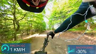
trail: Tropem Wilczej Watahy
22:40 |
459 |
Nov 20, 2023 , Nowy Targ
Recent Trail Reports
| status | trail | date | condition | info | user |
|---|---|---|---|---|---|
| Hala Bukowina Miejska | May 28, 2026 @ 10:34am (Europe/Budapest) May 28, 2026 | Ideal | slavio | ||
| Turbacz - Kiczora | May 28, 2026 @ 10:34am (Europe/Budapest) May 28, 2026 | Ideal | slavio | ||
| Turban | May 28, 2026 @ 10:34am (Europe/Budapest) May 28, 2026 | Ideal | slavio | ||
| Kiczora Knurowska | Oct 11, 2025 @ 10:47am (Europe/Budapest) Oct 11, 2025 | Prevalent Mud | R62 | ||
| Tropem Wilczej Watahy | Sep 27, 2025 @ 8:58am (Europe/Warsaw) Sep 26, 2025 | Unknown | AliaksandrCZPcWJ | ||
| Jezioro Czorsztyńskie - Dębno | Aug 8, 2025 @ 7:00am Aug 8, 2025 | Ideal | Vlado95 | ||
| Trasa 5 | Dec 15, 2024 @ 9:55am Dec 15, 2024 | Snow Covered | MsSlowmo |
Activity Feed
| username | action | type | title | date |
|---|---|---|---|---|
| pStawros | wishlist | trail | activity #97579087 | Jun 22, 2026 @ 12:34pm 22 hours |
| slavio | add | report | activity #95760837 and 2 more | May 29, 2026 @ 12:38am May 29, 2026 |
| mrmarcs | difficultyvote | trail | activity #94493649 | May 11, 2026 @ 7:32am May 11, 2026 |
| mrmarcs | ridden | trail | activity #94493464 and 1 more | May 11, 2026 @ 7:28am May 11, 2026 |
| MalbiMTB | comment | trail | activity #84031452 | Nov 12, 2025 @ 11:09am Nov 12, 2025 |
Recent Comments
| username | type | title | comment | date |
|---|---|---|---|---|
| trail | Ktoś chętny na ogarnięcie nowych singli z... | Nov 12, 2025 @ 11:09am Nov 12, 2025 | ||
| trail | Tak jak poprzednicy pisali, nic ciekawego,... | May 4, 2024 @ 4:22am May 4, 2024 | ||
| trail | ale to nie singiel raczej ? | Nov 20, 2023 @ 6:05am Nov 20, 2023 | ||
| trail | Nic ciekawego, szeroka utwardzona droga, w... | Aug 16, 2022 @ 12:19pm Aug 16, 2022 | ||
| trail | Ścieżka jest legalna. To oficjalny gminny... | Jun 9, 2022 @ 12:25am Jun 9, 2022 |
Local Badges
-

Epic Mountain Bike Climb 2k24 awarded -

Climbing 10k Badge5 awarded -

Mountain Biking 100k Badge0 awarded -

Epic Ride Descent 2k24 awarded -

Descent 10k Badge5 awarded -

Descent 100k Badge0 awarded
Activity Type Stats
| activitytype | trails | distance | descent | descent distance | total vertical | rating | global rank | state rank | photos | reports | routes | ridelogs |
|---|---|---|---|---|---|---|---|---|---|---|---|---|
| Mountain Bike | 17 | 39 miles | 10,164 ft | 23 miles | 2,352 ft | #7,931 | #216 | 5 | 39 | 1,771 | ||
| E-Bike | 15 | 34 miles | 8,235 ft | 19 miles | 2,323 ft | #3,095 | #309 | 35 | 531 | |||
| Hike | 18 | 44 miles | 10,955 ft | 25 miles | 2,352 ft | #4,314 | #78 | 39 | 424 | |||
| Trail Running | 17 | 44 miles | 10,955 ft | 25 miles | 2,352 ft | #4,028 | #70 | 39 | 52 | |||
| Backcountry Ski | 1 | 2 miles | 469 ft | 2 miles | 463 ft | #378 | #41 | 2 | 151 | |||
| Nordic Ski | 3 | 9 miles | 774 ft | 3 miles | 1,637 ft | #75 | #19 | 2 | 71 |
Frequently Asked Questions About Nowy Targ
▼
What are the highest rated mountain biking trails in Nowy Targ?
The highest rated mountain biking trails in Nowy Targ are:
- Kiczora Knurowska (4.1/5)
- Tropem Wilczej Watahy (3.9/5)
- Turbacz - Kiczora (3.8/5)
- Trasa 5 (0/5)
- Trasa 7 (0/5)
▼
What is the best time of the year to ride in Nowy Targ?
Based on ride log data, the most popular months to ride in Nowy Targ are:
- September (9 activities)
- August (9 activities)
- May (6 activities)
▼
Where can I park to ride in Nowy Targ?
Check the Nowy Targ trail map for trailhead and parking information. Community members regularly update access and parking details for trails in the area.
▼
What is the longest trail in Nowy Targ?
The longest trail in Nowy Targ is Tropem Wilczej Watahy at 10.6 km. View all trails sorted by distance.
Activities
Trails
- By piterbiker & contributors
- Admins: apply
- #19648 - 3,658 views
- nowy targ activity log | embed map of Nowy Targ mountain bike trails | nowy targ mountain biking points of interest
Downloading of trail gps tracks in kml & gpx formats is enabled for Nowy Targ.
You must login to download files.