close
-
Layers w
- Weather Layers
- Pro
- Pro
- Pro
- Pro
- Pro
- Pro
- More Layers
- Pro
- Pro
- Pro
- Pro
-
Upgrade to

3D
Trail Conditions
- Unknown
- Snow Groomed
- Snow Packed
- Snow Covered
- Snow Cover Partial
- Freeze/thaw Cycle
- Icy
- Prevalent Mud
- Wet
- Variable
- Ideal
- Dry
- Very Dry
Trail Flow (Ridden Direction)
Trailforks scans users ridelogs to determine the most popular direction each trail is ridden. A good flowing trail network will have most trails flowing in a single direction according to their intension.
The colour categories are based on what percentage of riders are riding a trail in its intended direction.
The colour categories are based on what percentage of riders are riding a trail in its intended direction.
- > 96%
- > 90%
- > 80%
- > 70%
- > 50%
- < 50%
- bi-directional trail
- no data
Trail Last Ridden
Trailforks scans ridelogs to determine the last time a trail was ridden.
- < 2 days
- < 1 week
- < 2 weeks
- < 1 month
- < 6 months
- > 6 months
Trail Ridden Direction
The intended direction a trail should be ridden.
- Downhill Only
- Downhill Primary
- Both Directions
- Uphill Primary
- Uphill Only
- One Direction
Contribute Details
Colors indicate trail is missing specified detail.
- Description
- Photos
- Description & Photos
- Videos
Trail Popularity ?
Trailforks scans ridelogs to determine which trails are ridden the most in the last 9 months.
Trails are compared with nearby trails in the same city region with a possible 25 colour shades.
Think of this as a heatmap, more rides = more kinetic energy = warmer colors.
- most popular
- popular
- less popular
- not popular
ATV/ORV/OHV Filter
Max Vehicle Width
inches
US Cell Coverage
Legend

Radar Time
Activity Recordings
Trailforks uses anonymized public activity data.
?
Activity Recordings
Trailforks uses anonymized public activity data.
?
Personal Heatmap
▶
Activity Types
all
/
none
▶
Options
2
Date range
month
–
Winter Trails
Warning
A routing network for winter maps does not exist. Selecting trails using the winter trails layer has been disabled.
Missing Trails
Most Popular
Least Popular
Trails are colored based on popularity. The more popular a trail is, the more red. Less popular trails trend towards green.
Jump Magnitude Heatmap
Heatmap of where riders jump on trails. Zoom in to see individual jumps, click circles to view jump details.
BC Backroad Status
![map legend]()
Service Road Atlas is a free to use, community-driven service for viewing and creating reports on the numerous back-country service roads around B.C. and Alberta.

Slope Aspect
Direction the slope faces
Trails Deemphasized
Trails are shown in grey.
Only show trails with no bike usage.
Suggested Layers
Based on selected activity type
Save the current map location and zoom level as your default home location whenever this page is loaded.
Save
No description for Nucla has been added yet!
Login or register to submit one.
Activities Click to view
- Mountain Bike
66 trails
- E-Bike
68 trails
- Adaptive Bike
0 trails
- Horse
6 trails
- Hike
75 trails
- Trail Running
56 trails
- Dirtbike/Moto
6 trails
Region Details
- 33
- 4
- 21
- 6
Region Status
Open as of Jun 6, 2026Stats
- Avg Trail Rating
- Trails (view details)
- 70
- Trails Mountain Bike
- 69
- Trails E-Bike
- 68
- Trails Horse
- 6
- Trails Hike
- 75
- Trails Trail Running
- 56
- Trails Dirtbike/Moto
- 6
- Trails Observed Trials
- 1
- Trails ATV/ORV/OHV
- 1
- Total Distance
- 395 miles
- Total Descent Distance
- 187 miles
- Total Descent
- 45,391 ft
- Total Vertical
- 5,133 ft
- Highest Trailhead
- 9,942 ft
- Reports
- 34
- Photos
- 123
- Ridden Counter
- 541
Sub Regions
-
Nucla Range Trails
- 7
-
Nucla/Naturita Area Trails
- 3
- 13
- 6
Popular Nucla Mountain Biking Trails
• 90 ★ 3.0 • 1,745 ft • 68 ft • 27 •
Popular blue difficulty singletrack. This mountain bike primary trail can be used both directions with a 68 ft blue climb. On average it takes 6 minutes to complete this trail.
• 100 ★ 0.0 • 3,012 ft • 153 ft • 20 •
Popular blue difficulty family friendly singletrack. This mountain bike primary trail can be used both directions and has a moderate overall physical rating with a 153 ft blue climb. Trail visibility is always easy to follow. On average it takes 5 minutes to complete this trail.
• 85 ★ 5.0 • 3 miles • 154 ft • 17 •
Dropping 1000' over the first four miles, this section of trail is a great introduction to West End Jank! You'll find loose, chunky rock gardens with some small, rollable drops throughout the doubletrack. It rides technical, fast and...
• 85 ★ 0.0 • 10 miles • 346 ft • 14 •
The Tabeguache and Paradox Trails meet about 6 miles north of Iron Springs CG just off the . Follow the PT signs to the Hauser Rd (FS 603). The Hauser Rd drops off the west side of the Uncompaghre Plateau as it heads down to the Delta...
• 50 ★ 0.0 • 15 miles • 2,196 ft • 11 •
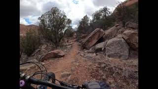
The Naturita Ridge Loop brings users to the top of Naturita Ridge and through two old burn areas. The ride starts from CR GG 25 about one mile from Hwy 90 and the Coke Oven Ranch. The two track climbs steadily and sometimes steeply...
• 80 ★ 0.0 • 12 miles • 1,453 ft • 11 •
From the Nucla Trailhead parking area the old two track climbs to the top of the low ridge. Follow the PT signs as it continues to climb until reaching the new singletrack section. The singletrack goes for about 2 miles dropping to...
• 95 ★ 0.0 • 1,765 ft • 48 ft • 10 •
Popular blue difficulty singletrack. This mountain bike primary trail can be used both directions. On average it takes 4 minutes to complete this trail.
• 100 ★ 0.0 • 325 ft • 0 ft • 10 •
Popular blue difficulty singletrack. This mountain bike primary trail can be used both directions with a 0 ft blue climb. On average it takes minutes to complete this trail.
Nucla Mountain Bike Routes
Photos of Nucla Mountain Bike
Videos of Nucla Mountain Bike
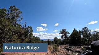
trail: Naturita Ridge Loop
5:34 |
119 |
Oct 14, 2024 , Nucla
trail: Shamrock (Y-11)
7:52 |
248 |
Jan 27, 2023 , Nucla
Recent Trail Reports
| status | trail | date | condition | info | user |
|---|---|---|---|---|---|
| Bucktail Draw Loop | Mar 29, 2026 @ 7:50am (America/Denver) Mar 29, 2026 | Unknown | timtait WETA | ||
| Ricochet | Oct 16, 2025 @ 4:24pm (America/Denver) Oct 16, 2025 | Unknown | domy98 | ||
| Connector to Paradox | Oct 16, 2025 @ 4:24pm (America/Denver) Oct 16, 2025 | Unknown | domy98 | ||
| Red Eye | Oct 16, 2025 @ 4:24pm (America/Denver) Oct 16, 2025 | Unknown | domy98 | ||
| Crapshoot | Oct 16, 2025 @ 4:24pm (America/Denver) Oct 16, 2025 | Unknown | domy98 | ||
| Paradox Trail - Hauser Road ( FS 603) | Aug 4, 2024 @ 12:26pm Aug 4, 2024 | Unknown | timtait WETA | ||
| Paradox Trail- Glencoe Bench to Pinto Mesa | Oct 6, 2024 @ 6:56am Oct 6, 2024 | Unknown | timtait WETA | ||
| Naturita Ridge Loop | Sep 23, 2024 @ 11:12am Sep 23, 2024 | Ideal | falcon013 | ||
| Paradox Trail - Pinto Mesa to Coal Canyon | Aug 4, 2024 @ 12:27pm Aug 4, 2024 | Unknown | timtait WETA | ||
| Paradox Trail -Spring Creek Mesa to Mesa Cr | May 5, 2024 @ 5:22pm May 5, 2024 | Ideal | timtait WETA |
Activity Feed
| username | action | type | title | date |
|---|---|---|---|---|
| B6ItbQ | wishlist | route | activity #95751045 | May 28, 2026 @ 7:16pm May 28, 2026 |
| SMcM | wishlist | region | activity #94110966 | May 5, 2026 @ 1:13pm May 5, 2026 |
| HRVVC8m0 | ridden | trail | activity #94092180 | May 5, 2026 @ 8:24am May 5, 2026 |
| JessJoy | wishlist | route | activity #93577065 | Apr 28, 2026 @ 6:40am Apr 28, 2026 |
| Klonsky24 | wishlist | region | activity #92358491 | Apr 10, 2026 @ 6:22pm Apr 10, 2026 |
Recent Comments
| username | type | title | comment | date |
|---|---|---|---|---|
| trail | It seems like the recent rains have done some... | Sep 14, 2025 @ 8:39am Sep 14, 2025 | ||
| trail | On the downhill side, there appears to be two... | Sep 24, 2024 @ 9:45am Sep 24, 2024 | ||
| trail | I absolutely loved this trail. It was techy... | Oct 31, 2023 @ 10:06pm Oct 31, 2023 | ||
| report | This section of the Paradox Trail has been... | Oct 4, 2023 @ 3:37pm Oct 4, 2023 | ||
| report | The GlenCoe section of the PT has been cleared... | Oct 4, 2023 @ 3:33pm Oct 4, 2023 |
Local Badges
-

Completionist0 awarded -

10 Blue Trails1 awarded -

Epic Mountain Bike Climb 2k7 awarded -

Climbing 10k Badge1 awarded -

Mountain Biking 100k Badge0 awarded -

Epic Ride Descent 2k7 awarded
Activity Type Stats
| activitytype | trails | distance | descent | descent distance | total vertical | rating | global rank | state rank | photos | reports | routes | ridelogs |
|---|---|---|---|---|---|---|---|---|---|---|---|---|
| Mountain Bike | 66 | 374 miles | 40,955 ft | 177 miles | 5,135 ft | #823 | #321 | 123 | 34 | 1 | 670 | |
| E-Bike | 68 | 374 miles | 40,955 ft | 177 miles | 5,135 ft | #292 | #681 | 20 | 12 | |||
| Horse | 6 | 40 miles | 4,354 ft | 18 miles | 4,672 ft | #1,416 | #845 | 4 | ||||
| Hike | 75 | 395 miles | 45,390 ft | 187 miles | 5,135 ft | #468 | #217 | 9 | 34 | 50 | ||
| Trail Running | 56 | 348 miles | 40,764 ft | 168 miles | 5,135 ft | #410 | #163 | 34 | 13 | |||
| Dirtbike/Moto | 6 | 60 miles | 3,743 ft | 17 miles | 4,895 ft | #668 | #229 | 4 | 9 | |||
| Observed Trials | 1 | 27 miles | 367 ft | 3 miles | 4,154 ft | 1 | ||||||
| ATV/ORV/OHV | 1 | 27 miles | 367 ft | 3 miles | 4,154 ft | 3 |
Frequently Asked Questions About Nucla
▼
What are the best places to ride in Nucla?
Nucla has 2 areas to explore for mountain biking. The top rated areas are:
▼
What are the highest rated mountain biking trails in Nucla?
The highest rated mountain biking trails in Nucla are:
- Paradox Trail - Pinto Mesa to Coal Canyon (4.1/5)
- Mears Trail (4/5)
- Ricochet (3.8/5)
- Crapshoot (0/5)
- Red Eye (0/5)
▼
What is the best time of the year to ride in Nucla?
Based on ride log data, the most popular months to ride in Nucla are:
- August (3 activities)
- June (3 activities)
- July (2 activities)
▼
Where can I park to ride in Nucla?
There are 3 parking locations listed in Nucla. The most popular parking spots are: View all parking and trailhead locations on the map to plan your visit.
Activities
Trails
Points of Interest
- CampV campground Camping
- CampV Glamping Lodge
- Tabeguache Creek campsite Camping
- Upper Spring Creek Mesa Campsite Camping
- Pinto Mesa Campsite near the Indian Trail Camping
- Pinto Mesa West Rim Campsite Camping
- Blackburn Upper Tabeguache Campsite Camping
- Reade Hill (9,728 ft)
- Spruce Mountain (9,724 ft)
- Uncompahgre Butte (9,662 ft)
- By WestEndTrails
 & contributors
 - Admins: WETA
- #27505 - 3,065 views
- nucla activity log | embed map of Nucla mountain bike trails | nucla mountain biking points of interest
Downloading of trail gps tracks in kml & gpx formats is enabled for Nucla.
You must login to download files.