close
-
Layers w
- Weather Layers
- Pro
- Pro
- Pro
- Pro
- Pro
- Pro
- More Layers
- Pro
- Pro
- Pro
- Pro
-
Upgrade to

3D
Trail Conditions
- Unknown
- Snow Groomed
- Snow Packed
- Snow Covered
- Snow Cover Partial
- Freeze/thaw Cycle
- Icy
- Prevalent Mud
- Wet
- Variable
- Ideal
- Dry
- Very Dry
Trail Flow (Ridden Direction)
Trailforks scans users ridelogs to determine the most popular direction each trail is ridden. A good flowing trail network will have most trails flowing in a single direction according to their intension.
The colour categories are based on what percentage of riders are riding a trail in its intended direction.
The colour categories are based on what percentage of riders are riding a trail in its intended direction.
- > 96%
- > 90%
- > 80%
- > 70%
- > 50%
- < 50%
- bi-directional trail
- no data
Trail Last Ridden
Trailforks scans ridelogs to determine the last time a trail was ridden.
- < 2 days
- < 1 week
- < 2 weeks
- < 1 month
- < 6 months
- > 6 months
Trail Ridden Direction
The intended direction a trail should be ridden.
- Downhill Only
- Downhill Primary
- Both Directions
- Uphill Primary
- Uphill Only
- One Direction
Contribute Details
Colors indicate trail is missing specified detail.
- Description
- Photos
- Description & Photos
- Videos
Trail Popularity ?
Trailforks scans ridelogs to determine which trails are ridden the most in the last 9 months.
Trails are compared with nearby trails in the same city region with a possible 25 colour shades.
Think of this as a heatmap, more rides = more kinetic energy = warmer colors.
- most popular
- popular
- less popular
- not popular
ATV/ORV/OHV Filter
Max Vehicle Width
inches
US Cell Coverage
Legend

Radar Time
Activity Recordings
Trailforks uses anonymized public activity data.
?
Activity Recordings
Trailforks uses anonymized public activity data.
?
Personal Heatmap
▶
Activity Types
all
/
none
▶
Options
2
Date range
month
–
Winter Trails
Warning
A routing network for winter maps does not exist. Selecting trails using the winter trails layer has been disabled.
Missing Trails
Most Popular
Least Popular
Trails are colored based on popularity. The more popular a trail is, the more red. Less popular trails trend towards green.
Jump Magnitude Heatmap
Heatmap of where riders jump on trails. Zoom in to see individual jumps, click circles to view jump details.
BC Backroad Status
![map legend]()
Service Road Atlas is a free to use, community-driven service for viewing and creating reports on the numerous back-country service roads around B.C. and Alberta.

Slope Aspect
Direction the slope faces
Trails Deemphasized
Trails are shown in grey.
Only show trails with no bike usage.
Suggested Layers
Based on selected activity type
Save the current map location and zoom level as your default home location whenever this page is loaded.
SaveIn Hawaii, each island has it's own unique flavor of trails. This is the Oahu collection.
Region Details
- 20
- 44
- 98
- 45
- 10
- 1
Stats
- Avg Trail Rating
- Trails (view details)
- 310
- Trails Mountain Bike
- 252
- Trails E-Bike
- 44
- Trails Horse
- 10
- Trails Hike
- 330
- Trails Trail Running
- 321
- Trails Dirtbike/Moto
- 3
- Trails Observed Trials
- 6
- Trails ATV/ORV/OHV
- 1
- Trails Snowmobile
- 1
- Total Distance
- 313 miles
- Total Descent
- 93,286 ft
- Total Vertical
- 3,997 ft
- Highest Trailhead
- 3,998 ft
- Reports
- 1,808
- Photos
- 1,989
- Ridden Counter
- 33,642
Popular Trail Networks
view all areas »Sub Regions
- Central (Oahu) (8)
- Pearl City (6)
- Wahiawa (1)
- Pearl City (6)
- Leeward (Oahu) (7)
- Makakilo (2)
- Camp Timberline (2)
- Waianae (5)
- Makaha Valley (5)
- Makakilo (2)
- North Shore (Oahu) (138)
- Hauula (4)
- Kahuku (5)
- Laie (18)
- Laie Falls (18)
- Mokuleia (14)
- Peacock Flats (11)
- Pupukea (102)
- Hauula (4)
- South Shore (Oahu) (9)
- Honolulu (9)
- Honolulu (9)
- Windward (Oahu) (78)
- Kailua (78)
- Olomana Trails (72)
- Ahupuaʻa ʻO Kahana State Park (0)
- Kaaawa Valley (0)
- Kailua (78)
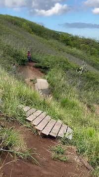
Popular Oahu Mountain Biking Trails
• 100 ★ 4.0 • 481 ft • 0 ft • 503 •
Popular blue difficulty singletrack. This mountain bike primary trail can be used downhill primary. On average it takes minutes to complete this trail.
• 100 ★ 3.4 • 1,130 ft • 4 ft • 376 •
is a "park style" trail, with over a dozen optional features. Depending on the line that you choose, the difficulty level ranges from blue to black. All features have go-arounds, and a few have small/medium/large . If you plan to...
• 100 ★ 3.0 • 472 ft • 0 ft • 354 •
A short techy descent that bypasses the White Fence's hairpin turn. Normally very dry, but challenging when wet.
• 95 ★ 4.7 • 985 ft • 15 ft • 319 •
Technically a part of Party Line, but in the opposite direction. Two small table top dirt jumps. Good place to practice jumps.
• 95 ★ 4.0 • 420 ft • 33 ft • 299 •
Short connector trail that allows you to hit Urban Legend and continue on Hula Girl to Lilikoi Junction
• 80 ★ 3.5 • 1 mile • 78 ft • 282 •
Popular blue difficulty singletrack. This mountain bike primary trail can be used both directions and has a moderate overall physical rating with a 78 ft blue climb. On average it takes 11 minutes to complete this trail.
Oahu Mountain Bike Routes
★ 4.5 • 21 miles • 3,266 ft • 5 • Loop •
The Peacock to Kealia Loop is an island favorite. When locals want a technically and physically...
6 miles • 943 ft • 3 •
Your basic Ohana loop from the Norfolk lines up and around, using Od Kalanianaole Hwy back up.
2,589 ft • 270 ft • 4 • Point to Point •
Climb from Ditch trail to near but below junction
13 miles • 1,966 ft • 11 •
Created to explore the trails by a visitor. Intermediate ride. The tour starts in the North at the start...
★ 2.0 • 10 miles • 1,531 ft • 7 •
epic ride. found a new trail. DA CHIZZ
11 miles • 1,666 ft • 18 • Loop •
This is a fun little route that I like to do. It has a little bit of everything. Beware of hula-girl in...
Photos of Oahu Mountain Bike
Videos of Oahu Mountain Bike

trail: Upper Desperado
0:21 |
120 |
Nov 8, 2023

0:06 |
42 |
Jul 11, 2023

0:06 |
18 |
Jul 11, 2023

0:05 |
44 |
Mar 13, 2023

0:06 |
29 |
Mar 13, 2023
0:05 |
15 |
Mar 13, 2023

0:13 |
33 |
Feb 7, 2023

trail: Dat's A Keeper
2:10 |
200 |
Apr 14, 2022
Recent Trail Reports
Activity Feed
| username | action | type | title | date |
|---|---|---|---|---|
| Jennieuev9TW | wishlist | route | activity #97454622 | Jun 20, 2026 @ 9:29pm 20 hours |
| Jasonrpool | wishlist | region | activity #96741790 | Jun 11, 2026 @ 9:07am Jun 11, 2026 |
| gjhicken | add | report | activity #96405427 and 1 more | Jun 6, 2026 @ 2:12pm Jun 6, 2026 |
| DTJB | add | report | activity #96397730 | Jun 6, 2026 @ 12:34pm Jun 6, 2026 |
| Jasonrpool | wishlist | region | activity #96045725 | Jun 1, 2026 @ 3:52pm Jun 1, 2026 |
Recent Comments
| username | type | title | comment | date |
|---|---|---|---|---|
| report | Approx. location = 21.33879,-157.75734 | Aug 16, 2025 @ 2:46pm Aug 16, 2025 | ||
| trail | Loved all the features on this trail. Dry... | May 10, 2025 @ 12:04am May 10, 2025 | ||
| trail | Rides nice. Clear and dry now. Liked the... | May 10, 2025 @ 12:03am May 10, 2025 | ||
| trail | Rode up Poke Bowl today. Nice trail but wet... | May 10, 2025 @ 12:02am May 10, 2025 | ||
| trail | Hike this if you dare, but don’t attempt to... | Apr 9, 2025 @ 12:33am Apr 9, 2025 |
Local Badges
-

Big Ride 30k812 awarded -

Descent 100k Badge0 awarded -
Descent 100k Badge0 awarded -
Big Ride 30k54 awarded -
Descent 100k Badge6 awarded -
Big Ride 30k652 awarded
Bike & Skill Parks
| name | type | city | rating |
|---|---|---|---|
| Kahuku motocross (muligvis) | skill park | Pupukea |
Upcoming Local Events
-
-
Local Mountain Biking Directory
-
Bikeadelic Hawaii
![Bikeadelic Hawaii]()
-
HBL Dirt
![HBL Dirt]()
-
The Bike Shop - Honolulu
![The Bike Shop - Honolulu]() Bike Shop
Bike Shop
-
The Bike Shop - Kailua
![The Bike Shop - Kailua]() Bike Shop
Bike Shop
-
Bike Factory
Bike Shop
-
Mccully Bicycle & Sporting Goods
Bike Shop
Local Mountain Biking Directory
-
Bikeadelic Hawaii
![Bikeadelic Hawaii]()
-
HBL Dirt
![HBL Dirt]()
-
The Bike Shop - HonoluluBike Shop
![The Bike Shop - Honolulu]()
-
The Bike Shop - KailuaBike Shop
![The Bike Shop - Kailua]()
-
Bike FactoryBike Shop
-
Mccully Bicycle & Sporting GoodsBike Shop
Activity Type Stats
| activitytype | trails | distance | descent | descent distance | total vertical | rating | global rank | state rank | photos | reports | routes | ridelogs |
|---|---|---|---|---|---|---|---|---|---|---|---|---|
| Mountain Bike | 245 | 181 miles | 41,280 ft | 76 miles | 2,762 ft | 1,655 | 1,816 | 11 | 46,724 | |||
| E-Bike | 44 | 42 miles | 8,694 ft | 18 miles | 2,018 ft | 1,482 | 2 | 2,740 | ||||
| Horse | 10 | 4 miles | 633 ft | 2 miles | 515 ft | 322 | 11 | |||||
| Hike | 325 | 296 miles | 88,704 ft | 124 miles | 3,996 ft | 378 | 1,806 | 3 | 12,366 | |||
| Trail Running | 321 | 283 miles | 87,133 ft | 122 miles | 3,996 ft | 2 | 1,806 | 3 | 3,321 | |||
| Dirtbike/Moto | 3 | 10 miles | 1,814 ft | 3 miles | 643 ft | 2 | 316 | 98 | ||||
| Observed Trials | 6 | 2 miles | 404 ft | 1 mile | 217 ft | 62 | 5 | |||||
| ATV/ORV/OHV | 1 | 1 mile | 469 ft | 316 | 45 | |||||||
| Snowmobile | 1 | 1 mile | 174 ft | 2,854 ft | 259 ft |
Activities
Trails
Points of Interest
- Extra Gravy Rock Drop TTF
- Mount Olympus Summit
- Makapu’u Lookout Viewpoint
- Diamond Head Summit
- Summit Lookout Viewpoint
- [helipad] Diamond Head Helipad Other
- Rock Face+Wooden Ramp TTF
- Aihualama Falls Sight
- Ski Patrol Hut Summit
- Lookout Viewpoint
- Kaʻala (4,042 ft)
- Puʻukalena (3,478 ft)
- Kamaohanui (3,360 ft)
- By mikeysolis
 & contributors
 - Admins: apply
- #3276 - 61,470 views
- oahu activity log | embed map of Oahu mountain bike trails | oahu mountain biking points of interest
Downloading of trail gps tracks in kml & gpx formats is enabled for Oahu.
You must login to download files.