close
-
Layers w
- Weather Layers
- Pro
- Pro
- Pro
- Pro
- Pro
- Pro
- More Layers
- Pro
- Pro
- Pro
- Pro
-
Upgrade to

3D
Trail Conditions
- Unknown
- Snow Groomed
- Snow Packed
- Snow Covered
- Snow Cover Partial
- Freeze/thaw Cycle
- Icy
- Prevalent Mud
- Wet
- Variable
- Ideal
- Dry
- Very Dry
Trail Flow (Ridden Direction)
Trailforks scans users ridelogs to determine the most popular direction each trail is ridden. A good flowing trail network will have most trails flowing in a single direction according to their intension.
The colour categories are based on what percentage of riders are riding a trail in its intended direction.
The colour categories are based on what percentage of riders are riding a trail in its intended direction.
- > 96%
- > 90%
- > 80%
- > 70%
- > 50%
- < 50%
- bi-directional trail
- no data
Trail Last Ridden
Trailforks scans ridelogs to determine the last time a trail was ridden.
- < 2 days
- < 1 week
- < 2 weeks
- < 1 month
- < 6 months
- > 6 months
Trail Ridden Direction
The intended direction a trail should be ridden.
- Downhill Only
- Downhill Primary
- Both Directions
- Uphill Primary
- Uphill Only
- One Direction
Contribute Details
Colors indicate trail is missing specified detail.
- Description
- Photos
- Description & Photos
- Videos
Trail Popularity ?
Trailforks scans ridelogs to determine which trails are ridden the most in the last 9 months.
Trails are compared with nearby trails in the same city region with a possible 25 colour shades.
Think of this as a heatmap, more rides = more kinetic energy = warmer colors.
- most popular
- popular
- less popular
- not popular
ATV/ORV/OHV Filter
Max Vehicle Width
inches
US Cell Coverage
Legend

Radar Time
Activity Recordings
Trailforks uses anonymized public activity data.
?
Activity Recordings
Trailforks uses anonymized public activity data.
?
Personal Heatmap
▶
Activity Types
all
/
none
▶
Options
2
Date range
month
–
Winter Trails
Warning
A routing network for winter maps does not exist. Selecting trails using the winter trails layer has been disabled.
Missing Trails
Most Popular
Least Popular
Trails are colored based on popularity. The more popular a trail is, the more red. Less popular trails trend towards green.
Jump Magnitude Heatmap
Heatmap of where riders jump on trails. Zoom in to see individual jumps, click circles to view jump details.
BC Backroad Status
![map legend]()
Service Road Atlas is a free to use, community-driven service for viewing and creating reports on the numerous back-country service roads around B.C. and Alberta.

Slope Aspect
Direction the slope faces
Trails Deemphasized
Trails are shown in grey.
Only show trails with no bike usage.
Suggested Layers
Based on selected activity type
Save the current map location and zoom level as your default home location whenever this page is loaded.
Save
No description for Oak Harbor has been added yet!
Login or register to submit one.
Activities Click to view
- Mountain Bike
18 trails
- E-Bike
7 trails
- Adaptive Bike
0 trails
- Hike
68 trails
- Trail Running
68 trails
Region Details
- 1
- 5
- 12
Region Status
Open as of Apr 15, 2026Local Trail Association
Stats
- Avg Trail Rating
- Trails (view details)
- 68
- Trails Mountain Bike
- 18
- Trails E-Bike
- 7
- Trails Hike
- 68
- Trails Trail Running
- 68
- Total Distance
- 33 miles
- Total Descent
- 5,243 ft
- Total Vertical
- 490 ft
- Highest Trailhead
- 491 ft
- Reports
- 110
- Photos
- 41
- Ridden Counter
- 7,087
Sub Regions
-
Deception Pass State Park
-
Dugualla State Park
- 1
- 6
-
Hoypus Hill
- 4
- 6
Popular Oak Harbor Mountain Biking Trails
• 80 ★ 0.0 • 4,316 ft • 45 ft • 66 •
Popular blue difficulty singletrack. This mountain bike primary trail can be used both directions. On average it takes 6 minutes to complete this trail.
• 50 ★ 5.0 • 2,202 ft • 138 ft • 53 •
Moderately popular green difficulty singletrack. This mountain bike primary trail can be used both directions. On average it takes 6 minutes to complete this trail.
• 85 ★ 0.0 • 1,953 ft • 24 ft • 47 •
Popular blue difficulty singletrack. This mountain bike primary trail can be used both directions. On average it takes 3 minutes to complete this trail.
• 45 ★ 0.0 • 1,374 ft • 4 ft • 40 •
Moderately popular blue difficulty singletrack. This mountain bike primary trail can be used both directions. On average it takes 3 minutes to complete this trail.
• 40 ★ 0.0 • 4,494 ft • 153 ft • 39 •
Classic PNW cross country with some roots and a few rocks. Very fun to ride!!
• 60 ★ 0.0 • 4,595 ft • 164 ft • 36 •
Moderately popular green difficulty singletrack. This mountain bike primary trail can be used both directions. On average it takes 10 minutes to complete this trail.
• 35 ★ 0.0 • 4,188 ft • 55 ft • 32 •
Less popular blue difficulty singletrack. This mountain bike primary trail can be used both directions. On average it takes 13 minutes to complete this trail.
• 65 ★ 0.0 • 1,643 ft • 87 ft • 29 •
Moderately popular blue difficulty singletrack. This mountain bike primary trail can be used both directions. On average it takes 4 minutes to complete this trail.
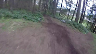
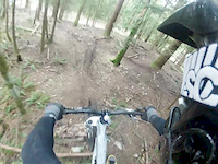
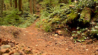
Photos of Oak Harbor Mountain Bike
Videos of Oak Harbor Mountain Bike
trail: Short Trail
0:25 |
176 |
Apr 5, 2015

trail: Short Trail
0:13 |
490 |
Jul 28, 2014

trail: Short Trail
0:05 |
147 |
Mar 31, 2014

trail: Short Trail
0:00 |
183 |
Feb 8, 2014
trail: Short Trail
0:37 |
454 |
Apr 23, 2013
trail: Short Trail
2:11 |
763 |
Nov 16, 2012

trail: Short Trail
0:47 |
56 |
Jan 13, 2011
Recent Trail Reports
| status | trail | date | condition | info | user |
|---|---|---|---|---|---|
| Big Marsh Trail | Jan 15, 2026 @ 10:08am (America/Los_Angeles) Jan 15, 2026 | Wet | jennekad | ||
| Fireside Trail | Jan 15, 2026 @ 10:02am (America/Los_Angeles) Jan 15, 2026 | Prevalent Mud | jennekad | ||
| Big Loop Trail | May 6, 2025 @ 4:06pm May 6, 2025 | Ideal | jennekad | ||
| Slug Slough | Dec 24, 2024 @ 3:06pm Dec 24, 2024 | Prevalent Mud | sailryan13 | ||
| Forest and Fern | Dec 24, 2024 @ 3:05pm Dec 24, 2024 | Prevalent Mud | sailryan13 | ||
| Little Alder Trail | Dec 24, 2024 @ 3:04pm Dec 24, 2024 | Prevalent Mud | sailryan13 | ||
| North Fork Trail | Dec 24, 2024 @ 3:02pm Dec 24, 2024 | Dry | sailryan13 | ||
| North Trail | Jul 17, 2024 @ 10:29am Jul 17, 2024 | Dry | Kangell | ||
| Slingshot Trail | Jan 14, 2024 @ 7:40am Jan 14, 2024 | Freeze/thaw Cycle | Kangell | ||
| Marsh Trail | Oct 12, 2023 @ 9:50am Oct 12, 2023 | Variable | Kangell |
Activity Feed
| username | action | type | title | date |
|---|---|---|---|---|
| TechieTedly | add | report | activity #92060821 and 1 more | Apr 6, 2026 @ 9:44am Apr 6, 2026 |
| jennekad | add | report | activity #87238109 and 1 more | Jan 15, 2026 @ 10:02am Jan 15, 2026 |
| cac528 | ridden | trail | activity #83873987 | Nov 9, 2025 @ 11:52am Nov 9, 2025 |
| k15235 | comment | trail | activity #80153464 | Sep 11, 2025 @ 7:28pm Sep 11, 2025 |
| dw18610 | wishlist | region | activity #75578715 | Jul 10, 2025 @ 3:01am Jul 10, 2025 |
Recent Comments
| username | type | title | comment | date |
|---|---|---|---|---|
| trail | Probably nettles. Wear pants/longsleeve. | Sep 11, 2025 @ 7:28pm Sep 11, 2025 | ||
| trail | Small Tree Down | May 26, 2025 @ 6:34am May 26, 2025 | ||
| trail | Many trees down, badly overgrown, do not... | May 26, 2025 @ 4:23am May 26, 2025 | ||
| trail | This was awful, all exposed skin got hit with... | Jun 18, 2024 @ 7:48pm Jun 18, 2024 | ||
| trail | ride from red to green for more flow and speed. | May 25, 2021 @ 2:55pm May 25, 2021 |
Local Badges
-

Epic Ride Climb 2k16 awarded -

Climbing 10k Badge9 awarded -

Climbing 100k Badge0 awarded -

Epic Ride Descent 2k16 awarded -

Descent 10k Badge9 awarded -

Descent 100k Badge0 awarded
Bike & Skill Parks
| name | type | city | rating |
|---|---|---|---|
| Whidbey Island Motocross LLC | skill park | Oak Harbor |
Activity Type Stats
| activitytype | trails | distance | descent | descent distance | total vertical | rating | global rank | state rank | photos | reports | routes | ridelogs |
|---|---|---|---|---|---|---|---|---|---|---|---|---|
| Mountain Bike | 18 | 12 miles | 1,299 ft | 6 miles | 341 ft | #6,144 | #2,078 | 37 | 110 | 2,525 | ||
| E-Bike | 7 | 5 miles | 686 ft | 3 miles | 341 ft | #7,398 | #2,232 | 91 | 58 | |||
| Hike | 68 | 33 miles | 5,243 ft | 15 miles | 489 ft | #3,711 | #1,310 | 4 | 100 | 4 | 1,078 | |
| Trail Running | 68 | 33 miles | 5,243 ft | 15 miles | 489 ft | #4,178 | #1,273 | 100 | 668 |
Frequently Asked Questions About Oak Harbor
▼
What are the best places to ride in Oak Harbor?
Oak Harbor has 4 areas to explore for mountain biking. The top rated areas are:
▼
What are the highest rated mountain biking trails in Oak Harbor?
The highest rated mountain biking trails in Oak Harbor are:
- Short Trail (4.1/5)
- North Trail (4/5)
- Marsh Trail (3.8/5)
- Little Alder Trail (0/5)
- Slingshot Trail (0/5)
▼
What is the best time of the year to ride in Oak Harbor?
Based on ride log data, the most popular months to ride in Oak Harbor are:
- July (28 activities)
- April (16 activities)
- May (12 activities)
▼
Where can I park to ride in Oak Harbor?
Activities
Trails
Points of Interest
- By Gonefishing4ever
 & contributors
 - Admins: EMBA-C2S
- #20433 - 4,507 views
- oak harbor activity log | embed map of Oak Harbor mountain bike trails | oak harbor mountain biking points of interest
Downloading of trail gps tracks in kml & gpx formats is enabled for Oak Harbor.
You must login to download files.