close
-
Layers w
- Weather Layers
- Pro
- Pro
- Pro
- Pro
- Pro
- Pro
- More Layers
- Pro
- Pro
- Pro
- Pro
-
Upgrade to

3D
Trail Conditions
- Unknown
- Snow Groomed
- Snow Packed
- Snow Covered
- Snow Cover Partial
- Freeze/thaw Cycle
- Icy
- Prevalent Mud
- Wet
- Variable
- Ideal
- Dry
- Very Dry
Trail Flow (Ridden Direction)
Trailforks scans users ridelogs to determine the most popular direction each trail is ridden. A good flowing trail network will have most trails flowing in a single direction according to their intension.
The colour categories are based on what percentage of riders are riding a trail in its intended direction.
The colour categories are based on what percentage of riders are riding a trail in its intended direction.
- > 96%
- > 90%
- > 80%
- > 70%
- > 50%
- < 50%
- bi-directional trail
- no data
Trail Last Ridden
Trailforks scans ridelogs to determine the last time a trail was ridden.
- < 2 days
- < 1 week
- < 2 weeks
- < 1 month
- < 6 months
- > 6 months
Trail Ridden Direction
The intended direction a trail should be ridden.
- Downhill Only
- Downhill Primary
- Both Directions
- Uphill Primary
- Uphill Only
- One Direction
Contribute Details
Colors indicate trail is missing specified detail.
- Description
- Photos
- Description & Photos
- Videos
Trail Popularity ?
Trailforks scans ridelogs to determine which trails are ridden the most in the last 9 months.
Trails are compared with nearby trails in the same city region with a possible 25 colour shades.
Think of this as a heatmap, more rides = more kinetic energy = warmer colors.
- most popular
- popular
- less popular
- not popular
ATV/ORV/OHV Filter
Max Vehicle Width
inches
US Cell Coverage
Legend

Radar Time
Activity Recordings
Trailforks uses anonymized public activity data.
?
Activity Recordings
Trailforks uses anonymized public activity data.
?
Personal Heatmap
▶
Activity Types
all
/
none
▶
Options
2
Date range
month
–
Winter Trails
Warning
A routing network for winter maps does not exist. Selecting trails using the winter trails layer has been disabled.
Missing Trails
Most Popular
Least Popular
Trails are colored based on popularity. The more popular a trail is, the more red. Less popular trails trend towards green.
Jump Magnitude Heatmap
Heatmap of where riders jump on trails. Zoom in to see individual jumps, click circles to view jump details.
BC Backroad Status
![map legend]()
Service Road Atlas is a free to use, community-driven service for viewing and creating reports on the numerous back-country service roads around B.C. and Alberta.

Slope Aspect
Direction the slope faces
Trails Deemphasized
Trails are shown in grey.
Only show trails with no bike usage.
Suggested Layers
Based on selected activity type
Save the current map location and zoom level as your default home location whenever this page is loaded.
SaveOak Mountain has trails for everyone There are downhill mountain biking trails, that range from beginner lever/family friendly to advanced level with some more technical terrain and jumps, and cross country biking trails. These trails can be hiked or used for trail running, but hikers and runners must yield to bikers. In the winter the downhill ski trails are open on the weekend, the snowshoe trail is open, and the cross country bike trails can be used as cross country ski trails.
Check out the Acorn Eatery at Oak Mtn for some delicious post-ride food! https://oakmountainski.com/things-to-do/dining
Check out the Acorn Eatery at Oak Mtn for some delicious post-ride food! https://oakmountainski.com/things-to-do/dining
Primary Trail Type: All-Mountain & Downhill
 google parking directions
 Disclaimer:
The bike park is closed for the season and will reopen in late May, or sooner if possible.
Links
Activities Click to view
- Mountain Bike
14 trails
- Hike
10 trails
- Trail Running
10 trails
Region Details
- 7
- 6
- 1
Region Status
Open as of Jun 9, 2026Stats
- Avg Trail Rating
- Trails (view details)
- 14
- Trails Mountain Bike
- 14
- Trails Hike
- 10
- Trails Trail Running
- 10
- Trails Snowshoe
- 2
- Trails Downhill Ski
- 1
- Trails Backcountry Ski
- 1
- Trails Nordic Ski
- 2
- Total Distance
- 7 miles
- Total Descent Distance
- 4 miles
- Total Descent
- 2,203 ft
- Total Vertical
- 598 ft
- Highest Trailhead
- 2,425 ft
- Reports
- 168
- Photos
- 32
- Ridden Counter
- 883
Popular Oak Mountain Mountain Biking Trails
• 100 ★ 5.0 • 3,130 ft • 77 ft • 100 •
Nice, family friendly trail up the Bunny Hill Slope that allows for easy access to other trails. It can be done as an access trail, or ride the loop around the island and back down the trail.
• 90 ★ 5.0 • 1 mile • 24 ft • 86 •
This is a fun, family-friendly trail that you can use to make a big loop or use as a connector to Smoothie. This trail goes out to a nice small pond and starts the climbing trail to the top of the mountain.
• 100 ★ 4.7 • 1 mile • 220 ft • 83 •
" " is the continuation of the climbing trail to the summit. Don't be surprised when you drop elevation, sometimes you got to take a step back to move forward and upward but - it's .....
• 75 ★ 5.0 • 984 ft • 14 ft • 73 •
Great little cross-country loop that is fun for the whole family!
• 95 ★ 5.0 • 797 ft • 0 ft • 62 •
Short trail that connects to Electric Ave, fun and flowy!
• 60 ★ 4.7 • 3,228 ft • 0 ft • 58 •
Moderately popular blue difficulty singletrack. This mountain bike primary trail can be used downhill only and has a moderate overall physical rating. It features bridge, drop, jump, rock face and wallride. On average it takes 4 minutes to complete this trail.
• 80 ★ 5.0 • 1,460 ft • 30 ft • 55 •
a fun stacked loop off of " ." best ridden clockwise. berms, jumps with easy go arounds. kid friendly. aka "fun size"
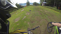
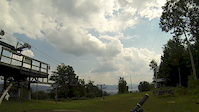
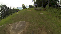
Photos of Oak Mountain Mountain Bike
Videos of Oak Mountain Mountain Bike
trail: Lupin
3:58 |
373 |
Oct 6, 2014
trail: Electric Avenue
2:30 |
340 |
Oct 6, 2014
trail: Supernova
0:12 |
492 |
Jul 15, 2014

trail: Lupin
1231 |
Oct 12, 2016 , Speculator

trail: Electric Avenue
761 |
Oct 12, 2016 , Speculator
Recent Trail Reports
| status | trail | date | condition | info | user |
|---|---|---|---|---|---|
| Worth It | Jun 9, 2026 @ 9:10am (America/New_York) Jun 9, 2026 | Unknown | charliechar | ||
| Venom Flow | Jun 9, 2026 @ 9:10am (America/New_York) Jun 9, 2026 | Unknown | charliechar | ||
| Snickers | Jun 9, 2026 @ 9:10am (America/New_York) Jun 9, 2026 | Unknown | charliechar | ||
| Smoothie | Jun 9, 2026 @ 9:10am (America/New_York) Jun 9, 2026 | Unknown | charliechar | ||
| Party of 5 | Jun 9, 2026 @ 9:10am (America/New_York) Jun 9, 2026 | Unknown | charliechar | ||
| Lupin | Jun 9, 2026 @ 9:10am (America/New_York) Jun 9, 2026 | Unknown | charliechar | ||
| JSmurf | Jun 9, 2026 @ 9:10am (America/New_York) Jun 9, 2026 | Unknown | charliechar | ||
| Groovin | Jun 9, 2026 @ 9:10am (America/New_York) Jun 9, 2026 | Unknown | charliechar | ||
| Grimm | Jun 9, 2026 @ 9:10am (America/New_York) Jun 9, 2026 | Unknown | charliechar | ||
| Electric Avenue | Jun 9, 2026 @ 9:10am (America/New_York) Jun 9, 2026 | Unknown | charliechar |
Activity Feed
| username | action | type | title | date |
|---|---|---|---|---|
| Christine2eVItT | wishlist | region | activity #96644366 | Jun 9, 2026 @ 6:10pm Jun 9, 2026 |
| charliechar | add | report | activity #96600590 and 12 more | Jun 9, 2026 @ 6:10am Jun 9, 2026 |
| markholloway | add | report | activity #85021797 and 13 more | Dec 1, 2025 @ 10:58am Dec 1, 2025 |
| ajperrin2 | wishlist | region | activity #82030844 | Oct 9, 2025 @ 3:32pm Oct 9, 2025 |
| Woodsman1111 | add | report | activity #80862775 | Sep 21, 2025 @ 3:15pm Sep 21, 2025 |
Recent Comments
| username | type | title | comment | date |
|---|---|---|---|---|
| trail | The trial WAS in great shape. Sorry about my... | May 25, 2025 @ 5:54pm May 25, 2025 | ||
| trail | Thank you to the people who maintain and... | May 25, 2025 @ 5:54pm May 25, 2025 | ||
| report | Ride at your own risk, two bridges are out-... | Sep 27, 2024 @ 6:26am Sep 27, 2024 | ||
| trail | There is a ride a round just below the head... | Jul 25, 2024 @ 8:20am Jul 25, 2024 | ||
| report | Cleared! Thanks for the tip. Trails are... | Jul 25, 2024 @ 8:07am Jul 25, 2024 |
Nearby Areas
| name | distance | ||||
|---|---|---|---|---|---|
| Perkins Clearing and Speculator Tree Farm Conservation | 3.1 km | ||||
| Moose River Plains Wild Forest (Eastern Region) | 16.4 km | ||||
| Garnet Hill Lodge | 5 | 5 | 3 | 19.2 km | |
| Gore Mountain | 4 | 6 | 3 | 20.1 km | |
| Moose River Plains Wild Forest (Western Region) | 5 | 5 | 21.2 km |
Activity Type Stats
| activitytype | trails | distance | descent | descent distance | total vertical | rating | global rank | state rank | photos | reports | routes | ridelogs |
|---|---|---|---|---|---|---|---|---|---|---|---|---|
| Mountain Bike | 14 | 7 miles | 2,205 ft | 4 miles | 597 ft | #4,856 | #1,746 | 32 | 168 | 521 | ||
| Hike | 10 | 5 miles | 1,001 ft | 3 miles | 597 ft | #15,184 | #6,792 | 145 | 116 | |||
| Trail Running | 10 | 5 miles | 1,001 ft | 3 miles | 597 ft | #14,135 | #5,978 | 145 | 48 | |||
| Snowshoe | 2 | 2,946 ft | 79 ft | 1,296 ft | 256 ft | #719 | #427 | 30 | 13 | |||
| Downhill Ski | 1 | 1,486 ft | 33 ft | 443 ft | 36 ft | #136 | 28 | 48 | ||||
| Backcountry Ski | 1 | 1,486 ft | 33 ft | 443 ft | 36 ft | #355 | 28 | 9 | ||||
| Nordic Ski | 2 | 2,470 ft | 46 ft | 735 ft | 518 ft | #77 | #58 | 30 | 31 |
Frequently Asked Questions About Oak Mountain
▼
What are the highest rated mountain biking trails in Oak Mountain?
The highest rated mountain biking trails in Oak Mountain are:
- Party of 5 (4.2/5)
- Venom Flow (4.2/5)
- JSmurf (4.2/5)
- Worth It (4.2/5)
- Electric Avenue (4.2/5)
▼
What is the best time of the year to ride in Oak Mountain?
Based on ride log data, the most popular months to ride in Oak Mountain are:
- July (23 activities)
- August (15 activities)
- September (8 activities)
▼
Where can I park to ride in Oak Mountain?
There are 1 parking locations listed in Oak Mountain. The most popular parking spots are:
▼
What is the longest trail in Oak Mountain?
The longest trail in Oak Mountain is JSmurf at 1.3 miles. View all trails sorted by distance.
Activities
Trails
Points of Interest
- By OneLapWonder
 & contributors
 - Admins: OMBA
- #16428 - 11,060 views
- oak mountain activity log | embed map of Oak Mountain mountain bike trails | oak mountain mountain biking points of interest
Downloading of trail gps tracks in kml & gpx formats is enabled for Oak Mountain.
You must login to download files.