close
-
Layers w
- Weather Layers
- Pro
- Pro
- Pro
- Pro
- Pro
- Pro
- More Layers
- Pro
- Pro
- Pro
- Pro
-
Upgrade to

3D
Trail Conditions
- Unknown
- Snow Groomed
- Snow Packed
- Snow Covered
- Snow Cover Partial
- Freeze/thaw Cycle
- Icy
- Prevalent Mud
- Wet
- Variable
- Ideal
- Dry
- Very Dry
Trail Flow (Ridden Direction)
Trailforks scans users ridelogs to determine the most popular direction each trail is ridden. A good flowing trail network will have most trails flowing in a single direction according to their intension.
The colour categories are based on what percentage of riders are riding a trail in its intended direction.
The colour categories are based on what percentage of riders are riding a trail in its intended direction.
- > 96%
- > 90%
- > 80%
- > 70%
- > 50%
- < 50%
- bi-directional trail
- no data
Trail Last Ridden
Trailforks scans ridelogs to determine the last time a trail was ridden.
- < 2 days
- < 1 week
- < 2 weeks
- < 1 month
- < 6 months
- > 6 months
Trail Ridden Direction
The intended direction a trail should be ridden.
- Downhill Only
- Downhill Primary
- Both Directions
- Uphill Primary
- Uphill Only
- One Direction
Contribute Details
Colors indicate trail is missing specified detail.
- Description
- Photos
- Description & Photos
- Videos
Trail Popularity ?
Trailforks scans ridelogs to determine which trails are ridden the most in the last 9 months.
Trails are compared with nearby trails in the same city region with a possible 25 colour shades.
Think of this as a heatmap, more rides = more kinetic energy = warmer colors.
- most popular
- popular
- less popular
- not popular
ATV/ORV/OHV Filter
Max Vehicle Width
inches
US Cell Coverage
Legend

Radar Time
Activity Recordings
Trailforks uses anonymized public activity data.
?
Activity Recordings
Trailforks uses anonymized public activity data.
?
Personal Heatmap
▶
Activity Types
all
/
none
▶
Options
2
Date range
month
–
Winter Trails
Warning
A routing network for winter maps does not exist. Selecting trails using the winter trails layer has been disabled.
Missing Trails
Most Popular
Least Popular
Trails are colored based on popularity. The more popular a trail is, the more red. Less popular trails trend towards green.
Jump Magnitude Heatmap
Heatmap of where riders jump on trails. Zoom in to see individual jumps, click circles to view jump details.
BC Backroad Status
![map legend]()
Service Road Atlas is a free to use, community-driven service for viewing and creating reports on the numerous back-country service roads around B.C. and Alberta.

Slope Aspect
Direction the slope faces
Trails Deemphasized
Trails are shown in grey.
Only show trails with no bike usage.
Suggested Layers
Based on selected activity type
Save the current map location and zoom level as your default home location whenever this page is loaded.
Save
No description for Oakland has been added yet!
Login or register to submit one.
Activities Click to view
- Mountain Bike
93 trails
- Gravel Bike
0 trails
- Adaptive Bike
0 trails
- Winter Fat Bike
0 trails
- Horse
31 trails
- Hike
127 trails
- Trail Running
126 trails
Region Details
- 25
- 2
- 25
- 20
- 6
- 2
Region Status
Caution as of Jun 4, 2026Stats
- Avg Trail Rating
- Trails (view details)
- 107
- Trails Mountain Bike
- 93
- Trails E-Bike
- 1
- Trails Horse
- 31
- Trails Hike
- 127
- Trails Trail Running
- 126
- Total Distance
- 64 miles
- Total Descent
- 14,634 ft
- Total Vertical
- 1,363 ft
- Highest Trailhead
- 1,576 ft
- Reports
- 2,199
- Photos
- 220
- Ridden Counter
- 60,969
Sub Regions
-
Joaquin Miller Park (JMP)
- 2
- 8
- 15
- 4
- 1
-
Leona Canyon Regional Open Space Preserve
- 4
- 1
-
Leona Heights Park
- 3
- 1
- 1
-
Redwood Regional Park
- 10
- 4
- 1
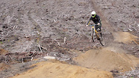
Popular Oakland Mountain Biking Trails
• 100 ★ 4.1 • 3,871 ft • 10 ft • 2,274 •
This trail between Sequoia and is a flowy downhill trail. For new or intermediate riders, it has features that are quite technical. Several of them come up fast without clean sight lines. Take it easy on your first ride. The trail can...
• 100 ★ 4.3 • 3,255 ft • 27 ft • 1,912 •
This is the eastern trail. There is another section that connects from the service road near the bathrooms down to the
• 95 ★ 3.7 • 1,545 ft • 0 ft • 1,846 •
There are a few sections to this trail. This middle section is open to bikes, but you cannot continue south past the Cabin, that is for hiking only.
• 95 ★ 4.3 • 2 miles • 162 ft • 1,789 •
Highly rated popular green difficulty doubletrack. This mountain bike primary trail. On average it takes 13 minutes to complete this trail.
• 100 ★ 3.2 • 680 ft • 0 ft • 1,652 •
Popular blue difficulty singletrack. This mountain bike primary trail can be used both directions. On average it takes 1 minutes to complete this trail.
• 95 ★ 4.1 • 1,014 ft • 0 ft • 1,553 •
Short with lots of roots and dips
• 90 ★ 4.1 • 1,916 ft • 0 ft • 1,334 •
This trail is not a trail for beginners. It is rated Black due to relative difficulty to other JMP blue trails, and the fact that this trail is JMP's bone breaker, especially with clipped XC riders. Please do not avoid the trail...
• 90 ★ 4.0 • 1,404 ft • 108 ft • 1,206 •
Trail drops you from the bathrooms down to the
Oakland Mountain Bike Routes
★ 4.7 • 8 miles • 1,194 ft • 30 • Loop •
Starts at Ranger station parking lot at 3540 Sanborn Dr, Oakland, CA. Uses to get to . Climbs up , cruises...
★ 4.0 • 10 miles • 1,479 ft • 7 • Out & Back •
Smorgasbord of easy, fun doubletrack mixed with a few short, kick your ass climbs and some techy rock...
★ 4.0 • 5 miles • 695 ft • 8 •
Joaquin Miller Park loop that is good for sessioning. One way loop only. Watch for hikers.
★ 4.5 • 8 miles • 1,124 ft • 5 •
Perfect for a mid morning. Going up the and down the west is the easier route. the west gets steep and...
★ 5.0 • 24 miles • 3,027 ft • 6 •
This the route from the 2018 East Bay Dirt Classic (short ride). I imported it from an export from Ride...
★ 4.0 • 2 miles • 185 ft • 7 • Loop •
A small awesome loop with minimal climbing, start at the Sequoia-Bayview Trail head on Skyline Blvd Side,...
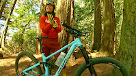
Photos of Oakland Mountain Bike
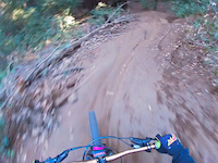
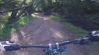
Videos of Oakland Mountain Bike
trail: McDonell
3:28 |
104 |
Jul 20, 2023
trail: Cinderella
2:01 |
194 |
Mar 25, 2021
trail: Cinderella
0:09 |
|
Dec 9, 2020

trail: Chaparral
2:24 |
36 |
Nov 20, 2020

trail: Chaparral
0:57 |
159 |
Jun 19, 2019

trail: Cinderella
0:04 |
798 |
Jun 22, 2017
trail: Cinderella
0:46 |
530 |
Jan 29, 2017
trail: West Ridge
3:20 |
321 |
Oct 5, 2016
Recent Trail Reports
| status | trail | date | condition | info | user |
|---|---|---|---|---|---|
| Palos Colorados | Jun 4, 2026 @ 2:58pm (America/Los_Angeles) Jun 4, 2026 | Very Dry | wwlighting | ||
| Orchard Trail | Jun 4, 2026 @ 2:58pm (America/Los_Angeles) Jun 4, 2026 | Very Dry | wwlighting | ||
| Cinderella | Jun 4, 2026 @ 2:58pm (America/Los_Angeles) Jun 4, 2026 | Very Dry | wwlighting | ||
| Castle Park (DH) | Jun 1, 2026 @ 5:31pm (America/Los_Angeles) Jun 1, 2026 | Dry | ArjangcaTHa7 | ||
| Big Trees (outer) | May 22, 2026 @ 9:59am (America/Los_Angeles) May 22, 2026 | Dry | Grvlspec | ||
| Scout Trail | Apr 27, 2026 @ 10:20am (America/Los_Angeles) Apr 27, 2026 | Dry | rickinlo | ||
| West Trail | Apr 27, 2026 @ 10:20am (America/Los_Angeles) Apr 27, 2026 | Dry | rickinlo | ||
| Conncector Conncector | Apr 27, 2026 @ 10:20am (America/Los_Angeles) Apr 27, 2026 | Dry | rickinlo | ||
| Big Trees (inner) | Apr 27, 2026 @ 10:20am (America/Los_Angeles) Apr 27, 2026 | Dry | rickinlo | ||
| Duke Ruffin (Tipi) | Apr 27, 2026 @ 10:20am (America/Los_Angeles) Apr 27, 2026 | Ideal | rickinlo |
Activity Feed
| username | action | type | title | date |
|---|---|---|---|---|
| rowdyrulez | wishlist | trail | activity #97260991 and 1 more | Jun 18, 2026 @ 10:21am 3 days |
| ArjangcaTHa7 | vote | trail | activity #97179348 and 1 more | Jun 17, 2026 @ 6:40am Jun 17, 2026 |
| thatcubingguy | difficultyvote | trail | activity #97007194 | Jun 14, 2026 @ 3:01pm Jun 14, 2026 |
| rmbrandt89 | wishlist | route | activity #97002577 | Jun 14, 2026 @ 1:54pm Jun 14, 2026 |
| mongolithic | wishlist | route | activity #96938239 | Jun 13, 2026 @ 9:28pm Jun 13, 2026 |
Recent Comments
| username | type | title | comment | date |
|---|---|---|---|---|
| trail | fun trail but overgrown. fun fast technical | Jun 6, 2026 @ 5:45pm Jun 6, 2026 | ||
| trail | No not ride this trail. Its impassable to... | Apr 28, 2026 @ 10:29am Apr 28, 2026 | ||
| trail | When there isn't rocks slowing you down? Lol... | Apr 17, 2026 @ 9:20am Apr 17, 2026 | ||
| report | Tree down (8” diameter?) west end on the... | Apr 14, 2026 @ 6:27pm Apr 14, 2026 | ||
| trail | The climbs at both ends are loose. Poison oak... | Apr 10, 2026 @ 10:08am Apr 10, 2026 |
Local Badges
-

10 Green Trails610 awarded -

10 Blue Trails838 awarded -

Epic Ride Climb 2k430 awarded -

Climbing 10k Badge465 awarded -

Climbing 100k Badge50 awarded -

Epic Ride Descent 2k434 awarded
Bike & Skill Parks
| name | type | city | rating |
|---|---|---|---|
| Oakland Pump Track | skill park | Oakland |
Activity Type Stats
| activitytype | trails | distance | descent | descent distance | total vertical | rating | global rank | state rank | photos | reports | routes | ridelogs |
|---|---|---|---|---|---|---|---|---|---|---|---|---|
| Mountain Bike | 93 | 44 miles | 7,861 ft | 22 miles | 1,312 ft | #324 | #120 | 217 | 2,201 | 19 | 62,576 | |
| E-Bike | 1 | 5 miles | 322 ft | 2 miles | 948 ft | 1,831 | 3,204 | |||||
| Horse | 31 | 18 miles | 6,506 ft | 8 miles | 1,037 ft | #1,524 | #897 | 394 | 11 | |||
| Hike | 127 | 64 miles | 14,633 ft | 30 miles | 1,362 ft | #1,908 | #825 | 7 | 2,193 | 2 | 4,936 | |
| Trail Running | 126 | 64 miles | 14,501 ft | 30 miles | 1,362 ft | #1,941 | #630 | 2,193 | 1 | 2,991 |
Frequently Asked Questions About Oakland
▼
What are the best places to ride in Oakland?
Oakland has 5 areas to explore for mountain biking. The top rated areas are:
▼
What are the highest rated mountain biking trails in Oakland?
The highest rated mountain biking trails in Oakland are:
- Big Trees (outer) (4.3/5)
- Sequoia-Bayview Trail (4.2/5)
- McDonell (4.1/5)
- Bayview (4.1/5)
- Castle Park (XC) (4.1/5)
▼
What is the best time of the year to ride in Oakland?
Based on ride log data, the most popular months to ride in Oakland are:
- July (325 activities)
- August (289 activities)
- September (262 activities)
▼
Where can I park to ride in Oakland?
There are 14 parking locations listed in Oakland. The most popular parking spots are: View all parking and trailhead locations on the map to plan your visit.
Activities
Trails
- By splatworldwide & contributors
- Admins: BTCEB
- #7706 - 20,588 views
- oakland activity log | embed map of Oakland mountain bike trails | oakland mountain biking points of interest
Downloading of trail gps tracks in kml & gpx formats is enabled for Oakland.
You must login to download files.