close
-
Layers w
- Weather Layers
- Pro
- Pro
- Pro
- Pro
- Pro
- Pro
- More Layers
- Pro
- Pro
- Pro
- Pro
-
Upgrade to

3D
Trail Conditions
- Unknown
- Snow Groomed
- Snow Packed
- Snow Covered
- Snow Cover Partial
- Freeze/thaw Cycle
- Icy
- Prevalent Mud
- Wet
- Variable
- Ideal
- Dry
- Very Dry
Trail Flow (Ridden Direction)
Trailforks scans users ridelogs to determine the most popular direction each trail is ridden. A good flowing trail network will have most trails flowing in a single direction according to their intension.
The colour categories are based on what percentage of riders are riding a trail in its intended direction.
The colour categories are based on what percentage of riders are riding a trail in its intended direction.
- > 96%
- > 90%
- > 80%
- > 70%
- > 50%
- < 50%
- bi-directional trail
- no data
Trail Last Ridden
Trailforks scans ridelogs to determine the last time a trail was ridden.
- < 2 days
- < 1 week
- < 2 weeks
- < 1 month
- < 6 months
- > 6 months
Trail Ridden Direction
The intended direction a trail should be ridden.
- Downhill Only
- Downhill Primary
- Both Directions
- Uphill Primary
- Uphill Only
- One Direction
Contribute Details
Colors indicate trail is missing specified detail.
- Description
- Photos
- Description & Photos
- Videos
Trail Popularity ?
Trailforks scans ridelogs to determine which trails are ridden the most in the last 9 months.
Trails are compared with nearby trails in the same city region with a possible 25 colour shades.
Think of this as a heatmap, more rides = more kinetic energy = warmer colors.
- most popular
- popular
- less popular
- not popular
ATV/ORV/OHV Filter
Max Vehicle Width
inches
US Cell Coverage
Legend

Radar Time
Activity Recordings
Trailforks uses anonymized public activity data.
?
Activity Recordings
Trailforks uses anonymized public activity data.
?
Personal Heatmap
▶
Activity Types
all
/
none
▶
Options
2
Date range
month
–
Winter Trails
Warning
A routing network for winter maps does not exist. Selecting trails using the winter trails layer has been disabled.
Missing Trails
Most Popular
Least Popular
Trails are colored based on popularity. The more popular a trail is, the more red. Less popular trails trend towards green.
Jump Magnitude Heatmap
Heatmap of where riders jump on trails. Zoom in to see individual jumps, click circles to view jump details.
BC Backroad Status
![map legend]()
Service Road Atlas is a free to use, community-driven service for viewing and creating reports on the numerous back-country service roads around B.C. and Alberta.

Slope Aspect
Direction the slope faces
Trails Deemphasized
Trails are shown in grey.
Only show trails with no bike usage.
Suggested Layers
Based on selected activity type
Save the current map location and zoom level as your default home location whenever this page is loaded.
Save
No description for Oakville has been added yet!
Login or register to submit one.
Activities Click to view
- Mountain Bike
116 trails
- E-Bike
12 trails
- Adaptive Bike
0 trails
- Winter Fat Bike
0 trails
- Hike
102 trails
- Trail Running
101 trails
- Snowshoe
18 trails
Region Details
- 27
- 2
- 45
- 29
- 9
- 4
Region Status
Open as of Jun 15, 2026Stats
- Avg Trail Rating
- Trails (view details)
- 117
- Trails Mountain Bike
- 116
- Trails E-Bike
- 12
- Trails Hike
- 102
- Trails Trail Running
- 101
- Trails Snowshoe
- 18
- Total Distance
- 52 miles
- Total Descent
- 3,368 ft
- Total Vertical
- 309 ft
- Highest Trailhead
- 553 ft
- Reports
- 486
- Photos
- 302
- Ridden Counter
- 6,538
Sub Regions
-
14 Mile Creek
- 1
- 1
- 1
-
16 Mile Creek
- 21
- 13
- 5
- 1
-
Bronte Creek Provincial Park
- 9
- 10
- 3
-
Ennisclare Park
- 4
- 1
- 1
-
Glenorchy Conservation Area
-
Joshua's Valley Park
- 10
- 14
- 1
- 3
Popular Oakville Mountain Biking Trails
• 100 ★ 4.2 • 2 miles • 173 ft • 493 •
You can start riding here around late April as long as it's dry, the trails north of Dundas handle water much better than the trails south. South of Dundas the trail is easy and flat, with few roots, making it good for new riders. As...
• 100 ★ 3.4 • 2,372 ft • 9 ft • 349 •
Popular green difficulty doubletrack. This multi-use trail can be used both directions. On average it takes 2 minutes to complete this trail.
• 100 ★ 3.4 • 492 ft • 5 ft • 307 •
A short trail that takes you through fields of gold.
• 95 ★ 3.5 • 2,881 ft • 27 ft • 258 •
Popular green difficulty singletrack. This multi-use trail can be used both directions and has a easy overall physical rating with a 27 ft green climb. Trail visibility is always easy to follow. On average it takes 2 minutes to complete this trail.
• 100 ★ 4.5 • 1,463 ft • 0 ft • 211 •
Trails runs right along the edge of the 12 mile creek ravine.
• 95 ★ 3.0 • 1,565 ft • 16 ft • 176 •
Popular green difficulty family friendly singletrack. This multi-use trail can be used both directions. On average it takes 1 minutes to complete this trail.
Oakville Mountain Bike Routes
5 miles • 431 ft • 3 • Out & Back •
A classic rip through Bronte Creek. You can also venture off onto some of the side trails.
• 7 miles • 783 ft • 4 •
• 9 miles • 526 ft • 5 •
• 10 miles • 784 ft • 5 •
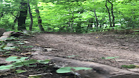
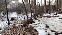
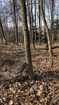
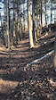
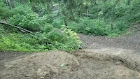
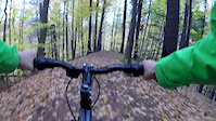
Photos of Oakville Mountain Bike
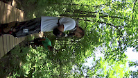
Videos of Oakville Mountain Bike
trail: 14 Mile Creek-South
0:11 |
|
Sep 7, 2021
trail: B-Line
0:46 |
533 |
Feb 8, 2021

trail: Scallywag
0:50 |
105 |
Apr 4, 2020
trail: O-Line
0:07 |
231 |
Apr 3, 2020
0:10 |
56 |
Apr 3, 2020
trail: Joshua's Run
0:05 |
1179 |
Aug 5, 2018
trail: Brace For Impact
0:11 |
1472 |
Oct 24, 2017
trail: Over the River
0:26 |
140 |
Jul 10, 2016
Recent Trail Reports
| status | trail | date | condition | info | user |
|---|---|---|---|---|---|
| Bronte Creek Field Trail | Jun 13, 2026 @ 6:53pm (America/Toronto) Jun 13, 2026 | Ideal | Sauljea | ||
| Field Connector | Jun 13, 2026 @ 6:53pm (America/Toronto) Jun 13, 2026 | Ideal | Sauljea | ||
| Bronte Creek South Extention | Jun 12, 2026 @ 8:01pm (America/Toronto) Jun 12, 2026 | Variable | Sauljea | ||
| Gateway Trail | Jun 12, 2026 @ 8:01pm (America/Toronto) Jun 12, 2026 | Ideal | Sauljea | ||
| Edge of Glory | May 11, 2026 @ 9:36am (America/Toronto) May 11, 2026 | Ideal | Jpennock99 | ||
| Upper Joshua's Run | May 11, 2026 @ 8:19am (America/Toronto) May 11, 2026 | Ideal | Jpennock99 | ||
| O-Line | May 9, 2026 @ 3:59pm (America/Toronto) May 9, 2026 | Ideal | Jpennock99 | ||
| Joshua's Run | May 9, 2026 @ 3:57pm (America/Toronto) May 9, 2026 | Ideal | Jpennock99 | ||
| Escarpment Trail | May 9, 2026 @ 3:56pm (America/Toronto) May 9, 2026 | Variable | Jpennock99 | ||
| NOS | May 9, 2026 @ 3:53pm (America/Toronto) May 9, 2026 | Ideal | Jpennock99 |
Activity Feed
| username | action | type | title | date |
|---|---|---|---|---|
| stik81 | wishlist | trail | activity #97293610 | Jun 18, 2026 @ 8:13pm 1 day |
| Sauljea | vote | trail | activity #97055867 and 3 more | Jun 15, 2026 @ 11:37am Jun 15, 2026 |
| Sauljea | add | report | activity #96927722 and 1 more | Jun 13, 2026 @ 5:12pm Jun 13, 2026 |
| Sauljea | add | report | activity #96843255 and 2 more | Jun 12, 2026 @ 7:07pm Jun 12, 2026 |
| markholloway | update | trail | activity #96679714 and 3 more | Jun 10, 2026 @ 9:49am Jun 10, 2026 |
Recent Comments
| username | type | title | comment | date |
|---|---|---|---|---|
| trail | I ride here often. Every hill is... | Aug 28, 2025 @ 7:33am Aug 28, 2025 | ||
| trail | Na | Aug 19, 2025 @ 9:25am Aug 19, 2025 | ||
| trail | This trail is closed due the trail restoration | Aug 13, 2025 @ 9:19am Aug 13, 2025 | ||
| report | Nooice | Sep 22, 2024 @ 4:43pm Sep 22, 2024 | ||
| trail | I feel that there should be three categories... | Jul 29, 2024 @ 3:12pm Jul 29, 2024 |
Local Badges
-

10 Green Trails103 awarded -

10 Blue Trails42 awarded -

Epic Ride Climb 2k2 awarded -

Climbing 10k Badge39 awarded -

Climbing 100k Badge0 awarded -

Epic Ride Descent 2k3 awarded
Bike & Skill Parks
| name | type | city | rating |
|---|---|---|---|
| Shell Skateboard Park | skill park | Oakville |
Local Mountain Biking Directory
-
Cyclepath OakvilleBike Shop
![Cyclepath Oakville]()
-
Racer Sportif OakvilleBike Shop
Activity Type Stats
| activitytype | trails | distance | descent | descent distance | total vertical | rating | global rank | state rank | photos | reports | routes | ridelogs |
|---|---|---|---|---|---|---|---|---|---|---|---|---|
| Mountain Bike | 116 | 52 miles | 3,366 ft | 20 miles | 308 ft | #1,239 | #33 | 207 | 482 | 1 | 15,670 | |
| E-Bike | 12 | 7 miles | 407 ft | 3 miles | 266 ft | #4,649 | #81 | 331 | 138 | |||
| Hike | 102 | 51 miles | 3,110 ft | 20 miles | 308 ft | #628 | #15 | 86 | 469 | 1,148 | ||
| Trail Running | 101 | 49 miles | 3,156 ft | 20 miles | 308 ft | #2,387 | #40 | 469 | 2,664 | |||
| Snowshoe | 18 | 12 miles | 1,362 ft | 5 miles | 197 ft | #683 | #71 | 2 | 70 | 20 |
Frequently Asked Questions About Oakville
▼
What are the best places to ride in Oakville?
Oakville has 5 areas to explore for mountain biking. The top rated areas are:
▼
What are the highest rated mountain biking trails in Oakville?
The highest rated mountain biking trails in Oakville are:
- The Cliff's Edge (4.2/5)
- Upper Bline (4.2/5)
- Connector (4.2/5)
- Lions Valley Parking to East Bank Connector (4.2/5)
- Ford Drive - Deer Run Park (4.2/5)
▼
What is the best time of the year to ride in Oakville?
Based on ride log data, the most popular months to ride in Oakville are:
- August (203 activities)
- July (187 activities)
- June (180 activities)
▼
Where can I park to ride in Oakville?
There are 17 parking locations listed in Oakville. The most popular parking spots are: View all parking and trailhead locations on the map to plan your visit.
Activities
Trails
- By gharris
 & contributors
 - Admins: apply
- #14241 - 23,930 views
- oakville activity log | embed map of Oakville mountain bike trails | oakville mountain biking points of interest
Downloading of trail gps tracks in kml & gpx formats is enabled for Oakville.
You must login to download files.