close
-
Layers w
- Weather Layers
- Pro
- Pro
- Pro
- Pro
- Pro
- Pro
- More Layers
- Pro
- Pro
- Pro
- Pro
-
Upgrade to

3D
Trail Conditions
- Unknown
- Snow Groomed
- Snow Packed
- Snow Covered
- Snow Cover Partial
- Freeze/thaw Cycle
- Icy
- Prevalent Mud
- Wet
- Variable
- Ideal
- Dry
- Very Dry
Trail Flow (Ridden Direction)
Trailforks scans users ridelogs to determine the most popular direction each trail is ridden. A good flowing trail network will have most trails flowing in a single direction according to their intension.
The colour categories are based on what percentage of riders are riding a trail in its intended direction.
The colour categories are based on what percentage of riders are riding a trail in its intended direction.
- > 96%
- > 90%
- > 80%
- > 70%
- > 50%
- < 50%
- bi-directional trail
- no data
Trail Last Ridden
Trailforks scans ridelogs to determine the last time a trail was ridden.
- < 2 days
- < 1 week
- < 2 weeks
- < 1 month
- < 6 months
- > 6 months
Trail Ridden Direction
The intended direction a trail should be ridden.
- Downhill Only
- Downhill Primary
- Both Directions
- Uphill Primary
- Uphill Only
- One Direction
Contribute Details
Colors indicate trail is missing specified detail.
- Description
- Photos
- Description & Photos
- Videos
Trail Popularity ?
Trailforks scans ridelogs to determine which trails are ridden the most in the last 9 months.
Trails are compared with nearby trails in the same city region with a possible 25 colour shades.
Think of this as a heatmap, more rides = more kinetic energy = warmer colors.
- most popular
- popular
- less popular
- not popular
ATV/ORV/OHV Filter
Max Vehicle Width
inches
US Cell Coverage
Legend

Radar Time
Activity Recordings
Trailforks uses anonymized public activity data.
?
Activity Recordings
Trailforks uses anonymized public activity data.
?
Personal Heatmap
▶
Activity Types
all
/
none
▶
Options
2
Date range
month
–
Winter Trails
Warning
A routing network for winter maps does not exist. Selecting trails using the winter trails layer has been disabled.
Missing Trails
Most Popular
Least Popular
Trails are colored based on popularity. The more popular a trail is, the more red. Less popular trails trend towards green.
Jump Magnitude Heatmap
Heatmap of where riders jump on trails. Zoom in to see individual jumps, click circles to view jump details.
BC Backroad Status
![map legend]()
Service Road Atlas is a free to use, community-driven service for viewing and creating reports on the numerous back-country service roads around B.C. and Alberta.

Slope Aspect
Direction the slope faces
Trails Deemphasized
Trails are shown in grey.
Only show trails with no bike usage.
Suggested Layers
Based on selected activity type
Save the current map location and zoom level as your default home location whenever this page is loaded.
SavePopular Trail Networks
view all areas »
No description for Okanogan County has been added yet!
Login or register to submit one.
Activities Click to view
- Mountain Bike
251 trails
- E-Bike
102 trails
- Horse
161 trails
- Hike
503 trails
- Trail Running
491 trails
- Dirtbike/Moto
54 trails
- Observed Trials
17 trails
- ATV/ORV/OHV
18 trails
- Snowmobile
2 trails
- Snowshoe
36 trails
- Downhill Ski
23 trails
- Backcountry Ski
15 trails
- Nordic Ski
107 trails
Stats
- Avg Trail Rating
- Trails (view details)
- 582
- Trails Mountain Bike
- 252
- Trails E-Bike
- 102
- Trails Horse
- 161
- Trails Hike
- 503
- Trails Trail Running
- 491
- Trails Dirtbike/Moto
- 54
- Trails Observed Trials
- 17
- Trails ATV/ORV/OHV
- 18
- Trails Snowmobile
- 2
- Trails Snowshoe
- 36
- Trails Downhill Ski
- 24
- Trails Backcountry Ski
- 15
- Trails Nordic Ski
- 107
- Total Distance
- 1,830 miles
- Total Descent
- 320,559 ft
- Total Vertical
- 8,093 ft
- Highest Trailhead
- 9,034 ft
- Reports
- 1,850
- Photos
- 1,111
- Ridden Counter
- 35,600
Articles

The Best Road Trips to Take This Summer Across the U.S.
Jul 3, 2025 from outsideonline.com
An expert roadtripper's guide to the best American road trips based on their proximity to adventure—from fly fishing holes to flowy singletrack...
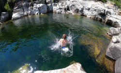
The 9 Best Swimming Holes in Our National Parks
Jun 20, 2025 from outsideonline.com
From waterfalls to deep plunge pools, here the best natural pools for cooling off this summer in national parks.
Sub Regions
- Conconully (23)
- Loomis (2)
- Mazama (6)
- Oroville (3)
- Pateros (1)
- Stehekin (4)
- Tonasket (23)
- Carter Mountain (1)
- Highlands Sno-Park (12)
- Lost Lake (3)
- Mt Bonaparte (1)
- The Sage (3)
- Twisp (120)
- Angels Staircase / Uno Peak (52)
- Lookout Mountain (2)
- Loup Loup (45)
- Pipestone Canyon (24)
- Winthrop (72)
- Okanogan-Wenatchee National Forest (0)
Popular Okanogan County Mountain Biking Trails
• 100 ★ 3.7 • 2 miles • 683 ft • 1,167 •
Climbing Trail from Lower Climb It or Inner Passage to the top of , , and .
• 100 ★ 4.0 • 3,520 ft • 19 ft • 1,145 •
Highly rated popular blue difficulty singletrack. This mountain bike primary trail can be used both directions. On average it takes 8 minutes to complete this trail.
• 100 ★ 4.1 • 1 mile • 380 ft • 1,125 •
Climbing trail to get to upper Sun Mountain trails and ultimately trail
• 90 ★ 4.3 • 10 miles • 1,192 ft • 805 •
The trail starts out as a double-track and then quickly turns into turns into an awesome narrow flowing singletrack ride. Takes you through pine forests as well as sage brush and balsam root meadows. Great views! Awesome wildflowers in...
• 95 ★ 4.6 • 3 miles • 29 ft • 717 •
is the trail to ride in the Sun Mountain area. A must-ride trial that has well-built berms and plenty of rollable features that will make riders of all abilities smile. The trail has three distinct sections (upper, middle, and Lower)...
• 90 ★ 4.7 • 3 miles • 1,039 ft • 607 •
Buck Up is a 4 mile climbing trail that provides a scenic and interesting way to connect Cub Creek with the traditional start of the Trail. Moderate grades, interesting trail alignment and nice views, make this up track a pleasant...
• 90 ★ 4.4 • 13 miles • 2,344 ft • 595 •
is designed to be ridden clockwise or south to north. Offers nice climbing grade with many view opportunities etc. Mix of open meadows, forested areas and rock outcroppings. Descending off the north end is fast and fun with many options...
• 95 ★ 4.2 • 1 mile • 701 ft • 595 •
Largely Rebuilt in 2023 by Evergreen, is a step up in difficulty from . It has table tops, rollable doubles, step-ups, step-downs, and shark fins. The largest jump is near the bottom at 25 feet to the sweet spot.
Okanogan County Mountain Bike Routes
★ 5.0 • 14 miles • 2,201 ft • 2 • Loop •
Rated Blue likely due to some grunt factor and warp speed descent potential. Otherwise I found no real...
★ 3.5 • 21 miles • 4,843 ft • 8 • Loop •
Angel's Staircase is a physically demanding, epic loop that takes you far from civilization, so bring...
★ 4.0 • 20 miles • 3,602 ft • 4 •
Great Sun Mountain 20 mile sampler. Utilizes most of the new trails at Sun Mountain to make a great loop....
★ 5.0 • 15 miles • 4,498 ft • 6 • Out & Back •
Epic ride with one of the best continuous descents you will ever do. Up Foggy, up Martin Creek, up Cooney...
★ 4.0 • 12 miles • 1,211 ft • 4 • Loop •
Mix of road with next to zero cars, double and singletrack through peaceful valleys. Not many surface...
★ 5.0 • 35 miles • 8,352 ft • 23 • Loop •
An alternative even more challenging series of trails that mirrors much of the famous Angels Staircase...
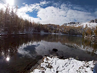
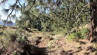
Photos of Okanogan County Mountain Bike
Videos of Okanogan County Mountain Bike

trail: Oso Peligroso
0:08 |
153 |
Aug 19, 2025
trail: Ain't Never Nuthin
0:07 |
|
Sep 19, 2023
trail: Angels Staircase
9:16 |
584 |
Oct 11, 2020
trail: Buck Mountain
3:44 |
|
Aug 1, 2019

trail: Black Bear
7:04 |
898 |
Oct 27, 2016
trail: Eagle Lake Trail
5:12 |
20668 |
Jan 26, 2016
trail: Cutthroat Pass
5:15 |
686 |
Aug 13, 2015
trail: Magpie Horse
3:05 |
120 |
May 28, 2015
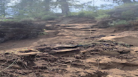
Current Trail Warnings
| status | trail | date | condition | user | info |
|---|---|---|---|---|---|
| Eagle Lake Trail Angels Staircase / Uno Peak | May 24, 2026 @ 2:43pm (America/Los_Angeles) May 24, 2026 | Snow Covered | vuke | 30+ downed trees of various size from the... |
Recent Trail Reports
Activity Feed
| username | action | type | title | date |
|---|---|---|---|---|
| shadubya | wishlist | trail | activity #97203719 | Jun 17, 2026 @ 12:40pm 5 hours |
| adias596 | wishlist | route | activity #97160380 | Jun 16, 2026 @ 8:43pm 21 hours |
| shadubya | wishlist | trail | activity #97137315 | Jun 16, 2026 @ 2:15pm 1 day |
| shadubya | wishlist | trail | activity #97137225 and 1 more | Jun 16, 2026 @ 2:13pm 1 day |
| shadubya | wishlist | trail | activity #97137171 | Jun 16, 2026 @ 2:12pm 1 day |
Recent Comments
| username | type | title | comment | date |
|---|---|---|---|---|
| trail | Absolute banger. Such a fun trail. | Jun 14, 2026 @ 1:03pm Jun 14, 2026 | ||
| trail | Seriously, one of the best trails I’ve... | Jun 11, 2026 @ 8:16pm Jun 11, 2026 | ||
| trail | Wow, what a trail! One of my new favorites... | Jun 8, 2026 @ 11:33am Jun 8, 2026 | ||
| trail | What a trail! Something for everyone rocks,... | May 18, 2026 @ 8:10am May 18, 2026 | ||
| trail | Ran into a trail closed sign at the twin Lakes... | May 9, 2026 @ 3:17pm May 9, 2026 |
Local Badges
-

Epic Mountain Bike Climb 2k4 awarded -

Climbing 10k Badge1 awarded -

Mountain Biking 100k Badge0 awarded -

Epic Ride Descent 2k4 awarded -

Descent 10k Badge1 awarded -

Descent 100k Badge0 awarded
Bike & Skill Parks
| name | type | city | rating |
|---|---|---|---|
| Methow Trails Skills Park | skill park | Winthrop |
Upcoming Local Events
Local Trail Supporters
- Evergreen Mountain Bike Alliane- Methow Chapter
- Methow Cycling Team
![]()
![Pacific Northwest]()
- Evergreen Mountain Bike Alliance -Methow Chapter
Local Trail Association
-

Local Trail Supporters
- Evergreen Mountain Bike Alliane- Methow Chapter
- Methow Cycling Team
![]()
![Pacific Northwest]()
- Evergreen Mountain Bike Alliance -Methow Chapter
Local Trail Association
Activity Type Stats
| activitytype | trails | distance | descent | descent distance | total vertical | rating | global rank | state rank | photos | reports | routes | ridelogs |
|---|---|---|---|---|---|---|---|---|---|---|---|---|
| Mountain Bike | 251 | 684 miles | 124,852 ft | 326 miles | 7,165 ft | 1,067 | 1,837 | 31 | 21,301 | |||
| E-Bike | 102 | 335 miles | 74,665 ft | 183 miles | 6,841 ft | 1,125 | 4 | 829 | ||||
| Horse | 161 | 708 miles | 118,409 ft | 300 miles | 7,923 ft | 415 | 1 | 14 | ||||
| Hike | 503 | 1,700 miles | 300,292 ft | 703 miles | 8,094 ft | 42 | 1,800 | 43 | 5,597 | |||
| Trail Running | 491 | 1,681 miles | 294,117 ft | 692 miles | 7,923 ft | 1,809 | 8 | 1,232 | ||||
| Dirtbike/Moto | 54 | 261 miles | 54,446 ft | 148 miles | 6,106 ft | 385 | 1 | 109 | ||||
| Observed Trials | 17 | 142 miles | 25,269 ft | 90 miles | 5,440 ft | 24 | 2 | |||||
| ATV/ORV/OHV | 18 | 149 miles | 25,000 ft | 90 miles | 5,440 ft | 301 | 9 | |||||
| Snowmobile | 2 | 15 miles | 2,697 ft | 4 | 25 | |||||||
| Snowshoe | 36 | 74 miles | 5,584 ft | 16 miles | 7,198 ft | 8 | 142 | |||||
| Downhill Ski | 23 | 7 miles | 7,703 ft | 7 miles | 1,217 ft | 6 | 204 | |||||
| Backcountry Ski | 15 | 28 miles | 1,663 ft | 2 miles | 6,880 ft | 7 | 760 | |||||
| Nordic Ski | 107 | 157 miles | 14,501 ft | 66 miles | 3,038 ft | 1 | 16 | 2 | 7,671 |
Frequently Asked Questions About Okanogan County
▼
What are the best places to ride in Okanogan County?
Okanogan County has 29 areas to explore for mountain biking. The top rated areas are:
▼
What are the highest rated mountain biking trails in Okanogan County?
The highest rated mountain biking trails in Okanogan County are:
- Oso Peligroso (4.6/5)
- Cutthroat Pass (4.6/5)
- Telemark (4.6/5)
- Pete's Dragon (4.5/5)
- Eagle Lake Trail (4.5/5)
▼
What is the best time of the year to ride in Okanogan County?
Based on ride log data, the most popular months to ride in Okanogan County are:
- May (418 activities)
- June (392 activities)
- July (342 activities)
▼
What is the longest trail in Okanogan County?
The longest trail in Okanogan County is Twisp River Trail at 14.0 miles. View all trails sorted by distance.
Activities
- Okanogan County Mountain Biking Trails
- Okanogan County E-Biking Trails
- Okanogan County Horseback Trails
- Okanogan County Hiking Trails
- Okanogan County Trail Running Trails
- Okanogan County Dirtbiking Trails
- Okanogan County Observed Trials Trails
- Okanogan County ATVing/Offroading Trails
- Okanogan County Snowshoeing Trails
- Okanogan County Skiing Trails
- Okanogan County Backcountry Skiing Trails
- Okanogan County Nordic Skiing Trails
Trails
Points of Interest
- Shale Mountain Summit
- Crescent Mine Sight
- Stiletto Peak Lookout Site Viewpoint
- Early Winters Spires Summit
- Tiffany Springs Campground Camping
- Strawberry Mountain Summit
- Lost Lake Campground Camping
- Lewis Butte Summit
- Falls Creek Falls Sight
- Starvation Mountain Summit
- North Gardner Mountain (8,914 ft)
- Gardner Mountain (8,911 ft)
- Silver Star Mountain (8,760 ft)
- By brenthillier
 NSMBA TRAILFORKS & contributors
 - Admins: NMA, EMBA-Staff, EMBA-BOD, sanfret, LoriTaylor, EMBA-METHOW
- #22259 - 9,206 views
- okanogan county activity log | embed map of Okanogan County mountain bike trails | okanogan county mountain biking points of interest
Downloading of trail gps tracks in kml & gpx formats is enabled for Okanogan County.
You must login to download files.