close
-
Layers w
- Weather Layers
- Pro
- Pro
- Pro
- Pro
- Pro
- Pro
- More Layers
- Pro
- Pro
- Pro
- Pro
-
Upgrade to

3D
Trail Conditions
- Unknown
- Snow Groomed
- Snow Packed
- Snow Covered
- Snow Cover Partial
- Freeze/thaw Cycle
- Icy
- Prevalent Mud
- Wet
- Variable
- Ideal
- Dry
- Very Dry
Trail Flow (Ridden Direction)
Trailforks scans users ridelogs to determine the most popular direction each trail is ridden. A good flowing trail network will have most trails flowing in a single direction according to their intension.
The colour categories are based on what percentage of riders are riding a trail in its intended direction.
The colour categories are based on what percentage of riders are riding a trail in its intended direction.
- > 96%
- > 90%
- > 80%
- > 70%
- > 50%
- < 50%
- bi-directional trail
- no data
Trail Last Ridden
Trailforks scans ridelogs to determine the last time a trail was ridden.
- < 2 days
- < 1 week
- < 2 weeks
- < 1 month
- < 6 months
- > 6 months
Trail Ridden Direction
The intended direction a trail should be ridden.
- Downhill Only
- Downhill Primary
- Both Directions
- Uphill Primary
- Uphill Only
- One Direction
Contribute Details
Colors indicate trail is missing specified detail.
- Description
- Photos
- Description & Photos
- Videos
Trail Popularity ?
Trailforks scans ridelogs to determine which trails are ridden the most in the last 9 months.
Trails are compared with nearby trails in the same city region with a possible 25 colour shades.
Think of this as a heatmap, more rides = more kinetic energy = warmer colors.
- most popular
- popular
- less popular
- not popular
ATV/ORV/OHV Filter
Max Vehicle Width
inches
US Cell Coverage
Legend

Radar Time
Activity Recordings
Trailforks uses anonymized public activity data.
?
Activity Recordings
Trailforks uses anonymized public activity data.
?
Personal Heatmap
▶
Activity Types
all
/
none
▶
Options
2
Date range
month
–
Winter Trails
Warning
A routing network for winter maps does not exist. Selecting trails using the winter trails layer has been disabled.
Missing Trails
Most Popular
Least Popular
Trails are colored based on popularity. The more popular a trail is, the more red. Less popular trails trend towards green.
Jump Magnitude Heatmap
Heatmap of where riders jump on trails. Zoom in to see individual jumps, click circles to view jump details.
BC Backroad Status
![map legend]()
Service Road Atlas is a free to use, community-driven service for viewing and creating reports on the numerous back-country service roads around B.C. and Alberta.

Slope Aspect
Direction the slope faces
Trails Deemphasized
Trails are shown in grey.
Only show trails with no bike usage.
Suggested Layers
Based on selected activity type
Save the current map location and zoom level as your default home location whenever this page is loaded.
Save
No description for Old Forge has been added yet!
Login or register to submit one.
Activities Click to view
- Mountain Bike
135 trails
- E-Bike
107 trails
- Adaptive Bike
25 trails
- Winter Fat Bike
33 trails
- Hike
152 trails
- Trail Running
129 trails
- Snowmobile
70 trails
- Snowshoe
23 trails
- Downhill Ski
20 trails
- Backcountry Ski
26 trails
- Nordic Ski
49 trails
Region Details
- 9
- 45
- 49
- 29
- 2
- 1
Region Status
Caution as of Jun 15, 2026Stats
- Avg Trail Rating
- Trails (view details)
- 213
- Trails Mountain Bike
- 135
- Trails E-Bike
- 107
- Trails Gravel Bike
- 6
- Trails Adaptive Bike
- 25
- Trails Winter Fat Bike
- 33
- Trails Horse
- 1
- Trails Hike
- 152
- Trails Trail Running
- 129
- Trails Snowmobile
- 70
- Trails Snowshoe
- 23
- Trails Downhill Ski
- 20
- Trails Backcountry Ski
- 26
- Trails Nordic Ski
- 49
- Total Distance
- 300 miles
- Total Descent
- 26,137 ft
- Total Vertical
- 1,432 ft
- Highest Trailhead
- 2,373 ft
- Reports
- 1,701
- Photos
- 361
- Ridden Counter
- 21,818
Articles
Video: Building & Riding a Brand New Flow Trail in New York
Sep 25, 2019 from pinkbike.com
There's nothing better than that fresh trail feeling.
Sub Regions
-
Black River Wild Forest - North
- 3
- 3
- 4
-
Fulton Chain Wild Forest
- 1
- 2
- 1
-
Maple Ridge
- 12
- 11
- 11
-
McCauley Mountain
- 6
- 17
- 12
- 2
- 1
-
Nicks Lake Area Trails
-
Town of Webb Recreational Trails
- 20
- 13
Popular Old Forge Mountain Biking Trails
• 100 ★ 4.4 • 1,119 ft • 84 ft • 664 •
Popular blue difficulty singletrack. This mountain bike primary trail can be used uphill primary and has a moderate overall physical rating with a 84 ft blue climb. On average it takes 2 minutes to complete this trail.
• 90 ★ 4.7 • 1,887 ft • 34 ft • 564 •
Machine built flow trail with large berms, rollers. Please do not ride after heavy rains when when trail surface is still soft.
• 100 ★ 4.7 • 623 ft • 36 ft • 559 •
Popular black diamond difficulty singletrack. This multi-use trail can be used both directions and has a hard overall physical rating with a 36 ft black diamond climb. On average it takes 1 minutes to complete this trail.
• 95 ★ 5.0 • 1,690 ft • 65 ft • 528 •
Popular blue difficulty machine groomed. This multi-use trail can be used both directions with a 65 ft blue climb. It features berm. On average it takes 4 minutes to complete this trail.
• 85 ★ 4.7 • 1,493 ft • 35 ft • 519 •
Machine built flow trail with large berms, rollers. Please do not ride after heavy rains when when trail surface is still soft.
• 95 ★ 0.0 • 561 ft • 0 ft • 481 •
McCauley Mountain end of the " is primarily a wide, grassy trail that doubles as a cross country ski trail in the winter. Part of this trail is also known as .
• 90 ★ 4.6 • 2,198 ft • 5 ft • 472 •
Please use caution when riding this two way trail and be watchful for riders approaching from the opposite direction. This trail serves as the primary connection between Old Forge, and McCauley Mountain riding areas. Riding from town,...
• 85 ★ 4.8 • 3,881 ft • 9 ft • 446 •
Highly rated popular black diamond difficulty machine groomed. This multi-use trail can be used downhill only and has a moderate overall physical rating. It features berm, bridge, drop, jump and gap jump. On average it takes 13 minutes to complete this trail.
Old Forge Mountain Bike Routes
★ 5.0 • 5 miles • 776 ft • 7 • Loop •
Suggested Route includes a mix of old school single track, flow trails and a steep climb to the . Route is...
★ 5.0 • 6 miles • 713 ft • 10 • Loop •
Can be done in both directions but better to go up 6 Mile and out Hall. Can be shuttled or ridden as a...
★ 5.0 • 2 miles • 207 ft • 4 • Loop •
This route is approximately 2 miles and includes a mix of moderately difficult blue trails. The route is...
★ 2.0 • 5 miles • 336 ft • 16 • Loop •
Moderate route suggested for intermediate / advanced level riders who are comfortable on moderately...
★ 5.0 • 5 miles • 422 ft • 7 • Loop •
This route is approximately 5 miles and includes a mix of moderately difficult blue trails. The route is...
2 miles • 187 ft • 3 • Loop •
This route is approximately 2 miles and includes a mix of moderate blue and more difficult black trails....
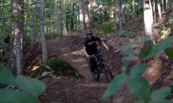
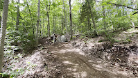
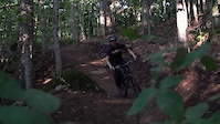
Photos of Old Forge Mountain Bike
Videos of Old Forge Mountain Bike
trail: D-Day
0:13 |
29 |
Aug 30, 2025

0:13 |
24 |
Aug 30, 2025

trail: Food Fight
0:32 |
123 |
Jul 22, 2021
trail: Dirt Safari
2:21 |
372 |
Sep 3, 2019

trail: Flounder
4:17 |
229 |
Mar 3, 2016

trail: Flounder
5:24 |
648 |
Nov 26, 2015

trail: Flounder
4:04 |
430 |
Aug 10, 2015

trail: Racer
4:06 |
245 |
Nov 27, 2014
Current Trail Warnings
| status | trail | date | condition | user | info |
|---|---|---|---|---|---|
| You Trusted Us | Jun 16, 2026 @ 12:55am (America/New_York) Jun 15, 2026 | Unknown | CloudSpin AFTA | Trail is closed due to trail construction... |
Recent Trail Reports
| status | trail | date | condition | info | user |
|---|---|---|---|---|---|
| Challenger Connector | Jun 14, 2026 @ 9:34am (America/New_York) Jun 14, 2026 | Ideal | oldforgebikepatrol | ||
| Delta House | Jun 14, 2026 @ 9:34am (America/New_York) Jun 14, 2026 | Ideal | oldforgebikepatrol | ||
| Summit Connector | Jun 14, 2026 @ 9:34am (America/New_York) Jun 14, 2026 | Ideal | oldforgebikepatrol | ||
| Bluto | Jun 14, 2026 @ 9:34am (America/New_York) Jun 14, 2026 | Ideal | oldforgebikepatrol | ||
| Omega | Jun 14, 2026 @ 9:34am (America/New_York) Jun 14, 2026 | Ideal | oldforgebikepatrol | ||
| No Prisoners | Jun 12, 2026 @ 10:09am (America/New_York) Jun 12, 2026 | Dry | eliQKpNnA | ||
| Eli's Coming | May 23, 2026 @ 10:12am (America/New_York) May 23, 2026 | Ideal | oldforgebikepatrol | ||
| Dirt Safari | May 23, 2026 @ 10:12am (America/New_York) May 23, 2026 | Ideal | oldforgebikepatrol | ||
| Abenaki | May 23, 2026 @ 10:12am (America/New_York) May 23, 2026 | Ideal | oldforgebikepatrol | ||
| Ridge Climbing Trail | May 23, 2026 @ 10:12am (America/New_York) May 23, 2026 | Ideal | oldforgebikepatrol |
Activity Feed
| username | action | type | title | date |
|---|---|---|---|---|
| AdkLucas | ridden | trail | activity #97289677 | Jun 18, 2026 @ 6:50pm 2 days |
| CaseyHGPmzd | wishlist | region | activity #97178048 | Jun 17, 2026 @ 6:13am Jun 17, 2026 |
| 000bdr | wishlist | region | activity #97176870 | Jun 17, 2026 @ 5:47am Jun 17, 2026 |
| Woodsman1111 | add | karma | activity #97173611 | Jun 17, 2026 @ 4:28am Jun 17, 2026 |
| CloudSpin | add | report | activity #97087757 | Jun 15, 2026 @ 10:07pm Jun 15, 2026 |
Recent Comments
| username | type | title | comment | date |
|---|---|---|---|---|
| report | Sweet! | Apr 25, 2026 @ 6:38am Apr 25, 2026 | ||
| trail | Also wondering if anyone has done this... | Jan 1, 2026 @ 5:10pm Jan 1, 2026 | ||
| trail | Bucksaw is a real one | Nov 12, 2025 @ 9:04am Nov 12, 2025 | ||
| trail | Bucksaw the legend of the one armed lumberjack | Oct 6, 2025 @ 12:54am Oct 6, 2025 | ||
| trail | Beautiful and technical. Loved it! | Sep 6, 2025 @ 7:58am Sep 6, 2025 |
Local Badges
-

Top 10 Trails3 awarded -

Descent 100k Badge1 awarded -

Big Ride 30k310 awarded -

Epic Ride 50k92 awarded -

Completionist1 awarded -
Completionist0 awarded
Bike & Skill Parks
| name | type | city | rating |
|---|---|---|---|
| Kids Skill Park | skill park | Old Forge | |
| Skill Park at Maple Ridge | skill park | Old Forge |
Activity Type Stats
| activitytype | trails | distance | descent | descent distance | total vertical | rating | global rank | state rank | photos | reports | routes | ridelogs |
|---|---|---|---|---|---|---|---|---|---|---|---|---|
| Mountain Bike | 135 | 133 miles | 11,955 ft | 56 miles | 928 ft | #868 | #340 | 355 | 1,627 | 9 | 5,919 | |
| E-Bike | 107 | 84 miles | 9,186 ft | 38 miles | 928 ft | #1,505 | #871 | 1,576 | 4 | 145 | ||
| Gravel Bike | 6 | 6 miles | 1,004 ft | 3 miles | 476 ft | #580 | #320 | 39 | 19 | |||
| Adaptive Bike | 25 | 40 miles | 2,339 ft | 16 miles | 476 ft | #269 | #1,590 | 133 | ||||
| Winter Fat Bike | 33 | 13 miles | 3,609 ft | 7 miles | 640 ft | #213 | #984 | 603 | 4 | |||
| Horse | 1 | 8 miles | 469 ft | 3 miles | 423 ft | 73 | ||||||
| Hike | 152 | 188 miles | 13,730 ft | 72 miles | 932 ft | #981 | #441 | 5 | 1,527 | 567 | ||
| Trail Running | 129 | 130 miles | 10,725 ft | 49 miles | 932 ft | #1,226 | #443 | 1,520 | 59 | |||
| Snowmobile | 70 | 193 miles | 10,741 ft | 77 miles | 1,421 ft | #19 | #14 | 78 | 28 | |||
| Snowshoe | 23 | 32 miles | 3,301 ft | 13 miles | 833 ft | #500 | #174 | 191 | 14 | |||
| Downhill Ski | 20 | 5 miles | 3,494 ft | 4 miles | 453 ft | #453 | #177 | 74 | 189 | |||
| Backcountry Ski | 26 | 15 miles | 2,651 ft | 7 miles | 623 ft | #393 | #82 | 141 | 31 | |||
| Nordic Ski | 49 | 46 miles | 4,209 ft | 19 miles | 515 ft | #442 | #130 | 203 | 112 |
Frequently Asked Questions About Old Forge
▼
What are the best places to ride in Old Forge?
Old Forge has 8 areas to explore for mountain biking. The top rated areas are:
▼
What are the highest rated mountain biking trails in Old Forge?
The highest rated mountain biking trails in Old Forge are:
- Delta House (4.5/5)
- Dirt Safari (4.5/5)
- Food Fight (4.5/5)
- Louie Louie - Upper (4.5/5)
- Gnarasaurus (4.4/5)
▼
What is the best time of the year to ride in Old Forge?
Based on ride log data, the most popular months to ride in Old Forge are:
- July (368 activities)
- August (255 activities)
- September (190 activities)
▼
Where can I park to ride in Old Forge?
Activities
- Old Forge Mountain Biking Trails
- Old Forge E-Biking Trails
- Old Forge Adaptive Biking Trails
- Old Forge Winter Fat Biking Trails
- Old Forge Hiking Trails
- Old Forge Trail Running Trails
- Old Forge Snowmobiling Trails
- Old Forge Snowshoeing Trails
- Old Forge Skiing Trails
- Old Forge Backcountry Skiing Trails
- Old Forge Nordic Skiing Trails
Trails
Points of Interest
- TOW Water Tank Other
- McCauley Base Lodge
- Remsen Falls Viewpoint
- Lean-to Camping
- Middle Branch Lake Lean-to Cabin
- Pine Lake Shelter Cabin
- Old Iron Bridge
- Little Safford Lake Scenic View Viewpoint
- Moose River Mountain (2,209 ft) Summit
- Bald Mountain (2,313 ft) Summit
- Panther Mountain (2,408 ft)
- Little Moose Mountain (2,349 ft)
- McCauley Mountain (2,280 ft)
- By CloudSpin
 AFTA & contributors
 - Admins: AFTA
- #23743 - 24,584 views
- old forge activity log | embed map of Old Forge mountain bike trails | old forge mountain biking points of interest
Downloading of trail gps tracks in kml & gpx formats is enabled for Old Forge.
You must login to download files.