close
-
Layers w
- Weather Layers
- Pro
- Pro
- Pro
- Pro
- Pro
- Pro
- More Layers
- Pro
- Pro
- Pro
- Pro
-
Upgrade to

3D
Trail Conditions
- Unknown
- Snow Groomed
- Snow Packed
- Snow Covered
- Snow Cover Partial
- Freeze/thaw Cycle
- Icy
- Prevalent Mud
- Wet
- Variable
- Ideal
- Dry
- Very Dry
Trail Flow (Ridden Direction)
Trailforks scans users ridelogs to determine the most popular direction each trail is ridden. A good flowing trail network will have most trails flowing in a single direction according to their intension.
The colour categories are based on what percentage of riders are riding a trail in its intended direction.
The colour categories are based on what percentage of riders are riding a trail in its intended direction.
- > 96%
- > 90%
- > 80%
- > 70%
- > 50%
- < 50%
- bi-directional trail
- no data
Trail Last Ridden
Trailforks scans ridelogs to determine the last time a trail was ridden.
- < 2 days
- < 1 week
- < 2 weeks
- < 1 month
- < 6 months
- > 6 months
Trail Ridden Direction
The intended direction a trail should be ridden.
- Downhill Only
- Downhill Primary
- Both Directions
- Uphill Primary
- Uphill Only
- One Direction
Contribute Details
Colors indicate trail is missing specified detail.
- Description
- Photos
- Description & Photos
- Videos
Trail Popularity ?
Trailforks scans ridelogs to determine which trails are ridden the most in the last 9 months.
Trails are compared with nearby trails in the same city region with a possible 25 colour shades.
Think of this as a heatmap, more rides = more kinetic energy = warmer colors.
- most popular
- popular
- less popular
- not popular
ATV/ORV/OHV Filter
Max Vehicle Width
inches
US Cell Coverage
Legend

Radar Time
Activity Recordings
Trailforks uses anonymized public activity data.
?
Activity Recordings
Trailforks uses anonymized public activity data.
?
Personal Heatmap
▶
Activity Types
all
/
none
▶
Options
2
Date range
month
–
Winter Trails
Warning
A routing network for winter maps does not exist. Selecting trails using the winter trails layer has been disabled.
Missing Trails
Most Popular
Least Popular
Trails are colored based on popularity. The more popular a trail is, the more red. Less popular trails trend towards green.
Jump Magnitude Heatmap
Heatmap of where riders jump on trails. Zoom in to see individual jumps, click circles to view jump details.
BC Backroad Status
![map legend]()
Service Road Atlas is a free to use, community-driven service for viewing and creating reports on the numerous back-country service roads around B.C. and Alberta.

Slope Aspect
Direction the slope faces
Trails Deemphasized
Trails are shown in grey.
Only show trails with no bike usage.
Suggested Layers
Based on selected activity type
Save the current map location and zoom level as your default home location whenever this page is loaded.
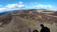
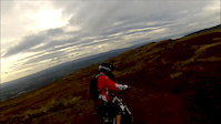
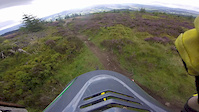
SaveNice mixture of natural and built trails. Good long fast descents. Nothing super technical but a couple of drops and steep sections. Avoid in winter when it's a mudbath. Accessible from Glasgow by train every 20 to 30min during the day.
Primary Trail Type: All-Mountain & Downhill
Land Status: National Forest
 google parking directions
 Access Info:
Bowling train station car park.
This region uses the Uk/Euro style trail grading system.
Activities Click to view
- Mountain Bike
72 trails
- E-Bike
72 trails
- Hike
57 trails
- Trail Running
57 trails
Region Details
- 23
- 8
- 18
- 12
- 9
Region Status
Caution as of Jun 14, 2026Stats
- Avg Trail Rating
- Trails (view details)
- 70
- Trails Mountain Bike
- 72
- Trails E-Bike
- 72
- Trails Hike
- 57
- Trails Trail Running
- 57
- Total Distance
- 62 miles
- Total Descent
- 12,751 ft
- Total Vertical
- 1,290 ft
- Highest Trailhead
- 1,312 ft
- Reports
- 681
- Photos
- 207
- Ridden Counter
- 8,477
Popular Old Kilpatrick Mountain Biking Trails
• 70 ★ 4.5 • 2,490 ft • 0 ft • 257 •
Highly rated popular black difficulty singletrack. This mountain bike primary trail can be used downhill primary. It features berm, drop, jump and gap jump. On average it takes 7 minutes to complete this trail.
• 85 ★ 3.5 • 1,188 ft • 0 ft • 254 • • hike
Super fast. Marbly and sketchy in the dry, crazily slick in the wet. Grip is an illusion.
• 95 ★ 0.0 • 1,421 ft • 52 ft • 239 • • hike
Popular blue difficulty singletrack. This hike primary trail can be used both directions. On average it takes 6 minutes to complete this trail.
• 90 ★ 4.9 • 1,440 ft • 0 ft • 222 •
Highly rated popular red difficulty singletrack. This mountain bike primary trail can be used one direction and has a moderate overall physical rating with a 0 ft blue climb. On average it takes 2 minutes to complete this trail.
• 65 ★ 3.8 • 1,089 ft • 0 ft • 192 •
Moderately popular red difficulty singletrack. This mountain bike primary trail can be used one direction. It features berm and drop. On average it takes 2 minutes to complete this trail.
• 65 ★ 4.4 • 1,299 ft • 0 ft • 191 •
A rooty through the woods including a chute and twisty turns. Good fun garanteed.
• 35 ★ 4.0 • 1,102 ft • 0 ft • 190 •
Less popular black difficulty singletrack. This mountain bike primary trail can be used downhill primary. On average it takes 1 minutes to complete this trail.
Photos of Old Kilpatrick Mountain Bike
Videos of Old Kilpatrick Mountain Bike

trail: Minceurs and Tatties
0:27 |
159 |
Apr 24, 2023

trail: Bottom Field
0:14 |
218 |
Jun 9, 2016
trail: Minceurs and Tatties
3:38 |
252 |
Apr 30, 2016
trail: Bottom Field
5:56 |
112 |
Oct 10, 2015
trail: Access Road
2:30 |
218 |
Sep 1, 2015

trail: The Valley
0:50 |
985 |
Apr 8, 2015

trail: The Valley
5:23 |
814 |
Oct 18, 2014

trail: Bottom Field
0:09 |
208 |
Apr 19, 2014
Recent Trail Reports
| status | trail | date | condition | info | user |
|---|---|---|---|---|---|
| Sesame Street | Jun 14, 2026 @ 12:29pm (Europe/London) Jun 14, 2026 | Ideal | andrewyQkzpb | ||
| Bottom Field | Jun 14, 2026 @ 12:29pm (Europe/London) Jun 14, 2026 | Ideal | andrewyQkzpb | ||
| Switchbacks | Jun 14, 2026 @ 12:29pm (Europe/London) Jun 14, 2026 | Ideal | andrewyQkzpb | ||
| Snakey | Jun 14, 2026 @ 12:29pm (Europe/London) Jun 14, 2026 | Ideal | andrewyQkzpb | ||
| Bomber Man | Jun 14, 2026 @ 12:29pm (Europe/London) Jun 14, 2026 | Ideal | andrewyQkzpb | ||
| Minceurs and Tatties | Jun 14, 2026 @ 12:29pm (Europe/London) Jun 14, 2026 | Ideal | andrewyQkzpb | ||
| The Slacks Descent | Jun 14, 2026 @ 12:29pm (Europe/London) Jun 14, 2026 | Ideal | andrewyQkzpb | ||
| Cochno Loch Trail | Jun 14, 2026 @ 12:29pm (Europe/London) Jun 14, 2026 | Prevalent Mud | andrewyQkzpb | ||
| Double Track | May 28, 2026 @ 6:15pm (Europe/Isle_of_Man) May 28, 2026 | Dry | Grahambush | ||
| Cake Walk | May 28, 2026 @ 6:15pm (Europe/Isle_of_Man) May 28, 2026 | Ideal | Grahambush |
Activity Feed
| username | action | type | title | date |
|---|---|---|---|---|
| andrewyQkzpb | add | report | activity #96972604 and 7 more | Jun 14, 2026 @ 8:35am Jun 14, 2026 |
| Grahambush | add | report | activity #95739228 and 5 more | May 28, 2026 @ 4:09pm May 28, 2026 |
| Dougmax11 | add | report | activity #95001201 | May 18, 2026 @ 2:39pm May 18, 2026 |
| Craighudson | add | report | activity #93958245 | May 3, 2026 @ 9:53am May 3, 2026 |
| chapps1 | ridden | trail | activity #93762373 | May 1, 2026 @ 1:46am May 1, 2026 |
Recent Comments
| username | type | title | comment | date |
|---|---|---|---|---|
| trail | Tree down blocking trial | Sep 7, 2025 @ 7:20am Sep 7, 2025 | ||
| trail | Cool trail Grass needs a trim 🎉👌🏼 | Jul 20, 2025 @ 3:04am Jul 20, 2025 | ||
| trail | Cool turns Grass needs a trim | Jul 20, 2025 @ 3:04am Jul 20, 2025 | ||
| trail | Moocho fun , needs a hair cut though 👌🏼 | Jul 20, 2025 @ 3:03am Jul 20, 2025 | ||
| trail | Rode it for the first time on Wednesday, good... | Jul 20, 2025 @ 3:02am Jul 20, 2025 |
Nearby Areas
| name | distance | ||||
|---|---|---|---|---|---|
| The Whangie | 1 | 4.4 km | |||
| Mugdock Park | 5 | 30 | 5.2 km | ||
| Dawsholm Park | 6.4 km | ||||
| Ben Bowie | 2 | 6 | 8.4 km | ||
| Lennox Forest | 6 | 22 | 8.9 km |
Local Badges
-

Completionist0 awarded
Activity Type Stats
| activitytype | trails | distance | descent | descent distance | total vertical | rating | global rank | state rank | photos | reports | routes | ridelogs |
|---|---|---|---|---|---|---|---|---|---|---|---|---|
| Mountain Bike | 72 | 62 miles | 12,749 ft | 34 miles | 1,289 ft | #1,515 | #54 | 203 | 681 | 7,566 | ||
| E-Bike | 72 | 62 miles | 12,749 ft | 34 miles | 1,289 ft | #1,333 | #59 | 620 | 1 | 1,441 | ||
| Hike | 57 | 60 miles | 10,600 ft | 32 miles | 1,289 ft | #2,641 | #40 | 1 | 588 | 295 | ||
| Trail Running | 57 | 60 miles | 10,600 ft | 32 miles | 1,289 ft | #2,190 | #39 | 588 | 708 |
Frequently Asked Questions About Old Kilpatrick
▼
What are the highest rated mountain biking trails in Old Kilpatrick?
The highest rated mountain biking trails in Old Kilpatrick are:
- Spexy Beast (4.4/5)
- Minceurs and Tatties (4.3/5)
- Overtoun Cliff Top (4.2/5)
- Hitman (4.1/5)
- Mr T (4.1/5)
▼
What is the best time of the year to ride in Old Kilpatrick?
Based on ride log data, the most popular months to ride in Old Kilpatrick are:
- August (28 activities)
- May (26 activities)
- July (26 activities)
▼
Where can I park to ride in Old Kilpatrick?
▼
What is the longest trail in Old Kilpatrick?
The longest trail in Old Kilpatrick is John Muir Way Section at 3.6 miles. View all trails sorted by distance.
Activities
- By brenthillier
 NSMBA TRAILFORKS & contributors
 - Admins: apply
- #7983 - 24,112 views
- old kilpatrick activity log | embed map of Old Kilpatrick mountain bike trails | old kilpatrick mountain biking points of interest
Downloading of trail gps tracks in kml & gpx formats is enabled for Old Kilpatrick.
You must login to download files.