close
-
Layers w
- Weather Layers
- Pro
- Pro
- Pro
- Pro
- Pro
- Pro
- More Layers
- Pro
- Pro
- Pro
- Pro
-
Upgrade to

3D
Trail Conditions
- Unknown
- Snow Groomed
- Snow Packed
- Snow Covered
- Snow Cover Partial
- Freeze/thaw Cycle
- Icy
- Prevalent Mud
- Wet
- Variable
- Ideal
- Dry
- Very Dry
Trail Flow (Ridden Direction)
Trailforks scans users ridelogs to determine the most popular direction each trail is ridden. A good flowing trail network will have most trails flowing in a single direction according to their intension.
The colour categories are based on what percentage of riders are riding a trail in its intended direction.
The colour categories are based on what percentage of riders are riding a trail in its intended direction.
- > 96%
- > 90%
- > 80%
- > 70%
- > 50%
- < 50%
- bi-directional trail
- no data
Trail Last Ridden
Trailforks scans ridelogs to determine the last time a trail was ridden.
- < 2 days
- < 1 week
- < 2 weeks
- < 1 month
- < 6 months
- > 6 months
Trail Ridden Direction
The intended direction a trail should be ridden.
- Downhill Only
- Downhill Primary
- Both Directions
- Uphill Primary
- Uphill Only
- One Direction
Contribute Details
Colors indicate trail is missing specified detail.
- Description
- Photos
- Description & Photos
- Videos
Trail Popularity ?
Trailforks scans ridelogs to determine which trails are ridden the most in the last 9 months.
Trails are compared with nearby trails in the same city region with a possible 25 colour shades.
Think of this as a heatmap, more rides = more kinetic energy = warmer colors.
- most popular
- popular
- less popular
- not popular
ATV/ORV/OHV Filter
Max Vehicle Width
inches
US Cell Coverage
Legend

Radar Time
Activity Recordings
Trailforks uses anonymized public activity data.
?
Activity Recordings
Trailforks uses anonymized public activity data.
?
Personal Heatmap
▶
Activity Types
all
/
none
▶
Options
2
Date range
month
–
Winter Trails
Warning
A routing network for winter maps does not exist. Selecting trails using the winter trails layer has been disabled.
Missing Trails
Most Popular
Least Popular
Trails are colored based on popularity. The more popular a trail is, the more red. Less popular trails trend towards green.
Jump Magnitude Heatmap
Heatmap of where riders jump on trails. Zoom in to see individual jumps, click circles to view jump details.
BC Backroad Status
![map legend]()
Service Road Atlas is a free to use, community-driven service for viewing and creating reports on the numerous back-country service roads around B.C. and Alberta.

Slope Aspect
Direction the slope faces
Trails Deemphasized
Trails are shown in grey.
Only show trails with no bike usage.
Suggested Layers
Based on selected activity type
Save the current map location and zoom level as your default home location whenever this page is loaded.
SaveThis region is Unsanctioned, Ride at your own Risk!
No description for Olpe has been added yet! Login or register to submit one.This region uses the Uk/Euro style trail grading system.
Activities Click to view
- Mountain Bike
4 trails
- E-Bike
4 trails
- Adaptive Bike
0 trails
- Winter Fat Bike
0 trails
- Dirtbike/Moto
0 trails
Region Details
- 3
- 1
Region Status
Open as of Sep 24, 2021Stats
- Avg Trail Rating
- Trails (view details)
- 4
- Trails Mountain Bike
- 4
- Trails E-Bike
- 4
- Total Distance
- 1 mile
- Total Descent
- 1,036 ft
- Total Vertical
- 287 ft
- Highest Trailhead
- 1,942 ft
- Reports
- 24
- Photos
- 8
- Ridden Counter
- 663
Sub Regions
-
bikeparkOE
- 3
- 1
Popular Olpe Mountain Biking Trails
• 75 ★ 4.0 • 2,493 ft • 75 ft • 157 •
Downhilltrack which is often used for the "Supergravity NRW Cup". Flat beginning with a tableline where you have to paddle to get speed. Then a manbuilt rockgarden following by a technical root section. A small roadgap is leading into...
• 100 ★ 5.0 • 1,100 ft • 29 ft • 153 •
This trail is the continuation of the "Rasenrennen Racetrack", it can also be accessed in the middle of the track. It starts with a wooden drop into a few berms. Then the biggest gap in the bikepark, continued by a gap, berm and a...
• 50 ★ 4.0 • 2,470 ft • 75 ft • 152 •
Moderately popular blue difficulty family friendly machine groomed. This mountain bike primary trail can be used downhill only and has a easy overall physical rating. It features a-frame, berm, jump, ladder bridge and wallride. Trail visibility is always easy to follow. On average it takes 3 minutes to complete this trail.
• 25 ★ 0.0 • 928 ft • 0 ft • 142 •
Beginning section of the Famous Rasenrennen Racetrack! some berms , a few tables and two different big Roadgaps to chose. Can be continued with the trail "gaps n jumps" or middle part of the "freeride" track!
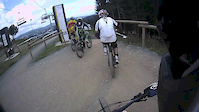
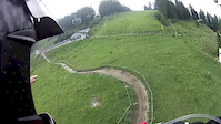
Photos of Olpe Mountain Bike
Videos of Olpe Mountain Bike
trail: Gaps'N'Jumps
0:41 |
64 |
Aug 17, 2020

trail: Downhill
3:00 |
39 |
Nov 12, 2018
trail: Downhill
2:37 |
243 |
Jan 24, 2017
trail: Downhill
0:54 |
61 |
May 22, 2016
trail: Downhill
2:54 |
42 |
Aug 3, 2015
trail: Downhill
2:28 |
105 |
Sep 16, 2014
trail: Gaps'N'Jumps
0:25 |
952 |
May 19, 2014
trail: Downhill
5:25 |
271 |
Aug 10, 2013
Recent Trail Reports
| status | trail | date | condition | info | user |
|---|---|---|---|---|---|
| Gaps'N'Jumps | Sep 24, 2021 @ 6:59am Sep 24, 2021 | Ideal | Lobiwan8 | ||
| Freeride | Sep 24, 2021 @ 6:59am Sep 24, 2021 | Ideal | Lobiwan8 | ||
| Downhill | Sep 24, 2021 @ 6:59am Sep 24, 2021 | Ideal | Lobiwan8 | ||
| RR-Racetrack | Sep 24, 2021 @ 6:59am Sep 24, 2021 | Ideal | Lobiwan8 |
Activity Feed
| username | action | type | title | date |
|---|---|---|---|---|
| trailforks | add | video | activity #95909840 | May 30, 2026 @ 10:00pm May 30, 2026 |
| trailforks | add | video | activity #93588384 | Apr 28, 2026 @ 10:00am Apr 28, 2026 |
| trailforks | add | video | activity #89428850 | Feb 23, 2026 @ 1:00pm Feb 23, 2026 |
| trailforks | add | video | activity #86498012 | Jan 2, 2026 @ 6:00am Jan 2, 2026 |
| Jenshor | ridden | trail | activity #80281588 and 3 more | Sep 13, 2025 @ 2:03pm Sep 13, 2025 |
Recent Comments
| username | type | title | comment | date |
|---|---|---|---|---|
| trail | Schöne Downhill Strecke mit vielen Features... | Sep 10, 2019 @ 2:02am Sep 10, 2019 | ||
| trail | Sehr spaßige Strecke für Jedermann und jedes... | Sep 10, 2019 @ 1:56am Sep 10, 2019 | ||
| trail | Perfekte Ergänzung zum Rasenrennen Racetrack,... | Sep 10, 2019 @ 1:53am Sep 10, 2019 | ||
| trail | Schöne Bikepark Strecke mit viel Airtime... | Sep 10, 2019 @ 1:48am Sep 10, 2019 | ||
| trail | Roadgaps, Tabels, Drops, Wall, alles vorhanden???? | Sep 9, 2019 @ 11:23pm Sep 9, 2019 |
Bike & Skill Parks
| name | type | city | rating |
|---|---|---|---|
| bikeparkOE | bike park | Olpe |
Activity Type Stats
| activitytype | trails | distance | descent | descent distance | total vertical | rating | global rank | state rank | photos | reports | routes | ridelogs |
|---|---|---|---|---|---|---|---|---|---|---|---|---|
| Mountain Bike | 4 | 1 mile | 1,037 ft | 1 mile | 289 ft | #7,240 | #268 | 8 | 24 | 556 | ||
| E-Bike | 4 | 1 mile | 1,037 ft | 1 mile | 289 ft | #4,187 | #112 | 24 | 272 |
- By frOErider & contributors
- Admins: apply
- #31146 - 2,807 views
- olpe activity log | embed map of Olpe mountain bike trails |
Downloading of trail gps tracks in kml & gpx formats is enabled for Olpe.
You must login to download files.