close
-
Layers w
- Weather Layers
- Pro
- Pro
- Pro
- Pro
- Pro
- Pro
- More Layers
- Pro
- Pro
- Pro
- Pro
-
Upgrade to

3D
Trail Conditions
- Unknown
- Snow Groomed
- Snow Packed
- Snow Covered
- Snow Cover Partial
- Freeze/thaw Cycle
- Icy
- Prevalent Mud
- Wet
- Variable
- Ideal
- Dry
- Very Dry
Trail Flow (Ridden Direction)
Trailforks scans users ridelogs to determine the most popular direction each trail is ridden. A good flowing trail network will have most trails flowing in a single direction according to their intension.
The colour categories are based on what percentage of riders are riding a trail in its intended direction.
The colour categories are based on what percentage of riders are riding a trail in its intended direction.
- > 96%
- > 90%
- > 80%
- > 70%
- > 50%
- < 50%
- bi-directional trail
- no data
Trail Last Ridden
Trailforks scans ridelogs to determine the last time a trail was ridden.
- < 2 days
- < 1 week
- < 2 weeks
- < 1 month
- < 6 months
- > 6 months
Trail Ridden Direction
The intended direction a trail should be ridden.
- Downhill Only
- Downhill Primary
- Both Directions
- Uphill Primary
- Uphill Only
- One Direction
Contribute Details
Colors indicate trail is missing specified detail.
- Description
- Photos
- Description & Photos
- Videos
Trail Popularity ?
Trailforks scans ridelogs to determine which trails are ridden the most in the last 9 months.
Trails are compared with nearby trails in the same city region with a possible 25 colour shades.
Think of this as a heatmap, more rides = more kinetic energy = warmer colors.
- most popular
- popular
- less popular
- not popular
ATV/ORV/OHV Filter
Max Vehicle Width
inches
US Cell Coverage
Legend

Radar Time
Activity Recordings
Trailforks uses anonymized public activity data.
?
Activity Recordings
Trailforks uses anonymized public activity data.
?
Personal Heatmap
▶
Activity Types
all
/
none
▶
Options
2
Date range
month
–
Winter Trails
Warning
A routing network for winter maps does not exist. Selecting trails using the winter trails layer has been disabled.
Missing Trails
Most Popular
Least Popular
Trails are colored based on popularity. The more popular a trail is, the more red. Less popular trails trend towards green.
Jump Magnitude Heatmap
Heatmap of where riders jump on trails. Zoom in to see individual jumps, click circles to view jump details.
BC Backroad Status
![map legend]()
Service Road Atlas is a free to use, community-driven service for viewing and creating reports on the numerous back-country service roads around B.C. and Alberta.

Slope Aspect
Direction the slope faces
Trails Deemphasized
Trails are shown in grey.
Only show trails with no bike usage.
Suggested Layers
Based on selected activity type
Save the current map location and zoom level as your default home location whenever this page is loaded.
SavePopular Trail Networks
view all areas »
No description for Olympia has been added yet!
Login or register to submit one.
Activities Click to view
- Mountain Bike
243 trails
- E-Bike
176 trails
- Gravel Bike
0 trails
- Adaptive Bike
0 trails
- Winter Fat Bike
0 trails
- Horse
23 trails
- Hike
270 trails
- Trail Running
271 trails
- Dirtbike/Moto
48 trails
- Observed Trials
8 trails
- ATV/ORV/OHV
33 trails
Region Details
- 93
- 3
- 59
- 66
- 13
- 5
Region Status
Caution as of Jun 14, 2026Stats
- Avg Trail Rating
- Trails (view details)
- 290
- Trails Mountain Bike
- 244
- Trails E-Bike
- 176
- Trails Horse
- 23
- Trails Hike
- 270
- Trails Trail Running
- 271
- Trails Dirtbike/Moto
- 48
- Trails Observed Trials
- 8
- Trails ATV/ORV/OHV
- 33
- Total Distance
- 366 miles
- Total Descent
- 58,230 ft
- Total Vertical
- 2,657 ft
- Highest Trailhead
- 2,658 ft
- Reports
- 1,876
- Photos
- 590
- Ridden Counter
- 32,033
Sub Regions
-
Capitol Forest
- 26
- 19
- 4
-
Grass Lake Nature Park
- 3
-
Heritage Park
-
Kennedy Summit Lake
- 5
- 30
-
Millersylvania State Park
- 1
- 14
-
North Slope Trails
- 4
- 7
- 7
- 4
-
Watershed Park
- 1
- 1
- 1
-
Woodward Bay Conservation Area
- 3
Popular Olympia Mountain Biking Trails
• 100 ★ 4.6 • 1 mile • 0 ft • 1,079 •
is a purpose-built, one-way mountain bike trail and the crown jewel of the North Slope Trails system on the north side of Capitol Forest. This trail has it all. Steeps, tabletop jumps, huge berms, rocks, roots, trees. is a true DH run....
• 100 ★ 4.7 • 1 mile • 9 ft • 1,075 •
Living the Dream is a purpose-built, one-way mountain bike trail with a "spicy blue" rating, depending on how you ride it. It is one of the newer additions to the Northslope Trails and includes mild to moderate tech via roots and rock...
• 95 ★ 4.5 • 2 miles • 0 ft • 1,049 •
Down and Rowdy (DNR) is a long, technical freeride/enduro trail and part of the new North Slope Trails system of one-way, purpose-built mountain bike trails. Narrow all the way and steep in spots, this killer trail will challenge riders...
• 95 ★ 4.3 • 6 miles • 1,453 ft • 912 •
Starting at Fall Creek Trailhead makes this a long climb that you can tie into Or all the way to .
• 100 ★ 4.5 • 2 miles • 127 ft • 869 •
The trail is a great trail for learning to do small, flowy jumps. It is a really fun trail, and most of the third section is a pump track. It mostly goes downhill, there are a few flatter spots, so if you are DH all day every day, you...
• 100 ★ 4.4 • 2,831 ft • 0 ft • 862 •
Highly rated popular black diamond difficulty singletrack. This mountain bike primary trail can be used downhill primary. On average it takes 4 minutes to complete this trail.
• 90 ★ 4.6 • 1,726 ft • 0 ft • 736 •
Fast upper section with lots of pumps and sneaky doubles. Steepens up at the end with a few rooty corner which are tough when wet. More technical blue than LTD upper or lower.
• 100 ★ 3.8 • 2 miles • 241 ft • 612 •
Popular green difficulty singletrack. This mountain bike primary trail can be used both directions and has a easy overall physical rating with a 241 ft green climb. On average it takes 14 minutes to complete this trail.
Olympia Mountain Bike Routes
★ 4.0 • 10 miles • 1,782 ft • 3 • Loop •
This is the poker ride route from the Capitol Forest Classic (also the beginner route for the XC race)....
★ 5.0 • 25 miles • 4,410 ft • 5 •
★ 4.0 • 27 miles • 4,843 ft • 11 •
We are super excited to team up with Friends of Capitol Forest and return home to where the first ever...
★ 4.0 • 7 miles • 1,069 ft • 6 • Loop •
Loop is a roughly 9 mile ride out of the Fall Creek TH. Debates rage about route, but most people ride...
★ 4.0 • 38 miles • 6,327 ft • 4 • Loop •
From the Mima Falls trailhead you can make several types of loops in a wide range of distances. The goal...
★ 4.5 • 13 miles • 2,125 ft • 3 • Loop •
Classic cap forest loop. The climb trail is pretty mellow and the downhill portion is great. You should...
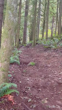
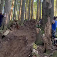
Photos of Olympia Mountain Bike
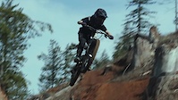
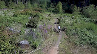
Videos of Olympia Mountain Bike
trail: Scoby
0:54 |
14 |
Nov 26, 2025

trail: Livin' The Dream (Upper)
0:11 |
40 |
May 27, 2025

trail: Slick Jimmy Lower
4:08 |
51 |
Oct 16, 2023

trail: Mr. Bones (Upper)
6:52 |
37 |
Oct 16, 2023

trail: Little Larch
0:14 |
|
Oct 10, 2022
trail: Low Key
0:16 |
418 |
Jul 15, 2022
trail: Octagon (lower)
2:08 |
4959 |
Mar 17, 2021
trail: Level Up
0:24 |
488 |
Jul 6, 2019
Current Trail Warnings
| status | trail | date | condition | user | info |
|---|---|---|---|---|---|
| Greenline Tie | Jun 7, 2026 @ 3:04pm (America/Los_Angeles) Jun 7, 2026 | Variable | daoloth | There was a closed trail sign at the... | |
| McKenny Trail | Jun 3, 2026 @ 11:16am (America/Los_Angeles) Jun 3, 2026 | Unknown | LanceGT4 | The Margaret McKenny campground entrance... |
Recent Trail Reports
| status | trail | date | condition | info | user |
|---|---|---|---|---|---|
| Campground Trail | Jun 11, 2026 @ 12:22pm (America/Vancouver) Jun 11, 2026 | Wet | marebearrr | ||
| Forever Ferns | Jun 11, 2026 @ 12:22pm (America/Vancouver) Jun 11, 2026 | Ideal | marebearrr | ||
| Level Up | Jun 11, 2026 @ 12:22pm (America/Vancouver) Jun 11, 2026 | Ideal | marebearrr | ||
| Lost Valley | Jun 11, 2026 @ 12:22pm (America/Vancouver) Jun 11, 2026 | Variable | marebearrr | ||
| Mima Falls Trail West | Jun 11, 2026 @ 12:22pm (America/Vancouver) Jun 11, 2026 | Wet | marebearrr | ||
| Wedekind Trail | Jun 7, 2026 @ 8:51am (America/Vancouver) Jun 7, 2026 | Variable | daoloth | ||
| Loki Trail | Jun 4, 2026 @ 4:39pm (America/Los_Angeles) Jun 4, 2026 | Wet | reekdeforge | ||
| Porter Trail | May 9, 2026 @ 7:36pm (America/Los_Angeles) May 9, 2026 | Ideal | alwayshardtail | ||
| Slick Jimmy Upper | May 4, 2026 @ 1:10pm (America/Los_Angeles) May 4, 2026 | Ideal | MiniRipperton | ||
| Mr. Bones (Upper) | May 4, 2026 @ 1:10pm (America/Los_Angeles) May 4, 2026 | Ideal | MiniRipperton |
Activity Feed
| username | action | type | title | date |
|---|---|---|---|---|
| JoefJLxA4 | wishlist | route | activity #97429489 | Jun 20, 2026 @ 1:43pm 1 day |
| nick1983 | wishlist | route | activity #97388654 | Jun 20, 2026 @ 6:33am 2 days |
| valhallas | wishlist | route | activity #97366874 | Jun 19, 2026 @ 10:24pm 2 days |
| valhallas | wishlist | trail | activity #97366788 | Jun 19, 2026 @ 10:20pm 2 days |
| ShakiahG | ridden | trail | activity #97361503 | Jun 19, 2026 @ 7:23pm 2 days |
Recent Comments
| username | type | title | comment | date |
|---|---|---|---|---|
| trail | I made the mistake of riding this not for mtb | May 16, 2026 @ 5:58am May 16, 2026 | ||
| trail | Mistagged. It’s a moto trail. Take the fire... | May 9, 2026 @ 7:33pm May 9, 2026 | ||
| trail | Really fun new section of trail! As far as... | Jan 10, 2026 @ 8:58pm Jan 10, 2026 | ||
| report | This one got removed on November 15th. All... | Nov 17, 2025 @ 12:47pm Nov 17, 2025 | ||
| trail | Super fun addition to Octagon. It’s steep,... | Nov 1, 2025 @ 10:36pm Nov 1, 2025 |
Local Badges
-

Completionist0 awarded -

Big Ride 30k4,338 awarded -

Epic Ride 50k1,609 awarded -

Top 10 Trails7 awarded -

Descent 100k Badge20 awarded -
Completionist0 awarded
Bike & Skill Parks
| name | type | city | rating |
|---|---|---|---|
| Grays Harbor ORV | skill park | Olympia |
Activity Type Stats
| activitytype | trails | distance | descent | descent distance | total vertical | rating | global rank | state rank | photos | reports | routes | ridelogs |
|---|---|---|---|---|---|---|---|---|---|---|---|---|
| Mountain Bike | 243 | 323 miles | 54,337 ft | 139 miles | 2,657 ft | #369 | #133 | 586 | 1,873 | 88 | 40,986 | |
| E-Bike | 176 | 266 miles | 42,802 ft | 110 miles | 2,657 ft | #357 | #692 | 1,498 | 5 | 2,764 | ||
| Horse | 23 | 25 miles | 4,606 ft | 9 miles | 1,867 ft | #1,367 | #821 | 312 | 2 | 1 | ||
| Hike | 270 | 313 miles | 44,488 ft | 128 miles | 2,657 ft | #439 | #201 | 3 | 1,645 | 3 | 1,490 | |
| Trail Running | 271 | 314 miles | 44,491 ft | 128 miles | 2,657 ft | #334 | #132 | 1 | 1,647 | 3 | 1,593 | |
| Dirtbike/Moto | 48 | 99 miles | 17,664 ft | 42 miles | 2,536 ft | #92 | #57 | 2 | 375 | 3 | 172 | |
| Observed Trials | 8 | 6 miles | 669 ft | 2 miles | 1,768 ft | #176 | #28 | 8 | 2 | 5 | ||
| ATV/ORV/OHV | 33 | 59 miles | 8,622 ft | 23 miles | 2,536 ft | #371 | #108 | 349 | 2 | 14 |
Frequently Asked Questions About Olympia
▼
What are the best places to ride in Olympia?
Olympia has 16 areas to explore for mountain biking. The top rated areas are:
▼
What are the highest rated mountain biking trails in Olympia?
The highest rated mountain biking trails in Olympia are:
- Low Key (4.5/5)
- Scoby (4.4/5)
- Livin' The Dream (Upper) (4.4/5)
- Mr Bones (lower) (4.4/5)
- Down 'N Rowdy (4.4/5)
▼
What is the best time of the year to ride in Olympia?
Based on ride log data, the most popular months to ride in Olympia are:
- July (380 activities)
- August (324 activities)
- May (288 activities)
▼
Where can I park to ride in Olympia?
There are 38 parking locations listed in Olympia. The most popular parking spots are: View all parking and trailhead locations on the map to plan your visit.
Activities
Trails
Points of Interest
- Kennedy Falls Sight
- Porter Creek Camp Camping
- Shelter Cabin
- Shelter Cabin
- Millersylvania State Park RV Camping
- Millersylvania State Park Camoground Camping
- Mima Falls Campground Camping
- Porter Falls Campground Camping
- Porter Falls Sight
- Fuzzy Top Summit
- Boistfort Peak (3,140 ft)
- Capitol Peak (2,661 ft)
- Little Onion (2,657 ft)
- By superman601 & contributors
- Admins: FOCF, EMBA-C2S, EMBA-C2S
- #5526 - 26,509 views
- olympia activity log | embed map of Olympia mountain bike trails | olympia mountain biking points of interest
Downloading of trail gps tracks in kml & gpx formats is enabled for Olympia.
You must login to download files.