close
-
Layers w
- Weather Layers
- Pro
- Pro
- Pro
- Pro
- Pro
- Pro
- More Layers
- Pro
- Pro
- Pro
- Pro
-
Upgrade to

3D
Trail Conditions
- Unknown
- Snow Groomed
- Snow Packed
- Snow Covered
- Snow Cover Partial
- Freeze/thaw Cycle
- Icy
- Prevalent Mud
- Wet
- Variable
- Ideal
- Dry
- Very Dry
Trail Flow (Ridden Direction)
Trailforks scans users ridelogs to determine the most popular direction each trail is ridden. A good flowing trail network will have most trails flowing in a single direction according to their intension.
The colour categories are based on what percentage of riders are riding a trail in its intended direction.
The colour categories are based on what percentage of riders are riding a trail in its intended direction.
- > 96%
- > 90%
- > 80%
- > 70%
- > 50%
- < 50%
- bi-directional trail
- no data
Trail Last Ridden
Trailforks scans ridelogs to determine the last time a trail was ridden.
- < 2 days
- < 1 week
- < 2 weeks
- < 1 month
- < 6 months
- > 6 months
Trail Ridden Direction
The intended direction a trail should be ridden.
- Downhill Only
- Downhill Primary
- Both Directions
- Uphill Primary
- Uphill Only
- One Direction
Contribute Details
Colors indicate trail is missing specified detail.
- Description
- Photos
- Description & Photos
- Videos
Trail Popularity ?
Trailforks scans ridelogs to determine which trails are ridden the most in the last 9 months.
Trails are compared with nearby trails in the same city region with a possible 25 colour shades.
Think of this as a heatmap, more rides = more kinetic energy = warmer colors.
- most popular
- popular
- less popular
- not popular
ATV/ORV/OHV Filter
Max Vehicle Width
inches
US Cell Coverage
Legend

Radar Time
Activity Recordings
Trailforks uses anonymized public activity data.
?
Activity Recordings
Trailforks uses anonymized public activity data.
?
Personal Heatmap
▶
Activity Types
all
/
none
▶
Options
2
Date range
month
–
Winter Trails
Warning
A routing network for winter maps does not exist. Selecting trails using the winter trails layer has been disabled.
Missing Trails
Most Popular
Least Popular
Trails are colored based on popularity. The more popular a trail is, the more red. Less popular trails trend towards green.
Jump Magnitude Heatmap
Heatmap of where riders jump on trails. Zoom in to see individual jumps, click circles to view jump details.
BC Backroad Status
![map legend]()
Service Road Atlas is a free to use, community-driven service for viewing and creating reports on the numerous back-country service roads around B.C. and Alberta.

Slope Aspect
Direction the slope faces
Trails Deemphasized
Trails are shown in grey.
Only show trails with no bike usage.
Suggested Layers
Based on selected activity type
Save the current map location and zoom level as your default home location whenever this page is loaded.
Save
No description for Omagh has been added yet!
Login or register to submit one.
AKA: An Ómaigh
This region uses the Uk/Euro style trail grading system.
Activities Click to view
- Mountain Bike
17 trails
- E-Bike
17 trails
- Hike
9 trails
- Trail Running
9 trails
Region Details
- 9
- 4
- 4
Region Status
Open as of Feb 18, 2026Stats
- Avg Trail Rating
- Trails (view details)
- 17
- Trails Mountain Bike
- 17
- Trails E-Bike
- 17
- Trails Hike
- 9
- Trails Trail Running
- 9
- Total Distance
- 15 miles
- Total Descent Distance
- 7 miles
- Total Descent
- 2,932 ft
- Total Vertical
- 1,185 ft
- Highest Trailhead
- 1,736 ft
- Reports
- 202
- Photos
- 34
- Ridden Counter
- 1,495
Sub Regions
-
Gortin Glen
- 4
- 4
Popular Omagh Mountain Biking Trails
• 95 ★ 4.7 • 1 mile • 14 ft • 119 •
Kelans Chase is a blue trail which is split into three stages, however only the first and second stage are mapped as they are downhill trails, with the third being an access trail back to the car park. It is advised to turn right after...
• 60 ★ 3.5 • 4,685 ft • 11 ft • 107 •
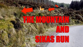
Sika's Run is a red grade trail. The trail starts with a steep chute into a wall ride feature (for advanced riders), followed by berms, rock steps and rock gardens.
• 55 ★ 3.5 • 4,062 ft • 121 ft • 102 •
The Mountain is a red grade trail. The first part of the trail is a climbing section followed by a flat "whoop" section before pointing downhill for the remainder of the trail for some rock steps and tight technical turns. berms and...
• 80 ★ 0.0 • 617 ft • 13 ft • 101 •
A short with technical climbs, small rock steps and bermed corners, ideal for younger riders and riders returning to the car park from and Sika's Run red trails.
• 90 ★ 4.0 • 1 mile • 74 ft • 101 •
The Roller Coaster blue trail consists of a mix of long twisty downhill sections and short flat sections. The trail is split into 4 stages separated by crossing walking trails, all of which are combined on this map. Pumping into and out...
• 85 ★ 0.0 • 600 ft • 12 ft • 100 •
A short with a flat elevation and bermed corners, ideal for younger riders and also a route to climb to the and Sika's Run red trails.
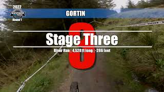
• 25 ★ 4.0 • 4,528 ft • 30 ft • 95 •
River Run is a red grade trail. This trail features a good mix of flat twisty sections as well as downhill flow sections. The trail has several river crossings/bridges and some small rock step / rock garden features. The trail finishes...
• 75 ★ 2.7 • 4,508 ft • 230 ft • 92 •
Kelans Climb is a blue climbing trail which leads you to the downhill trail. Along the trail are rock gardens, rollers, berms and some steep technical switchbacks.
Omagh Mountain Bike Routes
10 miles • 1,992 ft • 38 • Loop •
This route follows the official forest roads to guide users to all the official trails in the Gortin Glens...
5 miles • 1,004 ft • 15 • Loop •
This route follows the official forest roads to guide users to the blue trails in the Gortin Glens forest...
Photos of Omagh Mountain Bike
Videos of Omagh Mountain Bike

trail: The Mountain
4:16 |
5368 |
Mar 20, 2014
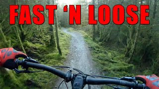
trail: Kelans Chase
0:16 |
227 |
Jan 30, 2023 , Omagh
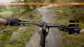
trail: Kelans Chase
0:15 |
206 |
May 13, 2022 , Omagh
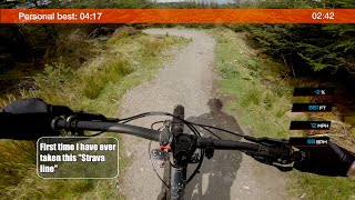
trail: Kelans Chase
4:10 |
216 |
May 7, 2022 , Omagh
24:42 |
163 |
Apr 16, 2022

trail: River Run
6:11 |
460 |
Apr 4, 2022 , Omagh
trail: The Mountain
9:24 |
160 |
Mar 20, 2022 , Omagh

trail: Sika's Run
9:24 |
158 |
Mar 20, 2022 , Omagh
Recent Trail Reports
| status | trail | date | condition | info | user |
|---|---|---|---|---|---|
| The Roller Coaster | Feb 17, 2026 @ 1:50pm (Europe/London) Feb 17, 2026 | Wet | mountainhash | ||
| River Run | Feb 17, 2026 @ 1:50pm (Europe/London) Feb 17, 2026 | Wet | mountainhash | ||
| Skills Trail | Feb 17, 2026 @ 1:50pm (Europe/London) Feb 17, 2026 | Wet | mountainhash | ||
| The Mountain | Feb 17, 2026 @ 1:50pm (Europe/London) Feb 17, 2026 | Wet | mountainhash | ||
| Kelans Chase | Feb 17, 2026 @ 1:50pm (Europe/London) Feb 17, 2026 | Icy | mountainhash | ||
| Skills Trail | Feb 17, 2026 @ 1:50pm (Europe/London) Feb 17, 2026 | Wet | mountainhash | ||
| Kelans Chase Climb | Feb 17, 2026 @ 1:50pm (Europe/London) Feb 17, 2026 | Wet | mountainhash | ||
| Sika's Run | Feb 17, 2026 @ 1:50pm (Europe/London) Feb 17, 2026 | Variable | mountainhash | ||
| Forest Road | Aug 9, 2025 @ 11:07am Aug 9, 2025 | Variable | caoimhinmarsh | ||
| Mullaghcarn Road | May 19, 2025 @ 3:17pm May 19, 2025 | Very Dry | mountainhash |
Activity Feed
| username | action | type | title | date |
|---|---|---|---|---|
| Roman8ycztK | ridden | trail | activity #94359051 | May 9, 2026 @ 10:51am May 9, 2026 |
| mountainhash | add | report | activity #89117783 and 7 more | Feb 18, 2026 @ 4:01am Feb 18, 2026 |
| caoimhinmarsh | add | report | activity #82705899 and 1 more | Oct 20, 2025 @ 6:01am Oct 20, 2025 |
| ngolicki | add | report | activity #80831615 and 1 more | Sep 21, 2025 @ 9:17am Sep 21, 2025 |
| ngolicki | add | photo | activity #80831314 | Sep 21, 2025 @ 9:14am Sep 21, 2025 |
Local Badges
-

Epic Mountain Bike Climb 2k1 awarded -

Climbing 10k Badge9 awarded -

Mountain Biking 100k Badge0 awarded -

Epic Ride Descent 2k1 awarded -

Descent 10k Badge9 awarded -

Descent 100k Badge0 awarded
Activity Type Stats
| activitytype | trails | distance | descent | descent distance | total vertical | rating | global rank | state rank | photos | reports | routes | ridelogs |
|---|---|---|---|---|---|---|---|---|---|---|---|---|
| Mountain Bike | 17 | 15 miles | 2,933 ft | 7 miles | 1,184 ft | #5,807 | #206 | 34 | 202 | 3 | 2,429 | |
| E-Bike | 17 | 15 miles | 2,933 ft | 7 miles | 1,184 ft | #5,080 | #216 | 202 | 3 | 183 | ||
| Hike | 9 | 9 miles | 1,027 ft | 3 miles | 1,184 ft | #10,337 | #338 | 188 | 19 | |||
| Trail Running | 9 | 9 miles | 1,027 ft | 3 miles | 1,184 ft | #9,845 | #322 | 188 | 11 |
Frequently Asked Questions About Omagh
▼
What are the best places to ride in Omagh?
Omagh has 1 areas to explore for mountain biking. The top rated areas are:
▼
What are the highest rated mountain biking trails in Omagh?
The highest rated mountain biking trails in Omagh are:
- Kelans Chase (4.2/5)
- The Roller Coaster (4/5)
- River Run (4/5)
- Sika's Run (3.9/5)
- The Mountain (3.9/5)
▼
What is the best time of the year to ride in Omagh?
Based on ride log data, the most popular months to ride in Omagh are:
- April (11 activities)
- October (9 activities)
- December (8 activities)
▼
Where can I park to ride in Omagh?
There are 2 parking locations listed in Omagh. The most popular parking spots are:
Activities
Trails
- By AaronSloane & contributors
- Admins: GRASS
- #18710 - 1,988 views
- omagh activity log | embed map of Omagh mountain bike trails | omagh mountain biking points of interest
Downloading of trail gps tracks in kml & gpx formats is enabled for Omagh.
You must login to download files.