close
-
Layers w
- Weather Layers
- Pro
- Pro
- Pro
- Pro
- Pro
- Pro
- More Layers
- Pro
- Pro
- Pro
- Pro
-
Upgrade to

3D
Trail Conditions
- Unknown
- Snow Groomed
- Snow Packed
- Snow Covered
- Snow Cover Partial
- Freeze/thaw Cycle
- Icy
- Prevalent Mud
- Wet
- Variable
- Ideal
- Dry
- Very Dry
Trail Flow (Ridden Direction)
Trailforks scans users ridelogs to determine the most popular direction each trail is ridden. A good flowing trail network will have most trails flowing in a single direction according to their intension.
The colour categories are based on what percentage of riders are riding a trail in its intended direction.
The colour categories are based on what percentage of riders are riding a trail in its intended direction.
- > 96%
- > 90%
- > 80%
- > 70%
- > 50%
- < 50%
- bi-directional trail
- no data
Trail Last Ridden
Trailforks scans ridelogs to determine the last time a trail was ridden.
- < 2 days
- < 1 week
- < 2 weeks
- < 1 month
- < 6 months
- > 6 months
Trail Ridden Direction
The intended direction a trail should be ridden.
- Downhill Only
- Downhill Primary
- Both Directions
- Uphill Primary
- Uphill Only
- One Direction
Contribute Details
Colors indicate trail is missing specified detail.
- Description
- Photos
- Description & Photos
- Videos
Trail Popularity ?
Trailforks scans ridelogs to determine which trails are ridden the most in the last 9 months.
Trails are compared with nearby trails in the same city region with a possible 25 colour shades.
Think of this as a heatmap, more rides = more kinetic energy = warmer colors.
- most popular
- popular
- less popular
- not popular
ATV/ORV/OHV Filter
Max Vehicle Width
inches
US Cell Coverage
Legend

Radar Time
Activity Recordings
Trailforks uses anonymized public activity data.
?
Activity Recordings
Trailforks uses anonymized public activity data.
?
Personal Heatmap
▶
Activity Types
all
/
none
▶
Options
2
Date range
month
–
Winter Trails
Warning
A routing network for winter maps does not exist. Selecting trails using the winter trails layer has been disabled.
Missing Trails
Most Popular
Least Popular
Trails are colored based on popularity. The more popular a trail is, the more red. Less popular trails trend towards green.
Jump Magnitude Heatmap
Heatmap of where riders jump on trails. Zoom in to see individual jumps, click circles to view jump details.
BC Backroad Status
![map legend]()
Service Road Atlas is a free to use, community-driven service for viewing and creating reports on the numerous back-country service roads around B.C. and Alberta.

Slope Aspect
Direction the slope faces
Trails Deemphasized
Trails are shown in grey.
Only show trails with no bike usage.
Suggested Layers
Based on selected activity type
Save the current map location and zoom level as your default home location whenever this page is loaded.
Save
No description for Oneida County has been added yet!
Login or register to submit one.
Activities Click to view
- Mountain Bike
114 trails
- E-Bike
57 trails
- Hike
108 trails
- Trail Running
108 trails
- Snowshoe
14 trails
- Nordic Ski
60 trails
Stats
- Avg Trail Rating
- Trails (view details)
- 138
- Trails Mountain Bike
- 114
- Trails E-Bike
- 57
- Trails Hike
- 108
- Trails Trail Running
- 108
- Trails Observed Trials
- 1
- Trails Snowshoe
- 14
- Trails Nordic Ski
- 60
- Total Distance
- 127 miles
- Total Descent
- 6,344 ft
- Total Vertical
- 234 ft
- Highest Trailhead
- 1,723 ft
- Reports
- 206
- Photos
- 43
- Ridden Counter
- 4,210
Sub Regions
- Harshaw (4)
- Nose Lake Trails (4)
- Minocqua (16)
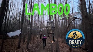
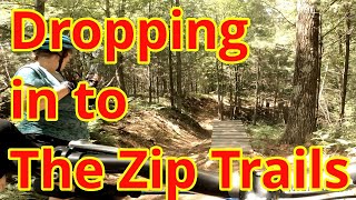
- LAMBO Zip Trail (18)
- Rhinelander (58)
- Tomahawk (5)
- Woodboro (13)
- Woodruff (9)
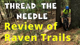
- Raven Trails (8)
Popular Oneida County Mountain Biking Trails
• 50 ★ 5.0 • 2 miles • 140 ft • 172 •
FREE and open to the public. Groomed for winter fat-biking. About 3.35 miles long. Fun fast and accessible for all riders. Developed with support from the Northwoods Zip Line, The town of Minocqua, and the Wisconsin DNR.
• 75 ★ 5.0 • 2,549 ft • 3 ft • 170 •
Fastest of the ZIP trails! Drop your seat post and let'r rip!
• 65 ★ 0.0 • 1,811 ft • 0 ft • 165 •
Several optional features with a fun drop, kicker, and table at the bottom
• 40 ★ 5.0 • 1,552 ft • 3 ft • 147 •
Moderately popular green difficulty singletrack. This multi-use trail can be used one direction and has a easy overall physical rating with a 3 ft green climb. It features bridge. Trail visibility is always easy to follow. On average it takes 2 minutes to complete this trail.
• 95 ★ 3.8 • 6 miles • 412 ft • 132 •
Popular blue difficulty singletrack. This multi-use trail can be used both directions and has a moderate overall physical rating with a 412 ft blue climb. Winter use: Groomed Smooth snow grooming. On average it takes 40 minutes to complete this trail.
Oneida County Mountain Bike Routes
5 miles • 360 ft • 0 •
6 miles • 365 ft • 1 • Loop • Race •
This is the potential WI NICA JV3/Var Lap 2024
Photos of Oneida County Mountain Bike
Videos of Oneida County Mountain Bike
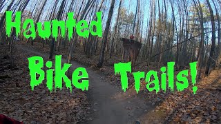
trail: Flowdag
3:47 |
63 |
Apr 2, 2026 , Rhinelander
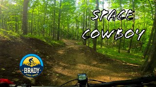
trail: Space Cowboy
4:50 |
75 |
Sep 11, 2025 , Rhinelander

trail: Flowdag
39:16 |
112 |
Sep 11, 2025 , Rhinelander
trail: Sue 1
4:54 |
107 |
Nov 10, 2024 , Minocqua
trail: Gem Trail
5:14 |
195 |
Oct 31, 2022 , Minocqua
10:08 |
150 |
Sep 9, 2022
17:56 |
254 |
Sep 9, 2022
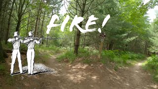
trail: Fire
0:41 |
208 |
Jul 31, 2022 , Minocqua
Recent Trail Reports
| status | trail | date | condition | info | user |
|---|---|---|---|---|---|
| North Cassian Loop Cassian Ski & Bike Trail | May 21, 2026 @ 12:08pm (America/Chicago) May 21, 2026 | Unknown | pppielage FOH | ||
| MTB & Snowshoe Loop Raven Trails | Apr 27, 2026 @ 12:09pm (America/Chicago) Apr 27, 2026 | Dry | SterlingFBhn2D | ||
| Woodruff Road Parking Area Access Raven Trails | Sep 26, 2025 @ 8:54am (America/Chicago) Sep 26, 2025 | Variable | nbnNmp | ||
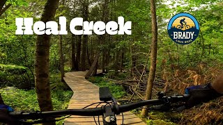
| Beaver Street Heal Creek Bike Park | Aug 25, 2025 @ 3:47pm Aug 25, 2025 | Dry | Northsupply | ||
| Over LAMBO Zip Trail | Aug 17, 2025 @ 12:48pm Aug 17, 2025 | Ideal | Rassierm | ||
| Under LAMBO Zip Trail | Aug 17, 2025 @ 12:48pm Aug 17, 2025 | Ideal | Rassierm | ||
| Mis-Fire LAMBO Zip Trail | Aug 17, 2025 @ 12:48pm Aug 17, 2025 | Ideal | Rassierm | ||
| Reload LAMBO Zip Trail | Aug 17, 2025 @ 12:48pm Aug 17, 2025 | Ideal | Rassierm | ||
| Ready LAMBO Zip Trail | Aug 17, 2025 @ 12:48pm Aug 17, 2025 | Ideal | Rassierm | ||
| Gem Trail LAMBO Zip Trail | Aug 17, 2025 @ 12:48pm Aug 17, 2025 | Ideal | Rassierm |
Activity Feed
| username | action | type | title | date |
|---|---|---|---|---|
| Candyj | add | trail | activity #97173207 and 1 more | Jun 17, 2026 @ 4:18am 2 days |
| JessVHn93h | wishlist | region | activity #97125242 | Jun 16, 2026 @ 11:14am 3 days |
| gwidter37 | wishlist | region | activity #96846910 | Jun 12, 2026 @ 8:52pm Jun 12, 2026 |
| KellyCUIgQJ | comment | trail | activity #95498132 | May 25, 2026 @ 9:49am May 25, 2026 |
| drtechnickal | ridden | trail | activity #95458305 | May 24, 2026 @ 5:46pm May 24, 2026 |
Recent Comments
| username | type | title | comment | date |
|---|---|---|---|---|
| trail | Did this on my 11th or so mtb ride, and... | May 25, 2026 @ 9:49am May 25, 2026 | ||
| trail | Rasta are Northwoods heroes. Great vision and... | Aug 4, 2025 @ 7:01am Aug 4, 2025 | ||
| trail | Love these trails! Plenty of variety and... | Aug 3, 2025 @ 9:14am Aug 3, 2025 | ||
| trail | Still the best trail within a 1.5hr drive. | Jul 6, 2025 @ 11:14am Jul 6, 2025 | ||
| trail | Very fun trail! Good for intermediate riders... | Jul 5, 2024 @ 6:40am Jul 5, 2024 |
Local Badges
-

10 Blue Trails4 awarded -

Climbing 10k Badge0 awarded -
Climbing 10k Badge1 awarded -

Epic Mountain Bike Climb 2k0 awarded -
Epic Mountain Bike Climb 2k0 awarded -

Epic Ride 50k13 awarded
Bike & Skill Parks
| name | type | city | rating |
|---|---|---|---|
| Heal Creek Skills Park | skill park | Rhinelander |
Activity Type Stats
| activitytype | trails | distance | descent | descent distance | total vertical | rating | global rank | state rank | photos | reports | routes | ridelogs |
|---|---|---|---|---|---|---|---|---|---|---|---|---|
| Mountain Bike | 114 | 85 miles | 4,708 ft | 31 miles | 210 ft | 32 | 198 | 5 | 6,029 | |||
| E-Bike | 57 | 23 miles | 312 ft | 10 miles | 174 ft | 183 | 156 | |||||
| Hike | 108 | 80 miles | 4,695 ft | 30 miles | 210 ft | 198 | 215 | |||||
| Trail Running | 108 | 80 miles | 4,695 ft | 30 miles | 210 ft | 198 | 35 | |||||
| Observed Trials | 1 | 2 | ||||||||||
| Snowshoe | 14 | 26 miles | 856 ft | 7 miles | 89 ft | 28 | 17 | |||||
| Nordic Ski | 60 | 55 miles | 2,011 ft | 18 miles | 174 ft | 25 | 359 |
Frequently Asked Questions About Oneida County
▼
What are the best places to ride in Oneida County?
Oneida County has 13 areas to explore for mountain biking. The top rated areas are:
▼
What are the highest rated mountain biking trails in Oneida County?
The highest rated mountain biking trails in Oneida County are:
- Gem Trail (4.3/5)
- Reload (4.2/5)
- Aim (4.2/5)
- More BS (4.1/5)
- Lee's Loop (4.1/5)
▼
What is the best time of the year to ride in Oneida County?
Based on ride log data, the most popular months to ride in Oneida County are:
- July (92 activities)
- August (40 activities)
- June (39 activities)
▼
What is the longest trail in Oneida County?
The longest trail in Oneida County is Bearskin State Trail at 19.9 miles. View all trails sorted by distance.
Activities
Trails
Points of Interest
- By brenthillier
 NSMBA TRAILFORKS & contributors
 - Admins: MW HIKING, feardabeast, LAMBO
- #10984 - 3,025 views
- oneida county activity log | embed map of Oneida County mountain bike trails | oneida county mountain biking points of interest
Downloading of trail gps tracks in kml & gpx formats is enabled for Oneida County.
You must login to download files.