close
-
Layers w
- Weather Layers
- Pro
- Pro
- Pro
- Pro
- Pro
- Pro
- More Layers
- Pro
- Pro
- Pro
- Pro
-
Upgrade to

3D
Trail Conditions
- Unknown
- Snow Groomed
- Snow Packed
- Snow Covered
- Snow Cover Partial
- Freeze/thaw Cycle
- Icy
- Prevalent Mud
- Wet
- Variable
- Ideal
- Dry
- Very Dry
Trail Flow (Ridden Direction)
Trailforks scans users ridelogs to determine the most popular direction each trail is ridden. A good flowing trail network will have most trails flowing in a single direction according to their intension.
The colour categories are based on what percentage of riders are riding a trail in its intended direction.
The colour categories are based on what percentage of riders are riding a trail in its intended direction.
- > 96%
- > 90%
- > 80%
- > 70%
- > 50%
- < 50%
- bi-directional trail
- no data
Trail Last Ridden
Trailforks scans ridelogs to determine the last time a trail was ridden.
- < 2 days
- < 1 week
- < 2 weeks
- < 1 month
- < 6 months
- > 6 months
Trail Ridden Direction
The intended direction a trail should be ridden.
- Downhill Only
- Downhill Primary
- Both Directions
- Uphill Primary
- Uphill Only
- One Direction
Contribute Details
Colors indicate trail is missing specified detail.
- Description
- Photos
- Description & Photos
- Videos
Trail Popularity ?
Trailforks scans ridelogs to determine which trails are ridden the most in the last 9 months.
Trails are compared with nearby trails in the same city region with a possible 25 colour shades.
Think of this as a heatmap, more rides = more kinetic energy = warmer colors.
- most popular
- popular
- less popular
- not popular
ATV/ORV/OHV Filter
Max Vehicle Width
inches
US Cell Coverage
Legend

Radar Time
Activity Recordings
Trailforks uses anonymized public activity data.
?
Activity Recordings
Trailforks uses anonymized public activity data.
?
Personal Heatmap
▶
Activity Types
all
/
none
▶
Options
2
Date range
month
–
Winter Trails
Warning
A routing network for winter maps does not exist. Selecting trails using the winter trails layer has been disabled.
Missing Trails
Most Popular
Least Popular
Trails are colored based on popularity. The more popular a trail is, the more red. Less popular trails trend towards green.
Jump Magnitude Heatmap
Heatmap of where riders jump on trails. Zoom in to see individual jumps, click circles to view jump details.
BC Backroad Status
![map legend]()
Service Road Atlas is a free to use, community-driven service for viewing and creating reports on the numerous back-country service roads around B.C. and Alberta.

Slope Aspect
Direction the slope faces
Trails Deemphasized
Trails are shown in grey.
Only show trails with no bike usage.
Suggested Layers
Based on selected activity type
Save the current map location and zoom level as your default home location whenever this page is loaded.
Save
No description for Oneonta has been added yet!
Login or register to submit one.
Activities Click to view
- Mountain Bike
103 trails
- E-Bike
6 trails
- Adaptive Bike
0 trails
- Winter Fat Bike
0 trails
- Hike
107 trails
- Trail Running
108 trails
- Snowmobile
25 trails
- Snowshoe
65 trails
- Backcountry Ski
6 trails
- Nordic Ski
38 trails
Region Details
- 4
- 4
- 26
- 56
- 12
Region Status
Open as of Jun 17, 2026Stats
- Avg Trail Rating
- Trails (view details)
- 132
- Trails Mountain Bike
- 103
- Trails E-Bike
- 6
- Trails Horse
- 3
- Trails Hike
- 107
- Trails Trail Running
- 108
- Trails Snowmobile
- 25
- Trails Snowshoe
- 65
- Trails Backcountry Ski
- 6
- Trails Nordic Ski
- 38
- Total Distance
- 172 miles
- Total Descent
- 23,893 ft
- Total Vertical
- 1,084 ft
- Highest Trailhead
- 2,089 ft
- Reports
- 162
- Photos
- 46
- Ridden Counter
- 2,656
Sub Regions
-
City Watershed
- 1
- 5
- 13
-
College Camp
- 9
- 1
-
Delaware-Otsego Audubon Society
- 1
- 4
-
Hartwick College
- 4
- 6
- 2
-
Homer Folks
- 1
- 8
- 2
-
New Island
- 1
- 5
- 4
-
Wilber Park
- 6
- 11
- 4
Popular Oneonta Mountain Biking Trails
• 100 ★ 4.0 • 3,579 ft • 2 ft • 127 •
R.I.P is a bi-directional trail starting at the Water Tanks above Homer Folks Job Corps campus, and ending at the north end of Strawberry Fields. It intersects and and is a local favorite in both directions. Starting at the top the...
• 90 ★ 2.0 • 3,018 ft • 72 ft • 115 •
This trail is a local favorite, named for the half-dozen nests of ground bees discovered the hard way during construction. Fun in both directions and loaded with optional TTFs including root clusters, rock ledge-ups, drops, and jumps....
• 85 ★ 3.0 • 4,150 ft • 24 ft • 109 •
is a bidirectional, technical singletrack. It is loaded with rock gardens, drops, ledge-ups, root clusters, boulders, tight turns, off-camber sections, and punchy, out-of-saddle climbs. It has several sections with multiple lines...
• 95 ★ 3.0 • 1,558 ft • 0 ft • 84 •
Shake-Down was built in 2011 as an alternate to the access road from the Homer Folks Campus to the top of the ridge and the water tanks. Smooth and bench-cut, it makes for a nice warm-up climb up to the water tanks or a quick ripper...
• 85 ★ 4.0 • 1,549 ft • 67 ft • 83 •
Red Maple is a short addition to the Homer Folks Trail system built by Sam Brown-Shaklee and the SUNY Oneonta Mountain Biking Club in 2012. If riding from South to North, the first half is an old-school, meandering climb and the second...
• 100 ★ 2.0 • 1,801 ft • 44 ft • 79 •
Sections of trail may not be usable due to solar field construction. Use caution and follow any detours or other warning signage posted by the Hartwick Trails Committee.
• 75 ★ 5.0 • 1 mile • 245 ft • 61 •
Blood Sweat & Tears was the first foray into mountain biking by the SUNY Oneonta Mountain Biking Club. Built between 2008 and 2010, Blood Sweat & Tears is an Oneonta favorite for bikers, walkers, runners, and cross-country skiers.
• 80 ★ 5.0 • 1 mile • 5 ft • 58 •
Inspired by DH race tracks of the northeast, this downhill-primary trail takes the flow and features of a downhill race track and scales them down to suit XC and trail bikes. With a twisty, pedally, bumpy top section, fast and flowy...
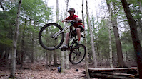
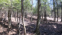
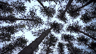
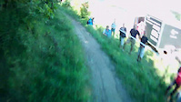
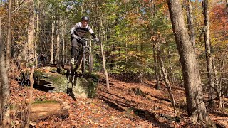
Photos of Oneonta Mountain Bike
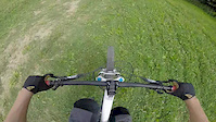
Videos of Oneonta Mountain Bike
trail: Nemisis/Flow Track Traverse
2:27 |
376 |
May 17, 2016
trail: Nemisis/Flow Track Traverse
0:27 |
229 |
Apr 27, 2016
trail: Blue Trail
5:19 |
121 |
Aug 17, 2015
trail: Black Coffee
6:30 |
23876 |
Dec 28, 2013
trail: Nemisis/Flow Track Traverse
45:58 |
321 |
Oct 23, 2011
9:28 |
207 |
Oct 7, 2023
Current Trail Warnings
| status | trail | date | condition | user | info |
|---|---|---|---|---|---|
| Ridge Runner | Jun 17, 2026 @ 7:47pm (America/New_York) Jun 17, 2026 | Unknown | Brad6y0yAq | near table rock is trail is impassable. ... | |
| Fork Buster | Jun 17, 2026 @ 7:43pm (America/New_York) Jun 17, 2026 | Unknown | Brad6y0yAq | trail messed up due to logging | |
| Sender | Jun 17, 2026 @ 7:42pm (America/New_York) Jun 17, 2026 | Unknown | Brad6y0yAq | logging ruined trail can't ride it |
Recent Trail Reports
| status | trail | date | condition | info | user |
|---|---|---|---|---|---|
| Ditch Route | May 16, 2026 @ 4:41pm (America/New_York) May 16, 2026 | Ideal | MrEndo CNY D.I.R.T | ||
| The Pit | May 16, 2026 @ 4:41pm (America/New_York) May 16, 2026 | Ideal | MrEndo CNY D.I.R.T | ||
| Dirty Window | May 16, 2026 @ 4:41pm (America/New_York) May 16, 2026 | Unknown | MrEndo CNY D.I.R.T | ||
| North Entry | May 16, 2026 @ 4:00pm (America/New_York) May 16, 2026 | Ideal | MrEndo CNY D.I.R.T | ||
| Autobahn | Nov 20, 2025 @ 9:23pm (America/New_York) Nov 20, 2025 | Prevalent Mud | Brad6y0yAq | ||
| Morgan Ave. Ext (The Punisher) | Nov 20, 2025 @ 9:21pm (America/New_York) Nov 20, 2025 | Prevalent Mud | Brad6y0yAq | ||
| East Side | Sep 30, 2025 @ 4:17pm (America/New_York) Sep 30, 2025 | Unknown | mfrphoto | ||
| Yellow Trail | Dec 20, 2024 @ 8:12am Dec 20, 2024 | Unknown | Plymovent OTA | ||
| Trailhead / Parking Area | Dec 20, 2024 @ 8:12am Dec 20, 2024 | Unknown | Plymovent OTA | ||
| Sosa Side Step | Dec 20, 2024 @ 8:12am Dec 20, 2024 | Unknown | Plymovent OTA |
Activity Feed
| username | action | type | title | date |
|---|---|---|---|---|
| Brad6y0yAq | add | report | activity #97217167 and 3 more | Jun 17, 2026 @ 4:40pm Jun 17, 2026 |
| Plymovent | add | trail | activity #96729431 | Jun 11, 2026 @ 4:59am Jun 11, 2026 |
| Plymovent | update | trail | activity #96728645 and 5 more | Jun 11, 2026 @ 4:37am Jun 11, 2026 |
| Plymovent | comment | report | activity #96334742 | Jun 5, 2026 @ 6:10pm Jun 5, 2026 |
| BBT3 | add | report | activity #96334297 | Jun 5, 2026 @ 6:02pm Jun 5, 2026 |
Recent Comments
| username | type | title | comment | date |
|---|---|---|---|---|
| report | Brush hogging scheduled for June 27th | Jun 5, 2026 @ 6:10pm Jun 5, 2026 | ||
| report | Trail closed due to logging | Mar 8, 2026 @ 9:09am Mar 8, 2026 | ||
| report | logging closed for a long time | Nov 20, 2025 @ 6:19pm Nov 20, 2025 | ||
| report | Logging has started trail closed | Nov 20, 2025 @ 1:53pm Nov 20, 2025 | ||
| trail | Trail is leaf blown and clear 11/8/2025 | Nov 9, 2025 @ 4:20pm Nov 9, 2025 |
Local Badges
-

10 Black Trails10 awarded -

Epic Ride 50k34 awarded -

Top 10 Trails5 awarded -

Completionist0 awarded -
Completionist0 awarded -

10 Green Trails3 awarded
Bike & Skill Parks
| name | type | city | rating |
|---|---|---|---|
| Skillpark | skill park | Oneonta | |
| Skate Park | skill park | Oneonta | |
| Beginner Skill Park | skill park | Oneonta |
Local Trail Supporters
- Otsego Bicycles
Activity Type Stats
| activitytype | trails | distance | descent | descent distance | total vertical | rating | global rank | state rank | photos | reports | routes | ridelogs |
|---|---|---|---|---|---|---|---|---|---|---|---|---|
| Mountain Bike | 103 | 54 miles | 6,791 ft | 20 miles | 1,050 ft | #2,834 | #1,004 | 44 | 161 | 2,570 | ||
| E-Bike | 6 | 2 miles | 135 ft | 1,942 ft | 686 ft | #5,655 | #1,747 | 83 | 816 | |||
| Horse | 3 | 1 mile | 52 ft | 2,231 ft | 59 ft | 22 | ||||||
| Hike | 107 | 56 miles | 6,919 ft | 21 miles | 1,050 ft | #3,237 | #1,138 | 161 | 429 | |||
| Trail Running | 108 | 56 miles | 6,965 ft | 21 miles | 1,050 ft | #2,884 | #828 | 161 | 151 | |||
| Snowmobile | 25 | 116 miles | 16,926 ft | 48 miles | 994 ft | #48 | #37 | 1 | ||||
| Snowshoe | 65 | 34 miles | 3,593 ft | 12 miles | 1,050 ft | #403 | #124 | 34 | 24 | |||
| Backcountry Ski | 6 | 3 miles | 289 ft | 3,494 ft | 262 ft | #511 | #139 | 4 | 20 | |||
| Nordic Ski | 38 | 20 miles | 1,115 ft | 6 miles | 1,050 ft | #657 | #227 | 2 | 25 | 20 |
Frequently Asked Questions About Oneonta
▼
What are the best places to ride in Oneonta?
Oneonta has 9 areas to explore for mountain biking. The top rated areas are:
▼
What are the highest rated mountain biking trails in Oneonta?
The highest rated mountain biking trails in Oneonta are:
- Sender (4.4/5)
- Widowmaker (4.3/5)
- Fork Buster (4.2/5)
- Blood Sweat & Tears (4.1/5)
- R.I.P. (4/5)
▼
What is the best time of the year to ride in Oneonta?
Based on ride log data, the most popular months to ride in Oneonta are:
- July (50 activities)
- August (32 activities)
- June (31 activities)
▼
Where can I park to ride in Oneonta?
There are 9 parking locations listed in Oneonta. The most popular parking spots are: View all parking and trailhead locations on the map to plan your visit.
Activities
Trails
Points of Interest
- By sammybikes916 MLTS & contributors
- Admins: OTA
- #8130 - 9,823 views
- oneonta activity log | embed map of Oneonta mountain bike trails | oneonta mountain biking points of interest
Downloading of trail gps tracks in kml & gpx formats is enabled for Oneonta.
You must login to download files.