close
-
Layers w
- Weather Layers
- Pro
- Pro
- Pro
- Pro
- Pro
- Pro
- More Layers
- Pro
- Pro
- Pro
- Pro
-
Upgrade to

3D
Trail Conditions
- Unknown
- Snow Groomed
- Snow Packed
- Snow Covered
- Snow Cover Partial
- Freeze/thaw Cycle
- Icy
- Prevalent Mud
- Wet
- Variable
- Ideal
- Dry
- Very Dry
Trail Flow (Ridden Direction)
Trailforks scans users ridelogs to determine the most popular direction each trail is ridden. A good flowing trail network will have most trails flowing in a single direction according to their intension.
The colour categories are based on what percentage of riders are riding a trail in its intended direction.
The colour categories are based on what percentage of riders are riding a trail in its intended direction.
- > 96%
- > 90%
- > 80%
- > 70%
- > 50%
- < 50%
- bi-directional trail
- no data
Trail Last Ridden
Trailforks scans ridelogs to determine the last time a trail was ridden.
- < 2 days
- < 1 week
- < 2 weeks
- < 1 month
- < 6 months
- > 6 months
Trail Ridden Direction
The intended direction a trail should be ridden.
- Downhill Only
- Downhill Primary
- Both Directions
- Uphill Primary
- Uphill Only
- One Direction
Contribute Details
Colors indicate trail is missing specified detail.
- Description
- Photos
- Description & Photos
- Videos
Trail Popularity ?
Trailforks scans ridelogs to determine which trails are ridden the most in the last 9 months.
Trails are compared with nearby trails in the same city region with a possible 25 colour shades.
Think of this as a heatmap, more rides = more kinetic energy = warmer colors.
- most popular
- popular
- less popular
- not popular
ATV/ORV/OHV Filter
Max Vehicle Width
inches
US Cell Coverage
Legend

Radar Time
Activity Recordings
Trailforks uses anonymized public activity data.
?
Activity Recordings
Trailforks uses anonymized public activity data.
?
Personal Heatmap
▶
Activity Types
all
/
none
▶
Options
2
Date range
month
–
Winter Trails
Warning
A routing network for winter maps does not exist. Selecting trails using the winter trails layer has been disabled.
Missing Trails
Most Popular
Least Popular
Trails are colored based on popularity. The more popular a trail is, the more red. Less popular trails trend towards green.
Jump Magnitude Heatmap
Heatmap of where riders jump on trails. Zoom in to see individual jumps, click circles to view jump details.
BC Backroad Status
![map legend]()
Service Road Atlas is a free to use, community-driven service for viewing and creating reports on the numerous back-country service roads around B.C. and Alberta.

Slope Aspect
Direction the slope faces
Trails Deemphasized
Trails are shown in grey.
Only show trails with no bike usage.
Suggested Layers
Based on selected activity type
Save the current map location and zoom level as your default home location whenever this page is loaded.
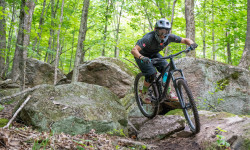
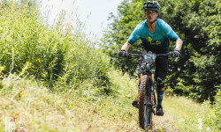
SaveOntario hosts thousands of kilometres of mountain bike trails for you to explore, no two experiences will be the same. Choose from untouched conservation lands, rugged technical trails, hand-built flow trails or even abandoned logging roads. And with the fat biking trend increasing, off-road cycling in Ontario is a four-season activity.
Mountain biking is fast becoming a popular resort activity, so can include it on in your vacation plans at popular resorts like Horseshoe, Sir Sam’s, and Deerhurst offer a variety of biking experiences, including mountain biking. From flowy trails right in the heart of Toronto in the Don Valley to rocky technical trails in Muskoka, Ontario boasts a wide variety of trails for every level of rider.
Mountain biking is fast becoming a popular resort activity, so can include it on in your vacation plans at popular resorts like Horseshoe, Sir Sam’s, and Deerhurst offer a variety of biking experiences, including mountain biking. From flowy trails right in the heart of Toronto in the Don Valley to rocky technical trails in Muskoka, Ontario boasts a wide variety of trails for every level of rider.
source: Discover Ontario
Region Details
- 4,140
- 1,622
- 4,926
- 3,341
- 1,130
- 204
- 26
Stats
- Avg Trail Rating
- Trails (view details)
- 18,928
- Trails Mountain Bike
- 15,410
- Trails E-Bike
- 5,629
- Trails Gravel Bike
- 1,259
- Trails Adaptive Bike
- 2,314
- Trails Winter Fat Bike
- 3,964
- Trails Horse
- 1,665
- Trails Hike
- 16,833
- Trails Trail Running
- 16,623
- Trails Dirtbike/Moto
- 1,003
- Trails Observed Trials
- 25
- Trails ATV/ORV/OHV
- 935
- Trails Snowmobile
- 1,049
- Trails Snowshoe
- 9,444
- Trails Downhill Ski
- 604
- Trails Backcountry Ski
- 456
- Trails Nordic Ski
- 5,570
- Total Distance
- 13,235 miles
- Total Descent
- 871,430 ft
- Total Vertical
- 2,097 ft
- Highest Trailhead
- 2,238 ft
- Reports
- 163,046
- Photos
- 26,828
- Ridden Counter
- 2,223,770
Articles
Race Report: Ontario Enduro Series Round 1 - Huntsville
Jul 21, 2025 from pinkbike.com
Despite the terrain in Ontario not allowing for big mountain enduros, the energy and momentum to make it a viable destination for staged enduro...
Race Report: Canadian Enduro League Eastern Cup, Huntsville, Ontario
Jul 19, 2024 from pinkbike.com
The We Are One Canadian Enduro League Presented By Leatt Eastern Cup tested riders on the Hidden Valley Ski Resort trail network.
The 10 Most Beautiful National Parks in Canada
Jun 17, 2024 from outsideonline.com
Spectacular mountains and deep fjords, powder-blue lakes and sea stacks: here’s your bucket list of national parks to visit up north

Grow Cycling Foundation's Inglewood Pumptrack is Officially Open
Sep 27, 2023 from pinkbike.com
This weekend was the official opening of the Inglewood Pumptrack, thanks to the work of Grow Cycling and its founder, Eliot Jackson.
Popular Trail Networks
view all areas »Sub Regions
- Central (7,281)
- City of Toronto (1,778)
- Durham Region (922)
- Halton Region (443)
- Muskoka District (399)
- Peel Region (477)
- Simcoe County (2,225)
- York Region (1,142)
- Eastern (2,741)
- Frontenac County (228)
- Haliburton County (289)
- Hastings County (149)
- Kawartha Lakes (151)
- Lanark County (56)
- Leeds & Grenville County (218)
- Lennox & Addington County (57)
- National Capital Region (Ottawa) (568)
- Northumberland County (337)
- Peterborough County (196)
- Prescott & Russell County (116)
- Prince Edward County (36)
- Renfrew County (259)
- Stormont, Dundas & Glengarry County (75)
- Northern (1,960)
- Algoma District (372)
- Cochrane District (204)
- District of Parry Sound (109)
- Kenora District (198)
- Manitoulin Island (16)
- Nipissing District (399)
- Rainy River District (27)
- Sudbury District (428)
- Thunder Bay District (229)
- Timiskaming District (26)
- Western (3,455)
- Bruce County (135)
- Chatham-Kent County (36)
- County of Brant (49)
- Dufferin County (186)
- Elgin County (130)
- Essex County (110)
- Grey County (617)
- Haldimand County (50)
- Huron County (123)
- Lambton County (23)
- Middlesex County (153)
- Niagara Region (313)
- Norfolk County (172)
- Oxford County (63)
- Perth County (44)
- Region of Hamilton-Wentworth (358)
- Waterloo Region (601)
- Wellington County (356)
Popular Ontario Mountain Biking Trails
• 100 ★ 4.5 • 2,136 ft • 0 ft • 2,918 •
Great down hill from the Map Kiosk. Loads of flow with a great sweeping corner at the end. Keep the flow going all the way back to the Glasgow Lot.
• 100 ★ 3.9 • 1,827 ft • 85 ft • 2,886 •
Mostly uphill with a few quick descents where it pays to carry speed into the next uphill. has 2 steeper sections that will challenge newer riders. There is an optional rock rollover to the right of the trail on an uphill and an...
• 95 ★ 3.3 • 2,093 ft • 25 ft • 2,795 •
Popular blue difficulty singletrack. This mountain bike primary trail and has a easy overall physical rating with a 25 ft green climb. On average it takes 3 minutes to complete this trail.
• 80 ★ 3.7 • 2,720 ft • 54 ft • 2,770 •
Popular blue difficulty singletrack. This mountain bike primary trail can be used one direction and has a easy overall physical rating with a 54 ft blue climb. On average it takes 1 minutes to complete this trail.
• 95 ★ 3.6 • 3,133 ft • 86 ft • 2,753 •
Popular blue difficulty singletrack. This mountain bike primary trail and has a hard overall physical rating with a 86 ft black diamond climb. On average it takes 6 minutes to complete this trail.
• 100 ★ 4.2 • 3,035 ft • 96 ft • 2,726 •
Return Trail with a steady climb up a hill back to the start where you can either go back to the East Parking Lot via , ride , or go back down via or .
Ontario Mountain Bike Routes
Fun Course Featured
★ 5.0 • 3 miles • 199 ft • 5 • Loop •
An easy beginner course. Starts with slow climb to high point on double track. Easy single track and ends...
G2G Rail Trail Featured
90 miles • 640 ft • 3 • Point to Point •
The fully accessible 132 KM Rail Trail Experience that is a multi-use green space from the 401 corridor at...
SCMBC Oro FatBike 2025 Featured
★ 5.0 • 14 miles • 982 ft • 10 • Loop •
SCMBC Oro fat bike route for 2025
Agreement Forest Easy Featured
★ 5.0 • 10 miles • 261 ft • 20 • Loop •
EASIER ROUTE FOR FIRST RIDE AT AGREEMENT FOREST
★ 1.0 • 11 miles • 1,485 ft • 30 • Loop •
Every HMBA trail at Hidden Valley / Deerhurst in the main area. Does not include the Driving Range trails.
WMBC Sept Social Ride - Advanced Featured
7 miles • 566 ft • 8 • Loop •
This is the Advanced Route for the social ride on Tuesday Sep 17, starting at 6:00 pm at Buzzy Brown's...
Photos of Ontario Mountain Bike
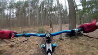
Videos of Ontario Mountain Bike
featured
![Copeland - April 16th, 2017]()
trail: Copeland Downhill
4:14 |
907 |
Apr 16, 2017
trail: Firepit
0:17 |
|
Jun 14, 2026

trail: Firepit
0:17 |
|
Jun 12, 2026
trail: Trinity Bellwoods X-ing
0:12 |
9 |
May 1, 2026
trail: Donaconda
0:22 |
26 |
Apr 19, 2026

trail: Castle Frank
0:43 |
42 |
Mar 29, 2026

trail: ST0
0:41 |
6 |
Feb 17, 2026

trail: Matheson Loop
0:23 |
20 |
Jan 29, 2026
Activity Feed
| username | action | type | title | date |
|---|---|---|---|---|
| hazelstew | add | report | activity #97259382 | Jun 18, 2026 @ 9:56am 3 mins |
| Canadmos | add | report | activity #97254635 and 1 more | Jun 18, 2026 @ 8:38am 1 hours |
| Canadmos | update | trail | activity #97254544 | Jun 18, 2026 @ 8:37am 1 hours |
| jacobondirt | ridden | trail | activity #97252674 and 5 more | Jun 18, 2026 @ 8:04am 2 hours |
| will-rides-bikes | add | report | activity #97246982 and 8 more | Jun 18, 2026 @ 6:13am 4 hours |
Recent Comments
| username | type | title | comment | date |
|---|---|---|---|---|
| report | I am not sure how to attach a screenshot.. its... | Jun 17, 2026 @ 3:51pm 18 hours | ||
| report | Can you locate with a screenshot on Trailforks... | Jun 17, 2026 @ 5:35am 1 day | ||
| report | Ride around started at the down tree and... | Jun 16, 2026 @ 7:34am 2 days | ||
| report | right before the rock gardens, I think | Jun 16, 2026 @ 4:55am 2 days | ||
| report | I think I know what their talking about. It's... | Jun 16, 2026 @ 4:55am 2 days |
Local Badges
-

Batawa Shred the Gnar235 awarded -

The Miner0 awarded -

Horseshoe Single Ride Thriller v218 awarded -

Completionist4 awarded -

Completionist217 awarded -

MORCA Double Black Diamonds!48 awarded
Bike & Skill Parks
| name | type | city | rating |
|---|---|---|---|
| Horseshoe Valley Bike Park | bike park | Oro-Medonte | |
| Boler Mountain | bike park | London | |
| Sir Sam's Ski / Ride | bike park | Haliburton | |
| Wilderness Tours Bike Park | bike park | Beachburg | |
| Crother's Woods Skill Park / Pump Track | skill park | Toronto |
Upcoming Local Events
Activity Type Stats
| activitytype | trails | distance | descent | descent distance | total vertical | rating | global rank | state rank | photos | reports | routes | ridelogs |
|---|---|---|---|---|---|---|---|---|---|---|---|---|
| Mountain Bike | 15,410 | 10,078 miles | 542,825 ft | 3,528 miles | 1,982 ft | #3 | 22,066 | 161,075 | 849 | 1,551,212 | ||
| E-Bike | 5,629 | 4,202 miles | 205,728 ft | 1,523 miles | 1,982 ft | #8 | 86 | 129,963 | 136 | 29,583 | ||
| Gravel Bike | 1,259 | 1,177 miles | 49,977 ft | 429 miles | 1,529 ft | #13 | 6 | 18,601 | 79 | 12,391 | ||
| Adaptive Bike | 2,314 | 2,329 miles | 83,497 ft | 843 miles | 1,585 ft | #6 | 1 | 18,299 | 23 | 93 | ||
| Winter Fat Bike | 3,964 | 2,862 miles | 141,463 ft | 1,022 miles | 1,601 ft | #1 | 40 | 48,082 | 39 | 2,212 | ||
| Horse | 1,665 | 1,396 miles | 61,427 ft | 521 miles | 2,018 ft | #16 | 23,976 | 5 | 509 | |||
| Hike | 16,833 | 11,860 miles | 685,719 ft | 4,215 miles | 2,093 ft | #6 | 4,248 | 157,258 | 127 | 112,436 | ||
| Trail Running | 16,623 | 11,774 miles | 679,423 ft | 4,183 miles | 2,093 ft | #6 | 105 | 157,148 | 208 | 117,331 | ||
| Dirtbike/Moto | 1,003 | 1,427 miles | 54,803 ft | 525 miles | 1,391 ft | #12 | 46 | 22,333 | 6 | 1,187 | ||
| Observed Trials | 25 | 82 miles | 2,822 ft | 30 miles | 935 ft | #11 | 4 | 874 | 2 | 412 | ||
| ATV/ORV/OHV | 935 | 1,999 miles | 59,859 ft | 694 miles | 1,604 ft | #9 | 12 | 23,415 | 3 | 675 | ||
| Snowmobile | 1,049 | 1,841 miles | 63,898 ft | 736 miles | 1,578 ft | #4 | 2 | 3,608 | 4 | 228 | ||
| Snowshoe | 9,444 | 6,681 miles | 385,476 ft | 2,394 miles | 1,955 ft | #1 | 30 | 29,097 | 79 | 8,882 | ||
| Downhill Ski | 604 | 160 miles | 113,842 ft | 141 miles | 1,339 ft | #13 | 9 | 1,762 | 21,826 | |||
| Backcountry Ski | 456 | 323 miles | 30,518 ft | 123 miles | 1,470 ft | #10 | 17 | 4,450 | 29 | 3,214 | ||
| Nordic Ski | 5,570 | 4,211 miles | 175,633 ft | 1,485 miles | 1,640 ft | #1 | 26 | 20,775 | 44 | 33,787 |
Activities
- Ontario Mountain Biking Trails
- Ontario E-Biking Trails
- Ontario Gravel Biking Trails
- Ontario Adaptive Biking Trails
- Ontario Winter Fat Biking Trails
- Ontario Horseback Trails
- Ontario Hiking Trails
- Ontario Trail Running Trails
- Ontario Dirtbiking Trails
- Ontario Observed Trials Trails
- Ontario ATVing/Offroading Trails
- Ontario Snowmobiling Trails
- Ontario Snowshoeing Trails
- Ontario Skiing Trails
- Ontario Backcountry Skiing Trails
- Ontario Nordic Skiing Trails
Trails
Points of Interest
- Sticks Rock TTF
- Big Chute Marine Railway Sight
- Gnome Rock TTF
- The Bluffs Lookout Viewpoint
- Outdoor BMX/Stake Park TTF
- Moto Hill Viewpoint
- North Lookout Viewpoint
- Cliff Top View Viewpoint
- Warming Hut / Rest Hut Viewpoint
- Kinsmen Park Bridge
- Furnace Mountain (2,415 ft)
- Ragged Mountain (2,287 ft)
- Ishpatina Ridge Fire Tower (2,254 ft)
- By canadaka
 Trailforks & contributors
 - Admins: IMBA Canada, brenthillier, adaptivemike, maddy03, Canadmos
- #3003 - 205,677 views
- ontario activity log | embed map of Ontario mountain bike trails | ontario mountain biking points of interest polygons
Downloading of trail gps tracks in kml & gpx formats is enabled for Ontario.
You must login to download files.