close
-
Layers w
- Weather Layers
- Pro
- Pro
- Pro
- Pro
- Pro
- Pro
- More Layers
- Pro
- Pro
- Pro
- Pro
-
Upgrade to

3D
Trail Conditions
- Unknown
- Snow Groomed
- Snow Packed
- Snow Covered
- Snow Cover Partial
- Freeze/thaw Cycle
- Icy
- Prevalent Mud
- Wet
- Variable
- Ideal
- Dry
- Very Dry
Trail Flow (Ridden Direction)
Trailforks scans users ridelogs to determine the most popular direction each trail is ridden. A good flowing trail network will have most trails flowing in a single direction according to their intension.
The colour categories are based on what percentage of riders are riding a trail in its intended direction.
The colour categories are based on what percentage of riders are riding a trail in its intended direction.
- > 96%
- > 90%
- > 80%
- > 70%
- > 50%
- < 50%
- bi-directional trail
- no data
Trail Last Ridden
Trailforks scans ridelogs to determine the last time a trail was ridden.
- < 2 days
- < 1 week
- < 2 weeks
- < 1 month
- < 6 months
- > 6 months
Trail Ridden Direction
The intended direction a trail should be ridden.
- Downhill Only
- Downhill Primary
- Both Directions
- Uphill Primary
- Uphill Only
- One Direction
Contribute Details
Colors indicate trail is missing specified detail.
- Description
- Photos
- Description & Photos
- Videos
Trail Popularity ?
Trailforks scans ridelogs to determine which trails are ridden the most in the last 9 months.
Trails are compared with nearby trails in the same city region with a possible 25 colour shades.
Think of this as a heatmap, more rides = more kinetic energy = warmer colors.
- most popular
- popular
- less popular
- not popular
ATV/ORV/OHV Filter
Max Vehicle Width
inches
US Cell Coverage
Legend

Radar Time
Activity Recordings
Trailforks uses anonymized public activity data.
?
Activity Recordings
Trailforks uses anonymized public activity data.
?
Personal Heatmap
▶
Activity Types
all
/
none
▶
Options
2
Date range
month
–
Winter Trails
Warning
A routing network for winter maps does not exist. Selecting trails using the winter trails layer has been disabled.
Missing Trails
Most Popular
Least Popular
Trails are colored based on popularity. The more popular a trail is, the more red. Less popular trails trend towards green.
Jump Magnitude Heatmap
Heatmap of where riders jump on trails. Zoom in to see individual jumps, click circles to view jump details.
BC Backroad Status
![map legend]()
Service Road Atlas is a free to use, community-driven service for viewing and creating reports on the numerous back-country service roads around B.C. and Alberta.

Slope Aspect
Direction the slope faces
Trails Deemphasized
Trails are shown in grey.
Only show trails with no bike usage.
Suggested Layers
Based on selected activity type
Save the current map location and zoom level as your default home location whenever this page is loaded.
Save
No description for Orangeville has been added yet!
Login or register to submit one.
Activities Click to view
- Mountain Bike
10 trails
- Hike
32 trails
- Trail Running
25 trails
- Snowshoe
18 trails
- Nordic Ski
42 trails
Region Details
- 2
- 4
- 4
Region Status
Open as of Jun 6, 2026Stats
- Avg Trail Rating
- Trails (view details)
- 64
- Trails Mountain Bike
- 10
- Trails Horse
- 1
- Trails Hike
- 32
- Trails Trail Running
- 25
- Trails Snowshoe
- 18
- Trails Nordic Ski
- 42
- Total Distance
- 38 miles
- Total Descent Distance
- 16 miles
- Total Descent
- 3,690 ft
- Total Vertical
- 677 ft
- Highest Trailhead
- 1,719 ft
- Reports
- 74
- Photos
- 44
- Ridden Counter
- 2,660
Sub Regions
-
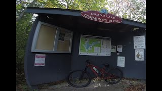
Island Lake Conservation Area
- 3
Popular Orangeville Mountain Biking Trails
• 100 ★ 2.0 • 2,838 ft • 60 ft • 170 •
Popular blue difficulty singletrack. This multi-use trail can be used both directions. On average it takes 3 minutes to complete this trail.
• 45 ★ 5.0 • 5 miles • 218 ft • 91 •
Moderately popular green difficulty family friendly doubletrack. This multi-use trail can be used both directions and has a moderate overall physical rating with a 218 ft blue climb. Trail visibility is always easy to follow. On average it takes 30 minutes to complete this trail.
• 65 ★ 5.0 • 3,146 ft • 4 ft • 70 •
Links to North loop/Baker Trail & Vicki Barron Lakeside Trail
• 30 ★ 0.0 • 1,470 ft • 71 ft • 11 •
Less popular green difficulty singletrack. This multi-use trail can be used both directions. On average it takes 5 minutes to complete this trail.
• 10 ★ 0.0 • 430 ft • 0 ft • 9 •
Less popular blue difficulty singletrack. This multi-use trail can be used both directions. On average it takes minutes to complete this trail.
• 40 ★ 0.0 • 3,156 ft • 47 ft • 7 •
Moderately popular white difficulty gravel path. This multi-use trail can be used both directions.
• 20 ★ 0.0 • 2,569 ft • 8 ft • 1 •
Less popular white difficulty gravel path. This multi-use trail can be used both directions. On average it takes minutes to complete this trail.
Orangeville Mountain Bike Routes
170 miles • 7,957 ft • 28 • Loop •
A collection of gravel roads, unmaintained back roads and singletrack for a challenging bikepacking loop....
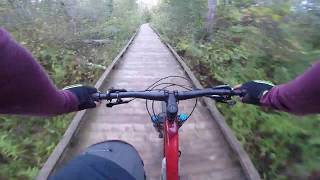
Photos of Orangeville Mountain Bike
Videos of Orangeville Mountain Bike
trail: Island Lake Family Trail
7:58 |
566 |
Nov 17, 2019 , Orangeville
trail: Hockley Trail
3:56 |
514 |
Nov 17, 2019 , Orangeville

trail: Vicki Barron Lakeside Trail
7:58 |
2251 |
Nov 17, 2019 , Orangeville

trail: Vicki Barron Lakeside Trail
5:43 |
1289 |
Nov 17, 2019 , Orangeville

trail: Vicki Barron Lakeside Trail
14:31 |
1786 |
Nov 17, 2019 , Orangeville
Recent Trail Reports
| status | trail | date | condition | info | user |
|---|---|---|---|---|---|
| Spillway Trail - South Section | Dec 1, 2024 @ 9:18am Dec 1, 2024 | Ideal | Yuliy | ||
| Vicki Barron Lakeside Trail | Aug 10, 2023 @ 7:55pm Aug 10, 2023 | Variable | cecole1 | ||
| Entrance - 2 Line E | Jul 28, 2023 @ 2:24pm Jul 28, 2023 | Variable | extremumadventura | ||
| Connector | Jul 28, 2023 @ 2:24pm Jul 28, 2023 | Variable | extremumadventura | ||
| Link Trail | Jul 28, 2023 @ 2:24pm Jul 28, 2023 | Variable | extremumadventura | ||
| No Name | Nov 27, 2022 @ 12:38am Nov 27, 2022 | Wet | paulloeffelholz | ||
| Anderson Tract Entrance | Nov 27, 2022 @ 8:38am Nov 27, 2022 | Wet | paulloeffelholz | ||
| Hockley Trail | Oct 13, 2022 @ 8:33am Oct 13, 2022 | Wet | BXA2l7 | ||
| Island Lake Family Trail | Dec 11, 2021 @ 8:13am Dec 11, 2021 | Freeze/thaw Cycle | paulloeffelholz |
Activity Feed
| username | action | type | title | date |
|---|---|---|---|---|
| MarcpCGYFI | add | photo | activity #88245921 and 4 more | Feb 2, 2026 @ 6:02pm Feb 2, 2026 |
| extremumadventura | ridden | trail | activity #85919427 and 5 more | Dec 22, 2025 @ 4:27pm Dec 22, 2025 |
| CassMcCutcheon | wishlist | route | activity #76591424 | Jul 24, 2025 @ 5:23am Jul 24, 2025 |
| GTDoesMTB | comment | trail | activity #76262111 | Jul 19, 2025 @ 1:20pm Jul 19, 2025 |
| GTDoesMTB | ridden | trail | activity #76260865 | Jul 19, 2025 @ 1:06pm Jul 19, 2025 |
Recent Comments
| username | type | title | comment | date |
|---|---|---|---|---|
| trail | This trail is perfect for a afternoon family... | Jul 19, 2025 @ 1:20pm Jul 19, 2025 | ||
| trail | Great trail to add to the Vickie Barron Loop.... | Sep 17, 2022 @ 2:25pm Sep 17, 2022 | ||
| trail | Great trail to add to the Vicki Barron Loop.... | Sep 17, 2022 @ 2:24pm Sep 17, 2022 | ||
| trail | Great trail to add to the Vickie Barron Loop.... | Sep 17, 2022 @ 2:24pm Sep 17, 2022 | ||
| trail | Truly an easy (green) trail that is great for... | Sep 17, 2022 @ 2:21pm Sep 17, 2022 |
Local Badges
-

Epic Mountain Bike Climb 2k3 awarded -

Climbing 10k Badge5 awarded -

Mountain Biking 100k Badge0 awarded -

Epic Ride Descent 2k3 awarded -

Descent 10k Badge5 awarded -

Descent 100k Badge0 awarded
Activity Type Stats
| activitytype | trails | distance | descent | descent distance | total vertical | rating | global rank | state rank | photos | reports | routes | ridelogs |
|---|---|---|---|---|---|---|---|---|---|---|---|---|
| Mountain Bike | 10 | 10 miles | 728 ft | 4 miles | 538 ft | #5,802 | #99 | 16 | 63 | 1 | 2,466 | |
| Horse | 1 | 2,838 ft | 20 ft | 492 ft | 62 ft | 10 | ||||||
| Hike | 32 | 32 miles | 3,068 ft | 13 miles | 676 ft | #3,400 | #67 | 28 | 73 | 1 | 405 | |
| Trail Running | 25 | 26 miles | 2,598 ft | 11 miles | 676 ft | #6,268 | #106 | 73 | 203 | |||
| Snowshoe | 18 | 18 miles | 2,116 ft | 7 miles | 676 ft | #960 | #97 | 22 | 42 | |||
| Nordic Ski | 42 | 15 miles | 1,486 ft | 7 miles | 331 ft | #915 | #64 | 1 | 2 | 263 |
Frequently Asked Questions About Orangeville
▼
What are the best places to ride in Orangeville?
Orangeville has 4 areas to explore for mountain biking. The top rated areas are:
▼
What are the highest rated mountain biking trails in Orangeville?
The highest rated mountain biking trails in Orangeville are:
- Vicki Barron Lakeside Trail (4.2/5)
- Hockley Trail (4.1/5)
- Island Lake Family Trail (4.1/5)
- Spillway Trail - South Section (3.7/5)
- Mill Creek Trail (0/5)
▼
What is the best time of the year to ride in Orangeville?
Based on ride log data, the most popular months to ride in Orangeville are:
- May (51 activities)
- June (49 activities)
- July (35 activities)
▼
Where can I park to ride in Orangeville?
There are 4 parking locations listed in Orangeville. The most popular parking spots are: View all parking and trailhead locations on the map to plan your visit.
Activities
- By brenthillier
 NSMBA TRAILFORKS & contributors
 - Admins: apply
- #5804 - 11,507 views
- orangeville activity log | embed map of Orangeville mountain bike trails | orangeville mountain biking points of interest
Downloading of trail gps tracks in kml & gpx formats is enabled for Orangeville.
You must login to download files.