close
-
Layers w
- Weather Layers
- Pro
- Pro
- Pro
- Pro
- Pro
- Pro
- More Layers
- Pro
- Pro
- Pro
- Pro
-
Upgrade to

3D
Trail Conditions
- Unknown
- Snow Groomed
- Snow Packed
- Snow Covered
- Snow Cover Partial
- Freeze/thaw Cycle
- Icy
- Prevalent Mud
- Wet
- Variable
- Ideal
- Dry
- Very Dry
Trail Flow (Ridden Direction)
Trailforks scans users ridelogs to determine the most popular direction each trail is ridden. A good flowing trail network will have most trails flowing in a single direction according to their intension.
The colour categories are based on what percentage of riders are riding a trail in its intended direction.
The colour categories are based on what percentage of riders are riding a trail in its intended direction.
- > 96%
- > 90%
- > 80%
- > 70%
- > 50%
- < 50%
- bi-directional trail
- no data
Trail Last Ridden
Trailforks scans ridelogs to determine the last time a trail was ridden.
- < 2 days
- < 1 week
- < 2 weeks
- < 1 month
- < 6 months
- > 6 months
Trail Ridden Direction
The intended direction a trail should be ridden.
- Downhill Only
- Downhill Primary
- Both Directions
- Uphill Primary
- Uphill Only
- One Direction
Contribute Details
Colors indicate trail is missing specified detail.
- Description
- Photos
- Description & Photos
- Videos
Trail Popularity ?
Trailforks scans ridelogs to determine which trails are ridden the most in the last 9 months.
Trails are compared with nearby trails in the same city region with a possible 25 colour shades.
Think of this as a heatmap, more rides = more kinetic energy = warmer colors.
- most popular
- popular
- less popular
- not popular
ATV/ORV/OHV Filter
Max Vehicle Width
inches
US Cell Coverage
Legend

Radar Time
Activity Recordings
Trailforks uses anonymized public activity data.
?
Activity Recordings
Trailforks uses anonymized public activity data.
?
Personal Heatmap
▶
Activity Types
all
/
none
▶
Options
2
Date range
month
–
Winter Trails
Warning
A routing network for winter maps does not exist. Selecting trails using the winter trails layer has been disabled.
Missing Trails
Most Popular
Least Popular
Trails are colored based on popularity. The more popular a trail is, the more red. Less popular trails trend towards green.
Jump Magnitude Heatmap
Heatmap of where riders jump on trails. Zoom in to see individual jumps, click circles to view jump details.
BC Backroad Status
![map legend]()
Service Road Atlas is a free to use, community-driven service for viewing and creating reports on the numerous back-country service roads around B.C. and Alberta.

Slope Aspect
Direction the slope faces
Trails Deemphasized
Trails are shown in grey.
Only show trails with no bike usage.
Suggested Layers
Based on selected activity type
Save the current map location and zoom level as your default home location whenever this page is loaded.
Save
No description for Orford has been added yet!
Login or register to submit one.
Activities Click to view
- Mountain Bike
32 trails
- E-Bike
15 trails
- Adaptive Bike
0 trails
- Winter Fat Bike
0 trails
- Hike
58 trails
- Trail Running
54 trails
- Snowshoe
25 trails
- Downhill Ski
55 trails
- Backcountry Ski
8 trails
- Nordic Ski
42 trails
Region Details
- 7
- 4
- 8
- 10
- 3
Region Status
Open as of May 30, 2026Local Trail Association
Stats
- Avg Trail Rating
- Trails (view details)
- 156
- Trails Mountain Bike
- 32
- Trails E-Bike
- 15
- Trails Hike
- 58
- Trails Trail Running
- 54
- Trails Snowshoe
- 25
- Trails Downhill Ski
- 55
- Trails Backcountry Ski
- 8
- Trails Nordic Ski
- 42
- Total Distance
- 138 miles
- Total Descent
- 32,151 ft
- Total Vertical
- 1,932 ft
- Highest Trailhead
- 2,754 ft
- Reports
- 312
- Photos
- 60
- Ridden Counter
- 16,938
Sub Regions
-
Parc National du Mont-Orford
- 4
- 8
- 9
- 3
Popular Orford Mountain Biking Trails
• 100 ★ 2.5 • 1,944 ft • 122 ft • 821 •
Popular green difficulty singletrack. This mountain bike primary trail can be used both directions. On average it takes 4 minutes to complete this trail.
• 90 ★ 4.0 • 3,159 ft • 0 ft • 682 •
Popular green difficulty singletrack. This mountain bike primary trail can be used both directions. On average it takes 5 minutes to complete this trail.
• 95 ★ 4.6 • 1 mile • 217 ft • 681 •
Highly rated popular blue difficulty singletrack. This mountain bike primary trail can be used one direction. On average it takes 17 minutes to complete this trail.
• 95 ★ 4.4 • 4,972 ft • 158 ft • 669 •
Popular green difficulty singletrack. This mountain bike primary trail can be used one direction. Trail visibility is always easy to follow. On average it takes 6 minutes to complete this trail.
• 100 ★ 3.0 • 2 miles • 171 ft • 637 •
Popular green difficulty singletrack. This mountain bike primary trail can be used one direction. On average it takes 13 minutes to complete this trail.
• 85 ★ 4.5 • 1 mile • 177 ft • 582 •
Popular green difficulty singletrack. This mountain bike primary trail can be used uphill only. Trail visibility is always easy to follow. On average it takes 11 minutes to complete this trail.
• 80 ★ 4.5 • 2 miles • 145 ft • 552 •
Highly rated popular blue difficulty singletrack. This mountain bike primary trail can be used one direction and has a moderate overall physical rating with a 145 ft blue climb. It features berm, drop, jump, rock face and rock garden. Trail visibility is always easy to follow. On average it takes 28 minutes to complete this trail.
• 70 ★ 3.5 • 2,021 ft • 41 ft • 495 •
Popular blue difficulty singletrack. This mountain bike primary trail can be used one direction with a 41 ft blue climb. It features berm, jump and rock garden. Trail visibility is always easy to follow. On average it takes 4 minutes to complete this trail.
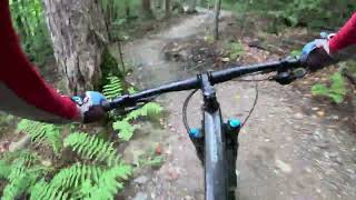
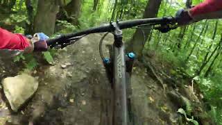
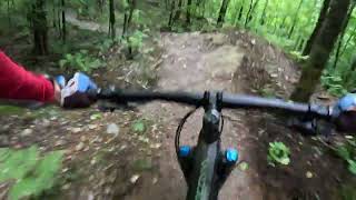
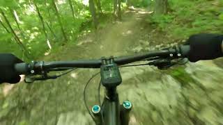
Photos of Orford Mountain Bike
Videos of Orford Mountain Bike
trail: La Morille
2:13 |
182 |
Aug 11, 2023 , Orford
trail: Le Bolet
0:40 |
187 |
Aug 11, 2023 , Orford
trail: Le Chaga
3:00 |
316 |
Aug 11, 2023 , Orford
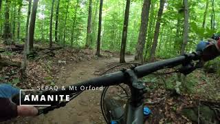
trail: Amanite
4:30 |
197 |
Aug 11, 2023 , Orford
trail: La Médéole
6:59 |
240 |
Jun 24, 2023 , Orford
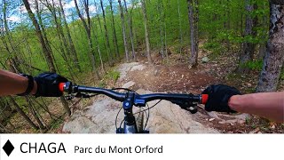
trail: Le Chaga
10:12 |
494 |
Jun 6, 2022 , Orford

trail: La Sanguinaire
4:06 |
933 |
Nov 12, 2021 , Orford
Recent Trail Reports
| status | trail | date | condition | info | user |
|---|---|---|---|---|---|
| La Grande-Halte | May 27, 2026 @ 10:31am (America/New_York) May 27, 2026 | Ideal | RussDuhaime | ||
| Connecteur Amiral | Aug 23, 2025 @ 10:50am Aug 23, 2025 | Ideal | JeffLOtttawa | ||
| Le Vice-Roi | Aug 23, 2025 @ 10:50am Aug 23, 2025 | Ideal | JeffLOtttawa | ||
| L'Amiral | Aug 23, 2025 @ 10:50am Aug 23, 2025 | Ideal | JeffLOtttawa | ||
| La Chanterelle | Aug 23, 2025 @ 10:50am Aug 23, 2025 | Ideal | JeffLOtttawa | ||
| Le Monarque | Jun 5, 2025 @ 10:11am Jun 5, 2025 | Wet | VieParProcuration | ||
| Amanite | Jun 5, 2025 @ 7:46am Jun 5, 2025 | Wet | VieParProcuration | ||
| Connecteur Chanterelle | Jun 5, 2025 @ 7:45am Jun 5, 2025 | Ideal | VieParProcuration | ||
| Chemin Forestier 7A | Oct 25, 2024 @ 4:34pm Oct 25, 2024 | Variable | Flogirl | ||
| Le Chaga | Jul 26, 2024 @ 2:24pm Jul 26, 2024 | Dry | jeanClement |
Activity Feed
| username | action | type | title | date |
|---|---|---|---|---|
| SoniaR5Rx9S | wishlist | region | activity #96454667 | Jun 7, 2026 @ 6:35am Jun 7, 2026 |
| Cedelli | add | report | activity #95891723 | May 30, 2026 @ 3:26pm May 30, 2026 |
| RussDuhaime | add | report | activity #95652260 and 1 more | May 27, 2026 @ 12:05pm May 27, 2026 |
| Anthony91 | wishlist | region | activity #93408805 | Apr 25, 2026 @ 7:13pm Apr 25, 2026 |
| Mvnqvq | add | photo | activity #83075730 and 4 more | Oct 26, 2025 @ 12:27pm Oct 26, 2025 |
Recent Comments
| username | type | title | comment | date |
|---|---|---|---|---|
| trail | Not single track and not a mtn bike trail. Its... | Sep 16, 2024 @ 7:03am Sep 16, 2024 | ||
| trail | Très belle piste avec de belle courbe | Aug 10, 2023 @ 4:59pm Aug 10, 2023 | ||
| trail | Full of flow f*ck. Not the best one, but it's... | Jun 12, 2022 @ 1:07pm Jun 12, 2022 | ||
| trail | Agree with the previous poster that some of... | Sep 15, 2021 @ 6:50am Sep 15, 2021 | ||
| trail | Trail direction is contrary to what indicated... | Jul 28, 2021 @ 5:52am Jul 28, 2021 |
Local Badges
-

Epic Ride Climb 2k3 awarded -

Climbing 10k Badge45 awarded -

Climbing 100k Badge0 awarded -

Epic Ride Descent 2k3 awarded -

Descent 10k Badge44 awarded -

Descent 100k Badge0 awarded
Activity Type Stats
| activitytype | trails | distance | descent | descent distance | total vertical | rating | global rank | state rank | photos | reports | routes | ridelogs |
|---|---|---|---|---|---|---|---|---|---|---|---|---|
| Mountain Bike | 32 | 41 miles | 5,148 ft | 18 miles | 456 ft | #2,444 | #32 | 54 | 307 | 9,363 | ||
| E-Bike | 15 | 26 miles | 2,861 ft | 11 miles | 436 ft | #4,579 | #44 | 301 | 340 | |||
| Hike | 58 | 71 miles | 10,049 ft | 27 miles | 1,929 ft | #2,784 | #18 | 5 | 291 | 3 | 2,725 | |
| Trail Running | 54 | 59 miles | 7,664 ft | 23 miles | 1,463 ft | #3,678 | #20 | 289 | 1 | 548 | ||
| Snowshoe | 25 | 25 miles | 3,448 ft | 8 miles | 1,089 ft | #533 | #15 | 156 | 3 | 33 | ||
| Downhill Ski | 55 | 17 miles | 15,869 ft | 16 miles | 1,686 ft | #350 | #7 | 5 | 1,475 | |||
| Backcountry Ski | 8 | 6 miles | 1,178 ft | 2 miles | 1,699 ft | #233 | #6 | 5 | 2,735 | |||
| Nordic Ski | 42 | 50 miles | 5,591 ft | 19 miles | 728 ft | #232 | #10 | 1 | 156 | 2,066 |
Frequently Asked Questions About Orford
▼
What are the best places to ride in Orford?
Orford has 1 areas to explore for mountain biking. The top rated areas are:
▼
What are the highest rated mountain biking trails in Orford?
The highest rated mountain biking trails in Orford are:
- Le Chaga (4.4/5)
- Amanite (4.4/5)
- Le Quatre-temps (4.3/5)
- Le Vice-Roi (4.1/5)
- L'Amiral (4.1/5)
▼
What is the best time of the year to ride in Orford?
Based on ride log data, the most popular months to ride in Orford are:
- July (259 activities)
- August (207 activities)
- June (188 activities)
▼
Where can I park to ride in Orford?
Activities
Trails
Points of Interest
- By StephaneMarceau
 TRAILFORKS & contributors
 - Admins: VQ, bigjay, StephaneMarceau, Canadmos
- #21833 - 8,948 views
- orford activity log | embed map of Orford mountain bike trails | orford mountain biking points of interest
Downloading of trail gps tracks in kml & gpx formats is enabled for Orford.
You must login to download files.