close
-
Layers w
- Weather Layers
- Pro
- Pro
- Pro
- Pro
- Pro
- Pro
- More Layers
- Pro
- Pro
- Pro
- Pro
-
Upgrade to

3D
Trail Conditions
- Unknown
- Snow Groomed
- Snow Packed
- Snow Covered
- Snow Cover Partial
- Freeze/thaw Cycle
- Icy
- Prevalent Mud
- Wet
- Variable
- Ideal
- Dry
- Very Dry
Trail Flow (Ridden Direction)
Trailforks scans users ridelogs to determine the most popular direction each trail is ridden. A good flowing trail network will have most trails flowing in a single direction according to their intension.
The colour categories are based on what percentage of riders are riding a trail in its intended direction.
The colour categories are based on what percentage of riders are riding a trail in its intended direction.
- > 96%
- > 90%
- > 80%
- > 70%
- > 50%
- < 50%
- bi-directional trail
- no data
Trail Last Ridden
Trailforks scans ridelogs to determine the last time a trail was ridden.
- < 2 days
- < 1 week
- < 2 weeks
- < 1 month
- < 6 months
- > 6 months
Trail Ridden Direction
The intended direction a trail should be ridden.
- Downhill Only
- Downhill Primary
- Both Directions
- Uphill Primary
- Uphill Only
- One Direction
Contribute Details
Colors indicate trail is missing specified detail.
- Description
- Photos
- Description & Photos
- Videos
Trail Popularity ?
Trailforks scans ridelogs to determine which trails are ridden the most in the last 9 months.
Trails are compared with nearby trails in the same city region with a possible 25 colour shades.
Think of this as a heatmap, more rides = more kinetic energy = warmer colors.
- most popular
- popular
- less popular
- not popular
ATV/ORV/OHV Filter
Max Vehicle Width
inches
US Cell Coverage
Legend

Radar Time
Activity Recordings
Trailforks uses anonymized public activity data.
?
Activity Recordings
Trailforks uses anonymized public activity data.
?
Personal Heatmap
▶
Activity Types
all
/
none
▶
Options
2
Date range
month
–
Winter Trails
Warning
A routing network for winter maps does not exist. Selecting trails using the winter trails layer has been disabled.
Missing Trails
Most Popular
Least Popular
Trails are colored based on popularity. The more popular a trail is, the more red. Less popular trails trend towards green.
Jump Magnitude Heatmap
Heatmap of where riders jump on trails. Zoom in to see individual jumps, click circles to view jump details.
BC Backroad Status
![map legend]()
Service Road Atlas is a free to use, community-driven service for viewing and creating reports on the numerous back-country service roads around B.C. and Alberta.

Slope Aspect
Direction the slope faces
Trails Deemphasized
Trails are shown in grey.
Only show trails with no bike usage.
Suggested Layers
Based on selected activity type
Save the current map location and zoom level as your default home location whenever this page is loaded.
Save
No description for Ortisei has been added yet!
Login or register to submit one.
eBikes Allowed:
Yes
AKA: St. Ulrich
This region uses the Uk/Euro style trail grading system.
Activities Click to view
- Mountain Bike
5 trails
- Hike
8 trails
- Trail Running
8 trails
- Downhill Ski
23 trails
Region Details
- 1
- 2
Region Status
Open as of Jul 14, 2025Stats
- Avg Trail Rating
- Trails (view details)
- 19
- Trails Mountain Bike
- 5
- Trails Hike
- 8
- Trails Trail Running
- 8
- Trails Downhill Ski
- 23
- Total Distance
- 19 miles
- Total Descent
- 15,583 ft
- Total Vertical
- 4,062 ft
- Highest Trailhead
- 7,182 ft
- Reports
- 55
- Photos
- 23
- Ridden Counter
- 3,145
Sub Regions
-
Seiser Alm / Alpe di Siusi
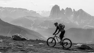
Popular Ortisei Mountain Biking Trails
• 100 ★ 4.5 • 3 miles • 76 ft • 131 •
fantastic natural trail from Brogles pass to Ortisei
• 50 ★ 3.0 • 1 mile • 18 ft • 41 •
Moderately popular blue difficulty singletrack. This mountain bike primary trail can be used downhill primary. On average it takes 14 minutes to complete this trail.
• 25 ★ 0.0 • 2 miles • 0 ft • 5 •
Nice Trail, sometimes difficult to find. Follow GPS and you'll be fine ;) Respect the hikers coming uphill. It's a trail for both!
Ortisei Mountain Bike Routes
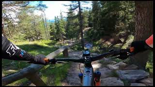
Photos of Ortisei Mountain Bike
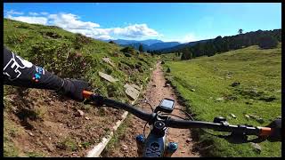
Videos of Ortisei Mountain Bike
trail: Brogles trail
5:53 |
232 |
Sep 22, 2022 , Ortisei
trail: Brogles trail
3:01 |
317 |
Sep 22, 2022 , Ortisei
trail: Brogles trail
13:08 |
291 |
Sep 22, 2022 , Ortisei
Recent Trail Reports
| status | trail | date | condition | info | user |
|---|---|---|---|---|---|
| Ortisei - Furnes | Nov 11, 2024 @ 1:05pm Nov 11, 2024 | Dry | StevetEREdG | ||
| Brogles trail | Nov 2, 2024 @ 8:35am Nov 2, 2024 | Ideal | Stefanosurf68 | ||
| Feuer Alm | Jun 17, 2023 @ 7:52am Jun 17, 2023 | Ideal | sp87 |
Activity Feed
| username | action | type | title | date |
|---|---|---|---|---|
| MauroazjFfC | ridden | trail | activity #95426707 | May 24, 2026 @ 10:54am May 24, 2026 |
| Specncerjpeck | wishlist | trail | activity #95130926 | May 20, 2026 @ 1:44pm May 20, 2026 |
| Pcueto3 | wishlist | trail | activity #94110957 | May 5, 2026 @ 1:13pm May 5, 2026 |
| combatclifton | wishlist | trail | activity #93176254 | Apr 22, 2026 @ 3:31pm Apr 22, 2026 |
| combatclifton | wishlist | trail | activity #93138849 | Apr 22, 2026 @ 4:21am Apr 22, 2026 |
Recent Comments
| username | type | title | comment | date |
|---|---|---|---|---|
| trail | questa estate 2022 sul finale c'è un cancello... | Sep 22, 2022 @ 8:08am Sep 22, 2022 | ||
| trail | This trail is not that great (July 2022). The... | Jul 19, 2022 @ 11:51am Jul 19, 2022 | ||
| trail | A superb trail that is mostly green but... | Sep 4, 2020 @ 7:14pm Sep 4, 2020 | ||
| trail | Excellent condition for October and only a few... | Oct 4, 2019 @ 7:16am Oct 4, 2019 | ||
| trail | So over run with hikers in the middle of the... | Sep 11, 2019 @ 12:06pm Sep 11, 2019 |
Local Badges
-

Epic Ride Descent 2k3 awarded -

Descent 10k Badge0 awarded -

Descent 100k Badge0 awarded
Bike & Skill Parks
| name | type | city | rating |
|---|---|---|---|
| Mountain Bike Skill Park Palmer | skill park | Ortisei |
Activity Type Stats
| activitytype | trails | distance | descent | descent distance | total vertical | rating | global rank | state rank | photos | reports | routes | ridelogs |
|---|---|---|---|---|---|---|---|---|---|---|---|---|
| Mountain Bike | 5 | 8 miles | 6,706 ft | 7 miles | 3,986 ft | #4,194 | #263 | 22 | 20 | 1 | 1,377 | |
| Hike | 8 | 8 miles | 6,706 ft | 7 miles | 3,986 ft | #3,721 | #130 | 20 | 1,468 | |||
| Trail Running | 8 | 8 miles | 6,706 ft | 7 miles | 3,986 ft | #3,322 | #120 | 20 | 37 | |||
| Downhill Ski | 23 | 11 miles | 8,878 ft | 11 miles | 1,637 ft | #133 | #13 | 1 | 36 | 1,030 |
Frequently Asked Questions About Ortisei
▼
What are the best places to ride in Ortisei?
Ortisei has 1 areas to explore for mountain biking.
▼
What are the highest rated mountain biking trails in Ortisei?
The highest rated mountain biking trails in Ortisei are:
- Brogles trail (4.3/5)
- Feuer Alm (3.7/5)
- Lumberjack Trail - Val Gardena (0/5)
▼
What is the best time of the year to ride in Ortisei?
Based on ride log data, the most popular months to ride in Ortisei are:
- August (26 activities)
- July (12 activities)
- September (11 activities)
▼
Where can I park to ride in Ortisei?
There are 2 parking locations listed in Ortisei. The most popular parking spots are:
Activities
Trails
- By StefanSchenk & contributors
- Admins: caval, larry81541, micheletraversi
- #23669 - 5,450 views
- ortisei activity log | embed map of Ortisei mountain bike trails | ortisei mountain biking points of interest
Downloading of trail gps tracks in kml & gpx formats is enabled for Ortisei.
You must login to download files.