close
-
Layers w
- Weather Layers
- Pro
- Pro
- Pro
- Pro
- Pro
- Pro
- More Layers
- Pro
- Pro
- Pro
- Pro
-
Upgrade to

3D
Trail Conditions
- Unknown
- Snow Groomed
- Snow Packed
- Snow Covered
- Snow Cover Partial
- Freeze/thaw Cycle
- Icy
- Prevalent Mud
- Wet
- Variable
- Ideal
- Dry
- Very Dry
Trail Flow (Ridden Direction)
Trailforks scans users ridelogs to determine the most popular direction each trail is ridden. A good flowing trail network will have most trails flowing in a single direction according to their intension.
The colour categories are based on what percentage of riders are riding a trail in its intended direction.
The colour categories are based on what percentage of riders are riding a trail in its intended direction.
- > 96%
- > 90%
- > 80%
- > 70%
- > 50%
- < 50%
- bi-directional trail
- no data
Trail Last Ridden
Trailforks scans ridelogs to determine the last time a trail was ridden.
- < 2 days
- < 1 week
- < 2 weeks
- < 1 month
- < 6 months
- > 6 months
Trail Ridden Direction
The intended direction a trail should be ridden.
- Downhill Only
- Downhill Primary
- Both Directions
- Uphill Primary
- Uphill Only
- One Direction
Contribute Details
Colors indicate trail is missing specified detail.
- Description
- Photos
- Description & Photos
- Videos
Trail Popularity ?
Trailforks scans ridelogs to determine which trails are ridden the most in the last 9 months.
Trails are compared with nearby trails in the same city region with a possible 25 colour shades.
Think of this as a heatmap, more rides = more kinetic energy = warmer colors.
- most popular
- popular
- less popular
- not popular
ATV/ORV/OHV Filter
Max Vehicle Width
inches
US Cell Coverage
Legend

Radar Time
Activity Recordings
Trailforks uses anonymized public activity data.
?
Activity Recordings
Trailforks uses anonymized public activity data.
?
Personal Heatmap
▶
Activity Types
all
/
none
▶
Options
2
Date range
month
–
Winter Trails
Warning
A routing network for winter maps does not exist. Selecting trails using the winter trails layer has been disabled.
Missing Trails
Most Popular
Least Popular
Trails are colored based on popularity. The more popular a trail is, the more red. Less popular trails trend towards green.
Jump Magnitude Heatmap
Heatmap of where riders jump on trails. Zoom in to see individual jumps, click circles to view jump details.
BC Backroad Status
![map legend]()
Service Road Atlas is a free to use, community-driven service for viewing and creating reports on the numerous back-country service roads around B.C. and Alberta.

Slope Aspect
Direction the slope faces
Trails Deemphasized
Trails are shown in grey.
Only show trails with no bike usage.
Suggested Layers
Based on selected activity type
Save the current map location and zoom level as your default home location whenever this page is loaded.
Save
No description for Orvieto has been added yet!
Login or register to submit one.
This region uses the Uk/Euro style trail grading system.
Activities Click to view
- Mountain Bike
130 trails
- E-Bike
123 trails
- Adaptive Bike
0 trails
- Hike
6 trails
- Trail Running
4 trails
Region Details
- 13
- 3
- 49
- 16
Region Status
Open as of Apr 6, 2026Stats
- Avg Trail Rating
- Trails (view details)
- 83
- Trails Mountain Bike
- 131
- Trails E-Bike
- 123
- Trails Hike
- 6
- Trails Trail Running
- 4
- Total Distance
- 36 miles
- Total Descent
- 8,149 ft
- Total Vertical
- 2,080 ft
- Highest Trailhead
- 2,486 ft
- Reports
- 296
- Photos
- 24
- Ridden Counter
- 1,055
Sub Regions
-
Caciotosto Trail Zone
- 29
- 10
Popular Orvieto Mountain Biking Trails
• 70 ★ 5.0 • 2 miles • 76 ft • 51 •
Popular green difficulty singletrack. This mountain bike primary trail can be used downhill only. On average it takes 10 minutes to complete this trail.
• 70 ★ 0.0 • 2,684 ft • 149 ft • 49 •
Popular green difficulty singletrack. This mountain bike primary trail can be used uphill primary. On average it takes 5 minutes to complete this trail.
• 60 ★ 4.0 • 341 ft • 51 ft • 37 •
Moderately popular green difficulty singletrack. This mountain bike primary trail can be used both directions. On average it takes minutes to complete this trail.
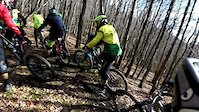
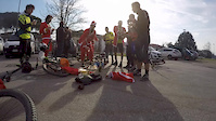
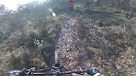
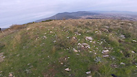
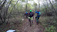
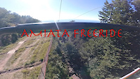
Photos of Orvieto Mountain Bike
Videos of Orvieto Mountain Bike
trail: Vaiano
5:23 |
47 |
Jan 16, 2017
trail: Vaiano
4:10 |
27 |
Jan 16, 2017
trail: Vaiano
3:40 |
47 |
Jan 11, 2017
trail: Vaiano
6:21 |
38 |
Nov 17, 2016
trail: Vaiano
6:03 |
47 |
Nov 14, 2016
trail: Vaiano
9:06 |
83 |
Aug 16, 2016
trail: Vaiano
4:31 |
155 |
Mar 13, 2016
trail: Vaiano
10:15 |
223 |
Feb 23, 2016
Recent Trail Reports
| status | trail | date | condition | info | user |
|---|---|---|---|---|---|
| La Dighetta | Apr 6, 2026 @ 1:34pm (Europe/Rome) Apr 6, 2026 | Ideal | alessio5Ap6zL | ||
| Montarsone | Apr 6, 2026 @ 1:33pm (Europe/Rome) Apr 6, 2026 | Variable | alessio5Ap6zL | ||
| Cacioroller | Apr 6, 2026 @ 9:22am (Europe/Rome) Apr 6, 2026 | Ideal | alessio5Ap6zL | ||
| Iron Cex | Mar 8, 2026 @ 9:56pm (Europe/Rome) Mar 8, 2026 | Dry | Lorenzo212 | ||
| To the top | Jan 28, 2026 @ 4:56pm (Europe/Rome) Jan 28, 2026 | Unknown | Lorenzo212 | ||
| Fiacca Trail | Jan 17, 2026 @ 2:03am (Europe/Rome) Jan 16, 2026 | Unknown | Lorenzo212 | ||
| Micky | Jan 2, 2026 @ 8:09pm (Europe/Rome) Jan 2, 2026 | Variable | Lorenzo212 | ||
| Ughetto | Jan 2, 2026 @ 8:08pm (Europe/Rome) Jan 2, 2026 | Variable | Lorenzo212 | ||
| Vipera | Jan 2, 2026 @ 8:08pm (Europe/Rome) Jan 2, 2026 | Ideal | Lorenzo212 | ||
| Cacio Rocks | Dec 28, 2025 @ 9:54am (Europe/Rome) Dec 28, 2025 | Ideal | pigiguidi |
Activity Feed
| username | action | type | title | date |
|---|---|---|---|---|
| elcapitano | wishlist | region | activity #95941915 | May 31, 2026 @ 8:16am May 31, 2026 |
| alessio5Ap6zL | add | report | activity #92040907 and 1 more | Apr 6, 2026 @ 4:33am Apr 6, 2026 |
| alessio5Ap6zL | add | report | activity #92030163 and 1 more | Apr 6, 2026 @ 12:19am Apr 6, 2026 |
| Lorenzo212 | add | trail | activity #90855670 | Mar 19, 2026 @ 7:10am Mar 19, 2026 |
| Lorenzo212 | add | report | activity #90229087 | Mar 8, 2026 @ 1:56pm Mar 8, 2026 |
Recent Comments
| username | type | title | comment | date |
|---|---|---|---|---|
| trail | Singletrack super-flow molto entusiasmante e... | Aug 22, 2025 @ 5:50am Aug 22, 2025 | ||
| trail | Singletrack tecnico rocciosetro molto carino... | Aug 22, 2025 @ 5:49am Aug 22, 2025 | ||
| trail | Ho provato ad accedere dal km4 della Strada... | Aug 22, 2025 @ 5:46am Aug 22, 2025 | ||
| trail | Prima parte molto carina in singletrack... | Aug 22, 2025 @ 5:45am Aug 22, 2025 | ||
| trail | Singletrack flow potenzialmente carino e... | Aug 22, 2025 @ 5:43am Aug 22, 2025 |
Local Badges
-

Completionist0 awarded -

Epic Mountain Bike Climb 2k30 awarded -

Climbing 10k Badge7 awarded -

Mountain Biking 100k Badge1 awarded -

Epic Ride Descent 2k30 awarded -

Descent 10k Badge7 awarded
Activity Type Stats
| activitytype | trails | distance | descent | descent distance | total vertical | rating | global rank | state rank | photos | reports | routes | ridelogs |
|---|---|---|---|---|---|---|---|---|---|---|---|---|
| Mountain Bike | 130 | 36 miles | 8,150 ft | 16 miles | 2,080 ft | #2,349 | #108 | 15 | 297 | 1,169 | ||
| E-Bike | 123 | 34 miles | 7,310 ft | 14 miles | 2,080 ft | #2,792 | 9 | 291 | 173 | |||
| Hike | 6 | 3 miles | 1,480 ft | 2 miles | 1,106 ft | #12,000 | #890 | 169 | 134 | |||
| Trail Running | 4 | 3 miles | 1,394 ft | 2 miles | 1,106 ft | #11,931 | #926 | 167 | 14 |
Frequently Asked Questions About Orvieto
▼
What are the best places to ride in Orvieto?
Orvieto has 1 areas to explore for mountain biking. The top rated areas are:
▼
What are the highest rated mountain biking trails in Orvieto?
The highest rated mountain biking trails in Orvieto are:
- Cacioroller (4.4/5)
- Lollo 1.2 (4.4/5)
- Iron Cex (4.3/5)
- Fiacca Trail (4.3/5)
- Ughetto (4.3/5)
▼
What is the best time of the year to ride in Orvieto?
Based on ride log data, the most popular months to ride in Orvieto are:
- September (7 activities)
- June (6 activities)
- July (6 activities)
▼
Where can I park to ride in Orvieto?
There are 1 parking locations listed in Orvieto. The most popular parking spots are:
Trails
- By Guydebord & contributors
- Admins: apply
- #29151 - 2,575 views
- orvieto activity log | embed map of Orvieto mountain bike trails | orvieto mountain biking points of interest
Downloading of trail gps tracks in kml & gpx formats is enabled for Orvieto.
You must login to download files.