close
-
Layers w
- Weather Layers
- Pro
- Pro
- Pro
- Pro
- Pro
- Pro
- More Layers
- Pro
- Pro
- Pro
- Pro
-
Upgrade to

3D
Trail Conditions
- Unknown
- Snow Groomed
- Snow Packed
- Snow Covered
- Snow Cover Partial
- Freeze/thaw Cycle
- Icy
- Prevalent Mud
- Wet
- Variable
- Ideal
- Dry
- Very Dry
Trail Flow (Ridden Direction)
Trailforks scans users ridelogs to determine the most popular direction each trail is ridden. A good flowing trail network will have most trails flowing in a single direction according to their intension.
The colour categories are based on what percentage of riders are riding a trail in its intended direction.
The colour categories are based on what percentage of riders are riding a trail in its intended direction.
- > 96%
- > 90%
- > 80%
- > 70%
- > 50%
- < 50%
- bi-directional trail
- no data
Trail Last Ridden
Trailforks scans ridelogs to determine the last time a trail was ridden.
- < 2 days
- < 1 week
- < 2 weeks
- < 1 month
- < 6 months
- > 6 months
Trail Ridden Direction
The intended direction a trail should be ridden.
- Downhill Only
- Downhill Primary
- Both Directions
- Uphill Primary
- Uphill Only
- One Direction
Contribute Details
Colors indicate trail is missing specified detail.
- Description
- Photos
- Description & Photos
- Videos
Trail Popularity ?
Trailforks scans ridelogs to determine which trails are ridden the most in the last 9 months.
Trails are compared with nearby trails in the same city region with a possible 25 colour shades.
Think of this as a heatmap, more rides = more kinetic energy = warmer colors.
- most popular
- popular
- less popular
- not popular
ATV/ORV/OHV Filter
Max Vehicle Width
inches
US Cell Coverage
Legend

Radar Time
Activity Recordings
Trailforks uses anonymized public activity data.
?
Activity Recordings
Trailforks uses anonymized public activity data.
?
Personal Heatmap
▶
Activity Types
all
/
none
▶
Options
2
Date range
month
–
Winter Trails
Warning
A routing network for winter maps does not exist. Selecting trails using the winter trails layer has been disabled.
Missing Trails
Most Popular
Least Popular
Trails are colored based on popularity. The more popular a trail is, the more red. Less popular trails trend towards green.
Jump Magnitude Heatmap
Heatmap of where riders jump on trails. Zoom in to see individual jumps, click circles to view jump details.
BC Backroad Status
![map legend]()
Service Road Atlas is a free to use, community-driven service for viewing and creating reports on the numerous back-country service roads around B.C. and Alberta.

Slope Aspect
Direction the slope faces
Trails Deemphasized
Trails are shown in grey.
Only show trails with no bike usage.
Suggested Layers
Based on selected activity type
Save the current map location and zoom level as your default home location whenever this page is loaded.
Save
No description for Osoyoos has been added yet!
Login or register to submit one.
Activities Click to view
- Mountain Bike
76 trails
- E-Bike
53 trails
- Gravel Bike
2 trails
- Adaptive Bike
12 trails
- Winter Fat Bike
8 trails
- Horse
36 trails
- Hike
73 trails
- Trail Running
74 trails
- Dirtbike/Moto
6 trails
- ATV/ORV/OHV
4 trails
- Snowshoe
4 trails
Region Details
- 20
- 7
- 17
- 21
- 9
- 2
Region Status
Caution as of Jun 12, 2026Local Trail Association
Stats
- Avg Trail Rating
- Trails (view details)
- 81
- Trails Mountain Bike
- 76
- Trails E-Bike
- 53
- Trails Gravel Bike
- 2
- Trails Adaptive Bike
- 12
- Trails Winter Fat Bike
- 8
- Trails Horse
- 36
- Trails Hike
- 73
- Trails Trail Running
- 74
- Trails Dirtbike/Moto
- 6
- Trails ATV/ORV/OHV
- 4
- Trails Snowmobile
- 3
- Trails Snowshoe
- 4
- Total Distance
- 77 miles
- Total Descent
- 18,800 ft
- Total Vertical
- 3,041 ft
- Highest Trailhead
- 3,954 ft
- Reports
- 485
- Photos
- 314
- Ridden Counter
- 4,396
Sub Regions
-
Kruger Mountain/Blue Lake/Kilpoola
- 16
- 11
- 10
- 1
Popular Osoyoos Mountain Biking Trails
• 95 ★ 4.0 • 2,776 ft • 4 ft • 313 •
is an Osoyoos classic that has now been downgraded in difficulty to Blue as the Original iconic features have been separated onto an optional black line called . The fire burnt the old wooden features but they will be rebuilt bigger and...
• 100 ★ 3.7 • 4 miles • 1,618 ft • 229 •
A mostly non technical single track climb trail with some double track to get you almost all the way to the top of the network. Mostly well shaded, the trail travels through both desert scrub and thick forest and provides excellent...
• 95 ★ 4.5 • 3,304 ft • 8 ft • 216 •
Tricky Bits is fast singletrack with a double drop, natural rock-launch over a 12 foot table with wide wooden transition, steep rock face, a small rock drop, a 100 ft long berm and a wooden drop named "Big Boy Pants". Ya so basically...
• 95 ★ 3.0 • 2 miles • 183 ft • 159 •
This trail starts at the Osoyoos Canal where it crosses Hwy 3 in a tunnel. The trail starts paved for the ascent to Osoyoos Airport. From there, it changes to a gravel path. The path is loose in some places but should get more compact...
• 95 ★ 3.5 • 427 ft • 0 ft • 144 •
Connector aprox. 2/3 of the way down giving direct access to Lower for those that want to bypass Upper .
• 100 ★ 4.0 • 928 ft • 0 ft • 137 •
The classic rhythm section of has been rebuilt better than ever and separated into it's own trail.
Osoyoos Mountain Bike Routes
15 miles • 303 ft • 1 • Out & Back •
Start at Sessions and ride on Pathways all the way to Oliver! Only have to cross the Highway never ride on...
8 miles • 1,876 ft • 6 • Loop •
The hardest loop on the mountain, Parking by the Gun Range, on , this route is for those that like to...
4 miles • 235 ft • 4 • Point to Point •
Strawberry Creeks Iconic, was the first black trail available on the mountain. With steep rock chutes,...
4 miles • 226 ft • 4 • Out & Back •
Strawberry Creeks Iconic, "Tricky bits" trail, was the first black trail available on the mountain. With...
4 miles • 203 ft • 4 • Point to Point •
Strawberry Creeks most common Intermediate Ride, with a great mix of flow, and easy technical features,...
2 miles • 375 ft • 1 •
An out and back Lollipop style ride, easy ride with 2 moderately difficult short climbs. Easily walked,...
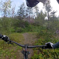
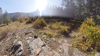
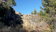
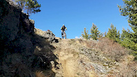
Photos of Osoyoos Mountain Bike
Videos of Osoyoos Mountain Bike
trail: Moving Target
2:05 |
383 |
Jun 22, 2019
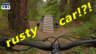
trail: Tricky Bits
0:08 |
568 |
Mar 23, 2019
trail: Tricky Bits
0:18 |
332 |
Oct 30, 2018
trail: Tricky Bits
0:06 |
267 |
Oct 30, 2018
trail: Tricky Bits
0:04 |
286 |
Oct 30, 2018
youtuber
![Osoyoos...who knew?!?]()
trail: Tricky Bits
6:22 |
315 |
Jul 6, 2023 , Osoyoos

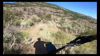
trail: Moon Curser
2:57 |
301 |
Sep 11, 2022 , Osoyoos
trail: Moon Curser
2:57 |
354 |
Jul 24, 2022 , Osoyoos
Recent Trail Reports
| status | trail | date | condition | info | user |
|---|---|---|---|---|---|
| Skyfall | Jun 12, 2026 @ 8:58pm (America/Vancouver) Jun 12, 2026 | Variable | Somuchmud | ||
| Little Loup | Jun 7, 2026 @ 8:13am (America/Creston) Jun 7, 2026 | Ideal | pocketpizza | ||
| Loup des Bois | Jun 6, 2026 @ 6:11pm (America/Creston) Jun 6, 2026 | Ideal | pocketpizza | ||
| Upside Down | Jun 6, 2026 @ 3:00pm (America/Vancouver) Jun 6, 2026 | Unknown | Burgie8416 | ||
| Hundred Acre Wood | Jun 4, 2026 @ 11:39am (America/Vancouver) Jun 4, 2026 | Unknown | Reinout | ||
| Punch Bowl | Apr 3, 2026 @ 3:47pm (America/Vancouver) Apr 3, 2026 | Ideal | D-Lo79 | ||
| Tricky Bits | Apr 3, 2026 @ 3:43pm (America/Vancouver) Apr 3, 2026 | Ideal | D-Lo79 | ||
| Moving Target | Mar 20, 2026 @ 8:49pm (America/Vancouver) Mar 20, 2026 | Ideal | kenergeo | ||
| Cherry Cola | Mar 3, 2026 @ 7:31pm (America/Vancouver) Mar 3, 2026 | Ideal | osoyoooos OBC | ||
| Upper Punch Connector | Feb 2, 2026 @ 10:28am (America/Vancouver) Feb 2, 2026 | Wet | osoyoooos OBC |
Activity Feed
| username | action | type | title | date |
|---|---|---|---|---|
| avgart | wishlist | trail | activity #97269809 | Jun 18, 2026 @ 12:29pm 2 days |
| TylerPierce787 | wishlist | route | activity #96848274 and 1 more | Jun 12, 2026 @ 9:46pm Jun 12, 2026 |
| Somuchmud | add | report | activity #96847052 | Jun 12, 2026 @ 8:58pm Jun 12, 2026 |
| pocketpizza | add | report | activity #96482303 | Jun 7, 2026 @ 11:29am Jun 7, 2026 |
| pocketpizza | add | report | activity #96456580 | Jun 7, 2026 @ 7:03am Jun 7, 2026 |
Recent Comments
| username | type | title | comment | date |
|---|---|---|---|---|
| trail | Impossible to follow , grown over and pretty... | May 8, 2026 @ 9:13pm May 8, 2026 | ||
| trail | To be honest, we've found the same thing. ... | Apr 27, 2026 @ 9:02am Apr 27, 2026 | ||
| trail | Thanks for the information. Is trailforks the... | Apr 21, 2026 @ 11:29am Apr 21, 2026 | ||
| trail | Vehicle access is limited due to the park... | Apr 18, 2026 @ 8:59pm Apr 18, 2026 | ||
| trail | Is this trail closed? It appears that most of... | Apr 18, 2026 @ 8:57pm Apr 18, 2026 |
Local Badges
-

Epic Ride Climb 2k37 awarded -

Climbing 10k Badge9 awarded -

Climbing 100k Badge0 awarded -

Epic Ride Descent 2k38 awarded -

Descent 10k Badge12 awarded -

Descent 100k Badge0 awarded
Activity Type Stats
| activitytype | trails | distance | descent | descent distance | total vertical | rating | global rank | state rank | photos | reports | routes | ridelogs |
|---|---|---|---|---|---|---|---|---|---|---|---|---|
| Mountain Bike | 76 | 76 miles | 18,655 ft | 35 miles | 2,979 ft | #2,238 | #72 | 314 | 485 | 13 | 3,129 | |
| E-Bike | 53 | 52 miles | 13,563 ft | 23 miles | 2,838 ft | #2,512 | #66 | 346 | 13 | 275 | ||
| Gravel Bike | 2 | 2 miles | 20 ft | 817 ft | 702 ft | #407 | #102 | 14 | 10 | 23 | ||
| Adaptive Bike | 12 | 10 miles | 1,677 ft | 4 miles | 1,886 ft | #287 | #118 | 47 | 7 | |||
| Winter Fat Bike | 8 | 5 miles | 1,936 ft | 3 miles | 1,585 ft | #239 | #96 | 82 | ||||
| Horse | 36 | 36 miles | 8,953 ft | 15 miles | 2,838 ft | #979 | #31 | 114 | 1 | 2 | ||
| Hike | 73 | 75 miles | 17,461 ft | 34 miles | 3,041 ft | #2,986 | #89 | 422 | 3 | 366 | ||
| Trail Running | 74 | 75 miles | 17,572 ft | 34 miles | 3,041 ft | #2,667 | #74 | 425 | 8 | 151 | ||
| Dirtbike/Moto | 6 | 8 miles | 2,228 ft | 4 miles | 1,168 ft | #813 | #57 | 49 | 16 | |||
| ATV/ORV/OHV | 4 | 6 miles | 1,699 ft | 3 miles | 951 ft | #637 | #52 | 49 | 8 | |||
| Snowmobile | 3 | 6 miles | 1,686 ft | 3 miles | 702 ft | 3 | ||||||
| Snowshoe | 4 | 7 miles | 1,831 ft | 4 miles | 1,677 ft | #968 | #56 | 3 | 7 |
Frequently Asked Questions About Osoyoos
▼
What are the best places to ride in Osoyoos?
Osoyoos has 1 areas to explore for mountain biking. The top rated areas are:
▼
What are the highest rated mountain biking trails in Osoyoos?
The highest rated mountain biking trails in Osoyoos are:
- Skip It (4.5/5)
- Punch Bowl (4.4/5)
- Upper Punch Connector (4.3/5)
- Tricky Bits (4.3/5)
- Slabtastic Voyage (4.3/5)
▼
What is the best time of the year to ride in Osoyoos?
Based on ride log data, the most popular months to ride in Osoyoos are:
- May (82 activities)
- July (71 activities)
- August (70 activities)
▼
Where can I park to ride in Osoyoos?
There are 8 parking locations listed in Osoyoos. The most popular parking spots are: View all parking and trailhead locations on the map to plan your visit.
Activities
Trails
Points of Interest
- Rock Face TTF
- Chief's Lookout Shelter Cabin
- Sage Flats Shelter Cabin
- Rancher Creek Shelter Cabin
- The Village Sight
- Water trough Other
- Osoyoos Gun & Archery Range Other
- Rock Ridge TTF
- Rock Scree Roll TTF
- Trail Information
- Richter Mountain (4,495 ft)
- Ellemeham Mountain (4,344 ft)
- Kruger Mountain (2,743 ft)
- By Bricklin69
 & contributors
 - Admins: canadianenduro, pocketpizza, PACA, 1partatatime, PACApenticton
- #6612 - 29,608 views
- osoyoos activity log | embed map of Osoyoos mountain bike trails | osoyoos mountain biking points of interest
Downloading of trail gps tracks in kml & gpx formats is enabled for Osoyoos.
You must login to download files.