close
-
Layers w
- Weather Layers
- Pro
- Pro
- Pro
- Pro
- Pro
- Pro
- More Layers
- Pro
- Pro
- Pro
- Pro
-
Upgrade to

3D
Trail Conditions
- Unknown
- Snow Groomed
- Snow Packed
- Snow Covered
- Snow Cover Partial
- Freeze/thaw Cycle
- Icy
- Prevalent Mud
- Wet
- Variable
- Ideal
- Dry
- Very Dry
Trail Flow (Ridden Direction)
Trailforks scans users ridelogs to determine the most popular direction each trail is ridden. A good flowing trail network will have most trails flowing in a single direction according to their intension.
The colour categories are based on what percentage of riders are riding a trail in its intended direction.
The colour categories are based on what percentage of riders are riding a trail in its intended direction.
- > 96%
- > 90%
- > 80%
- > 70%
- > 50%
- < 50%
- bi-directional trail
- no data
Trail Last Ridden
Trailforks scans ridelogs to determine the last time a trail was ridden.
- < 2 days
- < 1 week
- < 2 weeks
- < 1 month
- < 6 months
- > 6 months
Trail Ridden Direction
The intended direction a trail should be ridden.
- Downhill Only
- Downhill Primary
- Both Directions
- Uphill Primary
- Uphill Only
- One Direction
Contribute Details
Colors indicate trail is missing specified detail.
- Description
- Photos
- Description & Photos
- Videos
Trail Popularity ?
Trailforks scans ridelogs to determine which trails are ridden the most in the last 9 months.
Trails are compared with nearby trails in the same city region with a possible 25 colour shades.
Think of this as a heatmap, more rides = more kinetic energy = warmer colors.
- most popular
- popular
- less popular
- not popular
ATV/ORV/OHV Filter
Max Vehicle Width
inches
US Cell Coverage
Legend

Radar Time
Activity Recordings
Trailforks uses anonymized public activity data.
?
Activity Recordings
Trailforks uses anonymized public activity data.
?
Personal Heatmap
▶
Activity Types
all
/
none
▶
Options
2
Date range
month
–
Winter Trails
Warning
A routing network for winter maps does not exist. Selecting trails using the winter trails layer has been disabled.
Missing Trails
Most Popular
Least Popular
Trails are colored based on popularity. The more popular a trail is, the more red. Less popular trails trend towards green.
Jump Magnitude Heatmap
Heatmap of where riders jump on trails. Zoom in to see individual jumps, click circles to view jump details.
BC Backroad Status
![map legend]()
Service Road Atlas is a free to use, community-driven service for viewing and creating reports on the numerous back-country service roads around B.C. and Alberta.

Slope Aspect
Direction the slope faces
Trails Deemphasized
Trails are shown in grey.
Only show trails with no bike usage.
Suggested Layers
Based on selected activity type
Save the current map location and zoom level as your default home location whenever this page is loaded.
SavePopular Trail Networks
view all areas »
No description for Östergötland has been added yet!
Login or register to submit one.
This region uses the Uk/Euro style trail grading system.
Region Details
- 355
- 285
- 763
- 197
- 41
- 2
Stats
- Avg Trail Rating
- Trails (view details)
- 1,654
- Trails Mountain Bike
- 1,644
- Trails E-Bike
- 64
- Trails Horse
- 73
- Trails Hike
- 1,605
- Trails Trail Running
- 1,613
- Trails Dirtbike/Moto
- 1
- Trails ATV/ORV/OHV
- 2
- Trails Snowshoe
- 1
- Trails Downhill Ski
- 10
- Trails Backcountry Ski
- 8
- Trails Nordic Ski
- 57
- Total Distance
- 868 miles
- Total Descent
- 83,195 ft
- Total Vertical
- 868 ft
- Highest Trailhead
- 876 ft
- Reports
- 3,515
- Photos
- 230
- Ridden Counter
- 42,295
Sub Regions
- Åtvidaberg (41)
- Åtvidaberg (11)
- Grebo (28)
- Boxholm (51)
- Boxholm Centralt (43)
- Malexander (7)
- Finspång (75)
- Kinda (172)
- Kinda Bikepark (10)
- Kisa (8)
- Kisa MTB Park (17)
- Rimforsa skogsområde (133)
- Linköping (446)
- Edhaga (19)
- Ekängen (0)
- Gamla Skyttecentrum (14)
- Linköping Sydost (35)
- Ljungsbro (16)
- Olstorp-Sandvik (236)
- Slaka (47)
- Sturefors (5)
- Ullstämma (22)
- Valla (5)
- Vidingsjöbanan (28)
- Mjölby (40)
- Kea´s bana (3)
- Skogssjön (3)
- Sya (13)
- Vifolkavallen (15)
- Motala (129)
- BIF-gården (75)
- Fålehagen (13)
- Godegård (4)
- Ödeby (18)
- Tjällmo (7)
- Norrköping (539)
- Abborreberg (11)
- Kättsätter (18)
- Kimstad (14)
- Klockaretorpet (21)
- Kolmården Bergscykling (331)
- Norrköping Södra (10)
- Skärblacka (26)
- Svärtinge / Bergkulla (70)
- Vånga (2)
- Vrinnevi (15)
- Yxbacken (0)
- Yxbacken cykelpark (8)
- Ödeshög (59)
- Ödeshög Centralt (4)
- Omberg (54)
- Söderköping (55)
- Gäverstad (24)
- Ramunderberget (14)
- Vennerberga (4)
- Valdemarsvik (16)
- Ydre (21)
Popular Östergötland Mountain Biking Trails
• 100 ★ 4.0 • 2 miles • 199 ft • 185 •
Popular blue difficulty singletrack. This mountain bike primary trail can be used one direction. It features berm, bridge, drop, jump, rock face and rock garden. On average it takes 18 minutes to complete this trail.
• 100 ★ 3.0 • 1,056 ft • 0 ft • 182 •
Popular green difficulty singletrack. This mountain bike primary trail can be used one direction. On average it takes 1 minutes to complete this trail.
• 100 ★ 3.8 • 4,285 ft • 36 ft • 177 •
Popular blue difficulty singletrack. This mountain bike primary trail can be used one direction. It features berm, bridge, drop, jump, rock face and rock garden. On average it takes 6 minutes to complete this trail.
• 95 ★ 3.7 • 3,684 ft • 0 ft • 165 •
Popular blue difficulty machine groomed. This mountain bike primary trail can be used downhill only. It features berm and jump. Trail visibility is always easy to follow. On average it takes 3 minutes to complete this trail.
• 90 ★ 5.0 • 1,280 ft • 0 ft • 161 •
Popular red difficulty machine groomed. This mountain bike primary trail. Trail visibility is always easy to follow. On average it takes minutes to complete this trail.
• 65 ★ 5.0 • 1,220 ft • 0 ft • 157 •
Moderately popular red difficulty machine groomed. This mountain bike primary trail. Trail visibility is always easy to follow. On average it takes minutes to complete this trail.
• 85 ★ 4.5 • 3,114 ft • 4 ft • 155 •
Popular red difficulty machine groomed. This mountain bike primary trail can be used downhill only and has a moderate overall physical rating with a 4 ft blue climb. It features berm, drop, jump and gap jump. Trail visibility is always easy to follow. On average it takes 4 minutes to complete this trail.
Östergötland Mountain Bike Routes
Kättsätter MTB 7km Featured
4 miles • 232 ft • 6 • Loop •
Officiella 7km MTB leden i Kättsätter. Följ markeringarna med vit cirkel och svart cykel i mitten.
★ 4.0 • 5 miles • 327 ft • 5 • Loop •
Jäterolig, bra, lite av varje. Följ svart cykel i vit cirkel markering.
★ 4.0 • 20 miles • 1,081 ft • 29 • Loop •
Rosa spåret är det senaste tillskottet till Mera Lera MTBs banor. Med sina nästan 33 km är det också...
★ 4.0 • 3 miles • 180 ft • 2 • Loop •
Vidingsjöbanan är ca 5 km lång, och har ett gult spår som går hela vägen runt, samt ett flertal...
★ 4.0 • 2 miles • 215 ft • 5 • Loop •
Den används flitigt för träning och tävling. Har en lite annorlunda karaktär än Vidingsjöbanan....
Photos of Östergötland Mountain Bike
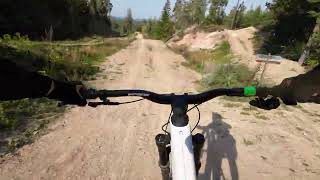
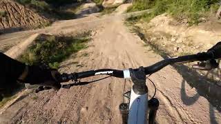
Videos of Östergötland Mountain Bike
trail: Mera Lera
0:05 |
107 |
Jun 7, 2022
trail: Östgötaleden Tjällmo
6:08 |
62 |
Jun 20, 2018
trail: Rotmos
2:01 |
237 |
May 10, 2016
trail: Jakobsdal Västra Sidan
2:51 |
359 |
Jul 4, 2015
trail: Intense - Skogspartiet
3:03 |
105 |
Sep 19, 2024 , Kinda

trail: Intense - Motorvägen
3:03 |
99 |
Sep 19, 2024 , Kinda

trail: Intense - Whip Off Hoppet
3:03 |
85 |
Sep 19, 2024 , Kinda
trail: Goldmine
3:03 |
94 |
Sep 19, 2024 , Kinda
Recent Trail Reports
Activity Feed
| username | action | type | title | date |
|---|---|---|---|---|
| mountain-viking | add | report | activity #97186779 and 2 more | Jun 17, 2026 @ 8:43am 3 days |
| Synert | add | report | activity #97121200 | Jun 16, 2026 @ 10:26am Jun 16, 2026 |
| Hummern | add | route | activity #97043678 | Jun 15, 2026 @ 8:36am Jun 15, 2026 |
| Synert | add | report | activity #96878398 | Jun 13, 2026 @ 8:07am Jun 13, 2026 |
| kallentoft | wishlist | route | activity #96787147 | Jun 11, 2026 @ 11:42pm Jun 11, 2026 |
Recent Comments
| username | type | title | comment | date |
|---|---|---|---|---|
| trail | Omgrävd. Skogsmaskiner använt stigen men som... | Jun 10, 2026 @ 9:12pm Jun 10, 2026 | ||
| trail | DO NOT! Ride this trail. It does not literally... | Apr 24, 2025 @ 9:29pm Apr 24, 2025 | ||
| report | Gör en ny stigrapport istället. | Aug 25, 2024 @ 11:08am Aug 25, 2024 | ||
| report | Gör en ny rapport istället. | Aug 25, 2024 @ 11:06am Aug 25, 2024 | ||
| report | Stigen rensad och tillsnyggad i sin helhet. | Aug 25, 2024 @ 9:30am Aug 25, 2024 |
Local Badges
-

Descent 10k Badge2 awarded -

Descent 100k Badge0 awarded -
Descent 100k Badge1 awarded -
Descent 100k Badge0 awarded -
Descent 10k Badge1 awarded -

Epic Ride Descent 2k0 awarded
Bike & Skill Parks
| name | type | city | rating |
|---|---|---|---|
| Kisa MTB Park | bike park | Kinda | |
| Yxbacken cykelpark | bike park | Norrköping | |
| Vidingsjö skillpark | skill park | Linköping | |
| Finspångs CA - Pump Track | skill park | Finspång | |
| Mjölby Pump track | skill park | Mjölby |
Local Trail Supporters
- Vreta Somk
Activity Type Stats
| activitytype | trails | distance | descent | descent distance | total vertical | rating | global rank | state rank | photos | reports | routes | ridelogs |
|---|---|---|---|---|---|---|---|---|---|---|---|---|
| Mountain Bike | 1,644 | 861 miles | 82,251 ft | 387 miles | 869 ft | 227 | 3,511 | 75 | 52,843 | |||
| E-Bike | 64 | 34 miles | 7,001 ft | 17 miles | 837 ft | 2,746 | 691 | |||||
| Horse | 73 | 30 miles | 3,235 ft | 15 miles | 525 ft | 582 | 107 | |||||
| Hike | 1,605 | 857 miles | 76,982 ft | 382 miles | 869 ft | 2 | 3,472 | 15 | 2,371 | |||
| Trail Running | 1,613 | 858 miles | 77,484 ft | 382 miles | 869 ft | 1 | 3,469 | 24 | 9,407 | |||
| Dirtbike/Moto | 1 | 1,434 ft | 33 ft | 538 ft | 33 ft | 578 | 16 | |||||
| ATV/ORV/OHV | 2 | 2,854 ft | 56 ft | 1,844 ft | 59 ft | 579 | ||||||
| Snowshoe | 1 | 2,126 ft | 102 ft | 1,512 ft | 85 ft | 5 | ||||||
| Downhill Ski | 9 | 2 miles | 712 ft | 1 mile | 423 ft | 5 | 143 | |||||
| Backcountry Ski | 8 | 4 miles | 633 ft | 2 miles | 371 ft | 15 | 31 | |||||
| Nordic Ski | 57 | 37 miles | 3,127 ft | 17 miles | 584 ft | 5 | 2,037 |
Activities
Trails
- By brenthillier
 NSMBA TRAILFORKS & contributors
 - Admins: ollesvenskonthetrail, JALLE, OrjanX, martinlindstr
- #9826 - 20,887 views
- Östergötland activity log | embed map of Östergötland mountain bike trails | Östergötland mountain biking points of interest
Downloading of trail gps tracks in kml & gpx formats is enabled for Östergötland.
You must login to download files.