close
-
Layers w
- Weather Layers
- Pro
- Pro
- Pro
- Pro
- Pro
- Pro
- More Layers
- Pro
- Pro
- Pro
- Pro
-
Upgrade to

3D
Trail Conditions
- Unknown
- Snow Groomed
- Snow Packed
- Snow Covered
- Snow Cover Partial
- Freeze/thaw Cycle
- Icy
- Prevalent Mud
- Wet
- Variable
- Ideal
- Dry
- Very Dry
Trail Flow (Ridden Direction)
Trailforks scans users ridelogs to determine the most popular direction each trail is ridden. A good flowing trail network will have most trails flowing in a single direction according to their intension.
The colour categories are based on what percentage of riders are riding a trail in its intended direction.
The colour categories are based on what percentage of riders are riding a trail in its intended direction.
- > 96%
- > 90%
- > 80%
- > 70%
- > 50%
- < 50%
- bi-directional trail
- no data
Trail Last Ridden
Trailforks scans ridelogs to determine the last time a trail was ridden.
- < 2 days
- < 1 week
- < 2 weeks
- < 1 month
- < 6 months
- > 6 months
Trail Ridden Direction
The intended direction a trail should be ridden.
- Downhill Only
- Downhill Primary
- Both Directions
- Uphill Primary
- Uphill Only
- One Direction
Contribute Details
Colors indicate trail is missing specified detail.
- Description
- Photos
- Description & Photos
- Videos
Trail Popularity ?
Trailforks scans ridelogs to determine which trails are ridden the most in the last 9 months.
Trails are compared with nearby trails in the same city region with a possible 25 colour shades.
Think of this as a heatmap, more rides = more kinetic energy = warmer colors.
- most popular
- popular
- less popular
- not popular
ATV/ORV/OHV Filter
Max Vehicle Width
inches
US Cell Coverage
Legend

Radar Time
Activity Recordings
Trailforks uses anonymized public activity data.
?
Activity Recordings
Trailforks uses anonymized public activity data.
?
Personal Heatmap
▶
Activity Types
all
/
none
▶
Options
2
Date range
month
–
Winter Trails
Warning
A routing network for winter maps does not exist. Selecting trails using the winter trails layer has been disabled.
Missing Trails
Most Popular
Least Popular
Trails are colored based on popularity. The more popular a trail is, the more red. Less popular trails trend towards green.
Jump Magnitude Heatmap
Heatmap of where riders jump on trails. Zoom in to see individual jumps, click circles to view jump details.
BC Backroad Status
![map legend]()
Service Road Atlas is a free to use, community-driven service for viewing and creating reports on the numerous back-country service roads around B.C. and Alberta.

Slope Aspect
Direction the slope faces
Trails Deemphasized
Trails are shown in grey.
Only show trails with no bike usage.
Suggested Layers
Based on selected activity type
Save the current map location and zoom level as your default home location whenever this page is loaded.
SaveAs 1 Jan 2020 Østfold has merged along with Buskerud, Akershus, into Viken.
Østfold ble reetablert den 1. januar 2024 etter at Viken fylke ble oppløst fra samme dato.
Østfold ble reetablert den 1. januar 2024 etter at Viken fylke ble oppløst fra samme dato.
Links
This region uses the Uk/Euro style trail grading system.
Stats
- Avg Trail Rating
- Trails (view details)
- 2,745
- Trails Mountain Bike
- 2,546
- Trails E-Bike
- 1,419
- Trails Gravel Bike
- 1
- Trails Adaptive Bike
- 6
- Trails Winter Fat Bike
- 4
- Trails Horse
- 259
- Trails Hike
- 2,572
- Trails Trail Running
- 2,545
- Trails Dirtbike/Moto
- 40
- Trails Observed Trials
- 1
- Trails ATV/ORV/OHV
- 61
- Trails Snowmobile
- 46
- Trails Snowshoe
- 287
- Trails Downhill Ski
- 8
- Trails Backcountry Ski
- 231
- Trails Nordic Ski
- 361
- Total Distance
- 1,028 miles
- Total Descent
- 165,524 ft
- Total Vertical
- 4,348 ft
- Highest Trailhead
- 4,353 ft
- Reports
- 4,568
- Photos
- 5,916
- Ridden Counter
- 17,222
Articles
Video: Brage Vestavik Makes the Most of Sloppy Winter Conditions in 'Time is Now'
Dec 18, 2019 from pinkbike.com
Another creative edit from the Norwegian.
Popular Trail Networks
view all areas »Sub Regions
- Fet kommune (20)
- Halden (21)
- Halden (10)
- Ertemarka (0)
- Idrettsplassen (8)
- Tistedalen skianlegg (0)
- Halden (10)
- Hvaler (0)
- Spjærøy (0)
- Indre Østfold (1,386)
- Askim (963)
- Åsermarka (111)
- Askim City Centre (94)
- Askim Museum (24)
- Henstadskogen (22)
- Hovskogen (89)
- Hundremeterskogen (42)
- Korsegård (39)
- Kråkåsen (60)
- Kykkelsrud (26)
- Langnes (32)
- Nylendeåsen (20)
- Prestegårdsskogen (160)
- Romsåsen (19)
- Rudsmosen (12)
- Sekkelsten (5)
- Trollskogen (22)
- Eidsberg (161)
- Eidsberg Stadion (2)
- Hærland (6)
- Høytorp Fort (33)
- Monaryggen (13)
- Sameiga (6)
- Slitu (21)
- Trømborgfjella (57)
- Hobøl (67)
- Elgmyråsen (0)
- Gullenga (6)
- Holstadmarka (22)
- Knapstad (29)
- Ulvåsen (6)
- Spydeberg (154)
- Grååsen (28)
- Griniskogen Turpark (16)
- Hylliskogen (36)
- Skimtefjell (23)
- Spydeberg City (27)
- Trøgstad (20)
- Havnås (5)
- Skjønhaug (4)
- Trøgstad Fort (10)
- Mysen (21)
- Askim (963)
- Marker (14)
- Kjølen Sportcenter (0)
- Ørje (13)
- Oppegård (13)
- Råde (1)
- Rakkestad (33)
- Bekkevoll (20)
- Fladstadparken (5)
- Rørfjell (1)
- Skedsmo (1)
- Skiptvet (12)
- Toen (0)
- Sørum (135)
- Lørenfallet (42)
- Stomperudland (42)
- Sørumsand (65)
- Fjuk / Armoen (28)
- Lørenfallet (42)
- Aurskog (10)
- Blaker (77)
- Breisjøen (5)
- Igletjern (17)
- Skytebaneåsen (25)
- Drøbak (90)
- Fredrikstad (72)
- Fredrikstadmarka (13)
- Sprinkelskauen (8)
- Torsnes (35)
- Valhall (0)
- Frogner (39)
- Lunderåsen (28)
- Gjelleråsen (5)
- Gjelleråsen (5)
- Moss (15)
- Mossemarka (1)
- Nesparken (9)
- Reierskogen (3)
- Sarpsborg (164)
- Hafslundskogen (0)
- Hasleskogen (1)
- Isesjø (4)
- Kalnesskogen (42)
- Kjerringåsen Alpinsenter (14)
- Moåsen (8)
- Ravneberget (2)
- Sarpsborgmarka (18)
- Stikkaåsen (7)
- Ski (9)
- Ellingsrudåsen (0)
- Kjekstadmarka (0)
Popular Østfold Mountain Biking Trails
• 100 ★ 0.0 • 1 mile • 66 ft • 46 •
Popular white difficulty paved path. This multi-use trail can be used both directions and has a easy overall physical rating with a 66 ft green climb. Trail visibility is always easy to follow. On average it takes 3 minutes to complete this trail.
• 100 ★ 0.0 • 659 ft • 0 ft • 42 •
Rough terrain with rock surface, drops, of camber rock surface, sharp rocks, cliffs, narrow between trees, ends with 3 drop options. this trail is used for hill climb competition( Crux/Cruxjam)
• 95 ★ 0.0 • 735 ft • 0 ft • 40 •
A a ride trough the woods, with few turns and out with a boardwalk to an optional rock wall ride, left turn and continue straight down to the bottom.
• 100 ★ 0.0 • 597 ft • 0 ft • 39 •
Entry mountain rocks, few rocks few meters in the forest, with some up & downs with rocky sections to a left S turn berm, with optional drop shortcut, followed by a short straight with left turn to bridge, over a stream, short strraight...
• 90 ★ 0.0 • 676 ft • 0 ft • 38 •
Popular white difficulty paved path. This mountain bike primary trail can be used both directions and has a easy overall physical rating with a 0 ft green climb. Trail visibility is always easy to follow. On average it takes minutes to complete this trail.
• 80 ★ 0.0 • 1,775 ft • 0 ft • 38 •
Popular blue difficulty singletrack. This mountain bike primary trail can be used downhill only. On average it takes 2 minutes to complete this trail.
• 90 ★ 0.0 • 564 ft • 0 ft • 38 •
Popular blue difficulty singletrack. This mountain bike primary trail can be used downhill primary. On average it takes minutes to complete this trail.
• 50 ★ 0.0 • 1,135 ft • 0 ft • 37 •
Moderately popular red difficulty alpine singletrack. This mountain bike primary trail can be used downhill only. On average it takes 2 minutes to complete this trail.
Østfold Mountain Bike Routes
5 miles • 317 ft • 1 • Loop •
A long route , starting near the old hotel, going down to thee north west country side of Askim. the rout...
3,182 ft • 13 ft • 1 •
1050 m lang - går fra sørenden av / Buerveien og ned til Vilsundneset i Glomma.
3,143 ft • 20 ft • 2 •
1050 m lang - går fra sørenden av / Buerveien og ned til Vilsundneset i Glomma.
★ 5.0 • 2,185 ft • 3 • Point to Point •
thee top trail has a lot of bare rock, ends with easy exit at to the gravel road.
11 miles • 322 ft • 0 •
This is the section is a part of Unionsleden Moss – Karlstad. But this is the section which goes through...
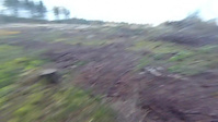
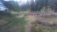
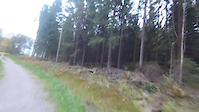
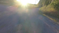
Photos of Østfold Mountain Bike
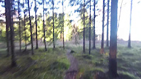
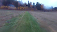
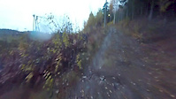
Videos of Østfold Mountain Bike
25:35 |
20 |
Nov 17, 2016
trail: Trostebekk Gård Grassti
0:37 |
5 |
Oct 27, 2016
4:13 |
17 |
Oct 26, 2016
trail: Ned i skogen
6:36 |
16 |
Oct 23, 2016
trail: Gudim Runden
6:05 |
15 |
Oct 21, 2016
trail: Røtter og trangt
3:47 |
11 |
Oct 17, 2016
0:40 |
8 |
Oct 3, 2016
trail: Langs parkerings plassen
0:57 |
2 |
Oct 3, 2016
Recent Trail Reports
Activity Feed
| username | action | type | title | date |
|---|---|---|---|---|
| Chrove | add | report | activity #97816440 and 2 more | Jun 25, 2026 @ 10:38pm 1 day |
| kidahl | wishlist | trail | activity #95389937 and 5 more | May 24, 2026 @ 3:07am May 24, 2026 |
| oyviaase | add | report | activity #95327652 | May 23, 2026 @ 9:32am May 23, 2026 |
| GP70 | add | photo | activity #95307285 | May 23, 2026 @ 5:22am May 23, 2026 |
| mtbboy1993 | update | trail | activity #95231661 | May 22, 2026 @ 4:01am May 22, 2026 |
Recent Comments
| username | type | title | comment | date |
|---|---|---|---|---|
| trail | Den måste nog delas upp. Den delar spår med... | Sep 17, 2025 @ 7:21am Sep 17, 2025 | ||
| report | Hello, {[email protected]} I am... | Apr 27, 2025 @ 12:28pm Apr 27, 2025 | ||
| report | Det | Aug 31, 2021 @ 10:30am Aug 31, 2021 | ||
| report | To wet to ride | Mar 21, 2020 @ 5:26pm Mar 21, 2020 | ||
| report | new trail/link made before logging area. Make... | Feb 10, 2020 @ 3:28am Feb 10, 2020 |
Local Badges
-

Descent 10k Badge3 awarded -
Descent 10k Badge1 awarded -
Descent 10k Badge0 awarded -
Descent 10k Badge4 awarded -
Descent 10k Badge12 awarded -
Descent 10k Badge0 awarded
Bike & Skill Parks
| name | type | city | rating |
|---|---|---|---|
| Kjerringåsen Alpinsenter | bike park | Sarpsborg | |
| Mysebu Dirt jumps | skill park | Eidsberg | |
| Askim Skatepark | skill park | Askim | |
| UBS-Banen | skill park | Spydeberg | |
| Askim Pumptrack | skill park | Askim |
Local Trail Supporters
- Simen Kalnæs Danielsen
Activity Type Stats
| activitytype | trails | distance | descent | descent distance | total vertical | rating | global rank | state rank | photos | reports | routes | ridelogs |
|---|---|---|---|---|---|---|---|---|---|---|---|---|
| Mountain Bike | 2,544 | 956 miles | 154,780 ft | 439 miles | 4,347 ft | 5,850 | 4,550 | 58 | 39,092 | |||
| E-Bike | 1,419 | 478 miles | 67,326 ft | 212 miles | 4,334 ft | 3,914 | 27 | 3,851 | ||||
| Gravel Bike | 1 | 24 | 4 | 220 | ||||||||
| Adaptive Bike | 5 | 16 | ||||||||||
| Winter Fat Bike | 4 | 19 | 1 | 4 | ||||||||
| Horse | 259 | 140 miles | 13,399 ft | 56 miles | 830 ft | 6 | 1,649 | 2 | 1 | |||
| Hike | 2,572 | 961 miles | 146,640 ft | 436 miles | 4,347 ft | 10 | 4,389 | 14 | 3,488 | |||
| Trail Running | 2,545 | 956 miles | 145,561 ft | 433 miles | 4,347 ft | 4,380 | 13 | 2,142 | ||||
| Dirtbike/Moto | 40 | 24 miles | 2,336 ft | 10 miles | 584 ft | 1,649 | 1 | |||||
| Observed Trials | 1 | 2,257 ft | 3 ft | 259 ft | 92 ft | 1 | 3 | |||||
| ATV/ORV/OHV | 61 | 44 miles | 1,867 ft | 14 miles | 686 ft | 1,649 | ||||||
| Snowmobile | 46 | 30 miles | 1,545 ft | 11 miles | 390 ft | 5 | ||||||
| Snowshoe | 287 | 156 miles | 19,528 ft | 70 miles | 1,414 ft | 16 | 3 | 34 | ||||
| Downhill Ski | 8 | 2 miles | 1,381 ft | 2 miles | 1,785 ft | 6 | 576 | |||||
| Backcountry Ski | 231 | 120 miles | 10,925 ft | 47 miles | 981 ft | 7 | 3 | 692 | ||||
| Nordic Ski | 360 | 92 miles | 8,022 ft | 40 miles | 1,972 ft | 3 | 157 | 4 | 4,272 |
Activities
- Østfold Mountain Biking Trails
- Østfold E-Biking Trails
- Østfold Adaptive Biking Trails
- Østfold Horseback Trails
- Østfold Hiking Trails
- Østfold Trail Running Trails
- Østfold Dirtbiking Trails
- Østfold ATVing/Offroading Trails
- Østfold Snowmobiling Trails
- Østfold Snowshoeing Trails
- Østfold Skiing Trails
- Østfold Backcountry Skiing Trails
- Østfold Nordic Skiing Trails
Trails
Points of Interest
- Tiny jump TTF
- Dirt edge TTF
- Stream crossing TTF
- Stream crossing TTF
- Gapahuk Camping
- Nordre Stange Varde Viewpoint
- Kykkelsrud kraftverk Sight
- Romsåsen gruver Sight
- Stream crossing TTF
- Historisk informasjon om stien inn i gravplassen Information
- Synhovd (4,662 ft)
- Gråvårandan (4,557 ft)
- Vikstølnuten (4,534 ft)
- By brenthillier
 NSMBA TRAILFORKS & contributors
 - Admins: mtbboy1993, Cykeljohan
- #11191 - 9,990 views
- Østfold activity log | embed map of Østfold mountain bike trails | Østfold mountain biking points of interest polygons
Downloading of trail gps tracks in kml & gpx formats is enabled for Østfold.
You must login to download files.