close
-
Layers w
- Weather Layers
- Pro
- Pro
- Pro
- Pro
- Pro
- Pro
- More Layers
- Pro
- Pro
- Pro
- Pro
-
Upgrade to

3D
Trail Conditions
- Unknown
- Snow Groomed
- Snow Packed
- Snow Covered
- Snow Cover Partial
- Freeze/thaw Cycle
- Icy
- Prevalent Mud
- Wet
- Variable
- Ideal
- Dry
- Very Dry
Trail Flow (Ridden Direction)
Trailforks scans users ridelogs to determine the most popular direction each trail is ridden. A good flowing trail network will have most trails flowing in a single direction according to their intension.
The colour categories are based on what percentage of riders are riding a trail in its intended direction.
The colour categories are based on what percentage of riders are riding a trail in its intended direction.
- > 96%
- > 90%
- > 80%
- > 70%
- > 50%
- < 50%
- bi-directional trail
- no data
Trail Last Ridden
Trailforks scans ridelogs to determine the last time a trail was ridden.
- < 2 days
- < 1 week
- < 2 weeks
- < 1 month
- < 6 months
- > 6 months
Trail Ridden Direction
The intended direction a trail should be ridden.
- Downhill Only
- Downhill Primary
- Both Directions
- Uphill Primary
- Uphill Only
- One Direction
Contribute Details
Colors indicate trail is missing specified detail.
- Description
- Photos
- Description & Photos
- Videos
Trail Popularity ?
Trailforks scans ridelogs to determine which trails are ridden the most in the last 9 months.
Trails are compared with nearby trails in the same city region with a possible 25 colour shades.
Think of this as a heatmap, more rides = more kinetic energy = warmer colors.
- most popular
- popular
- less popular
- not popular
ATV/ORV/OHV Filter
Max Vehicle Width
inches
US Cell Coverage
Legend

Radar Time
Activity Recordings
Trailforks uses anonymized public activity data.
?
Activity Recordings
Trailforks uses anonymized public activity data.
?
Personal Heatmap
▶
Activity Types
all
/
none
▶
Options
2
Date range
month
–
Winter Trails
Warning
A routing network for winter maps does not exist. Selecting trails using the winter trails layer has been disabled.
Missing Trails
Most Popular
Least Popular
Trails are colored based on popularity. The more popular a trail is, the more red. Less popular trails trend towards green.
Jump Magnitude Heatmap
Heatmap of where riders jump on trails. Zoom in to see individual jumps, click circles to view jump details.
BC Backroad Status
![map legend]()
Service Road Atlas is a free to use, community-driven service for viewing and creating reports on the numerous back-country service roads around B.C. and Alberta.

Slope Aspect
Direction the slope faces
Trails Deemphasized
Trails are shown in grey.
Only show trails with no bike usage.
Suggested Layers
Based on selected activity type
Save the current map location and zoom level as your default home location whenever this page is loaded.
SavePopular Trail Networks
view all areas »
No description for Central Otago District has been added yet!
Login or register to submit one.
Activities Click to view
- Mountain Bike
332 trails
- E-Bike
198 trails
- Horse
9 trails
- Hike
382 trails
- Trail Running
383 trails
- Dirtbike/Moto
5 trails
- ATV/ORV/OHV
2 trails
- Snowmobile
1 trails
- Snowshoe
1 trails
- Downhill Ski
1 trails
- Backcountry Ski
1 trails
- Nordic Ski
3 trails
Stats
- Avg Trail Rating
- Trails (view details)
- 392
- Trails Mountain Bike
- 332
- Trails E-Bike
- 198
- Trails Horse
- 9
- Trails Hike
- 382
- Trails Trail Running
- 383
- Trails Dirtbike/Moto
- 5
- Trails ATV/ORV/OHV
- 2
- Trails Snowmobile
- 1
- Trails Snowshoe
- 1
- Trails Downhill Ski
- 1
- Trails Backcountry Ski
- 1
- Trails Nordic Ski
- 3
- Total Distance
- 802 miles
- Total Descent
- 116,075 ft
- Total Vertical
- 7,464 ft
- Highest Trailhead
- 7,470 ft
- Reports
- 1,206
- Photos
- 644
- Ridden Counter
- 286,778
Articles
Photo Report: Oceania Downhill Continental Championships 2025
Mar 24, 2025 from pinkbike.com
Heavy overnight rains turned to legendary hero dirt—perfect conditions for fast times.

Interview: Cam McCaul Talks Natural Selection Bike Event
Mar 4, 2025 from pinkbike.com
We chat about how it all came together, where it's headed, and what everyone can look forward to in tomorrow's broadcast.
Practice Photo Report: Natural Selection Bike 2025
Feb 14, 2025 from pinkbike.com
It's almost showtime. The riders have been throwing down on the new course.

5 Riders Out at Natural Selection Bike After Practice Injuries
Feb 13, 2025 from pinkbike.com
We're wishing all the riders a speedy recovery and a safe and succesful contest tomorrow.
Sub Regions
- Alexandra (80)
- Alexandra Airport (10)
- Boot Hill (7)
- Flat Top Hill (13)
- Matangi Station MTB (37)
- Obelisk Range (6)
- Arrowtown (3)
- Balclutha (5)
- Clyde (3)
- Cromwell (37)
- Bendigo (1)
- Cairnmuir Range (0)
- The Inlet (10)
- kaitangata (1)
- Lawrence (6)
- Naseby (129)
- Naseby Forest (109)
- Oamaru (38)
- Cape Wanbrow (31)
- Herbert Forest (26)
- Oamaru Reservoir (1)
- Roxburgh (7)
- Catlins Coastal Area (0)
- Diamond Lake and Hospital Flat Conservation Areas (0)
- Glenorchy Area (0)
- Hāwea Conservation Park (0)
- Macetown Historic Reserve (0)
- Saint Bathans Area (0)
- Waipori Valley (2)
Popular Central Otago District Mountain Biking Trails
• 100 ★ 5.0 • 21 miles • 2,494 ft • 982 •
was built and is maintained by Southern Lakes Trails Trust. It is a purpose-built cycling and walking trail with a total length of 55km. There are 3 sections. Smith’s Way to Old Cromwell. Old Cromwell to Bannockburn Bridge....
• 95 ★ 5.0 • 4 miles • 176 ft • 565 •
was built and is maintained by Southern Lakes Trails Trust. It is a purpose-built cycling and walking trail with a total length of 55km. There are 3 sections. Smith’s Way to Old Cromwell. Old Cromwell to Bannockburn Bridge....
• 100 ★ 4.4 • 7 miles • 143 ft • 555 •
A good alternative to following the rail trail to Alexandra is to leave Clyde Rail head and ride down into the township of Clyde. Explore the old Township with its historical buildings on the main street and Power Dam just behind the...
• 80 ★ 4.0 • 6 miles • 281 ft • 343 •
Either ride this as a there-and-back, or continue along on the full Roxburgh Gorge Cycle Trail by catching a boat down river. This is an easy gravelled cycle path following the Clutha River through the Roxburgh Gorge. You ride past...
• 100 ★ 3.5 • 4,516 ft • 21 ft • 282 •
Popular white difficulty gravel path. This mountain bike primary trail can be used both directions and has a easy overall physical rating. On average it takes 7 minutes to complete this trail.
• 100 ★ 0.0 • 1,831 ft • 57 ft • 273 •
Best route to Appendix, Entrails & more Closed Oct 1st - Nov 30th for Lambing.
• 80 ★ 3.8 • 2 miles • 27 ft • 250 •
Popular blue difficulty singletrack. This mountain bike primary trail can be used downhill primary. On average it takes 5 minutes to complete this trail.
• 100 ★ 3.5 • 7 miles • 650 ft • 240 •
Starting from above Roxburgh Dam, riders soon enter the Roxburgh Gorge, with bluffs rising almost 350m on either side of the river at its most dramatic point. Gold-mining history plays a big part in the attraction of this trail, with...
Central Otago District Mountain Bike Routes
★ 5.0 • 25 miles • 2,955 ft • 1 • Point to Point •
The Lake Dunstan Cycle trail is a totally unique 42km journey through the Cromwell Gorge skirting one of...
25 miles • 2,908 ft • 1 • Point to Point •
The full 42km Lake Dunstan cycle trail, starting from Cromwell Historic Precinct ending in Clyde. The Lake...
25 miles • 2,908 ft • 1 • Point to Point •
The full 42km Lake Dunstan cycle trail, starting from Cromwell Historic Precinct ending in Clyde. The Lake...
★ 5.0 • 25 miles • 2,837 ft • 0 • Point to Point •
The full 42km Lake Dunstan cycle trail, starting from Cromwell Historic Precinct ending in Clyde. The Lake...
★ 5.0 • 7 miles • 664 ft • 0 • Loop •
Torpedo7 12 Hour Naseby Challenge 2015 Torpedo7 and Mountain Biking Otago got together to run the 11th...
14 miles • 1,846 ft • 2 • Loop •
Nice pedal loop from Arrowtown. Can also be started on Coronet Peak station rd where Hot Rod ends but...
Photos of Central Otago District Mountain Bike
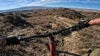
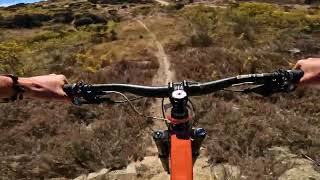
Videos of Central Otago District Mountain Bike
trail: Deep Lead
0:12 |
124 |
May 10, 2023

trail: Gold Handler
0:18 |
85 |
Apr 7, 2023
trail: Moonscape
0:07 |
301 |
Nov 9, 2021

trail: A Digger Did It
0:08 |
651 |
Feb 16, 2019
0:58 |
72 |
Sep 9, 2018
trail: Gully
4:28 |
220 |
Aug 3, 2015
youtuber
![Resurrection @ Matangi Station. Alexandra]()
trail: Resurrection
5:07 |
13 |
Jun 1, 2026 , Alexandra
youtuber
![Prospector @ Matangi Station. Alexandra]()
trail: Prospector
0:52 |
21 |
Apr 27, 2026 , Alexandra
Current Trail Warnings
| status | trail | date | condition | user | info |
|---|---|---|---|---|---|
| Knott Rode Herbert Forest | Jun 14, 2026 @ 9:20pm (Pacific/Auckland) Jun 14, 2026 | Unknown | rattyboy | ||
| South Ridge Road Herbert Forest | Jun 14, 2026 @ 9:19pm (Pacific/Auckland) Jun 14, 2026 | Unknown | rattyboy | closed until further notice | |
| South Ridge Singletrack Herbert Forest | Jun 14, 2026 @ 9:18pm (Pacific/Auckland) Jun 14, 2026 | Unknown | rattyboy |
Recent Trail Reports
Activity Feed
| username | action | type | title | date |
|---|---|---|---|---|
| atupoUJ0 | add | photo | activity #97349229 and 1 more | Jun 19, 2026 @ 3:36pm 12 hours |
| rattyboy | add | report | activity #96946488 and 2 more | Jun 14, 2026 @ 2:18am Jun 14, 2026 |
| skieralex | add | report | activity #96925217 | Jun 13, 2026 @ 4:31pm Jun 13, 2026 |
| skieralex | comment | trail | activity #96925055 | Jun 13, 2026 @ 4:29pm Jun 13, 2026 |
| mtbmarty54 | ridden | trail | activity #96774807 | Jun 11, 2026 @ 6:12pm Jun 11, 2026 |
Recent Comments
| username | type | title | comment | date |
|---|---|---|---|---|
| trail | Fun trail. I would say hazard country is a bit... | Jun 13, 2026 @ 4:29pm Jun 13, 2026 | ||
| trail | Just a warning for anyone riding for the first... | May 2, 2026 @ 11:47pm May 2, 2026 | ||
| trail | We rode from the Clyde end and mostly... | Apr 24, 2026 @ 12:54am Apr 24, 2026 | ||
| trail | Started loop anti-clockwise and pulled the... | Mar 30, 2026 @ 1:25pm Mar 30, 2026 | ||
| trail | Cycled today. Climbed Wamgalia Road, taking... | Mar 3, 2026 @ 6:42pm Mar 3, 2026 |
Local Badges
-

Completionist2 awarded -

Top 10 Trails55 awarded -
Completionist0 awarded -
Top 10 Trails2 awarded -

Epic Ride Descent 2k11 awarded -

Descent 10k Badge2 awarded
Bike & Skill Parks
| name | type | city | rating |
|---|---|---|---|
| Alexandra BMX Track | skill park | Alexandra | |
| Kaitangata BMX Track | skill park | kaitangata | |
| Cromwell Bike Park | skill park | Cromwell |
Activity Type Stats
| activitytype | trails | distance | descent | descent distance | total vertical | rating | global rank | state rank | photos | reports | routes | ridelogs |
|---|---|---|---|---|---|---|---|---|---|---|---|---|
| Mountain Bike | 332 | 605 miles | 79,793 ft | 269 miles | 5,509 ft | 582 | 1,205 | 11 | 26,088 | |||
| E-Bike | 198 | 485 miles | 58,947 ft | 214 miles | 5,046 ft | 11 | 900 | 7 | 3,000 | |||
| Horse | 9 | 84 miles | 12,057 ft | 39 miles | 3,648 ft | 70 | 1 | |||||
| Hike | 382 | 787 miles | 111,204 ft | 331 miles | 7,464 ft | 21 | 1,179 | 4 | 3,544 | |||
| Trail Running | 383 | 782 miles | 107,635 ft | 327 miles | 7,464 ft | 7 | 1,182 | 6 | 1,450 | |||
| Dirtbike/Moto | 5 | 64 miles | 7,408 ft | 30 miles | 3,648 ft | 69 | 6 | |||||
| ATV/ORV/OHV | 2 | 41 miles | 5,066 ft | 23 miles | 3,051 ft | 69 | 6 | |||||
| Snowmobile | 1 | |||||||||||
| Snowshoe | 1 | 129 | 3 | |||||||||
| Downhill Ski | 1 | 843 | ||||||||||
| Backcountry Ski | 1 | 167 | ||||||||||
| Nordic Ski | 3 | 5 miles | 436 ft | 2 miles | 220 ft | 40 | 179 |
Frequently Asked Questions About Central Otago District
▼
What are the best places to ride in Central Otago District?
Central Otago District has 27 areas to explore for mountain biking. The top rated areas are:
▼
What are the highest rated mountain biking trails in Central Otago District?
The highest rated mountain biking trails in Central Otago District are:
- Hazard County (4.6/5)
- Lake Dunstan Trail (4.5/5)
- 5th Amendment (4.5/5)
- Panhead (4.4/5)
- Dr Strangelove (4.4/5)
▼
What is the best time of the year to ride in Central Otago District?
Based on ride log data, the most popular months to ride in Central Otago District are:
- January (955 activities)
- February (876 activities)
- December (818 activities)
▼
What is the longest trail in Central Otago District?
The longest trail in Central Otago District is Otago Central Rail Trail at 93.8 miles. View all trails sorted by distance.
Activities
Trails
- Hard trails in Central Otago District
- Easy trails in Central Otago District
- Favorite trails in Central Otago District
- Most ridden trails in Central Otago District
- Singletrack in Central Otago District
- Viewpoint trails in Central Otago District
- Trails with technical features in Central Otago District
- Race routes in Central Otago District
Points of Interest
- By brenthillier
 NSMBA TRAILFORKS & contributors
 - Admins: TFNZ, lintbagger, Alps2Ocean-Cycle-Trail, MBO, Dubnyk
- #3656 - 26,713 views
- central otago district activity log | embed map of Central Otago District mountain bike trails | central otago district mountain biking points of interest
Downloading of trail gps tracks in kml & gpx formats is enabled for Central Otago District.
You must login to download files.