close
-
Layers w
- Weather Layers
- Pro
- Pro
- Pro
- Pro
- Pro
- Pro
- More Layers
- Pro
- Pro
- Pro
- Pro
-
Upgrade to

3D
Trail Conditions
- Unknown
- Snow Groomed
- Snow Packed
- Snow Covered
- Snow Cover Partial
- Freeze/thaw Cycle
- Icy
- Prevalent Mud
- Wet
- Variable
- Ideal
- Dry
- Very Dry
Trail Flow (Ridden Direction)
Trailforks scans users ridelogs to determine the most popular direction each trail is ridden. A good flowing trail network will have most trails flowing in a single direction according to their intension.
The colour categories are based on what percentage of riders are riding a trail in its intended direction.
The colour categories are based on what percentage of riders are riding a trail in its intended direction.
- > 96%
- > 90%
- > 80%
- > 70%
- > 50%
- < 50%
- bi-directional trail
- no data
Trail Last Ridden
Trailforks scans ridelogs to determine the last time a trail was ridden.
- < 2 days
- < 1 week
- < 2 weeks
- < 1 month
- < 6 months
- > 6 months
Trail Ridden Direction
The intended direction a trail should be ridden.
- Downhill Only
- Downhill Primary
- Both Directions
- Uphill Primary
- Uphill Only
- One Direction
Contribute Details
Colors indicate trail is missing specified detail.
- Description
- Photos
- Description & Photos
- Videos
Trail Popularity ?
Trailforks scans ridelogs to determine which trails are ridden the most in the last 9 months.
Trails are compared with nearby trails in the same city region with a possible 25 colour shades.
Think of this as a heatmap, more rides = more kinetic energy = warmer colors.
- most popular
- popular
- less popular
- not popular
ATV/ORV/OHV Filter
Max Vehicle Width
inches
US Cell Coverage
Legend

Radar Time
Activity Recordings
Trailforks uses anonymized public activity data.
?
Activity Recordings
Trailforks uses anonymized public activity data.
?
Personal Heatmap
▶
Activity Types
all
/
none
▶
Options
2
Date range
month
–
Winter Trails
Warning
A routing network for winter maps does not exist. Selecting trails using the winter trails layer has been disabled.
Missing Trails
Most Popular
Least Popular
Trails are colored based on popularity. The more popular a trail is, the more red. Less popular trails trend towards green.
Jump Magnitude Heatmap
Heatmap of where riders jump on trails. Zoom in to see individual jumps, click circles to view jump details.
BC Backroad Status
![map legend]()
Service Road Atlas is a free to use, community-driven service for viewing and creating reports on the numerous back-country service roads around B.C. and Alberta.

Slope Aspect
Direction the slope faces
Trails Deemphasized
Trails are shown in grey.
Only show trails with no bike usage.
Suggested Layers
Based on selected activity type
Save the current map location and zoom level as your default home location whenever this page is loaded.
SaveThe riding in the Bourne/Falmouth area is usually referred to as riding at Otis. The riding area abuts the Otis Air Force Base which has been officially closed to anyone except official personal since the events of September 11th 2001.
Most people don't realize that they are actually riding on Town of Falmouth Conservation Land and The Frances Crane Wildlife Management Area, which is not part of the base. Unfortunately, there is really no physical delineation between these areas. Most people ride Otis without ever crossing into base land or seeing military police. But, if you happen to be crossing a paved road and encounter a base official, they will ask you to leave, or perhaps escort you out. They are not out there patrolling, or looking for mountain bikers in the woods. If you see what looks like base housing or the National Cemetery you are no longer in an open riding area.
Most people don't realize that they are actually riding on Town of Falmouth Conservation Land and The Frances Crane Wildlife Management Area, which is not part of the base. Unfortunately, there is really no physical delineation between these areas. Most people ride Otis without ever crossing into base land or seeing military police. But, if you happen to be crossing a paved road and encounter a base official, they will ask you to leave, or perhaps escort you out. They are not out there patrolling, or looking for mountain bikers in the woods. If you see what looks like base housing or the National Cemetery you are no longer in an open riding area.
Primary Trail Type: Cross-Country
eBikes Allowed:
No
Land Status: Conservation Reserve
Land Manager: Town of Bourne
Links
Activities Click to view
- Mountain Bike
68 trails
- Hike
68 trails
- Trail Running
68 trails
- Snowshoe
66 trails
Region Details
- 14
- 15
- 31
- 8
Region Status
Open as of Jun 13, 2026Stats
- Avg Trail Rating
- Trails (view details)
- 68
- Trails Mountain Bike
- 68
- Trails Horse
- 3
- Trails Hike
- 68
- Trails Trail Running
- 68
- Trails Snowshoe
- 66
- Total Distance
- 31 miles
- Total Descent Distance
- 12 miles
- Total Descent
- 2,533 ft
- Total Vertical
- 210 ft
- Highest Trailhead
- 258 ft
- Reports
- 234
- Photos
- 118
- Ridden Counter
- 3,071
Popular Otis (Bourne) Mountain Biking Trails
• 100 ★ 0.0 • 1,194 ft • 0 ft • 557 •
is a great way to stay out of the dry dust of " ".
• 95 ★ 3.5 • 1 mile • 96 ft • 466 •
is a fun intermediate trail that is most commonly used to venture over to the Northern section of Otis.
• 100 ★ 4.0 • 4,327 ft • 55 ft • 434 •
Winding back and forth through tight trees, this singletrack features some small rock gardens. This can be a blast if you choose the right line.
• 100 ★ 4.0 • 2 miles • 279 ft • 432 •
A little bit of a climb on some excellent trail up to an old foundation for a lighthouse. The foundation is at about 200' ft and from there you can head down the or down the Bushwhack Trail.
• 95 ★ 2.7 • 2,949 ft • 61 ft • 404 •
Paul's Bypass parallels Route 28 and has everything from sweet punchy climbs to loose rocky chunk. A darker mood alternative to " ", unless you like a little gnarly with your mountain biking :)
• 100 ★ 5.0 • 4,068 ft • 24 ft • 371 •
is a crazy fun trail with lots of features, rocks, and challenges. Starts from the top of Mt Zig and drops down thru Heaven's Gate into a short but tough little rock garden. From there rocks abound as you weave along a ridge topping out...
• 100 ★ 5.0 • 2,644 ft • 16 ft • 355 •
From the lighthouse, this trail drops all the way down to . This is a favorite trail to test your speed and bike handling. Turn on Strava and see if you can take the KOM from our local shop, Sailworld Cape Cod.
• 100 ★ 4.0 • 741 ft • 0 ft • 345 •
Head out on this trail across and bang a left to get ready for the trail to "S" curve and fall away for about 300 yards. Then comes a sweet little burst of a climb after which another long downhill drops down to a three-way intersection.
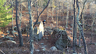
Photos of Otis (Bourne) Mountain Bike
Videos of Otis (Bourne) Mountain Bike
trail: Aya's Wild Ride
0:30 |
802 |
May 10, 2016
Current Trail Warnings
| status | trail | date | condition | user | info |
|---|---|---|---|---|---|
| Scully's Trail | Jun 13, 2026 @ 3:52pm (America/New_York) Jun 13, 2026 | Dry | pclark92 | ||
| Rocket Launcher | May 31, 2026 @ 2:11pm (America/New_York) May 31, 2026 | Unknown | jfamely |
Recent Trail Reports
| status | trail | date | condition | info | user |
|---|---|---|---|---|---|
| Cobble Gobbler | May 31, 2026 @ 1:56pm (America/New_York) May 31, 2026 | Unknown | jfamely | ||
| Lighthouse Climb | May 5, 2026 @ 6:27pm (America/New_York) May 5, 2026 | Unknown | ArdenKTH | ||
| K-Meister | Apr 7, 2026 @ 3:49pm (America/New_York) Apr 7, 2026 | Unknown | dlafreniere CC NEMBA | ||
| Trail Less Taken | Apr 7, 2026 @ 3:48pm (America/New_York) Apr 7, 2026 | Unknown | dlafreniere CC NEMBA | ||
| Country Berms | Apr 5, 2026 @ 1:33pm (America/New_York) Apr 5, 2026 | Unknown | dlafreniere CC NEMBA | ||
| Lighthouse Downhill Trail | Mar 31, 2026 @ 5:56pm (America/New_York) Mar 31, 2026 | Ideal | dlafreniere CC NEMBA | ||
| Aya's Wild Ride | Mar 31, 2026 @ 3:37pm (America/New_York) Mar 31, 2026 | Unknown | dlafreniere CC NEMBA | ||
| Hannah's Way | Mar 31, 2026 @ 2:38pm (America/New_York) Mar 31, 2026 | Unknown | dlafreniere CC NEMBA | ||
| Fort Apache | Mar 21, 2026 @ 7:18pm (America/New_York) Mar 21, 2026 | Variable | jkubick | ||
| Pamela's | Mar 21, 2026 @ 6:55pm (America/New_York) Mar 21, 2026 | Variable | jkubick |
Activity Feed
| username | action | type | title | date |
|---|---|---|---|---|
| pclark92 | add | report | activity #96908131 | Jun 13, 2026 @ 12:52pm Jun 13, 2026 |
| jfamely | add | report | activity #95958505 and 1 more | May 31, 2026 @ 10:56am May 31, 2026 |
| ArdenKTH | add | report | activity #94118023 | May 5, 2026 @ 3:27pm May 5, 2026 |
| MaxdY6bMi | wishlist | trail | activity #92618274 | Apr 14, 2026 @ 1:48pm Apr 14, 2026 |
| dlafreniere | add | report | activity #92136231 and 1 more | Apr 7, 2026 @ 12:48pm Apr 7, 2026 |
Recent Comments
| username | type | title | comment | date |
|---|---|---|---|---|
| report | Blake, this report is set to green (all... | Apr 7, 2026 @ 6:10am Apr 7, 2026 | ||
| report | Amazing! Keep reporting them and hopefully... | Mar 22, 2026 @ 9:28am Mar 22, 2026 | ||
| report | All cleared | Mar 22, 2026 @ 6:12am Mar 22, 2026 | ||
| report | Have all those trees been removed? (The status... | Mar 22, 2026 @ 4:56am Mar 22, 2026 | ||
| report | Done | Dec 23, 2023 @ 6:39am Dec 23, 2023 |
Nearby Areas
| name | distance | ||||
|---|---|---|---|---|---|
| Cataumet Greenway & Red Brook Pond | 22 | 1 | 1 | 1 km | |
| Baxendale Woods | 7 | 3 | 1.1 km | ||
| Red Brook Pond Conservation Area | 7 | 5 | 1.2 km | ||
| Otis (Falmouth) | 33 | 26 | 12 | 5 | 1.4 km |
| Four Ponds Conservation / Pocasset SF | 24 | 42 | 6 | 2.5 km |
Local Badges
-

Completionist - Otis (Bourne) - CC10002 awarded -

Completionist2 awarded
Activity Type Stats
| activitytype | trails | distance | descent | descent distance | total vertical | rating | global rank | state rank | photos | reports | routes | ridelogs |
|---|---|---|---|---|---|---|---|---|---|---|---|---|
| Mountain Bike | 68 | 31 miles | 2,533 ft | 12 miles | 210 ft | #2,925 | #1,007 | 106 | 234 | 641 | ||
| Horse | 3 | 1,316 ft | 39 ft | 492 ft | 43 ft | 58 | ||||||
| Hike | 68 | 31 miles | 2,533 ft | 12 miles | 210 ft | #5,880 | #2,124 | 10 | 234 | 6 | ||
| Trail Running | 68 | 31 miles | 2,533 ft | 12 miles | 210 ft | #5,003 | #1,492 | 1 | 234 | 1 | ||
| Snowshoe | 66 | 31 miles | 2,526 ft | 12 miles | 210 ft | #443 | #155 | 130 |
Frequently Asked Questions About Otis (Bourne)
▼
What are the highest rated mountain biking trails in Otis (Bourne)?
The highest rated mountain biking trails in Otis (Bourne) are:
- Aya's Wild Ride (4.4/5)
- Scully's Trail (4.2/5)
- Lighthouse Downhill Trail (4.2/5)
- Buzzard's Trail (4.1/5)
- Pamela's (4.1/5)
▼
What is the best time of the year to ride in Otis (Bourne)?
Based on ride log data, the most popular months to ride in Otis (Bourne) are:
- December (3 activities)
- November (2 activities)
- October (1 activities)
▼
Where can I park to ride in Otis (Bourne)?
Check the Otis (Bourne) trail map for trailhead and parking information. Community members regularly update access and parking details for trails in the area.
▼
What is the longest trail in Otis (Bourne)?
The longest trail in Otis (Bourne) is JBCC Moto Loop at 4.7 km. View all trails sorted by distance.
Activities
Trails
Points of Interest
- By dlafreniere
 CC NEMBA & contributors
 - Admins: apply
- #53515 - 2,133 views
- otis (bourne) activity log | embed map of Otis (Bourne) mountain bike trails | otis (bourne) mountain biking points of interest
Downloading of trail gps tracks in kml & gpx formats is enabled for Otis (Bourne).
You must login to download files.