close
-
Layers w
- Weather Layers
- Pro
- Pro
- Pro
- Pro
- Pro
- Pro
- More Layers
- Pro
- Pro
- Pro
- Pro
-
Upgrade to

3D
Trail Conditions
- Unknown
- Snow Groomed
- Snow Packed
- Snow Covered
- Snow Cover Partial
- Freeze/thaw Cycle
- Icy
- Prevalent Mud
- Wet
- Variable
- Ideal
- Dry
- Very Dry
Trail Flow (Ridden Direction)
Trailforks scans users ridelogs to determine the most popular direction each trail is ridden. A good flowing trail network will have most trails flowing in a single direction according to their intension.
The colour categories are based on what percentage of riders are riding a trail in its intended direction.
The colour categories are based on what percentage of riders are riding a trail in its intended direction.
- > 96%
- > 90%
- > 80%
- > 70%
- > 50%
- < 50%
- bi-directional trail
- no data
Trail Last Ridden
Trailforks scans ridelogs to determine the last time a trail was ridden.
- < 2 days
- < 1 week
- < 2 weeks
- < 1 month
- < 6 months
- > 6 months
Trail Ridden Direction
The intended direction a trail should be ridden.
- Downhill Only
- Downhill Primary
- Both Directions
- Uphill Primary
- Uphill Only
- One Direction
Contribute Details
Colors indicate trail is missing specified detail.
- Description
- Photos
- Description & Photos
- Videos
Trail Popularity ?
Trailforks scans ridelogs to determine which trails are ridden the most in the last 9 months.
Trails are compared with nearby trails in the same city region with a possible 25 colour shades.
Think of this as a heatmap, more rides = more kinetic energy = warmer colors.
- most popular
- popular
- less popular
- not popular
ATV/ORV/OHV Filter
Max Vehicle Width
inches
US Cell Coverage
Legend

Radar Time
Activity Recordings
Trailforks uses anonymized public activity data.
?
Activity Recordings
Trailforks uses anonymized public activity data.
?
Personal Heatmap
▶
Activity Types
all
/
none
▶
Options
2
Date range
month
–
Winter Trails
Warning
A routing network for winter maps does not exist. Selecting trails using the winter trails layer has been disabled.
Missing Trails
Most Popular
Least Popular
Trails are colored based on popularity. The more popular a trail is, the more red. Less popular trails trend towards green.
Jump Magnitude Heatmap
Heatmap of where riders jump on trails. Zoom in to see individual jumps, click circles to view jump details.
BC Backroad Status
![map legend]()
Service Road Atlas is a free to use, community-driven service for viewing and creating reports on the numerous back-country service roads around B.C. and Alberta.

Slope Aspect
Direction the slope faces
Trails Deemphasized
Trails are shown in grey.
Only show trails with no bike usage.
Suggested Layers
Based on selected activity type
Save the current map location and zoom level as your default home location whenever this page is loaded.
SaveGreat XC trail network built around the Otway Nordic Ski Centre. Facilities include parking lot and day-use lodges.
Primary Trail Type: Cross-Country
AKA: Otway Nordic Centre
Land Status: Ski Resort
 google parking directions
 Activities Click to view
- Mountain Bike
39 trails
- Hike
39 trails
- Trail Running
39 trails
Region Details
- 7
- 19
- 13
Region Status
Caution as of May 31, 2026Stats
- Avg Trail Rating
- Trails (view details)
- 39
- Trails Mountain Bike
- 39
- Trails Hike
- 39
- Trails Trail Running
- 39
- Total Distance
- 20 miles
- Total Descent
- 4,407 ft
- Total Vertical
- 429 ft
- Highest Trailhead
- 2,425 ft
- Reports
- 1,476
- Photos
- 128
- Ridden Counter
- 10,182
Popular Otway Mountain Biking Trails
• 95 ★ 4.2 • 1,522 ft • 87 ft • 435 •
Trail climbs from junction to Haggen's Hub. Ridden in both directions.
• 95 ★ 4.0 • 3,025 ft • 116 ft • 423 •
This trail climbs from '55 Chevy Junction to the Junction. Expect two-way traffic on this trail (as for most trails at Otway).
• 95 ★ 4.1 • 4,209 ft • 281 ft • 403 •
Easiest way to get to the top of the Otway trails. Moderate climbing trail.
Otway Mountain Bike Routes
4 miles • 510 ft • 7 • Loop •
Trail forks keeps freezing on IPhone trying to add to ridelog
★ 1.0 • 6 miles • 705 ft • 13 • Loop •
In celebration of PG Gals n Gears, we have created our first PG Gals n Gears Virtual Wild Ride for you to...
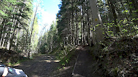
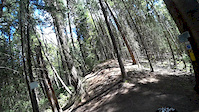
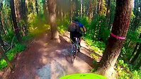
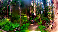
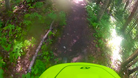
Photos of Otway Mountain Bike
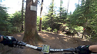
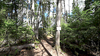
Videos of Otway Mountain Bike
trail: Tornado Alley
2:50 |
430 |
May 20, 2019
trail: Karma
3:10 |
150 |
May 20, 2019
trail: Bad Dog
3:41 |
188 |
May 20, 2019
trail: Curves
3:11 |
103 |
May 20, 2019
trail: Java
3:44 |
143 |
Aug 8, 2018
trail: Bad Dog
0:47 |
105 |
Aug 8, 2018
trail: Tincan Alley
2:28 |
202 |
Jun 18, 2018

trail: Inside Passage
3:24 |
110 |
Jun 18, 2018
Current Trail Warnings
| status | trail | date | condition | user | info |
|---|---|---|---|---|---|
| Gnarly Girls | May 24, 2026 @ 11:45am (America/Vancouver) May 24, 2026 | Unknown | bag-of-meat | Trees down. One in a horrible spot, on in... |
Recent Trail Reports
| status | trail | date | condition | info | user |
|---|---|---|---|---|---|
| Home Run | May 31, 2026 @ 11:02am (America/Dawson_Creek) May 31, 2026 | Ideal | bcsnipes | ||
| Lower Freeway | May 28, 2026 @ 5:07pm (Pacific/Midway) May 28, 2026 | Variable | wideload46 | ||
| AC/DC | May 28, 2026 @ 5:07pm (Pacific/Midway) May 28, 2026 | Variable | wideload46 | ||
| Karma | May 28, 2026 @ 5:07pm (Pacific/Midway) May 28, 2026 | Variable | wideload46 | ||
| Cyclone | May 17, 2026 @ 2:15pm (America/Vancouver) May 17, 2026 | Unknown | colinstoneh | ||
| Clearcut | May 17, 2026 @ 2:14pm (America/Vancouver) May 17, 2026 | Unknown | colinstoneh | ||
| Rollercoaster | May 17, 2026 @ 2:13pm (America/Vancouver) May 17, 2026 | Dry | colinstoneh | ||
| Treehugger | Apr 19, 2026 @ 10:38am (America/Vancouver) Apr 19, 2026 | Wet | mustang5o | ||
| Tincan Alley | Nov 1, 2025 @ 5:38pm (America/Vancouver) Nov 1, 2025 | Variable | Adammushumanski | ||
| Twister | Nov 1, 2025 @ 5:38pm (America/Vancouver) Nov 1, 2025 | Variable | Adammushumanski |
Activity Feed
| username | action | type | title | date |
|---|---|---|---|---|
| bcsnipes | add | report | activity #96014378 | Jun 1, 2026 @ 6:54am Jun 1, 2026 |
| Suilven | wishlist | route | activity #95793819 | May 29, 2026 @ 12:03pm May 29, 2026 |
| SuilvenNKZ9Bg | wishlist | route | activity #95756146 | May 28, 2026 @ 9:32pm May 28, 2026 |
| wideload46 | add | report | activity #95754270 and 2 more | May 28, 2026 @ 8:27pm May 28, 2026 |
| bag-of-meat | add | report | activity #95431568 and 1 more | May 24, 2026 @ 11:43am May 24, 2026 |
Recent Comments
| username | type | title | comment | date |
|---|---|---|---|---|
| trail | Wish this was ridden more. Fun, little steep... | Jun 7, 2025 @ 5:55pm Jun 7, 2025 | ||
| trail | Lots of tree down on trail and a little bit... | Sep 4, 2024 @ 1:55pm Sep 4, 2024 | ||
| trail | Tree down near the bottom. Could use a rake/blow. | May 6, 2024 @ 6:48am May 6, 2024 | ||
| trail | Trees down across the trail right at that... | Aug 20, 2023 @ 12:30pm Aug 20, 2023 | ||
| trail | Sweet climb. | Sep 13, 2022 @ 4:06pm Sep 13, 2022 |
Nearby Areas
| name | distance | ||||
|---|---|---|---|---|---|
| Pidherny Recreation Site | 19 | 45 | 19 | 1 | 1.6 km |
| Cranbrook Hill | 9 | 2 | 1 | 1 | 5.1 km |
| University Hill | 8 | 12 | 7 | 6.4 km | |
| Greenway/Forests for the World | 38 | 40 | 7 | 6.8 km | |
| The Swedes | 8.1 km |
Local Badges
-

Completionist0 awarded
Local Mountain Biking Directory
-
Caledonia Nordic Ski Club
![Caledonia Nordic Ski Club]()
-
Association of Caledonia Trailbuilders
![Association of Caledonia Trailbuilders]()
-
Prince George Cycling ClubTrail Association
![Prince George Cycling Club]()
-
Ruckus Skis Boards And BikesBike Shop
![Ruckus Skis Boards And Bikes]()
-
Players Bench Sports & Evolve BikeBike Shop
-
Koops Bike ShopBike Shop
Activity Type Stats
| activitytype | trails | distance | descent | descent distance | total vertical | rating | global rank | state rank | photos | reports | routes | ridelogs |
|---|---|---|---|---|---|---|---|---|---|---|---|---|
| Mountain Bike | 39 | 20 miles | 4,406 ft | 9 miles | 430 ft | #1,498 | #107 | 128 | 1,476 | 10 | 8,925 | |
| Hike | 39 | 20 miles | 4,406 ft | 9 miles | 430 ft | #6,108 | #250 | 1,476 | 893 | |||
| Trail Running | 39 | 20 miles | 4,406 ft | 9 miles | 430 ft | #4,915 | #173 | 1,476 | 1 | 882 |
Frequently Asked Questions About Otway
▼
What are the highest rated mountain biking trails in Otway?
The highest rated mountain biking trails in Otway are:
- Rollercoaster (4.4/5)
- Twister II (4.4/5)
- Cyclone (4.3/5)
- Freeway (upper) (4.3/5)
- Karma (4.3/5)
▼
What is the best time of the year to ride in Otway?
Based on ride log data, the most popular months to ride in Otway are:
- July (389 activities)
- June (327 activities)
- August (255 activities)
▼
Where can I park to ride in Otway?
There are 1 parking locations listed in Otway. The most popular parking spots are:
▼
What is the longest trail in Otway?
The longest trail in Otway is Tincan Alley at 2.7 km. View all trails sorted by distance.
Trails
- By hgriesbauer
 PGBRS & contributors
 - Admins: PGCC, forestuser, free-riders, Mostlyharmless80, CNSC, mikepalangio, NBC, PGBRS, aleksa
- #5323 - 35,663 views
- otway activity log | embed map of Otway mountain bike trails | otway mountain biking points of interest
Downloading of trail gps tracks in kml & gpx formats is enabled for Otway.
You must login to download files.