close
-
Layers w
- Weather Layers
- Pro
- Pro
- Pro
- Pro
- Pro
- Pro
- More Layers
- Pro
- Pro
- Pro
- Pro
-
Upgrade to

3D
Trail Conditions
- Unknown
- Snow Groomed
- Snow Packed
- Snow Covered
- Snow Cover Partial
- Freeze/thaw Cycle
- Icy
- Prevalent Mud
- Wet
- Variable
- Ideal
- Dry
- Very Dry
Trail Flow (Ridden Direction)
Trailforks scans users ridelogs to determine the most popular direction each trail is ridden. A good flowing trail network will have most trails flowing in a single direction according to their intension.
The colour categories are based on what percentage of riders are riding a trail in its intended direction.
The colour categories are based on what percentage of riders are riding a trail in its intended direction.
- > 96%
- > 90%
- > 80%
- > 70%
- > 50%
- < 50%
- bi-directional trail
- no data
Trail Last Ridden
Trailforks scans ridelogs to determine the last time a trail was ridden.
- < 2 days
- < 1 week
- < 2 weeks
- < 1 month
- < 6 months
- > 6 months
Trail Ridden Direction
The intended direction a trail should be ridden.
- Downhill Only
- Downhill Primary
- Both Directions
- Uphill Primary
- Uphill Only
- One Direction
Contribute Details
Colors indicate trail is missing specified detail.
- Description
- Photos
- Description & Photos
- Videos
Trail Popularity ?
Trailforks scans ridelogs to determine which trails are ridden the most in the last 9 months.
Trails are compared with nearby trails in the same city region with a possible 25 colour shades.
Think of this as a heatmap, more rides = more kinetic energy = warmer colors.
- most popular
- popular
- less popular
- not popular
ATV/ORV/OHV Filter
Max Vehicle Width
inches
US Cell Coverage
Legend

Radar Time
Activity Recordings
Trailforks uses anonymized public activity data.
?
Activity Recordings
Trailforks uses anonymized public activity data.
?
Personal Heatmap
▶
Activity Types
all
/
none
▶
Options
2
Date range
month
–
Winter Trails
Warning
A routing network for winter maps does not exist. Selecting trails using the winter trails layer has been disabled.
Missing Trails
Most Popular
Least Popular
Trails are colored based on popularity. The more popular a trail is, the more red. Less popular trails trend towards green.
Jump Magnitude Heatmap
Heatmap of where riders jump on trails. Zoom in to see individual jumps, click circles to view jump details.
BC Backroad Status
![map legend]()
Service Road Atlas is a free to use, community-driven service for viewing and creating reports on the numerous back-country service roads around B.C. and Alberta.

Slope Aspect
Direction the slope faces
Trails Deemphasized
Trails are shown in grey.
Only show trails with no bike usage.
Suggested Layers
Based on selected activity type
Save the current map location and zoom level as your default home location whenever this page is loaded.
SavePopular Trail Networks
view all areas »
No description for Outaouais has been added yet!
Login or register to submit one.
Region Details
- 64
- 6
- 126
- 181
- 121
- 22
- 2
Local Trail Association
Stats
- Avg Trail Rating
- Trails (view details)
- 693
- Trails Mountain Bike
- 636
- Trails E-Bike
- 332
- Trails Winter Fat Bike
- 10
- Trails Horse
- 1
- Trails Hike
- 450
- Trails Trail Running
- 438
- Trails ATV/ORV/OHV
- 1
- Trails Snowmobile
- 3
- Trails Snowshoe
- 220
- Trails Downhill Ski
- 9
- Trails Backcountry Ski
- 50
- Trails Nordic Ski
- 204
- Total Distance
- 483 miles
- Total Descent
- 54,040 ft
- Total Vertical
- 1,692 ft
- Highest Trailhead
- 1,823 ft
- Reports
- 7,039
- Photos
- 1,868
- Ridden Counter
- 135,966
Sub Regions
- Aylmer (25)
- Blue Sea (0)
- Cantley (41)
- Cantley (0)
- Domaine Kanawe (41)
- Chelsea (235)
- Gatineau (69)
- Lac Beauchamp (14)
- Le Harfang (37)
- Parc de Castillou (1)
- Hull (7)
- Lac-des-Plages (20)
- Lac-Sainte-Marie (61)
- Velo MSM (61)
- Montebello (109)
- Otter Lake (3)
- Leslie Park (3)
- Plaisance (0)
- Ripon (20)
- Sheenboro (0)
- Wakefield (31)
- Centre Vorlage (27)
Popular Outaouais Mountain Biking Trails
• 100 ★ 4.6 • 3 miles • 1,160 ft • 1,248 •
One of the premier climbing trails in all of eastern North America. An absolute must ride! Goes from the base of the Mont-Ste-Marie ski hill to the highest peak in the area, AKA the Jewel Peak.
• 100 ★ 4.8 • 2,612 ft • 147 ft • 1,101 •
Highly rated popular blue difficulty singletrack. This mountain bike primary trail and has a moderate overall physical rating with a 147 ft blue climb. Trail visibility is always easy to follow. On average it takes 6 minutes to complete this trail.
• 100 ★ 4.8 • 2 miles • 139 ft • 1,088 •
Highly rated popular blue difficulty singletrack. This mountain bike primary trail can be used both directions and has a moderate overall physical rating with a 139 ft blue climb. Trail visibility is always easy to follow. On average it takes 19 minutes to complete this trail.
• 100 ★ 4.3 • 4,967 ft • 52 ft • 1,054 •
Highly rated popular blue difficulty singletrack. This mountain bike primary trail and has a moderate overall physical rating with a 52 ft blue climb. Trail visibility is always easy to follow. On average it takes 8 minutes to complete this trail.
• 95 ★ 4.8 • 2,736 ft • 10 ft • 983 •
Sentier à une seule voie qui contient une des descentes les plus longues et rapides dans le parc. Il est facile d'atteindre une vitesse assez élevée mais il faut faire attention car il peut y avoir du trafic en sens inverse....
• 95 ★ 4.4 • 3,422 ft • 66 ft • 978 •
Highly rated popular blue difficulty singletrack. This mountain bike primary trail and has a moderate overall physical rating with a 66 ft blue climb. Trail visibility is always easy to follow. On average it takes 6 minutes to complete this trail.
• 100 ★ 4.5 • 4,984 ft • 0 ft • 954 •
Camp Fortunes beginner DH Trail. Lots of berms, good flow top to bottom. New mid section in 2024 (thanks TerraSculpt!) gives you more in the woods berm goodness!
Outaouais Mountain Bike Routes
★ 5.0 • 18 miles • 1,465 ft • 11 • Loop •
Une boucle de 29 kilomètres qui débute du P3
★ 5.0 • 9 miles • 1,656 ft • 8 • Loop •
Great Begginer to Intermediate fortune Loop
★ 5.0 • 6 miles • 1,266 ft • 9 •
The best intermediate difficulty mountain loop at Velo MSM.
★ 4.0 • 5 miles • 316 ft • 8 •
Parcour de 10 km a travers les pistes bleue de Montebello
★ 3.0 • 20 miles • 1,836 ft • 13 • Loop •
Very nice long route. Good variety of challenges. #78 is by far the most difficult part. There is no high...
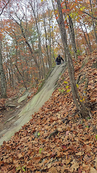
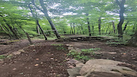
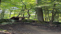
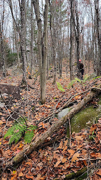
Photos of Outaouais Mountain Bike
Videos of Outaouais Mountain Bike
featured
![Montebello Vélo de Montagne]()
trail: Chat Sauvage
4:38 |
215 |
Jul 14, 2021
featured
![Salamander]()
trail: Salamander
0:26 |
2039 |
Jul 12, 2008
trail: Grizzly 2
0:04 |
43 |
Oct 19, 2025
trail: Grizzly 2
0:07 |
16 |
Oct 19, 2025
trail: Carcajou
0:07 |
24 |
Oct 19, 2025
trail: Megalodon
0:06 |
|
Dec 24, 2024
trail: DH Juice
0:34 |
|
Sep 14, 2024
trail: Diable
0:15 |
52 |
Oct 29, 2023
Current Trail Warnings
| status | trail | date | condition | user | info |
|---|---|---|---|---|---|
| Dirty Little Secret Camp Fortune | Jun 8, 2026 @ 12:00pm (America/Toronto) Jun 8, 2026 | Unknown | ehurleyrobert CAMP FORTUNE | Trail crew maintenance | |
| Hairway To Steven Camp Fortune | Jun 8, 2026 @ 11:59am (America/Toronto) Jun 8, 2026 | Unknown | ehurleyrobert CAMP FORTUNE | Trail crew maintenance | |
| Trail #53B (Bench) Parc de la Gatineau - Gatineau Park | Jun 2, 2026 @ 6:30pm (America/Toronto) Jun 2, 2026 | Unknown | ehurleyrobert CAMP FORTUNE | Tree down after downhill section near end... |
Recent Trail Reports
| status | trail | date | condition | info | user |
|---|---|---|---|---|---|
| Growler Velo MSM | Jun 17, 2026 @ 9:41am (America/Toronto) 20 hours | Dry | TylerDCA VMSM | ||
| Smell My Finger Camp Fortune | Jun 16, 2026 @ 9:10am (America/Toronto) 2 days | Ideal | ehurleyrobert CAMP FORTUNE | ||
| No Name Camp Fortune | Jun 16, 2026 @ 9:09am (America/Toronto) 2 days | Unknown | ehurleyrobert CAMP FORTUNE | ||
| Montée Meech Camp Fortune | Jun 16, 2026 @ 9:09am (America/Toronto) 2 days | Wet | ehurleyrobert CAMP FORTUNE | ||
| Sunset (Alternate) Camp Fortune | Jun 16, 2026 @ 9:08am (America/Toronto) 2 days | Wet | ehurleyrobert CAMP FORTUNE | ||
| Quebec Cup Camp Fortune | Jun 16, 2026 @ 9:07am (America/Toronto) 2 days | Ideal | ehurleyrobert CAMP FORTUNE | ||
| Boneshaker Velo MSM | Jun 14, 2026 @ 11:25am (America/Toronto) Jun 14, 2026 | Ideal | TylerDCA VMSM | ||
| Cheval Connector Velo MSM | Jun 14, 2026 @ 11:25am (America/Toronto) Jun 14, 2026 | Ideal | TylerDCA VMSM | ||
| Family Jewel Velo MSM | Jun 14, 2026 @ 11:25am (America/Toronto) Jun 14, 2026 | Variable | TylerDCA VMSM | ||
| Taylor's Tower of Power Velo MSM | Jun 14, 2026 @ 11:25am (America/Toronto) Jun 14, 2026 | Ideal | TylerDCA VMSM |
Activity Feed
| username | action | type | title | date |
|---|---|---|---|---|
| frankavid | ridden | trail | activity #97231016 | Jun 17, 2026 @ 9:13pm 5 hours |
| Lorddaviss | wishlist | region | activity #97228127 | Jun 17, 2026 @ 7:56pm 6 hours |
| tackerli | ridden | trail | activity #97220934 and 9 more | Jun 17, 2026 @ 5:40pm 9 hours |
| TylerDCA | add | report | activity #97179421 | Jun 17, 2026 @ 6:41am 20 hours |
| sdrvper | add | video | activity #97133192 and 1 more | Jun 16, 2026 @ 12:59pm 2 days |
Recent Comments
| username | type | title | comment | date |
|---|---|---|---|---|
| trail | This is the best Vorlage blue trail as of 2026... | Jun 7, 2026 @ 6:45pm Jun 7, 2026 | ||
| trail | So fun, so fast | Jun 5, 2026 @ 11:09am Jun 5, 2026 | ||
| trail | Connect via Chemin d'accès 3 and it's a... | Jun 3, 2026 @ 8:04am Jun 3, 2026 | ||
| report | Awesome! Thank you trail crew!! | Jun 1, 2026 @ 11:05am Jun 1, 2026 | ||
| trail | Couple fun drops before heading into Ol'... | May 18, 2026 @ 7:59am May 18, 2026 |
Local Badges
-

Epic Mountain Bike Climb 2k1 awarded -

Epic Ride 50k44 awarded -

Completionist0 awarded -

10 Blue Trails129 awarded -
Epic Mountain Bike Climb 2k6 awarded -

Climbing 10k Badge0 awarded
Bike & Skill Parks
| name | type | city | rating |
|---|---|---|---|
| Camp Fortune | bike park | Chelsea | |
| Centre Vorlage | bike park | Wakefield | |
| Pump Tack Camp Fortune | skill park | Chelsea | |
| Pump Track Meredith Center #2 | skill park | Chelsea | |
| Dog Pound | skill park | Lac-Sainte-Marie |
Upcoming Local Events
Activity Type Stats
| activitytype | trails | distance | descent | descent distance | total vertical | rating | global rank | state rank | photos | reports | routes | ridelogs |
|---|---|---|---|---|---|---|---|---|---|---|---|---|
| Mountain Bike | 624 | 367 miles | 44,108 ft | 155 miles | 1,693 ft | 1,850 | 6,565 | 93 | 132,973 | |||
| E-Bike | 332 | 172 miles | 12,375 ft | 69 miles | 1,529 ft | 4 | 5,354 | 6 | 3,776 | |||
| Winter Fat Bike | 10 | 1 | 39 | 4 | 139 | |||||||
| Horse | 1 | 954 | 9 | |||||||||
| Hike | 448 | 301 miles | 26,440 ft | 118 miles | 1,693 ft | 22 | 6,045 | 6 | 8,478 | |||
| Trail Running | 438 | 299 miles | 25,981 ft | 117 miles | 1,693 ft | 1 | 5,921 | 6 | 5,997 | |||
| ATV/ORV/OHV | 1 | 5 miles | 138 ft | 4,111 ft | 121 ft | 959 | 31 | |||||
| Snowmobile | 3 | 3,691 ft | 7 ft | 997 ft | 30 ft | 233 | 5 | |||||
| Snowshoe | 220 | 102 miles | 9,265 ft | 37 miles | 1,106 ft | 5 | 830 | 2 | 1,373 | |||
| Downhill Ski | 9 | 470 | 3,546 | |||||||||
| Backcountry Ski | 50 | 6 miles | 883 ft | 3 miles | 745 ft | 235 | 1 | 2,031 | ||||
| Nordic Ski | 199 | 160 miles | 11,594 ft | 58 miles | 1,168 ft | 9 | 572 | 2 | 17,875 |
Activities
Trails
- By brenthillier
 NSMBA TRAILFORKS & contributors
 - Admins: VQ, bigjay, StephaneMarceau, Canadmos
- #7334 - 11,721 views
- outaouais activity log | embed map of Outaouais mountain bike trails | outaouais mountain biking points of interest polygons
Downloading of trail gps tracks in kml & gpx formats is enabled for Outaouais.
You must login to download files.