close
-
Layers w
- Weather Layers
- Pro
- Pro
- Pro
- Pro
- Pro
- Pro
- More Layers
- Pro
- Pro
- Pro
- Pro
-
Upgrade to

3D
Trail Conditions
- Unknown
- Snow Groomed
- Snow Packed
- Snow Covered
- Snow Cover Partial
- Freeze/thaw Cycle
- Icy
- Prevalent Mud
- Wet
- Variable
- Ideal
- Dry
- Very Dry
Trail Flow (Ridden Direction)
Trailforks scans users ridelogs to determine the most popular direction each trail is ridden. A good flowing trail network will have most trails flowing in a single direction according to their intension.
The colour categories are based on what percentage of riders are riding a trail in its intended direction.
The colour categories are based on what percentage of riders are riding a trail in its intended direction.
- > 96%
- > 90%
- > 80%
- > 70%
- > 50%
- < 50%
- bi-directional trail
- no data
Trail Last Ridden
Trailforks scans ridelogs to determine the last time a trail was ridden.
- < 2 days
- < 1 week
- < 2 weeks
- < 1 month
- < 6 months
- > 6 months
Trail Ridden Direction
The intended direction a trail should be ridden.
- Downhill Only
- Downhill Primary
- Both Directions
- Uphill Primary
- Uphill Only
- One Direction
Contribute Details
Colors indicate trail is missing specified detail.
- Description
- Photos
- Description & Photos
- Videos
Trail Popularity ?
Trailforks scans ridelogs to determine which trails are ridden the most in the last 9 months.
Trails are compared with nearby trails in the same city region with a possible 25 colour shades.
Think of this as a heatmap, more rides = more kinetic energy = warmer colors.
- most popular
- popular
- less popular
- not popular
ATV/ORV/OHV Filter
Max Vehicle Width
inches
US Cell Coverage
Legend

Radar Time
Activity Recordings
Trailforks uses anonymized public activity data.
?
Activity Recordings
Trailforks uses anonymized public activity data.
?
Personal Heatmap
▶
Activity Types
all
/
none
▶
Options
2
Date range
month
–
Winter Trails
Warning
A routing network for winter maps does not exist. Selecting trails using the winter trails layer has been disabled.
Missing Trails
Most Popular
Least Popular
Trails are colored based on popularity. The more popular a trail is, the more red. Less popular trails trend towards green.
Jump Magnitude Heatmap
Heatmap of where riders jump on trails. Zoom in to see individual jumps, click circles to view jump details.
BC Backroad Status
![map legend]()
Service Road Atlas is a free to use, community-driven service for viewing and creating reports on the numerous back-country service roads around B.C. and Alberta.

Slope Aspect
Direction the slope faces
Trails Deemphasized
Trails are shown in grey.
Only show trails with no bike usage.
Suggested Layers
Based on selected activity type
Save the current map location and zoom level as your default home location whenever this page is loaded.
Save
No description for Ovanåker has been added yet!
Login or register to submit one.
This region uses the Uk/Euro style trail grading system.
Activities Click to view
- Mountain Bike
632 trails
- E-Bike
54 trails
- Gravel Bike
0 trails
- Adaptive Bike
0 trails
- Winter Fat Bike
0 trails
- Horse
10 trails
- Hike
631 trails
- Trail Running
630 trails
- Snowmobile
7 trails
- Nordic Ski
16 trails
Region Details
- 194
- 113
- 214
- 95
- 16
Region Status
Open as of May 3, 2026Stats
- Avg Trail Rating
- Trails (view details)
- 634
- Trails Mountain Bike
- 632
- Trails E-Bike
- 54
- Trails Horse
- 10
- Trails Hike
- 631
- Trails Trail Running
- 630
- Trails Dirtbike/Moto
- 1
- Trails Observed Trials
- 1
- Trails ATV/ORV/OHV
- 1
- Trails Snowmobile
- 7
- Trails Nordic Ski
- 16
- Total Distance
- 454 miles
- Total Descent
- 28,556 ft
- Total Vertical
- 1,320 ft
- Highest Trailhead
- 1,582 ft
- Reports
- 385
- Photos
- 181
- Ridden Counter
- 2,150
Articles
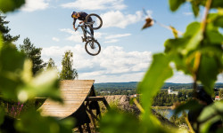
Video: The Final Battle - SlopeFest 2019
Aug 20, 2019 from pinkbike.com
2019 marks the end of an era and the last ever SlopeFest in Alfta Bike Park was held.
Sub Regions
-
Alfta
- 24
- 58
- 15
- 3
-
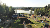
Alfta Bike Park
-
Edsbyn
- 76
- 114
- 55
- 8
-
Öjung
- 4
- 12
- 5
-
Skålsjögården
- 2
- 10
- 1
-
Svabensverk
- 5
- 4
- 1
-
Viksjöfors
- 2
- 5
Popular Ovanåker Mountain Biking Trails
• 100 ★ 4.0 • 4 miles • 27 ft • 13 •
Popular blue difficulty singletrack. This multi-use trail can be used both directions and has a moderate overall physical rating with a 27 ft blue climb. On average it takes 28 minutes to complete this trail.
• 80 ★ 0.0 • 1 mile • 113 ft • 12 •
Popular red difficulty singletrack. This multi-use trail can be used both directions and has a moderate overall physical rating with a 113 ft blue climb. On average it takes 11 minutes to complete this trail.
• 75 ★ 2.0 • 3 miles • 196 ft • 12 •
Popular red difficulty singletrack. This multi-use trail can be used both directions and has a moderate overall physical rating with a 196 ft blue climb. On average it takes 23 minutes to complete this trail.
• 90 ★ 0.0 • 2,815 ft • 0 ft • 10 •
Popular blue difficulty singletrack. This multi-use trail can be used both directions and has a moderate overall physical rating with a 0 ft blue climb. On average it takes 2 minutes to complete this trail.
• 75 ★ 3.5 • 5 miles • 236 ft • 10 •
Popular blue difficulty singletrack. This multi-use trail can be used both directions and has a moderate overall physical rating with a 236 ft blue climb. On average it takes 12 hours47 minutes to complete this trail.
• 75 ★ 0.0 • 814 ft • 24 ft • 10 •
Popular blue difficulty singletrack. This multi-use trail can be used both directions and has a moderate overall physical rating with a 24 ft blue climb. On average it takes 1 minutes to complete this trail.
• 90 ★ 0.0 • 1,089 ft • 0 ft • 8 •
Popular green difficulty family friendly singletrack. This multi-use trail can be used both directions and has a easy overall physical rating with a 0 ft green climb. Trail visibility is always easy to follow. On average it takes 1 minutes to complete this trail.
Ovanåker Mountain Bike Routes
★ 5.0 • 10 miles • 540 ft • 3 • Loop •
Blandad cykling med grusväg, dubbeltrack, singeltrack, och med inslag av kortare sträckor med tuffare...
★ 4.0 • 3 miles • 447 ft • 7 • Loop •
En omväxlande Mtb-bana med bl.a. fina stigar, rötter, blöthål och branta stigningar.
★ 4.0 • 10 miles • 944 ft • 5 • Loop •
Bergsborundan innehåller blandad terräng. Allt från grusvägar till rätt branta klättingar. Finns en...
★ 3.5 • 13 miles • 1,547 ft • 15 • Point to Point •
Utmanande rutt med mycket uppför och utför. Många sektioner innehåller fin stig medan vissa partier...
★ 4.0 • 9 miles • 676 ft • 5 • Loop •
Begins with a long uphill section up Vikeberget. Ends with nice fast sections down to Alfta again.
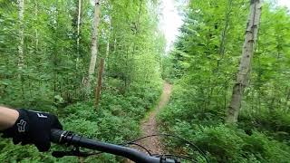
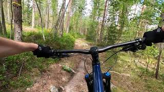
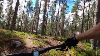
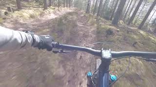
Photos of Ovanåker Mountain Bike
Videos of Ovanåker Mountain Bike
trail: Bränderna 1
0:18 |
7 |
May 13, 2020
trail: SlopeFest Slopestyle
5:34 |
956 |
Aug 10, 2019

trail: Bergs
2:32 |
6150 |
Aug 7, 2012

trail: Eggas 2
0:54 |
324 |
Jun 9, 2021 , Ovanåker
trail: Upp Till Crossbananvägen
0:45 |
364 |
Jan 13, 2021 , Ovanåker
trail: Vikebergsspåret 3
0:35 |
286 |
Jul 10, 2020 , Ovanåker
trail: Bränderna 1
0:11 |
295 |
Jul 10, 2020 , Ovanåker
trail: Ner Mot Bergsbo
0:25 |
301 |
Apr 13, 2020 , Ovanåker
Recent Trail Reports
| status | trail | date | condition | info | user |
|---|---|---|---|---|---|
| Storsvedsbacken 1 | May 3, 2026 @ 12:56pm (Europe/Stockholm) May 3, 2026 | Ideal | d00zer | ||
| Storsvedsbacken 2 | May 3, 2026 @ 12:56pm (Europe/Stockholm) May 3, 2026 | Variable | d00zer | ||
| Storsveden 3 | May 3, 2026 @ 12:56pm (Europe/Stockholm) May 3, 2026 | Variable | d00zer | ||
| Röd/Svart/Gul Till Blå | May 3, 2026 @ 12:56pm (Europe/Stockholm) May 3, 2026 | Ideal | d00zer | ||
| Röd/Svart Kvicktjärn | May 3, 2026 @ 12:56pm (Europe/Stockholm) May 3, 2026 | Ideal | d00zer | ||
| Vikebergsleden 8 | May 3, 2026 @ 12:56pm (Europe/Stockholm) May 3, 2026 | Ideal | d00zer | ||
| Rötjärn 1 | May 3, 2026 @ 12:56pm (Europe/Stockholm) May 3, 2026 | Ideal | d00zer | ||
| Rötjärn 2 | May 3, 2026 @ 12:56pm (Europe/Stockholm) May 3, 2026 | Ideal | d00zer | ||
| Svabenbyn | Jul 12, 2025 @ 9:50am Jul 12, 2025 | Dry | emilforsmark Ovanåkers | ||
| Långabäcksvägen | Jun 30, 2025 @ 5:50pm Jun 30, 2025 | Dry | emilforsmark Ovanåkers |
Activity Feed
| username | action | type | title | date |
|---|---|---|---|---|
| trailforks | add | video | activity #94113283 | May 5, 2026 @ 2:00pm May 5, 2026 |
| d00zer | add | report | activity #93980068 and 7 more | May 3, 2026 @ 1:46pm May 3, 2026 |
| Cykeljohan | comment | route | activity #81873619 | Oct 7, 2025 @ 5:11am Oct 7, 2025 |
| mattmalabanan | add | poi | activity #77949404 and 1 more | Aug 11, 2025 @ 11:12pm Aug 11, 2025 |
| emilforsmark | add | report | activity #75722021 | Jul 12, 2025 @ 5:54am Jul 12, 2025 |
Recent Comments
| username | type | title | comment | date |
|---|---|---|---|---|
| trail | Gör en stigrapport (Trail report) istället. | May 17, 2025 @ 11:31am May 17, 2025 | ||
| trail | Nyröjt över stigen. | May 17, 2025 @ 10:17am May 17, 2025 | ||
| trail | Cykelgodis. | Jul 10, 2024 @ 8:09am Jul 10, 2024 | ||
| trail | Del av en nyuppmärkt vandring(cykel)led. | Jul 25, 2022 @ 11:35pm Jul 25, 2022 | ||
| trail | Vi har inga avtal om nyttjande eller skötsel... | Jul 24, 2022 @ 11:39am Jul 24, 2022 |
Local Badges
-

Epic Ride Climb 2k2 awarded -

Climbing 10k Badge5 awarded -

Climbing 100k Badge2 awarded -

Epic Ride Descent 2k2 awarded -

Descent 10k Badge5 awarded -

Descent 100k Badge2 awarded
Bike & Skill Parks
| name | type | city | rating |
|---|---|---|---|
| Alfta Bike Park | bike park | Ovanåker | |
| Vikenbanan i Woxnadalen | skill park | Ovanåker | |
| Storabanan i Alfta-Edsbyn | skill park | Ovanåker |
Local Trail Supporters
- Edsbyns SK
Activity Type Stats
| activitytype | trails | distance | descent | descent distance | total vertical | rating | global rank | state rank | photos | reports | routes | ridelogs |
|---|---|---|---|---|---|---|---|---|---|---|---|---|
| Mountain Bike | 632 | 453 miles | 28,474 ft | 169 miles | 1,319 ft | #276 | #22 | 181 | 384 | 21 | 3,120 | |
| E-Bike | 54 | 51 miles | 1,644 ft | 13 miles | 971 ft | #1,669 | #45 | 375 | 7 | |||
| Horse | 10 | 9 miles | 886 ft | 3 miles | 610 ft | #915 | #51 | 41 | ||||
| Hike | 631 | 453 miles | 28,383 ft | 169 miles | 1,319 ft | #179 | #13 | 384 | 14 | 76 | ||
| Trail Running | 630 | 453 miles | 28,340 ft | 169 miles | 1,319 ft | #130 | #12 | 384 | 16 | 828 | ||
| Dirtbike/Moto | 1 | 1 mile | 210 ft | 1 mile | 210 ft | 41 | ||||||
| Observed Trials | 1 | 2 miles | 7 ft | 991 ft | 203 ft | |||||||
| ATV/ORV/OHV | 1 | 2 miles | 7 ft | 991 ft | 203 ft | 41 | ||||||
| Snowmobile | 7 | 2 miles | 187 ft | 3,425 ft | 285 ft | #85 | #8 | |||||
| Nordic Ski | 16 | 12 miles | 997 ft | 6 miles | 1,027 ft | #428 | #44 | 3 | 262 |
Frequently Asked Questions About Ovanåker
▼
What are the best places to ride in Ovanåker?
Ovanåker has 7 areas to explore for mountain biking. The top rated areas are:
▼
What are the highest rated mountain biking trails in Ovanåker?
The highest rated mountain biking trails in Ovanåker are:
- Gammel Homna (4.3/5)
- Motionsspår 2,5 (4.1/5)
- Vikebergsspåret 2 (4.1/5)
- Fältsbackavindskyddet (4/5)
- Kopparfors Cykelstigar - Glitterån (4/5)
▼
What is the best time of the year to ride in Ovanåker?
Based on ride log data, the most popular months to ride in Ovanåker are:
- July (19 activities)
- August (12 activities)
- May (4 activities)
▼
Where can I park to ride in Ovanåker?
There are 21 parking locations listed in Ovanåker. The most popular parking spots are: View all parking and trailhead locations on the map to plan your visit.
Activities
Trails
- By ollesvenskonthetrail
 TRAILFORKS & contributors
 - Admins: ollesvenskonthetrail, JALLE, OrjanX, martinlindstr, Ovanåkers, Hygabacka
- #15314 - 6,553 views
- ovanåker activity log | embed map of Ovanåker mountain bike trails | ovanåker mountain biking points of interest polygons
Downloading of trail gps tracks in kml & gpx formats is enabled for Ovanåker.
You must login to download files.