close
-
Layers w
- Weather Layers
- Pro
- Pro
- Pro
- Pro
- Pro
- Pro
- More Layers
- Pro
- Pro
- Pro
- Pro
-
Upgrade to

3D
Trail Conditions
- Unknown
- Snow Groomed
- Snow Packed
- Snow Covered
- Snow Cover Partial
- Freeze/thaw Cycle
- Icy
- Prevalent Mud
- Wet
- Variable
- Ideal
- Dry
- Very Dry
Trail Flow (Ridden Direction)
Trailforks scans users ridelogs to determine the most popular direction each trail is ridden. A good flowing trail network will have most trails flowing in a single direction according to their intension.
The colour categories are based on what percentage of riders are riding a trail in its intended direction.
The colour categories are based on what percentage of riders are riding a trail in its intended direction.
- > 96%
- > 90%
- > 80%
- > 70%
- > 50%
- < 50%
- bi-directional trail
- no data
Trail Last Ridden
Trailforks scans ridelogs to determine the last time a trail was ridden.
- < 2 days
- < 1 week
- < 2 weeks
- < 1 month
- < 6 months
- > 6 months
Trail Ridden Direction
The intended direction a trail should be ridden.
- Downhill Only
- Downhill Primary
- Both Directions
- Uphill Primary
- Uphill Only
- One Direction
Contribute Details
Colors indicate trail is missing specified detail.
- Description
- Photos
- Description & Photos
- Videos
Trail Popularity ?
Trailforks scans ridelogs to determine which trails are ridden the most in the last 9 months.
Trails are compared with nearby trails in the same city region with a possible 25 colour shades.
Think of this as a heatmap, more rides = more kinetic energy = warmer colors.
- most popular
- popular
- less popular
- not popular
ATV/ORV/OHV Filter
Max Vehicle Width
inches
US Cell Coverage
Legend

Radar Time
Activity Recordings
Trailforks uses anonymized public activity data.
?
Activity Recordings
Trailforks uses anonymized public activity data.
?
Personal Heatmap
▶
Activity Types
all
/
none
▶
Options
2
Date range
month
–
Winter Trails
Warning
A routing network for winter maps does not exist. Selecting trails using the winter trails layer has been disabled.
Missing Trails
Most Popular
Least Popular
Trails are colored based on popularity. The more popular a trail is, the more red. Less popular trails trend towards green.
Jump Magnitude Heatmap
Heatmap of where riders jump on trails. Zoom in to see individual jumps, click circles to view jump details.
BC Backroad Status
![map legend]()
Service Road Atlas is a free to use, community-driven service for viewing and creating reports on the numerous back-country service roads around B.C. and Alberta.

Slope Aspect
Direction the slope faces
Trails Deemphasized
Trails are shown in grey.
Only show trails with no bike usage.
Suggested Layers
Based on selected activity type
Save the current map location and zoom level as your default home location whenever this page is loaded.
SavePopular Trail Networks
view all areas »
No description for Overberg District has been added yet!
Login or register to submit one.
Activities Click to view
- Mountain Bike
984 trails
- E-Bike
865 trails
- Horse
33 trails
- Hike
1,069 trails
- Trail Running
1,080 trails
- Dirtbike/Moto
22 trails
- Observed Trials
20 trails
- ATV/ORV/OHV
20 trails
Region Details
- 482
- 2
- 187
- 239
- 33
Stats
- Avg Trail Rating
- Trails (view details)
- 1,274
- Trails Mountain Bike
- 986
- Trails E-Bike
- 865
- Trails Horse
- 33
- Trails Hike
- 1,069
- Trails Trail Running
- 1,080
- Trails Dirtbike/Moto
- 22
- Trails Observed Trials
- 20
- Trails ATV/ORV/OHV
- 20
- Total Distance
- 1,447 miles
- Total Descent
- 155,391 ft
- Total Vertical
- 5,168 ft
- Highest Trailhead
- 5,171 ft
- Reports
- 1,225
- Photos
- 302
- Ridden Counter
- 60,697
Sub Regions
- Arniston (30)
- Barrydale (55)
- Barrydale Trails (32)
- Bot Rivier (3)
- Botrivier (147)
- Botriver Kleinmond (147)
- Bredasdorp (52)
- Cape Infanta (1)
- Elgin (112)
- Gansbaai (82)
- Grabouw (237)
- Greyton (58)
- Hermanus (102)
- Malgas (22)
- Napier (21)
- Kleinberg Trails (7)
- Vadersberg (11)
- Onrus (1)
- Overberg DC (23)
- Stanford (10)
- Swellendam (60)
- Villiersdorp (5)
- Kogelberg Nature Reserve (0)
Popular Overberg District Mountain Biking Trails
• 100 ★ 5.0 • 1 mile • 106 ft • 608 •
Popular green difficulty family friendly singletrack. This multi-use trail can be used one direction and has a easy overall physical rating with a 106 ft green climb. Trail visibility is always easy to follow. On average it takes 6 minutes to complete this trail.
• 100 ★ 0.0 • 1,493 ft • 18 ft • 583 •
Popular green difficulty family friendly doubletrack. This multi-use trail can be used both directions and has a moderate overall physical rating with a 18 ft green climb. Trail visibility is always easy to follow. On average it takes 1 minutes to complete this trail.
• 100 ★ 0.0 • 679 ft • 16 ft • 513 •
Popular green difficulty family friendly singletrack. This multi-use trail can be used both directions and has a easy overall physical rating with a 16 ft green climb. Trail visibility is always easy to follow. On average it takes minutes to complete this trail.
• 100 ★ 5.0 • 1,604 ft • 46 ft • 513 •
Popular green difficulty family friendly singletrack. This multi-use trail can be used one direction and has a easy overall physical rating with a 46 ft green climb. Trail visibility is always easy to follow. On average it takes 1 minutes to complete this trail.
• 95 ★ 5.0 • 3,159 ft • 9 ft • 509 •
Popular blue difficulty family friendly singletrack. This multi-use trail can be used one direction and has a moderate overall physical rating with a 9 ft blue climb. Trail visibility is always easy to follow. On average it takes 2 minutes to complete this trail.
• 95 ★ 4.5 • 1 mile • 53 ft • 506 •
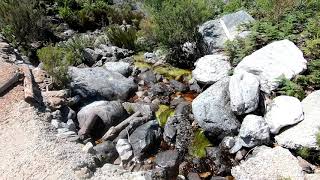
Fast single track in fynbos including some raised wooden trail section over a naturally wet stream area.
• 100 ★ 0.0 • 978 ft • 42 ft • 501 •
Popular green difficulty family friendly singletrack. This multi-use trail can be used both directions and has a easy overall physical rating with a 42 ft green climb. Trail visibility is always easy to follow. On average it takes 1 minutes to complete this trail.
• 80 ★ 5.0 • 3,005 ft • 170 ft • 477 •
Popular blue difficulty family friendly singletrack. This multi-use trail can be used one direction and has a moderate overall physical rating with a 170 ft blue climb. Trail visibility is always easy to follow. On average it takes 4 minutes to complete this trail.
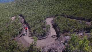
Overberg District Mountain Bike Routes
Hemel & Aarde BLACK & RED 30 Featured
★ 5.0 • 18 miles • 1,784 ft • 1 • Loop •
This route contains a mix of the traditional Black and Red Route, and even uses a short section on Blue...
Hemel & Aarde BLUE ROUTE Featured
★ 4.0 • 7 miles • 617 ft • 1 • Out & Back •
Family friendly on the Hermanus Trails. Stop at for a refreshment before turning back.
Greyton: 1st Bench Route (9.7km) Featured
★ 4.5 • 6 miles • 578 ft • 3 • Loop •
Distance: 9.7Km Elevation: 183m Difficulty: INTERMEDIATE Approximate ride time: 1 HOUR Arrows: LIGHT BLUE...
Grabouw Forest - Around The Dam Featured
★ 4.0 • 9 miles • 675 ft • 11 • Loop •
This is a great trail to get in a quick ride before or after work. Scenery changes from season to season....
★ 3.5 • 6 miles • 652 ft • 6 • Loop •
A fantastic race loop with 2 climbs and beautiful pipeline style switchback descents.
Paul Cluver: Orange Jeep Track Route Featured
★ 5.0 • 15 miles • 1,299 ft • 11 • Loop •
The traverses most of Paul CLuver Wines' Se Rust property, giving access to most of the single track...
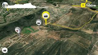
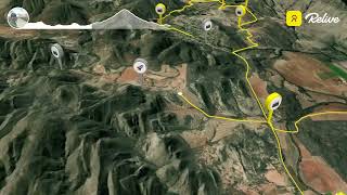
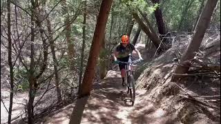
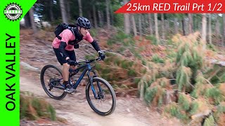
Photos of Overberg District Mountain Bike
Videos of Overberg District Mountain Bike
0:53 |
131 |
Jan 22, 2024
0:21 |
104 |
Jan 22, 2024
0:10 |
247 |
Feb 5, 2022

0:17 |
252 |
Feb 5, 2022

9:22 |
420 |
May 18, 2021
9:06 |
310 |
May 18, 2021
2:41 |
428 |
Dec 30, 2020
trail: Real + Simple
0:00 |
442 |
Jun 3, 2020 , Greyton
Recent Trail Reports
Activity Feed
| username | action | type | title | date |
|---|---|---|---|---|
| Bxvthn | wishlist | route | activity #97376811 | Jun 20, 2026 @ 3:09am 18 hours |
| jhgies | wishlist | route | activity #97168120 | Jun 17, 2026 @ 1:02am Jun 17, 2026 |
| NJhJdK | wishlist | route | activity #96817076 | Jun 12, 2026 @ 11:13am Jun 12, 2026 |
| gansbay | add | photo | activity #96729256 | Jun 11, 2026 @ 4:55am Jun 11, 2026 |
| gansbay | add | report | activity #96399297 | Jun 6, 2026 @ 12:51pm Jun 6, 2026 |
Recent Comments
| username | type | title | comment | date |
|---|---|---|---|---|
| trail | Not been checked after the May 2026 storm, not... | May 17, 2026 @ 11:37am May 17, 2026 | ||
| report | Wet sections on the green (fish eagle) route | May 17, 2026 @ 11:18am May 17, 2026 | ||
| report | G | Mar 18, 2026 @ 8:16am Mar 18, 2026 | ||
| report | Stunning riding - Spring is here | Aug 31, 2025 @ 9:53am Aug 31, 2025 | ||
| trail | I would avoid this route unless you want some... | Dec 27, 2024 @ 4:00am Dec 27, 2024 |
Local Badges
-

Epic Ride Descent 2k6 awarded -

Descent 10k Badge7 awarded -
Descent 10k Badge9 awarded -
Descent 10k Badge0 awarded -
Epic Ride Descent 2k1 awarded -

Mountain Biking 100k Badge0 awarded
Bike & Skill Parks
| name | type | city | rating |
|---|---|---|---|
| Vadersberg | bike park | Napier | |
| Kleinmond Bike Park | skill park | Kleinmond | |
| Kleinmond Bike Park | skill park | Botrivier |
Local Trail Supporters
![]()
- Magwitch Offshore
- JoKim
![Real & SImple]()
- Trail's End
Activity Type Stats
| activitytype | trails | distance | descent | descent distance | total vertical | rating | global rank | state rank | photos | reports | routes | ridelogs |
|---|---|---|---|---|---|---|---|---|---|---|---|---|
| Mountain Bike | 984 | 1,251 miles | 113,783 ft | 520 miles | 4,682 ft | 263 | 1,225 | 108 | 23,967 | |||
| E-Bike | 865 | 1,158 miles | 105,850 ft | 475 miles | 5,161 ft | 1,139 | 79 | 1,347 | ||||
| Horse | 33 | 91 miles | 6,811 ft | 50 miles | 1,923 ft | 100 | 1 | |||||
| Hike | 1,069 | 1,167 miles | 134,921 ft | 490 miles | 5,167 ft | 22 | 1,014 | 27 | 1,916 | |||
| Trail Running | 1,080 | 1,194 miles | 136,047 ft | 498 miles | 5,167 ft | 14 | 1,025 | 25 | 2,902 | |||
| Dirtbike/Moto | 22 | 76 miles | 4,954 ft | 45 miles | 1,496 ft | 88 | 5 | |||||
| Observed Trials | 20 | 72 miles | 4,764 ft | 40 miles | 1,496 ft | 5 | ||||||
| ATV/ORV/OHV | 20 | 72 miles | 4,764 ft | 40 miles | 1,496 ft | 88 | 1 |
Frequently Asked Questions About Overberg District
▼
What are the best places to ride in Overberg District?
Overberg District has 29 areas to explore for mountain biking. The top rated areas are:
▼
What are the highest rated mountain biking trails in Overberg District?
The highest rated mountain biking trails in Overberg District are:
- JK's Edge (4.2/5)
- Sound of Silence (4.2/5)
- Fountain of Youth (4.2/5)
- Fairy Forest (4.2/5)
- Rose Bowl (4.2/5)
▼
What is the best time of the year to ride in Overberg District?
Based on ride log data, the most popular months to ride in Overberg District are:
- December (53 activities)
- November (36 activities)
- October (27 activities)
▼
What is the longest trail in Overberg District?
The longest trail in Overberg District is Kogelberg Explore at 20.3 miles. View all trails sorted by distance.
Activities
- Overberg District Mountain Biking Trails
- Overberg District E-Biking Trails
- Overberg District Horseback Trails
- Overberg District Hiking Trails
- Overberg District Trail Running Trails
- Overberg District Dirtbiking Trails
- Overberg District Observed Trials Trails
- Overberg District ATVing/Offroading Trails
Trails
Points of Interest
- By WillieJacobsz
 Trailforks SBP SWW & contributors
 - Admins: WillieJacobsz, wesseljacobsz, Cape
- #34007 - 6,753 views
- overberg district activity log | embed map of Overberg District mountain bike trails | overberg district mountain biking points of interest polygons
Downloading of trail gps tracks in kml & gpx formats is enabled for Overberg District.
You must login to download files.