close
-
Layers w
- Weather Layers
- Pro
- Pro
- Pro
- Pro
- Pro
- Pro
- More Layers
- Pro
- Pro
- Pro
- Pro
-
Upgrade to

3D
Trail Conditions
- Unknown
- Snow Groomed
- Snow Packed
- Snow Covered
- Snow Cover Partial
- Freeze/thaw Cycle
- Icy
- Prevalent Mud
- Wet
- Variable
- Ideal
- Dry
- Very Dry
Trail Flow (Ridden Direction)
Trailforks scans users ridelogs to determine the most popular direction each trail is ridden. A good flowing trail network will have most trails flowing in a single direction according to their intension.
The colour categories are based on what percentage of riders are riding a trail in its intended direction.
The colour categories are based on what percentage of riders are riding a trail in its intended direction.
- > 96%
- > 90%
- > 80%
- > 70%
- > 50%
- < 50%
- bi-directional trail
- no data
Trail Last Ridden
Trailforks scans ridelogs to determine the last time a trail was ridden.
- < 2 days
- < 1 week
- < 2 weeks
- < 1 month
- < 6 months
- > 6 months
Trail Ridden Direction
The intended direction a trail should be ridden.
- Downhill Only
- Downhill Primary
- Both Directions
- Uphill Primary
- Uphill Only
- One Direction
Contribute Details
Colors indicate trail is missing specified detail.
- Description
- Photos
- Description & Photos
- Videos
Trail Popularity ?
Trailforks scans ridelogs to determine which trails are ridden the most in the last 9 months.
Trails are compared with nearby trails in the same city region with a possible 25 colour shades.
Think of this as a heatmap, more rides = more kinetic energy = warmer colors.
- most popular
- popular
- less popular
- not popular
ATV/ORV/OHV Filter
Max Vehicle Width
inches
US Cell Coverage
Legend

Radar Time
Activity Recordings
Trailforks uses anonymized public activity data.
?
Activity Recordings
Trailforks uses anonymized public activity data.
?
Personal Heatmap
▶
Activity Types
all
/
none
▶
Options
2
Date range
month
–
Winter Trails
Warning
A routing network for winter maps does not exist. Selecting trails using the winter trails layer has been disabled.
Missing Trails
Most Popular
Least Popular
Trails are colored based on popularity. The more popular a trail is, the more red. Less popular trails trend towards green.
Jump Magnitude Heatmap
Heatmap of where riders jump on trails. Zoom in to see individual jumps, click circles to view jump details.
BC Backroad Status
![map legend]()
Service Road Atlas is a free to use, community-driven service for viewing and creating reports on the numerous back-country service roads around B.C. and Alberta.

Slope Aspect
Direction the slope faces
Trails Deemphasized
Trails are shown in grey.
Only show trails with no bike usage.
Suggested Layers
Based on selected activity type
Save the current map location and zoom level as your default home location whenever this page is loaded.
Save
No description for Overland Park has been added yet!
Login or register to submit one.
Activities Click to view
- Mountain Bike
9 trails
- E-Bike
1 trails
- Gravel Bike
0 trails
- Adaptive Bike
0 trails
- Hike
9 trails
- Trail Running
9 trails
Region Details
- 8
- 1
Region Status
Open as of Mar 25, 2026Stats
- Avg Trail Rating
- Trails (view details)
- 9
- Trails Mountain Bike
- 9
- Trails E-Bike
- 1
- Trails Hike
- 9
- Trails Trail Running
- 9
- Total Distance
- 15 miles
- Total Descent
- 394 ft
- Total Vertical
- 224 ft
- Highest Trailhead
- 1,048 ft
- Reports
- 10
- Ridden Counter
- 505
Sub Regions
-
Indian Creek
- 1
-
Tomahawk Creek
- 1
Popular Overland Park Mountain Biking Trails
• 60 ★ 4.0 • 4,681 ft • 74 ft • 43 •
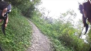
Fast and easy loop through the park. Basically buff singletrack that just winds around the dumps back out where you started. The trail is so flat and smooth, that it is a great little deviation to hit on your cyclocross or all-road bike.

Recent Trail Reports
| status | trail | date | condition | info | user |
|---|---|---|---|---|---|
| Roe Park Loop | Nov 6, 2023 @ 8:27am Nov 6, 2023 | Ideal | Yotzt | ||
| Amesbury Lake Loop | Dec 27, 2021 @ 10:12am Dec 27, 2021 | Ideal | Inspectorgad | ||
| Leawood | Aug 28, 2021 @ 6:21pm Aug 28, 2021 | Variable | sganson |
Activity Feed
| username | action | type | title | date |
|---|---|---|---|---|
| Vallecillo | wishlist | trail | activity #88595496 | Feb 8, 2026 @ 1:46pm Feb 8, 2026 |
| GuillermoJoseHernandez | add | trail | activity #86694091 | Jan 5, 2026 @ 7:49am Jan 5, 2026 |
| KyleB90 | wishlist | trail | activity #65670907 | Feb 3, 2025 @ 9:16pm Feb 3, 2025 |
| jcasby | add | trail | activity #64046842 | Jan 4, 2025 @ 5:26am Jan 4, 2025 |
| jcasby | ridden | trail | activity #63854275 and 1 more | Dec 31, 2024 @ 1:45pm Dec 31, 2024 |
Recent Comments
| username | type | title | comment | date |
|---|---|---|---|---|
| trail | Beware of inexperienced trail... | Jun 24, 2024 @ 10:32am Jun 24, 2024 |
Activity Type Stats
| activitytype | trails | distance | descent | descent distance | total vertical | rating | global rank | state rank | photos | reports | routes | ridelogs |
|---|---|---|---|---|---|---|---|---|---|---|---|---|
| Mountain Bike | 9 | 15 miles | 394 ft | 3 miles | 223 ft | #8,694 | #2,776 | 10 | 10,448 | |||
| E-Bike | 1 | 3,366 ft | 3 ft | 620 ft | 13 ft | #10,439 | #3,304 | 8 | 401 | |||
| Hike | 9 | 15 miles | 394 ft | 3 miles | 223 ft | #10,091 | #3,584 | 10 | 296 | |||
| Trail Running | 9 | 15 miles | 394 ft | 3 miles | 223 ft | #9,371 | #3,167 | 10 | 323 |
Frequently Asked Questions About Overland Park
▼
What are the best places to ride in Overland Park?
Overland Park has 2 areas to explore for mountain biking. The top rated areas are:
▼
What are the highest rated mountain biking trails in Overland Park?
The highest rated mountain biking trails in Overland Park are:
- Leawood (4/5)
▼
What is the best time of the year to ride in Overland Park?
Based on ride log data, the most popular months to ride in Overland Park are:
- July (80 activities)
- June (39 activities)
- August (38 activities)
▼
Where can I park to ride in Overland Park?
There are 1 parking locations listed in Overland Park. The most popular parking spots are:
Activities
- By schillingsworth
 TRAILFORKS HTA & contributors
 - Admins: UTC Central, UTC Master
- #8986 - 5,691 views
- overland park activity log | embed map of Overland Park mountain bike trails | overland park mountain biking points of interest
Downloading of trail gps tracks in kml & gpx formats is enabled for Overland Park.
You must login to download files.