close
-
Layers w
- Weather Layers
- Pro
- Pro
- Pro
- Pro
- Pro
- Pro
- More Layers
- Pro
- Pro
- Pro
- Pro
-
Upgrade to

3D
Trail Conditions
- Unknown
- Snow Groomed
- Snow Packed
- Snow Covered
- Snow Cover Partial
- Freeze/thaw Cycle
- Icy
- Prevalent Mud
- Wet
- Variable
- Ideal
- Dry
- Very Dry
Trail Flow (Ridden Direction)
Trailforks scans users ridelogs to determine the most popular direction each trail is ridden. A good flowing trail network will have most trails flowing in a single direction according to their intension.
The colour categories are based on what percentage of riders are riding a trail in its intended direction.
The colour categories are based on what percentage of riders are riding a trail in its intended direction.
- > 96%
- > 90%
- > 80%
- > 70%
- > 50%
- < 50%
- bi-directional trail
- no data
Trail Last Ridden
Trailforks scans ridelogs to determine the last time a trail was ridden.
- < 2 days
- < 1 week
- < 2 weeks
- < 1 month
- < 6 months
- > 6 months
Trail Ridden Direction
The intended direction a trail should be ridden.
- Downhill Only
- Downhill Primary
- Both Directions
- Uphill Primary
- Uphill Only
- One Direction
Contribute Details
Colors indicate trail is missing specified detail.
- Description
- Photos
- Description & Photos
- Videos
Trail Popularity ?
Trailforks scans ridelogs to determine which trails are ridden the most in the last 9 months.
Trails are compared with nearby trails in the same city region with a possible 25 colour shades.
Think of this as a heatmap, more rides = more kinetic energy = warmer colors.
- most popular
- popular
- less popular
- not popular
ATV/ORV/OHV Filter
Max Vehicle Width
inches
US Cell Coverage
Legend

Radar Time
Activity Recordings
Trailforks uses anonymized public activity data.
?
Activity Recordings
Trailforks uses anonymized public activity data.
?
Personal Heatmap
▶
Activity Types
all
/
none
▶
Options
2
Date range
month
–
Winter Trails
Warning
A routing network for winter maps does not exist. Selecting trails using the winter trails layer has been disabled.
Missing Trails
Most Popular
Least Popular
Trails are colored based on popularity. The more popular a trail is, the more red. Less popular trails trend towards green.
Jump Magnitude Heatmap
Heatmap of where riders jump on trails. Zoom in to see individual jumps, click circles to view jump details.
BC Backroad Status
![map legend]()
Service Road Atlas is a free to use, community-driven service for viewing and creating reports on the numerous back-country service roads around B.C. and Alberta.

Slope Aspect
Direction the slope faces
Trails Deemphasized
Trails are shown in grey.
Only show trails with no bike usage.
Suggested Layers
Based on selected activity type
Save the current map location and zoom level as your default home location whenever this page is loaded.
SaveOviedo (en asturiano Uviéu), es una ciudad y capital (según el Estatuto de Autonomía del Principado de Asturias) del Principado de Asturias, España. Su origen se remonta a la Alta Edad Media (siglo VIII), o incluso antes. Asimismo es un concejo asturiano cuya capital es la ciudad del mismo nombre, Oviedo, y una parroquia de dicho concejo, que comprende a Oviedo capital.
This region uses the Uk/Euro style trail grading system.
Activities Click to view
- Mountain Bike
178 trails
- E-Bike
177 trails
- Gravel Bike
6 trails
- Adaptive Bike
11 trails
- Horse
14 trails
- Hike
180 trails
- Trail Running
180 trails
Region Details
- 71
- 7
- 12
- 58
- 29
- 1
Region Status
Open as of May 30, 2026Stats
- Avg Trail Rating
- Trails (view details)
- 180
- Trails Mountain Bike
- 178
- Trails E-Bike
- 177
- Trails Gravel Bike
- 6
- Trails Adaptive Bike
- 11
- Trails Winter Fat Bike
- 15
- Trails Horse
- 14
- Trails Hike
- 180
- Trails Trail Running
- 180
- Trails Dirtbike/Moto
- 1
- Total Distance
- 239 miles
- Total Descent
- 76,706 ft
- Total Vertical
- 5,514 ft
- Highest Trailhead
- 5,746 ft
- Reports
- 194
- Photos
- 42
- Ridden Counter
- 2,742
Sub Regions
-
Concejo de Aller
- 2
- 4
-
El Cristo
- 3
-
Endufel
- 4
-
La Degollada
- 7
-
Nava
- 2
- 1
- 1
-
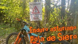
Pola de Siero
-
Sierra del Aramo
- 7
- 9
-
Sierra del Naranco
- 8
- 17
- 7
-
Somiedo
- 1
- 2
- 2
Popular Oviedo Mountain Biking Trails
• 95 ★ 4.0 • 7 miles • 819 ft • 96 •
Popular white difficulty family friendly gravel path. This multi-use trail can be used both directions and has a easy overall physical rating with a 819 ft green climb. Adaptive MTB rating: amtb green. Trail visibility is always easy to follow. On average it takes 55 minutes to complete this trail.
• 90 ★ 0.0 • 6 miles • 973 ft • 73 •
Popular white difficulty gravel path. This multi-use trail can be used both directions and has a easy overall physical rating with a 973 ft green climb. Adaptive MTB rating: amtb green. Trail visibility is always easy to follow. On average it takes 1 hour9 minutes to complete this trail.
• 100 ★ 0.0 • 1,906 ft • 23 ft • 71 •
Sendero muy rápido y divertido, estrecho, y algo expuesto a una caída por el lado izquierdo. Termina en el comienzo de Alta tensión, también se puede unir con .
• 100 ★ 5.0 • 1,886 ft • 3 ft • 49 •
Sendero muy divertido con alguna zona de raíces y con algunas curvas con un poco de peralte. Cerca del final se cruza una pequeña pasarela de madera para evitar una zona embarrada.
• 100 ★ 5.0 • 2,205 ft • 5 ft • 44 •
Popular blue difficulty singletrack. This multi-use trail can be used downhill primary and has a moderate overall physical rating with a 5 ft black diamond climb. It features skinny. On average it takes 2 minutes to complete this trail.
• 100 ★ 0.0 • 1,434 ft • 3 ft • 40 •
Popular green difficulty singletrack. This multi-use trail can be used both directions. On average it takes 4 minutes to complete this trail.
• 75 ★ 0.0 • 3 miles • 408 ft • 38 •
Popular white difficulty gravel path. This multi-use trail can be used both directions and has a easy overall physical rating with a 408 ft green climb. Adaptive MTB rating: amtb green. Trail visibility is always easy to follow. On average it takes 31 minutes to complete this trail.
Oviedo Mountain Bike Routes
14 miles • 1,742 ft • 1 • Point to Point •
La senda, en forma de "Y" cuenta con dos opciones para realizar el recorrido, Tuñón-Cueva Huerta...
39 miles • 6,750 ft • 3 • Loop •
Ruta épica, que une los Puertos del Marabio, San Lorenzo, recorre parte del Camín Real de La Mesa y...
18 miles • 4,533 ft • 3 • Loop •
Bonita y dura ruta por el Parque Natural, salimos de Santa Marina por carretera dirección Ronderos, para...
8 miles • 1,094 ft • 0 • Point to Point •
Esta ruta comienza en el área de descanso de Tuñón; primero discurre por la margen izquierda del río...
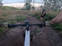
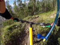
Photos of Oviedo Mountain Bike
Videos of Oviedo Mountain Bike

trail: Zetas
2:47 |
348 |
Apr 26, 2014
trail: Paisano al Parking
41 |
Aug 12, 2025 , Oviedo
youtuber
![♂️ Chatarreros y Cimatchu | Pola de...]()
trail: Chatarreros
8:06 |
252 |
Jul 28, 2022 , Oviedo
trail: Colmenas
2:37 |
775 |
Nov 6, 2015 , Oviedo

trail: Villamuerte
3:22 |
772 |
Nov 6, 2015 , Oviedo
trail: Villamuerte
2:58 |
628 |
Nov 6, 2015 , Oviedo
Recent Trail Reports
| status | trail | date | condition | info | user |
|---|---|---|---|---|---|
| Cimatuchu | May 30, 2026 @ 11:01am (Europe/Madrid) May 30, 2026 | Variable | JQuiroga | ||
| Chatarreros | May 30, 2026 @ 11:00am (Europe/Madrid) May 30, 2026 | Variable | JQuiroga | ||
| La Paralela | Apr 12, 2026 @ 10:30am (Europe/Madrid) Apr 12, 2026 | Ideal | Mendana | ||
| Zetas | Apr 12, 2026 @ 10:30am (Europe/Madrid) Apr 12, 2026 | Ideal | Mendana | ||
| Acceso Chatarreros | Dec 11, 2025 @ 3:45pm (Europe/Madrid) Dec 11, 2025 | Ideal | JQuiroga | ||
| Upper Chollers y Espiral | Nov 30, 2025 @ 6:44pm (Europe/Madrid) Nov 30, 2025 | Wet | JQuiroga | ||
| Cantera | Oct 26, 2025 @ 9:24am (Europe/Madrid) Oct 26, 2025 | Wet | entrecuetos | ||
| La Fontona | Oct 19, 2025 @ 9:41am (Europe/Madrid) Oct 19, 2025 | Ideal | entrecuetos | ||
| Variante Parking | Sep 14, 2025 @ 6:50pm (Europe/Madrid) Sep 14, 2025 | Dry | Mendana | ||
| Parking | Sep 14, 2025 @ 6:50pm (Europe/Madrid) Sep 14, 2025 | Dry | Mendana |
Activity Feed
| username | action | type | title | date |
|---|---|---|---|---|
| titoleta6 | wishlist | region | activity #96870776 | Jun 13, 2026 @ 6:42am Jun 13, 2026 |
| JQuiroga | add | report | activity #95830510 and 1 more | May 30, 2026 @ 2:00am May 30, 2026 |
| GustavoNpxCLG | wishlist | trail | activity #95242080 | May 22, 2026 @ 7:50am May 22, 2026 |
| juliangarciadh | ridden | trail | activity #95094311 | May 20, 2026 @ 2:00am May 20, 2026 |
| juliangarciadh | difficultyvote | trail | activity #95094308 | May 20, 2026 @ 2:00am May 20, 2026 |
Recent Comments
| username | type | title | comment | date |
|---|---|---|---|---|
| trail | Realizado desde Puertos del Marabio, en... | Jun 10, 2025 @ 6:03am Jun 10, 2025 | ||
| trail | Para trail running es un sendero bastante... | Sep 24, 2024 @ 3:39am Sep 24, 2024 | ||
| trail | A evitar | Aug 11, 2024 @ 9:52am Aug 11, 2024 | ||
| trail | Just an access trail, mostly hike & bike. | Aug 15, 2023 @ 6:28am Aug 15, 2023 | ||
| trail | Compared to all other red trails in Asturias I... | Aug 15, 2023 @ 6:27am Aug 15, 2023 |
Local Badges
-

Epic Mountain Bike Climb 2k303 awarded -

Climbing 10k Badge53 awarded -

Mountain Biking 100k Badge5 awarded -

Epic Ride Descent 2k303 awarded -

Descent 10k Badge54 awarded -

Descent 100k Badge5 awarded
Bike & Skill Parks
| name | type | city | rating |
|---|---|---|---|
| Pumptrack Bueño | skill park | Oviedo | |
| El Remedio motocross | skill park | Oviedo | |
| San Roman de Candamo motocross | skill park | Oviedo | |
| Skatepark Oviedo | skill park | Oviedo | |
| Pumptrack Oviedo | skill park | Oviedo |
Activity Type Stats
| activitytype | trails | distance | descent | descent distance | total vertical | rating | global rank | state rank | photos | reports | routes | ridelogs |
|---|---|---|---|---|---|---|---|---|---|---|---|---|
| Mountain Bike | 178 | 237 miles | 76,112 ft | 129 miles | 5,515 ft | #875 | #96 | 35 | 194 | 7 | 8,148 | |
| E-Bike | 177 | 236 miles | 76,083 ft | 129 miles | 5,515 ft | #347 | #122 | 7 | 193 | 4 | 557 | |
| Gravel Bike | 6 | 26 miles | 5,318 ft | 14 miles | 2,008 ft | #130 | #48 | 5 | 2 | 409 | ||
| Adaptive Bike | 11 | 37 miles | 5,751 ft | 17 miles | 4,744 ft | #124 | #94 | 13 | ||||
| Winter Fat Bike | 15 | 20 miles | 5,161 ft | 9 miles | 4,587 ft | #5,655 | #241 | |||||
| Horse | 14 | 16 miles | 4,613 ft | 9 miles | 5,000 ft | #881 | #50 | 12 | ||||
| Hike | 180 | 239 miles | 76,706 ft | 131 miles | 5,515 ft | #605 | #95 | 193 | 4 | 480 | ||
| Trail Running | 180 | 239 miles | 76,706 ft | 131 miles | 5,515 ft | #229 | #58 | 193 | 3 | 650 | ||
| Dirtbike/Moto | 1 | 1,148 ft | 128 ft | 1,148 ft | 128 ft | 12 |
Frequently Asked Questions About Oviedo
▼
What are the best places to ride in Oviedo?
Oviedo has 9 areas to explore for mountain biking. The top rated areas are:
▼
What are the highest rated mountain biking trails in Oviedo?
The highest rated mountain biking trails in Oviedo are:
- Colmenas (4.3/5)
- 5 Estrellas (4.1/5)
- Diagonales (4.1/5)
- Ancineres (4.1/5)
- Alto Los Carbaios (4.1/5)
▼
What is the best time of the year to ride in Oviedo?
Based on ride log data, the most popular months to ride in Oviedo are:
- September (45 activities)
- December (40 activities)
- July (35 activities)
▼
Where can I park to ride in Oviedo?
There are 2 parking locations listed in Oviedo. The most popular parking spots are:
Activities
Trails
Points of Interest
- By canadaka
 Trailforks & contributors
 - Admins: apply
- #3532 - 4,926 views
- oviedo activity log | embed map of Oviedo mountain bike trails | oviedo mountain biking points of interest
Downloading of trail gps tracks in kml & gpx formats is enabled for Oviedo.
You must login to download files.