close
-
Layers w
- Weather Layers
- Pro
- Pro
- Pro
- Pro
- Pro
- Pro
- More Layers
- Pro
- Pro
- Pro
- Pro
-
Upgrade to

3D
Trail Conditions
- Unknown
- Snow Groomed
- Snow Packed
- Snow Covered
- Snow Cover Partial
- Freeze/thaw Cycle
- Icy
- Prevalent Mud
- Wet
- Variable
- Ideal
- Dry
- Very Dry
Trail Flow (Ridden Direction)
Trailforks scans users ridelogs to determine the most popular direction each trail is ridden. A good flowing trail network will have most trails flowing in a single direction according to their intension.
The colour categories are based on what percentage of riders are riding a trail in its intended direction.
The colour categories are based on what percentage of riders are riding a trail in its intended direction.
- > 96%
- > 90%
- > 80%
- > 70%
- > 50%
- < 50%
- bi-directional trail
- no data
Trail Last Ridden
Trailforks scans ridelogs to determine the last time a trail was ridden.
- < 2 days
- < 1 week
- < 2 weeks
- < 1 month
- < 6 months
- > 6 months
Trail Ridden Direction
The intended direction a trail should be ridden.
- Downhill Only
- Downhill Primary
- Both Directions
- Uphill Primary
- Uphill Only
- One Direction
Contribute Details
Colors indicate trail is missing specified detail.
- Description
- Photos
- Description & Photos
- Videos
Trail Popularity ?
Trailforks scans ridelogs to determine which trails are ridden the most in the last 9 months.
Trails are compared with nearby trails in the same city region with a possible 25 colour shades.
Think of this as a heatmap, more rides = more kinetic energy = warmer colors.
- most popular
- popular
- less popular
- not popular
ATV/ORV/OHV Filter
Max Vehicle Width
inches
US Cell Coverage
Legend

Radar Time
Activity Recordings
Trailforks uses anonymized public activity data.
?
Activity Recordings
Trailforks uses anonymized public activity data.
?
Personal Heatmap
▶
Activity Types
all
/
none
▶
Options
2
Date range
month
–
Winter Trails
Warning
A routing network for winter maps does not exist. Selecting trails using the winter trails layer has been disabled.
Missing Trails
Most Popular
Least Popular
Trails are colored based on popularity. The more popular a trail is, the more red. Less popular trails trend towards green.
Jump Magnitude Heatmap
Heatmap of where riders jump on trails. Zoom in to see individual jumps, click circles to view jump details.
BC Backroad Status
![map legend]()
Service Road Atlas is a free to use, community-driven service for viewing and creating reports on the numerous back-country service roads around B.C. and Alberta.

Slope Aspect
Direction the slope faces
Trails Deemphasized
Trails are shown in grey.
Only show trails with no bike usage.
Suggested Layers
Based on selected activity type
Save the current map location and zoom level as your default home location whenever this page is loaded.
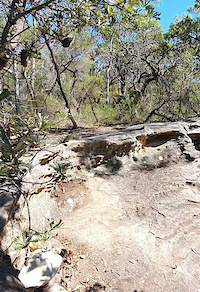
SaveOxford Falls is a zone which forms part of the Garigal National Park between Terrey Hills, Beacon Hill and Belrose. At the centre of this zone is the late Oxford Falls Freeride Park, located next to Morgan Road.
The terrain is hilly with sandy scrub up high and dense temperate rain forest down the base of the many gullies. Manly and Narrabeen are only a short distance away.
The terrain is hilly with sandy scrub up high and dense temperate rain forest down the base of the many gullies. Manly and Narrabeen are only a short distance away.
Primary Trail Type: All-Mountain & Downhill
Shuttleable: YES
AKA: Oxy
Land Status: Conservation Reserve
 google parking directions
 Activities Click to view
- Mountain Bike
23 trails
- E-Bike
7 trails
- Hike
17 trails
- Trail Running
17 trails
Region Details
- 6
- 7
- 4
- 4
Region Status
Caution as of Jun 12, 2026Stats
- Avg Trail Rating
- Trails (view details)
- 21
- Trails Mountain Bike
- 23
- Trails E-Bike
- 7
- Trails Hike
- 17
- Trails Trail Running
- 17
- Total Distance
- 12 miles
- Total Descent
- 2,933 ft
- Total Vertical
- 590 ft
- Highest Trailhead
- 678 ft
- Reports
- 511
- Photos
- 45
- Ridden Counter
- 16,538
Popular Oxford Falls Mountain Biking Trails
• 75 ★ 4.0 • 1,219 ft • 71 ft • 574 •
Short and sweet little link between the Five Mile and Slippery Dip Fire Trails.
• 85 ★ 4.8 • 1,919 ft • 9 ft • 526 •
Its like enduro; but its not enduro if you're only riding your enduro bike, and letting the bike do the enduro'ing. Also, you keep your feet on the pedals, but get your buddy to move your legs up and down.
• 90 ★ 3.5 • 899 ft • 61 ft • 478 •
Popular blue difficulty singletrack. This mountain bike primary trail can be used both directions. On average it takes 4 minutes to complete this trail.
• 75 ★ 4.0 • 3,884 ft • 105 ft • 454 •
Highly rated popular black diamond difficulty singletrack. This mountain bike primary trail can be used downhill primary and has a hard overall physical rating with a 105 ft black diamond climb. It features drop, rock face and rock garden. On average it takes 12 minutes to complete this trail.
• 65 ★ 3.8 • 2 miles • 223 ft • 348 •
Trail goes along ridge and finishes just before steep decent. Great view at end of trail.
• 55 ★ 4.2 • 1,296 ft • 0 ft • 276 •
Bernie's is a very steep decent from Bernie's trail to creek. There are a whole load of drops, chutes and technical roll-downs, which makes for one of the shortest, wildest decents in Sydney.
• 50 ★ 3.9 • 2,848 ft • 20 ft • 224 •
Moderately popular double black diamond difficulty singletrack. This mountain bike primary trail can be used downhill only and has a hard overall physical rating. It features drop, rock face and rock garden. On average it takes 14 minutes to complete this trail.
Oxford Falls Mountain Bike Routes
18 miles • 2,773 ft • 26 • Point to Point •
Route taking in Bunnings trail, Belrose (skyfall) trails then to Terry hills BMX track trails going...
7 miles • 1,001 ft • 11 • Loop •
Route of Twin Peaks Loop with Access Road
4 miles • 599 ft • 9 • Loop • Race •
• 13 miles • 1,685 ft • 13 •
Photos of Oxford Falls Mountain Bike
Videos of Oxford Falls Mountain Bike
trail: Dutch Rudder
0:16 |
17 |
Jan 3, 2026

trail: Nursery Rhymes
2:10 |
426 |
Sep 5, 2021 , Sydney

trail: Dutch Rudder
17:08 |
1210 |
Jan 28, 2020 , Sydney

trail: Powerlines
17:08 |
1086 |
Jan 28, 2020 , Sydney

trail: Bernie's DH
1657 |
Sep 19, 2017 , Sydney
Recent Trail Reports
Activity Feed
| username | action | type | title | date |
|---|---|---|---|---|
| MTB-AUS | add | report | activity #96851922 and 6 more | Jun 13, 2026 @ 12:28am Jun 13, 2026 |
| Eddomak | add | report | activity #96845485 and 2 more | Jun 12, 2026 @ 8:06pm Jun 12, 2026 |
| kbombtom | wishlist | route | activity #96285626 | Jun 5, 2026 @ 4:23am Jun 5, 2026 |
| archercant | ridden | trail | activity #96000244 | May 31, 2026 @ 10:53pm May 31, 2026 |
| JacobNJ0eW4 | wishlist | trail | activity #95447741 | May 24, 2026 @ 2:51pm May 24, 2026 |
Recent Comments
| username | type | title | comment | date |
|---|---|---|---|---|
| trail | IMO this is a great trail that I have cleared... | May 23, 2026 @ 4:55pm May 23, 2026 | ||
| trail | your right about the motorbike ruts. I have... | May 23, 2026 @ 4:23pm May 23, 2026 | ||
| trail | I've cleared this trail multiple times in the... | May 23, 2026 @ 4:18pm May 23, 2026 | ||
| trail | Had a great time on this today, despite going... | Oct 9, 2025 @ 3:14am Oct 9, 2025 | ||
| trail | No idea why you cannot ride an ebike here... | Oct 9, 2025 @ 3:13am Oct 9, 2025 |
Nearby Areas
| name | distance | ||||
|---|---|---|---|---|---|
| Belrose Bowl | 3 | 5 | 5 | 0.8 km | |
| Twin Peaks | 3 | 3 | 1 km | ||
| Bare Creek Bike Park | 5 | 4 | 4 | 3 | 1.6 km |
| Red Hill Reserve | 7 | 14 | 11 | 1 | 1.7 km |
| Mt Narra | 3 | 9 | 11 | 4 | 2.1 km |
Local Badges
-

Completionist0 awarded
Bike & Skill Parks
| name | type | city | rating |
|---|---|---|---|
| Manly Warringah BMX Track | skill park | Sydney |
Activity Type Stats
| activitytype | trails | distance | descent | descent distance | total vertical | rating | global rank | state rank | photos | reports | routes | ridelogs |
|---|---|---|---|---|---|---|---|---|---|---|---|---|
| Mountain Bike | 23 | 12 miles | 2,933 ft | 6 miles | 591 ft | #2,621 | #133 | 42 | 511 | 5 | 18,876 | |
| E-Bike | 7 | 3 miles | 883 ft | 2 miles | 312 ft | #4,318 | #217 | 3 | 460 | 2,348 | ||
| Hike | 17 | 11 miles | 2,218 ft | 5 miles | 591 ft | #6,816 | #213 | 496 | 327 | |||
| Trail Running | 17 | 11 miles | 2,218 ft | 5 miles | 591 ft | #5,894 | #196 | 496 | 216 |
Frequently Asked Questions About Oxford Falls
▼
What are the highest rated mountain biking trails in Oxford Falls?
The highest rated mountain biking trails in Oxford Falls are:
- Dutch Rudder (4.4/5)
- Sidewinder (4.1/5)
- Bernie's DH (4.1/5)
- Dutch Rudder Extension (4.1/5)
- Snakes and Ladders (4.1/5)
▼
What is the best time of the year to ride in Oxford Falls?
Based on ride log data, the most popular months to ride in Oxford Falls are:
- July (259 activities)
- October (178 activities)
- August (165 activities)
▼
Where can I park to ride in Oxford Falls?
There are 4 parking locations listed in Oxford Falls. The most popular parking spots are: View all parking and trailhead locations on the map to plan your visit.
▼
What is the longest trail in Oxford Falls?
The longest trail in Oxford Falls is Road to Somewhere at 1.6 miles. View all trails sorted by distance.
Activities
Trails
Points of Interest
- By nandayo
 & contributors
 - Admins: TrailCare
- #10516 - 23,989 views
- oxford falls activity log | embed map of Oxford Falls mountain bike trails | oxford falls mountain biking points of interest
Downloading of trail gps tracks in kml & gpx formats is enabled for Oxford Falls.
You must login to download files.