close
-
Layers w
- Weather Layers
- Pro
- Pro
- Pro
- Pro
- Pro
- Pro
- More Layers
- Pro
- Pro
- Pro
- Pro
-
Upgrade to

3D
Trail Conditions
- Unknown
- Snow Groomed
- Snow Packed
- Snow Covered
- Snow Cover Partial
- Freeze/thaw Cycle
- Icy
- Prevalent Mud
- Wet
- Variable
- Ideal
- Dry
- Very Dry
Trail Flow (Ridden Direction)
Trailforks scans users ridelogs to determine the most popular direction each trail is ridden. A good flowing trail network will have most trails flowing in a single direction according to their intension.
The colour categories are based on what percentage of riders are riding a trail in its intended direction.
The colour categories are based on what percentage of riders are riding a trail in its intended direction.
- > 96%
- > 90%
- > 80%
- > 70%
- > 50%
- < 50%
- bi-directional trail
- no data
Trail Last Ridden
Trailforks scans ridelogs to determine the last time a trail was ridden.
- < 2 days
- < 1 week
- < 2 weeks
- < 1 month
- < 6 months
- > 6 months
Trail Ridden Direction
The intended direction a trail should be ridden.
- Downhill Only
- Downhill Primary
- Both Directions
- Uphill Primary
- Uphill Only
- One Direction
Contribute Details
Colors indicate trail is missing specified detail.
- Description
- Photos
- Description & Photos
- Videos
Trail Popularity ?
Trailforks scans ridelogs to determine which trails are ridden the most in the last 9 months.
Trails are compared with nearby trails in the same city region with a possible 25 colour shades.
Think of this as a heatmap, more rides = more kinetic energy = warmer colors.
- most popular
- popular
- less popular
- not popular
ATV/ORV/OHV Filter
Max Vehicle Width
inches
US Cell Coverage
Legend

Radar Time
Activity Recordings
Trailforks uses anonymized public activity data.
?
Activity Recordings
Trailforks uses anonymized public activity data.
?
Personal Heatmap
▶
Activity Types
all
/
none
▶
Options
2
Date range
month
–
Winter Trails
Warning
A routing network for winter maps does not exist. Selecting trails using the winter trails layer has been disabled.
Missing Trails
Most Popular
Least Popular
Trails are colored based on popularity. The more popular a trail is, the more red. Less popular trails trend towards green.
Jump Magnitude Heatmap
Heatmap of where riders jump on trails. Zoom in to see individual jumps, click circles to view jump details.
BC Backroad Status
![map legend]()
Service Road Atlas is a free to use, community-driven service for viewing and creating reports on the numerous back-country service roads around B.C. and Alberta.

Slope Aspect
Direction the slope faces
Trails Deemphasized
Trails are shown in grey.
Only show trails with no bike usage.
Suggested Layers
Based on selected activity type
Save the current map location and zoom level as your default home location whenever this page is loaded.
SaveThis region is Unsanctioned, Ride at your own Risk!
No description for Příbram has been added yet! Login or register to submit one.This region uses the Uk/Euro style trail grading system.
Activities Click to view
- Mountain Bike
8 trails
- Adaptive Bike
0 trails
- Hike
3 trails
- Trail Running
2 trails
Region Details
- 3
- 2
- 1
- 2
Region Status
Caution as of Jul 20, 2024Stats
- Avg Trail Rating
- Trails (view details)
- 8
- Trails Mountain Bike
- 8
- Trails E-Bike
- 3
- Trails Hike
- 3
- Trails Trail Running
- 2
- Total Distance
- 7 miles
- Total Descent
- 3,052 ft
- Total Vertical
- 1,312 ft
- Highest Trailhead
- 2,321 ft
- Reports
- 14
- Photos
- 50
- Ridden Counter
- 332
Sub Regions
-
Bikepark Monínec
- 1
- 1
- 2
-
CHKO
Popular Příbram Mountain Biking Trails
• 100 ★ 4.5 • 4,265 ft • 0 ft • 62 •
Popular red difficulty singletrack. This mountain bike primary trail can be used downhill only and has a moderate overall physical rating. It features berm, drop, jump, gap jump and ladder bridge. Trail visibility is always easy to follow. On average it takes 5 minutes to complete this trail.
• 95 ★ 5.0 • 840 ft • 0 ft • 48 •
Popular black difficulty singletrack. This mountain bike primary trail can be used downhill only and has a moderate overall physical rating. It features a-frame, berm, bridge, drop, jump, gap jump and wallride. Trail visibility is always easy to follow. On average it takes 1 minutes to complete this trail.
• 60 ★ 3.0 • 1 mile • 11 ft • 32 •
Moderately popular green difficulty singletrack. This mountain bike primary trail can be used downhill primary and has a moderate overall physical rating with a 11 ft green climb. It features drop and rock face. On average it takes 57 minutes to complete this trail.
• 85 ★ 5.0 • 2,461 ft • 0 ft • 13 •
Difficult Enduro Line at Bikepark Monínec – just follow the signs with "EN", which starts next to the Downhill-Line. Natural Line with a few variations at difficult sections (chicken-lines). Last sections quite flat but super flowy...
• 5 ★ 0.0 • 942 ft • 0 ft • 4 •
Super počin příbramské party pro nejmenší a juniory, ale i jako výzva poskládat se do zatáček na 29" enduru pěkně v tempu.
• 5 ★ 5.0 • 2 miles • 52 ft • 3 • • hike
Trail začíná kousek od vrcholu Plešivce na vyhlídce Fabiánova zahrádka. Odtud sjíždíte kamenitý úsek po červené turistické značce. Po červené značce pokračujete na rozcestí modré a červené značky "Plešivecký...
• 5 ★ 5.0 • 1 mile • 19 ft • 1 •
Less popular blue difficulty singletrack. This multi-use trail can be used one direction and has a moderate overall physical rating with a 19 ft green climb. Trail visibility is always easy to follow.
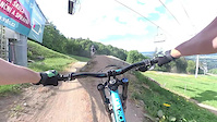
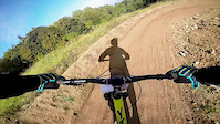
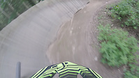
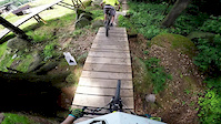
Photos of Příbram Mountain Bike
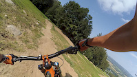
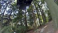
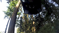
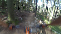
Videos of Příbram Mountain Bike
trail: Freeride
3:19 |
116 |
Nov 10, 2019
trail: Freeride
3:24 |
33 |
Nov 10, 2019
trail: Freeride
3:02 |
9 |
Nov 10, 2019
trail: Freeride
3:19 |
25 |
Nov 9, 2019
trail: Freeride
3:09 |
105 |
May 11, 2018
trail: Freeride
2:23 |
135 |
Oct 16, 2016
trail: Freeride
0:16 |
552 |
Aug 27, 2016
trail: Freeride
3:17 |
450 |
Jun 21, 2016
Recent Trail Reports
| status | trail | date | condition | info | user |
|---|---|---|---|---|---|
| DH Monínec | Jul 20, 2024 @ 4:31am Jul 20, 2024 | Dry | ktm-boy-69 TRAILFORKS | ||
| Family | Jul 20, 2024 @ 4:31am Jul 20, 2024 | Ideal | ktm-boy-69 TRAILFORKS | ||
| Freeride | Jul 20, 2024 @ 4:31am Jul 20, 2024 | Dry | ktm-boy-69 TRAILFORKS | ||
| Hadí královna | Sep 28, 2023 @ 12:42am Sep 28, 2023 | Ideal | Gorakhal | ||
| Drkoláč | Jul 4, 2021 @ 10:15am Jul 4, 2021 | Wet | Vojtas07258 | ||
| Vítr ve vlasech | Jan 10, 2021 @ 3:11am Jan 10, 2021 | Snow Covered | Blaza16 |
Activity Feed
| username | action | type | title | date |
|---|---|---|---|---|
| fcJhdf | ridden | trail | activity #90976229 | Mar 21, 2026 @ 5:13am Mar 21, 2026 |
| 7VTBcA | wishlist | trail | activity #68713459 | Mar 30, 2025 @ 12:51pm Mar 30, 2025 |
| ktm-boy-69 | add | photo | activity #56746270 and 3 more | Aug 5, 2024 @ 7:43am Aug 5, 2024 |
| ktm-boy-69 | vote | trail | activity #56746135 | Aug 5, 2024 @ 7:40am Aug 5, 2024 |
| ktm-boy-69 | ridden | trail | activity #56746132 | Aug 5, 2024 @ 7:40am Aug 5, 2024 |
Recent Comments
| username | type | title | comment | date |
|---|---|---|---|---|
| trail | old school freeride bikepark-line with lots of... | Jul 21, 2024 @ 1:29pm Jul 21, 2024 | ||
| trail | at the moment this is a bad joke. if you want... | Jul 21, 2024 @ 1:27pm Jul 21, 2024 | ||
| report | Velmi příjemný, málo klesající singletrail. | Jul 4, 2021 @ 10:16am Jul 4, 2021 | ||
| trail | Osobně tento trail hodnotím velmi kladně.... | Jan 5, 2021 @ 2:33pm Jan 5, 2021 | ||
| trail | Tenhle trail neexistuje, respektive jsme jej... | Jul 14, 2019 @ 4:44am Jul 14, 2019 |
Bike & Skill Parks
| name | type | city | rating |
|---|---|---|---|
| Pumptrack Drkoláč | skill park | Příbram |
Activity Type Stats
| activitytype | trails | distance | descent | descent distance | total vertical | rating | global rank | state rank | photos | reports | routes | ridelogs |
|---|---|---|---|---|---|---|---|---|---|---|---|---|
| Mountain Bike | 8 | 7 miles | 3,051 ft | 5 miles | 1,312 ft | #3,512 | #28 | 50 | 14 | 1,468 | ||
| E-Bike | 3 | 3 miles | 1,083 ft | 2 miles | 1,102 ft | 12 | 59 | |||||
| Hike | 3 | 4 miles | 1,598 ft | 3 miles | 1,102 ft | #4,674 | #38 | 12 | 170 | |||
| Trail Running | 2 | 3 miles | 1,434 ft | 3 miles | 896 ft | #4,228 | #38 | 12 | 9 |
Frequently Asked Questions About Příbram
▼
What are the best places to ride in Příbram?
Příbram has 2 areas to explore for mountain biking. The top rated areas are:
▼
What are the highest rated mountain biking trails in Příbram?
The highest rated mountain biking trails in Příbram are:
- DH Monínec (4.1/5)
- EN Monínec (4.1/5)
- Cesta do Pravěku (4.1/5)
- Vítr ve vlasech (4.1/5)
- Freeride (4.1/5)
▼
What is the best time of the year to ride in Příbram?
Based on ride log data, the most popular months to ride in Příbram are:
- August (16 activities)
- October (12 activities)
- July (9 activities)
▼
Where can I park to ride in Příbram?
There are 2 parking locations listed in Příbram. The most popular parking spots are:
- By novas752
 ČeMBA & contributors
 - Admins: ČeMBA
- #17136 - 2,837 views
- příbram activity log | embed map of Příbram mountain bike trails | příbram mountain biking points of interest
Downloading of trail gps tracks in kml & gpx formats is enabled for Příbram.
You must login to download files.