close
-
Layers w
- Weather Layers
- Pro
- Pro
- Pro
- Pro
- Pro
- Pro
- More Layers
- Pro
- Pro
- Pro
- Pro
-
Upgrade to

3D
Trail Conditions
- Unknown
- Snow Groomed
- Snow Packed
- Snow Covered
- Snow Cover Partial
- Freeze/thaw Cycle
- Icy
- Prevalent Mud
- Wet
- Variable
- Ideal
- Dry
- Very Dry
Trail Flow (Ridden Direction)
Trailforks scans users ridelogs to determine the most popular direction each trail is ridden. A good flowing trail network will have most trails flowing in a single direction according to their intension.
The colour categories are based on what percentage of riders are riding a trail in its intended direction.
The colour categories are based on what percentage of riders are riding a trail in its intended direction.
- > 96%
- > 90%
- > 80%
- > 70%
- > 50%
- < 50%
- bi-directional trail
- no data
Trail Last Ridden
Trailforks scans ridelogs to determine the last time a trail was ridden.
- < 2 days
- < 1 week
- < 2 weeks
- < 1 month
- < 6 months
- > 6 months
Trail Ridden Direction
The intended direction a trail should be ridden.
- Downhill Only
- Downhill Primary
- Both Directions
- Uphill Primary
- Uphill Only
- One Direction
Contribute Details
Colors indicate trail is missing specified detail.
- Description
- Photos
- Description & Photos
- Videos
Trail Popularity ?
Trailforks scans ridelogs to determine which trails are ridden the most in the last 9 months.
Trails are compared with nearby trails in the same city region with a possible 25 colour shades.
Think of this as a heatmap, more rides = more kinetic energy = warmer colors.
- most popular
- popular
- less popular
- not popular
ATV/ORV/OHV Filter
Max Vehicle Width
inches
US Cell Coverage
Legend

Radar Time
Activity Recordings
Trailforks uses anonymized public activity data.
?
Activity Recordings
Trailforks uses anonymized public activity data.
?
Personal Heatmap
▶
Activity Types
all
/
none
▶
Options
2
Date range
month
–
Winter Trails
Warning
A routing network for winter maps does not exist. Selecting trails using the winter trails layer has been disabled.
Missing Trails
Most Popular
Least Popular
Trails are colored based on popularity. The more popular a trail is, the more red. Less popular trails trend towards green.
Jump Magnitude Heatmap
Heatmap of where riders jump on trails. Zoom in to see individual jumps, click circles to view jump details.
BC Backroad Status
![map legend]()
Service Road Atlas is a free to use, community-driven service for viewing and creating reports on the numerous back-country service roads around B.C. and Alberta.

Slope Aspect
Direction the slope faces
Trails Deemphasized
Trails are shown in grey.
Only show trails with no bike usage.
Suggested Layers
Based on selected activity type
Save the current map location and zoom level as your default home location whenever this page is loaded.
Save
No description for Palazzago has been added yet!
Login or register to submit one.
This region uses the Uk/Euro style trail grading system.
Activities Click to view
- Mountain Bike
40 trails
- E-Bike
38 trails
- Adaptive Bike
- Winter Fat Bike
0 trails
- Hike
12 trails
- Trail Running
12 trails
Region Details
- 1
- 1
- 7
- 18
- 1
Region Status
Open as of Jun 6, 2026Stats
- Avg Trail Rating
- Trails (view details)
- 38
- Trails Mountain Bike
- 40
- Trails E-Bike
- 38
- Trails Hike
- 12
- Trails Trail Running
- 12
- Total Distance
- 11 miles
- Total Descent Distance
- 7 miles
- Total Descent
- 5,872 ft
- Total Vertical
- 3,631 ft
- Highest Trailhead
- 4,522 ft
- Reports
- 104
- Photos
- 7
- Ridden Counter
- 781
Popular Palazzago Mountain Biking Trails
• 90 ★ 5.0 • 2 miles • 335 ft • 47 •
Sentiero ricco di ripidi saliscendi con un paio di scalette che costeggiando il Golf Club dell'Albenza collega Palazzago con Almenno San Bartolomeo.
• 100 ★ 3.0 • 2,080 ft • 229 ft • 38 •
Popular green difficulty singletrack. This mountain bike primary trail can be used both directions and has a easy overall physical rating with a 229 ft green climb. Trail visibility is always easy to follow. On average it takes 3 minutes to complete this trail.
• 100 ★ 4.0 • 1,663 ft • 0 ft • 38 •
Popular red difficulty singletrack. This mountain bike primary trail can be used downhill only and has a moderate overall physical rating with a 0 ft blue climb. Adaptive MTB rating: amtb blue. Trail visibility is always easy to follow. On average it takes 4 minutes to complete this trail.
• 80 ★ 0.0 • 4,334 ft • 232 ft • 28 •
Strada che collega la località Secchia con la località Salvano, alla fine della salita è possibile trovare altri sentieri di diversa difficoltà. Il primo pezzo della salita e fatto di ghiaia poi è tutta asfaltata.
• 95 ★ 4.0 • 2,687 ft • 118 ft • 27 •
Popular blue difficulty singletrack. This mountain bike primary trail can be used downhill primary and has a moderate overall physical rating with a 118 ft blue climb. Adaptive MTB rating: amtb green. Trail visibility is always easy to follow. On average it takes 14 minutes to complete this trail.
• 85 ★ 0.0 • 4,272 ft • 163 ft • 23 •
Salita dalle Cave verso il linzone quasi tutta pedalabile (soprattutto in Emtb), è molto bella, su sentiero e presenta qualche passaggio tecnico
• 90 ★ 4.0 • 4,505 ft • 0 ft • 17 •
Trail che parte da quota 1000 m e arriva qualche centinaio di metri sotto la Forcella di Burligo. Presenta alcuni tratti tecnici.
• 70 ★ 0.0 • 843 ft • 0 ft • 15 •
Popular blue difficulty singletrack. This mountain bike primary trail can be used downhill primary and has a easy overall physical rating with a 0 ft blue climb. It features roller coaster. Trail visibility is always easy to follow. On average it takes 3 minutes to complete this trail.
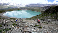
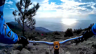
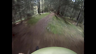
Videos of Palazzago Mountain Bike
trail: Enduro Palazzago
4:16 |
148 |
Nov 5, 2017
trail: Enduro Palazzago
4:45 |
1659 |
Aug 3, 2017
trail: Enduro Palazzago
7:20 |
150 |
Oct 27, 2014
trail: Enduro Palazzago
3:26 |
108 |
Oct 21, 2014

trail: La Palestra di Burligo
7:11 |
103 |
Feb 6, 2024 , Palazzago
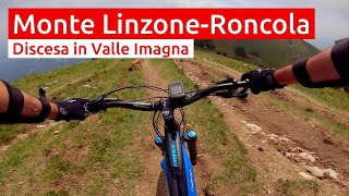
trail: Linzone-Roncola
15:34 |
244 |
Nov 23, 2022 , Palazzago
Recent Trail Reports
| status | trail | date | condition | info | user |
|---|---|---|---|---|---|
| Giallo-Blu ovest | Jun 7, 2026 @ 8:42am (Europe/Vaduz) Jun 6, 2026 | Wet | dadob | ||
| Colle Albenza - Spino | Jun 7, 2026 @ 8:42am (Europe/Vaduz) Jun 6, 2026 | Wet | dadob | ||
| Colle Albenza - Collepedrino | Jun 7, 2026 @ 8:42am (Europe/Vaduz) Jun 6, 2026 | Wet | dadob | ||
| Flow Burligo - DH Vipera | Jun 7, 2026 @ 8:42am (Europe/Vaduz) Jun 6, 2026 | Ideal | dadob | ||
| Salita Opreno - Burligo | May 17, 2026 @ 9:11am (Europe/Vaduz) May 17, 2026 | Variable | papapelatomtb | ||
| Trail delle capre | Apr 26, 2026 @ 1:39am (Europe/Rome) Apr 25, 2026 | Ideal | Alessandro5qZil | ||
| Vecchia Miniera | Apr 26, 2026 @ 1:39am (Europe/Rome) Apr 25, 2026 | Ideal | Alessandro5qZil | ||
| Salita Valcava Tesoro - EBIKE | Apr 25, 2026 @ 12:05pm (Europe/Rome) Apr 25, 2026 | Ideal | Pigisca67 | ||
| Variante DH Colle | Apr 1, 2026 @ 10:55am (Europe/Vaduz) Apr 1, 2026 | Ideal | ziosem991 | ||
| Linzone-Roncola | Mar 15, 2026 @ 11:53am (America/Vancouver) Mar 15, 2026 | Wet | AlbertokKbRr1 |
Activity Feed
| username | action | type | title | date |
|---|---|---|---|---|
| Unwilledshrimp | wishlist | trail | activity #96889773 | Jun 13, 2026 @ 9:51am Jun 13, 2026 |
| dadob | add | report | activity #96593583 and 3 more | Jun 9, 2026 @ 3:16am Jun 9, 2026 |
| dateo | ridden | trail | activity #95199265 | May 21, 2026 @ 2:00pm May 21, 2026 |
| papapelatomtb | add | report | activity #94900582 | May 17, 2026 @ 7:27am May 17, 2026 |
| Stefanof2Io9R | ridden | trail | activity #94580555 | May 12, 2026 @ 1:22pm May 12, 2026 |
Recent Comments
| username | type | title | comment | date |
|---|---|---|---|---|
| trail | E' chiamata anche la direttissima che collega... | Feb 3, 2026 @ 12:07am Feb 3, 2026 | ||
| trail | Primo pezzo tecnico, poi godereccio. Bello... | Nov 8, 2025 @ 1:30pm Nov 8, 2025 | ||
| trail | Trail schifoso che non è nemmeno un vero... | Aug 25, 2021 @ 11:54am Aug 25, 2021 | ||
| trail | Infattibile, pendenze estreme, rocce pericolose | Jun 27, 2021 @ 3:13pm Jun 27, 2021 | ||
| trail | Arrivati al pratone con casa (colle Albenza... | Mar 20, 2021 @ 12:45pm Mar 20, 2021 |
Activity Type Stats
| activitytype | trails | distance | descent | descent distance | total vertical | rating | global rank | state rank | photos | reports | routes | ridelogs |
|---|---|---|---|---|---|---|---|---|---|---|---|---|
| Mountain Bike | 40 | 11 miles | 5,873 ft | 7 miles | 3,632 ft | #7,397 | #621 | 7 | 105 | 720 | ||
| E-Bike | 38 | 10 miles | 5,869 ft | 7 miles | 3,596 ft | #4,956 | #480 | 102 | 175 | |||
| Hike | 12 | 10 miles | 5,020 ft | 6 miles | 3,632 ft | #9,188 | #600 | 93 | 69 | |||
| Trail Running | 12 | 8 miles | 3,507 ft | 4 miles | 3,632 ft | #9,366 | #657 | 93 | 11 |
Frequently Asked Questions About Palazzago
▼
What are the highest rated mountain biking trails in Palazzago?
The highest rated mountain biking trails in Palazzago are:
- Mascalzoni (4.1/5)
- La Palestra di Burligo (4.1/5)
- Sentiero del Golf (4.1/5)
- Enduro Palazzago (4.1/5)
- Salita Camoretti (4.1/5)
▼
What is the best time of the year to ride in Palazzago?
Based on ride log data, the most popular months to ride in Palazzago are:
- February (2 activities)
- December (1 activities)
- August (1 activities)
▼
Where can I park to ride in Palazzago?
Check the Palazzago trail map for trailhead and parking information. Community members regularly update access and parking details for trails in the area.
▼
What is the longest trail in Palazzago?
The longest trail in Palazzago is Discesa Linzone lato Sud verso Palazzago at 2.6 miles. View all trails sorted by distance.
Activities
Trails
Points of Interest
- By dingo67 & contributors
- Admins: marcoangeletti, adessoomaipiu, micheletraversi
- #32102 - 1,212 views
- palazzago activity log | embed map of Palazzago mountain bike trails |
Downloading of trail gps tracks in kml & gpx formats is enabled for Palazzago.
You must login to download files.